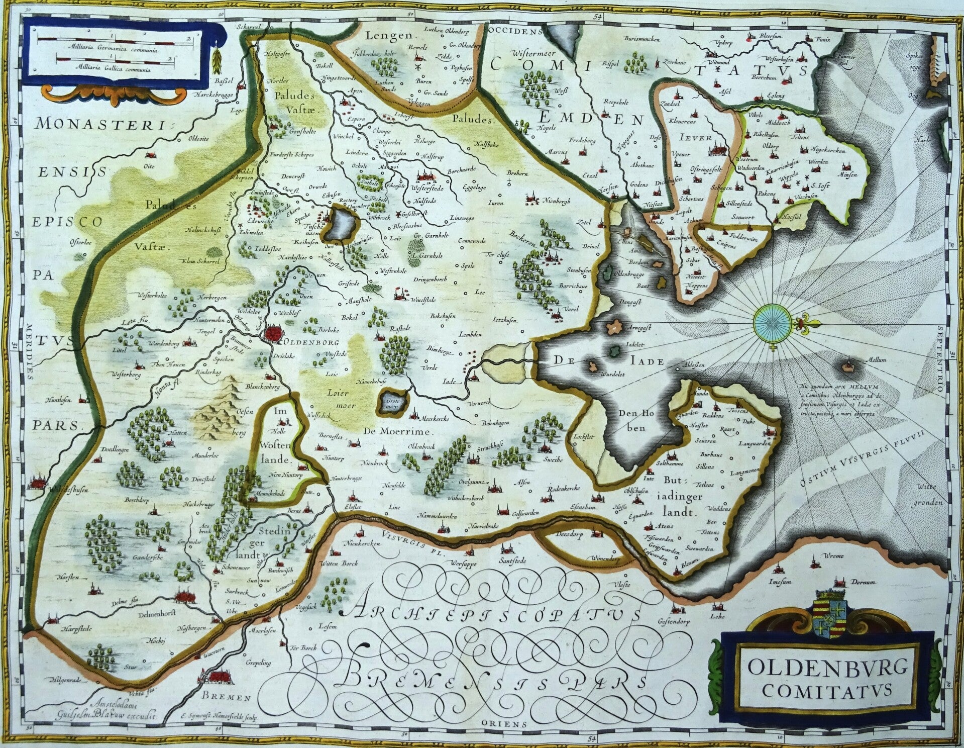
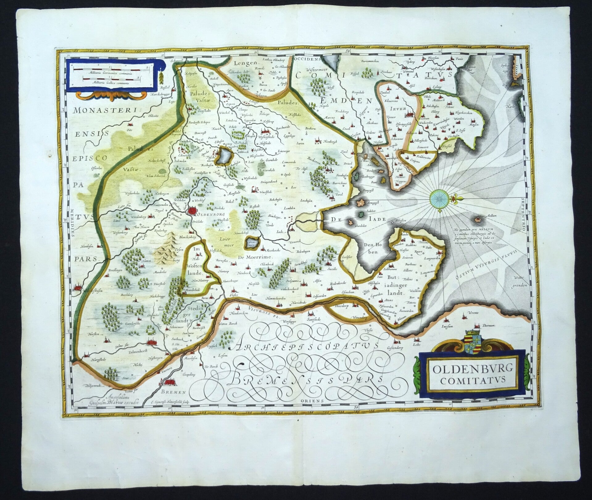
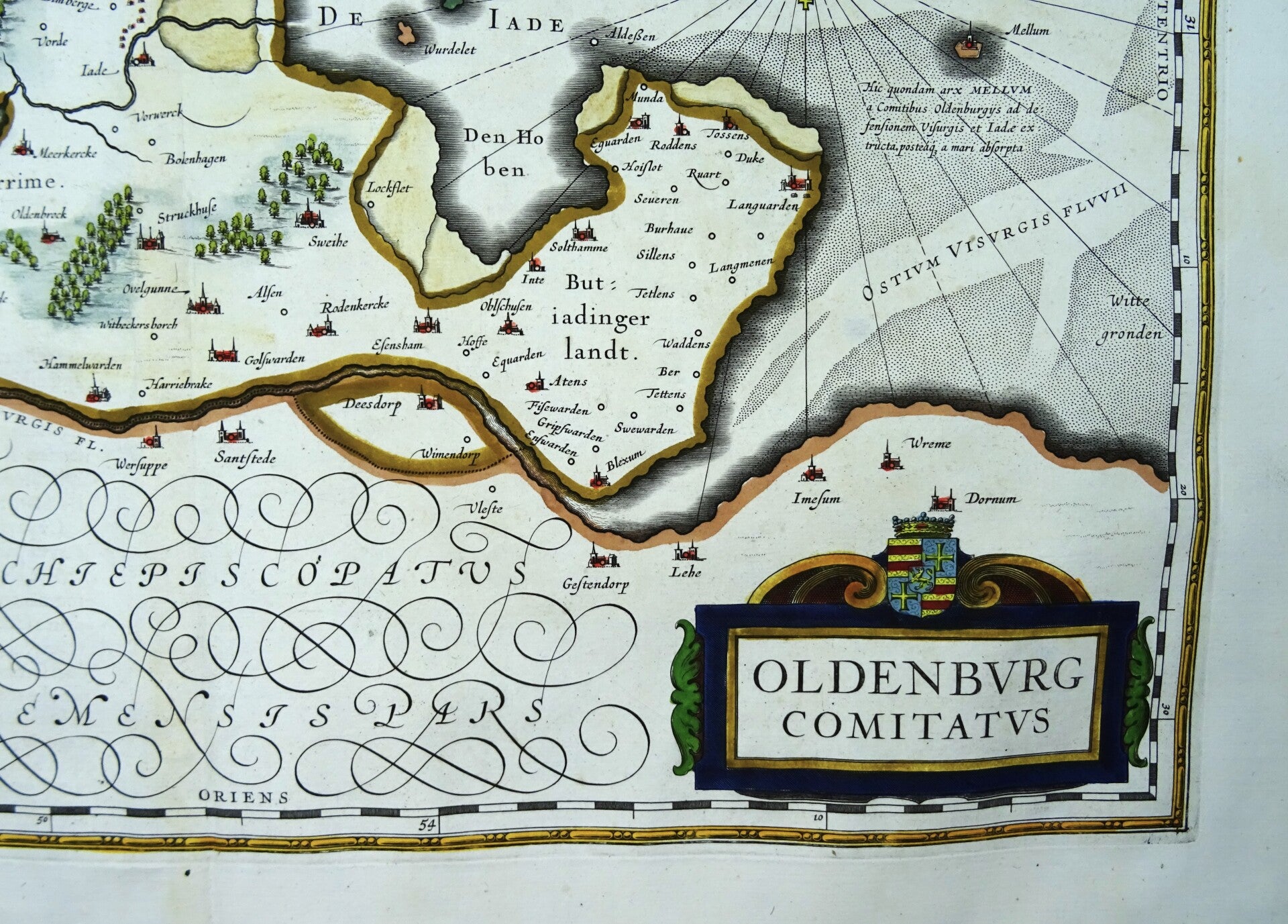
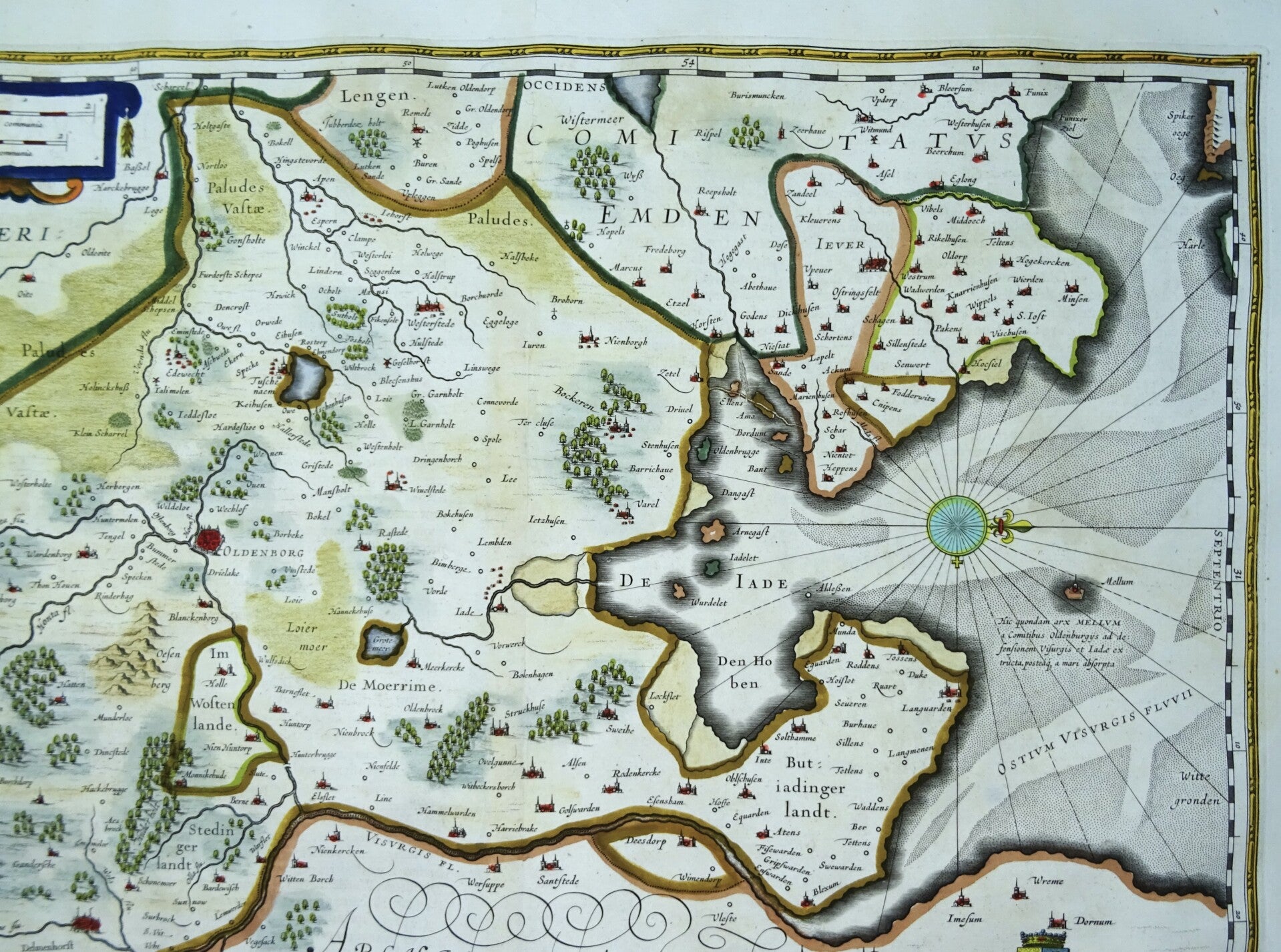
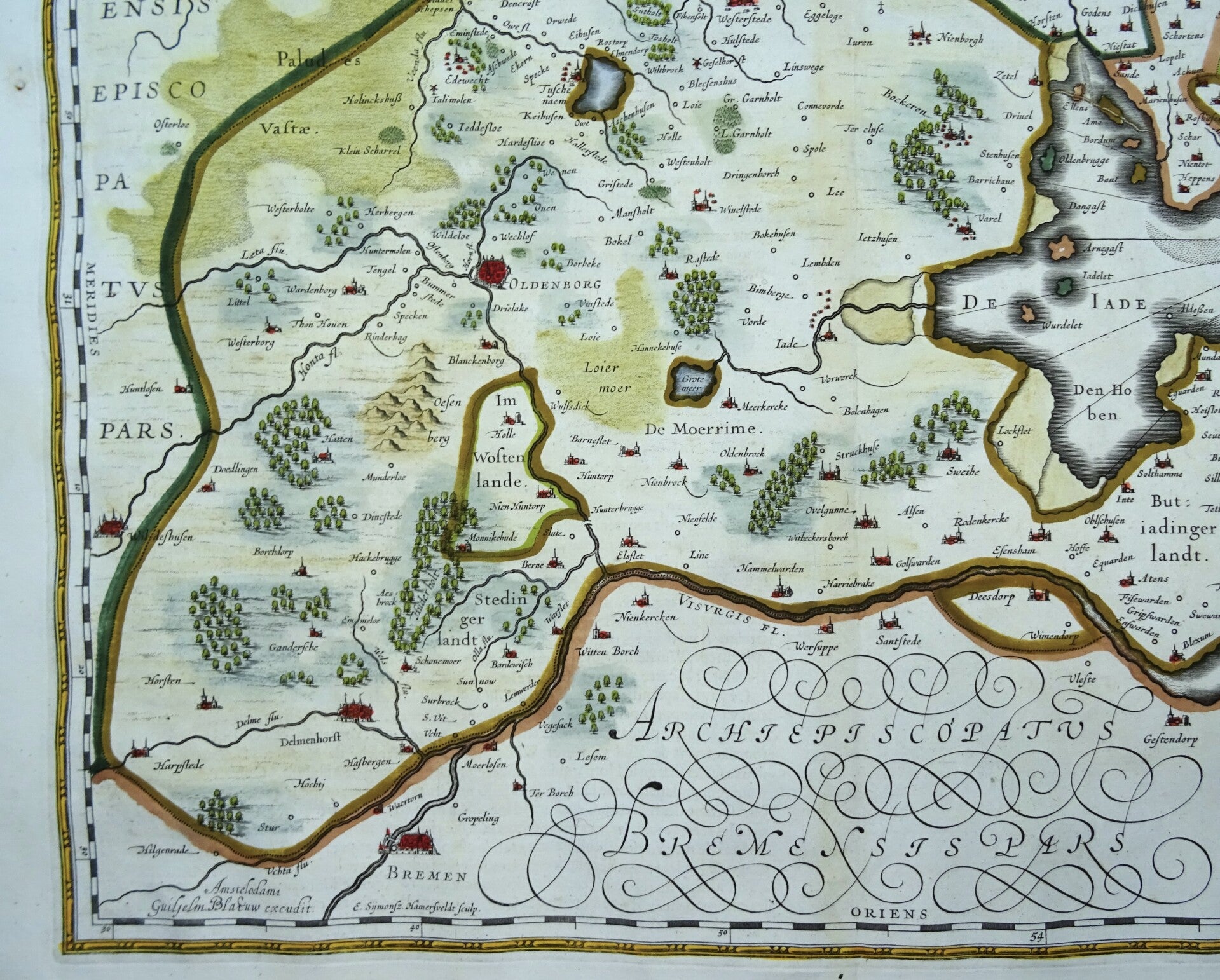
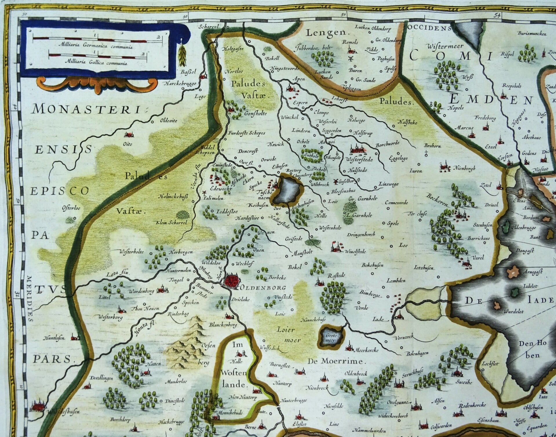
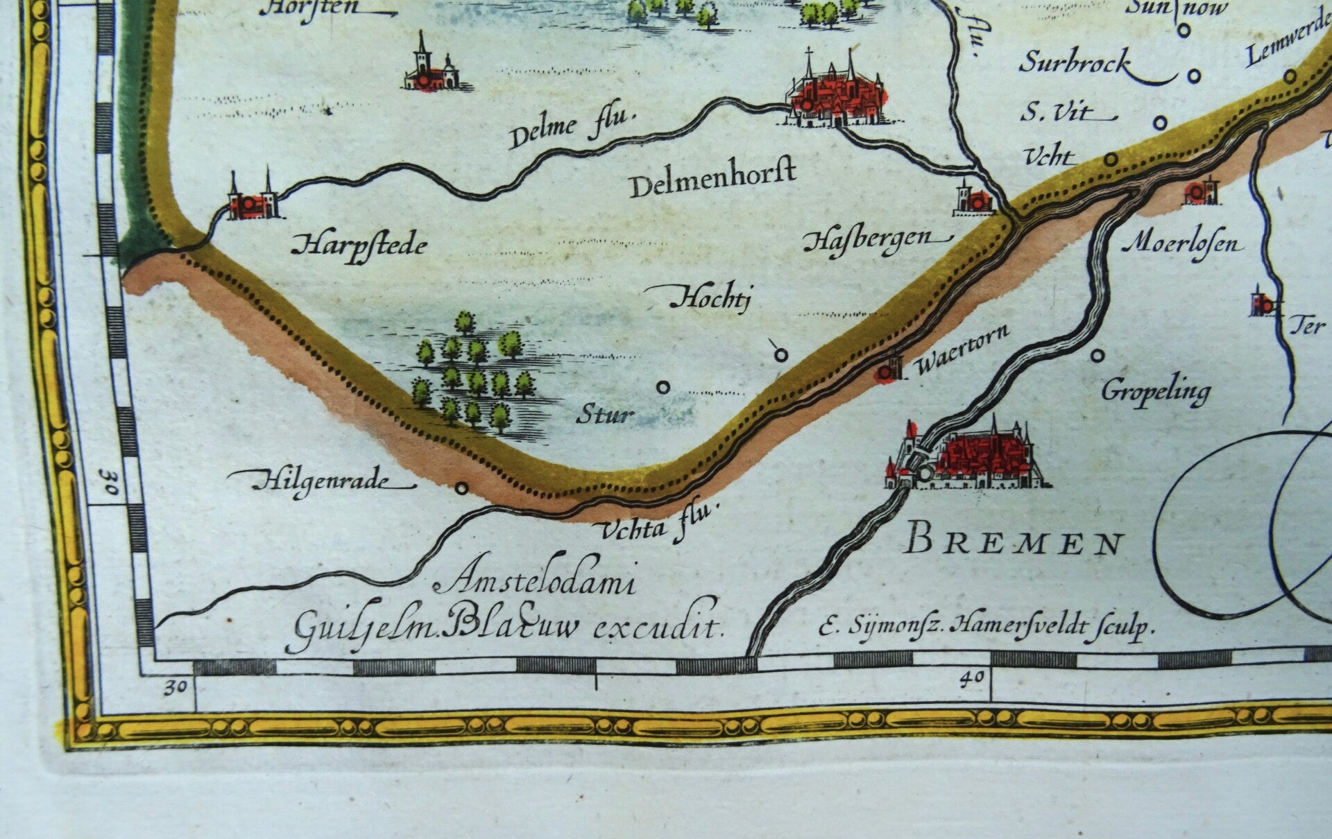
Germany, Oldenburg, Bremen, Niedersachsen, W. Blaeu, 1635, Oldenburg Comitatus
€79.00
Item number:
26 25 B
Beautiful 17th century map of the area around Oldenburg and Bremen in the North of Germany. Oriented with the North to the right, showing Bremen in the bottom left, Oldenburg in the center and the sea on the right.
Published by W. and J. Blaeu in 1635 in Amsterdam in the French edition of their first large atlas (Atlas Novus).
Excellent condition. Some minimal repairs in the margins, not affecting the image. Clean paper, clear print.
Image 37,5x49cm, sheet 49x57cm