South America, J.N. Bellin, 1757, Carte de l´Amerique Meridionale
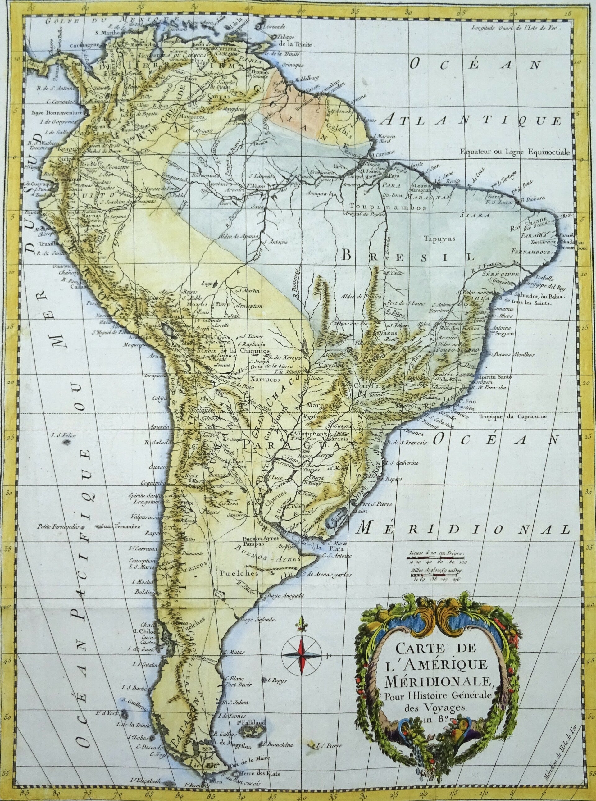
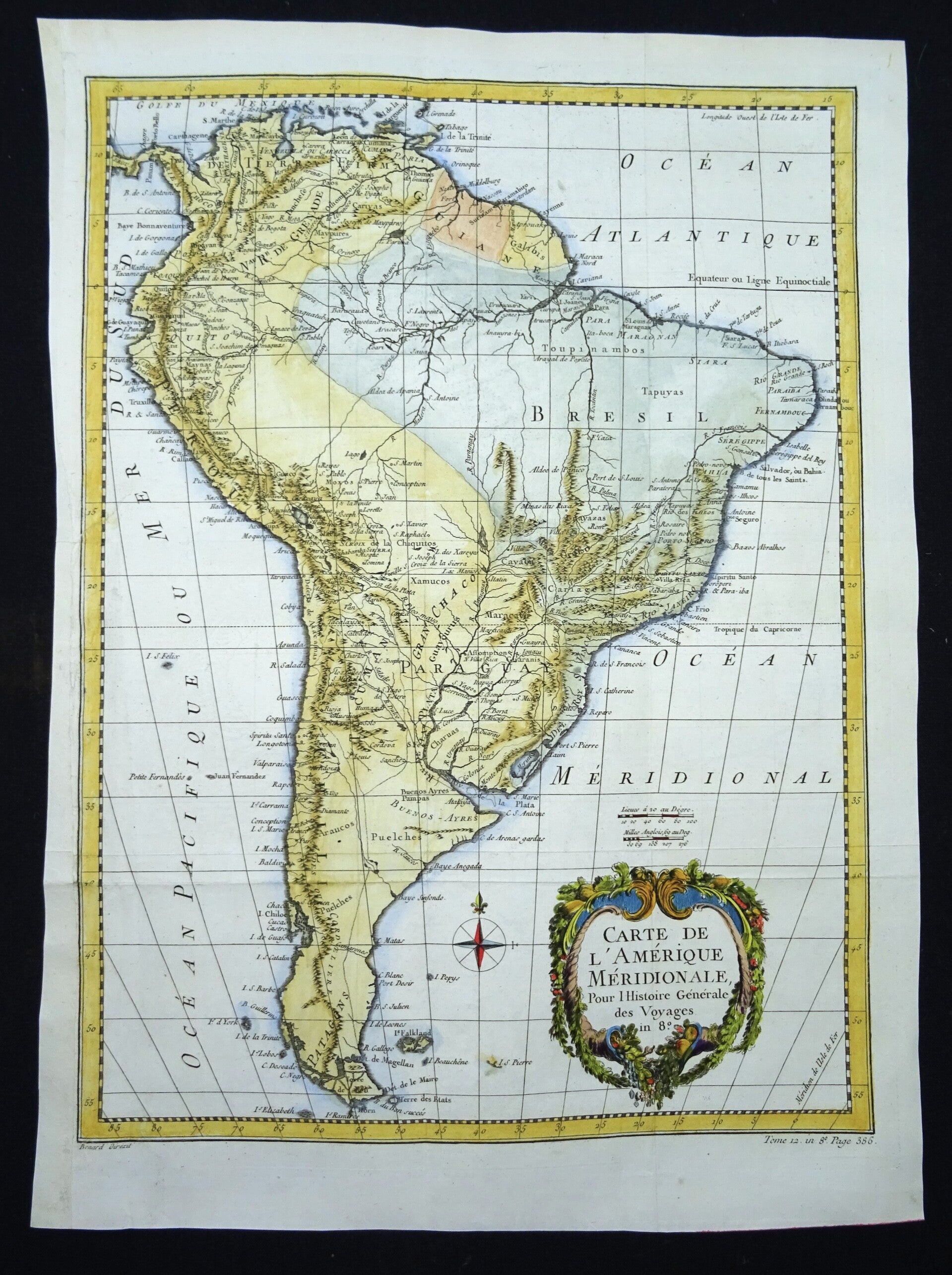
Large map of South America in colonial times, made by Bellin.
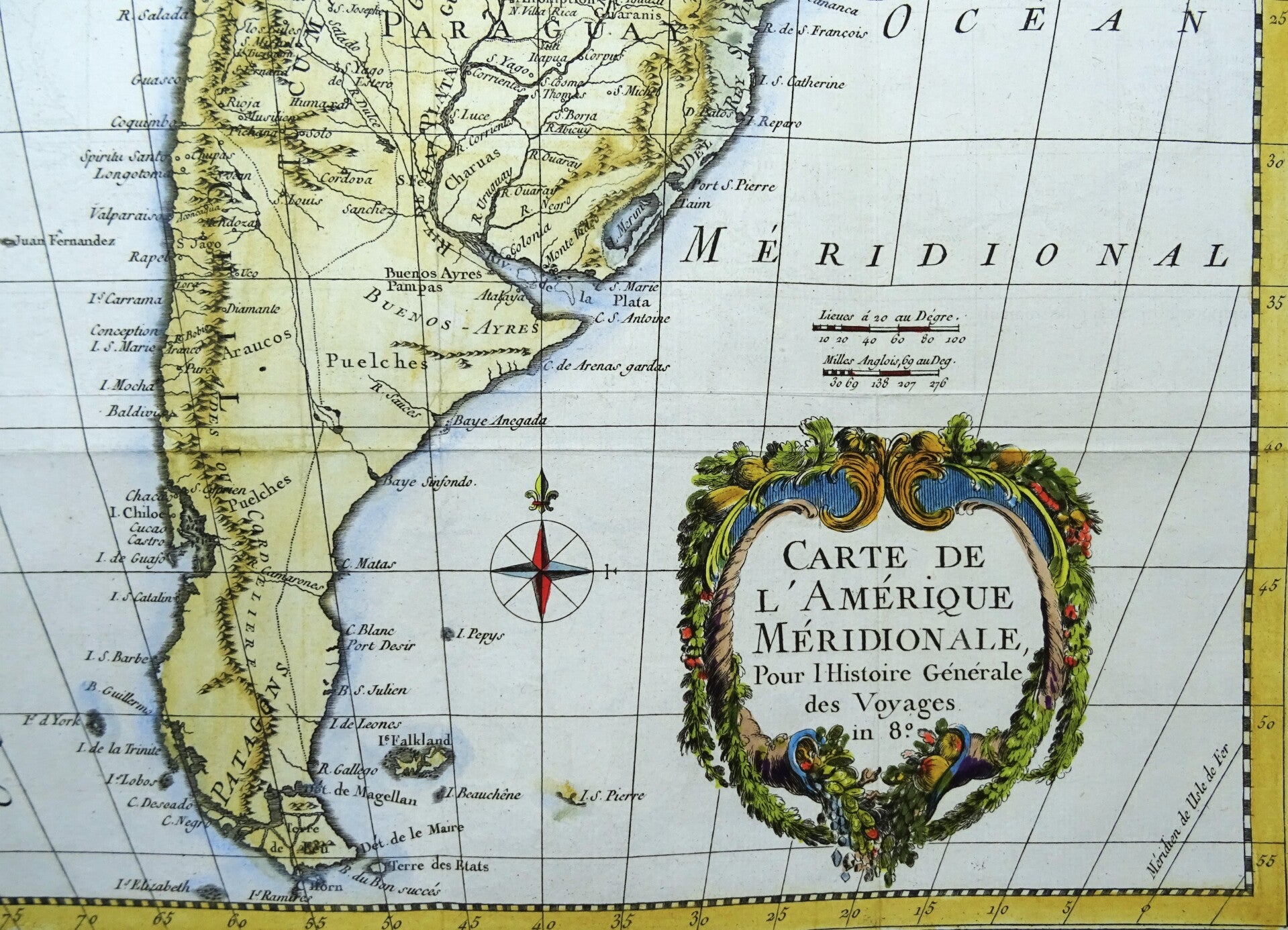
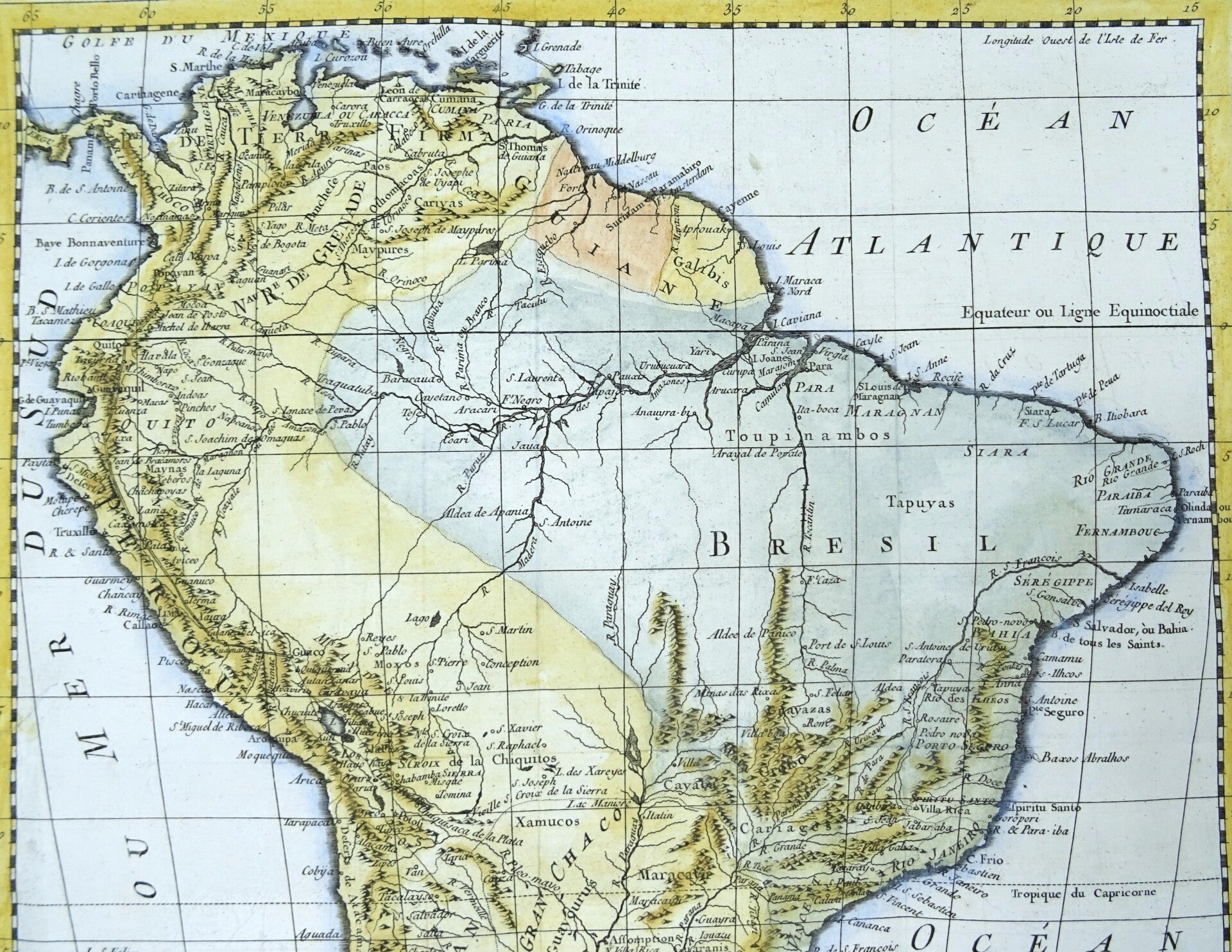
There are areas with many details, particularly along the west coast in Peru, Chile, and throughout northern South America. It shows where most of the era's interest and knowledge was concentrated. Most of Brazil, however, is a blank wasteland occupied by the Amazon rainforest. The Amazon River, on the other hand, and its tributaries, appear in surprising detail. Fort Negro, modern-day Manaus, is labeled near the confluence of the Negro and Solomoes rivers, where it was founded in 1669. Other major cities throughout the continent are identified as well, including Buenos Aires, Montevideo, Cuzco, Cartagena, and Rio de Janeiro. The Rio de la Plata, the Paraguay River, and their tributaries occupy a large portion of south-central South America and include the mythical Laguna de Xarayes.
Laguna de Xarayes
The mythical Laguna de Xarayes is illustrated here as the northern terminus, or source, of the Paraguay River. The Xarayes, a corruption of 'Xaraies' meaning 'Masters of the River', were an indigenous people occupying what are today parts of Brazil's Matte Grosso and the Pantanal. When Spanish and Portuguese explorers first navigated up the Paraguay River, as always in search of El Dorado, they encountered the vast Pantanal flood plain at the height of its annual inundation. Understandably misinterpreting the flood plain as a gigantic inland sea, they named it after the local inhabitants, the Xaraies. The Laguna de los Xarayes almost immediately began to appear on early maps of the region and, at the same time, to take on a legendary quality.
Includes a decorative title cartouche. One of the maps produced by J.N. Bellin for Prevost d'Exiles influential travel book, L'Histoire Generale des Voyages, dated 1757.
Excellent condition, folds as published.
Image 44x33cm, sheet 50x36cm