USA, Cuba, Puerto Rico, Jamaica... Lapie, 1806, États Unis et Grandes Antilles.
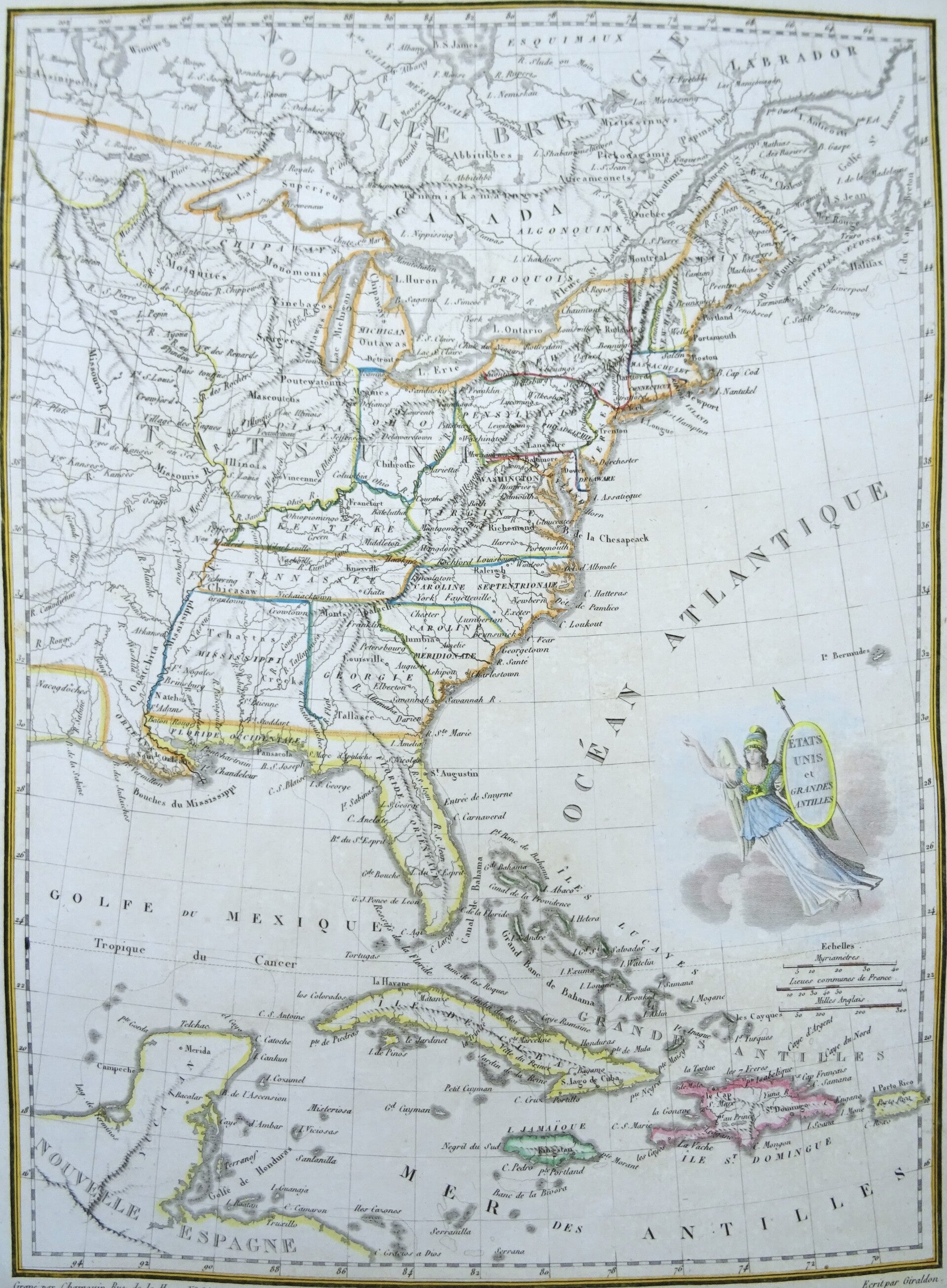
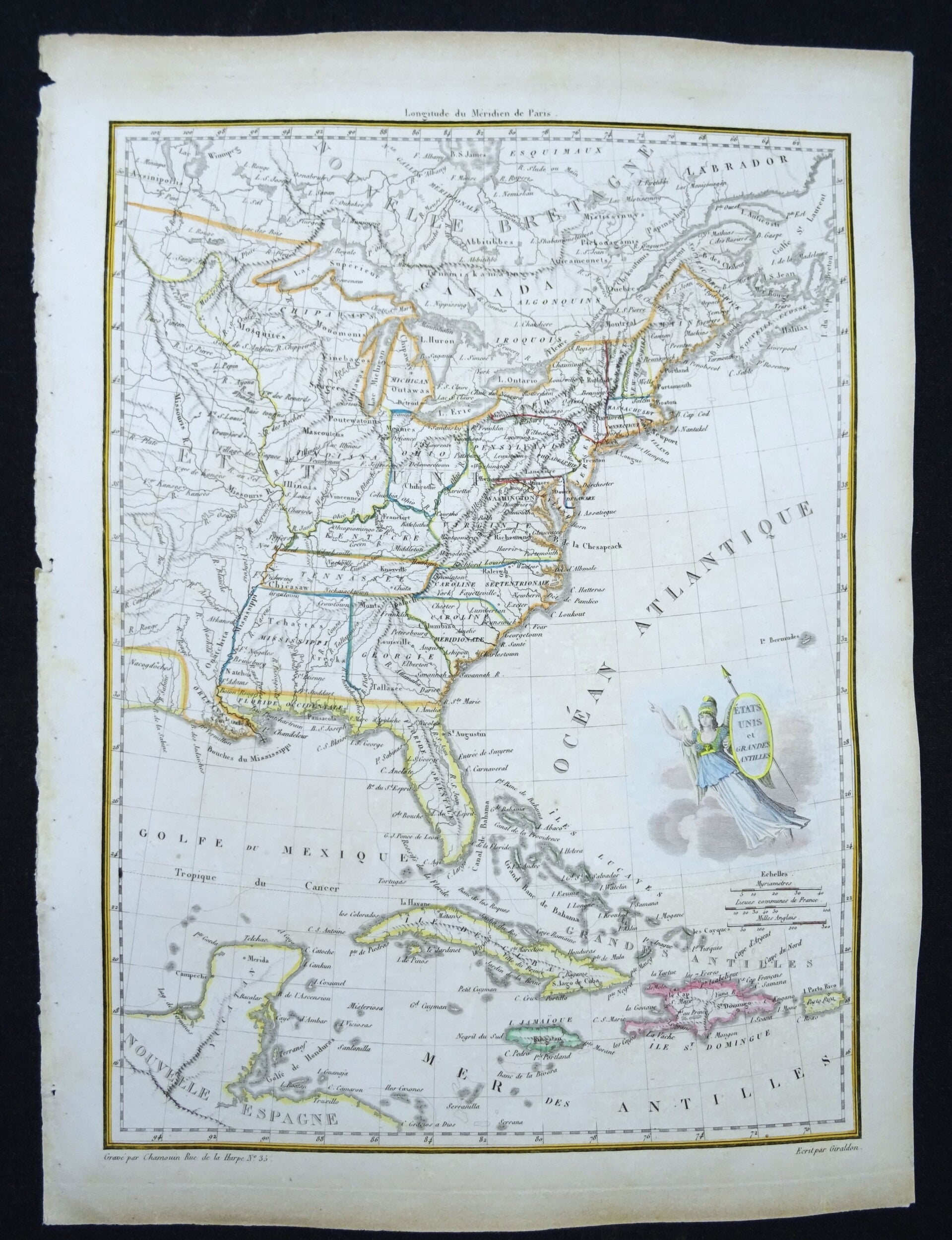
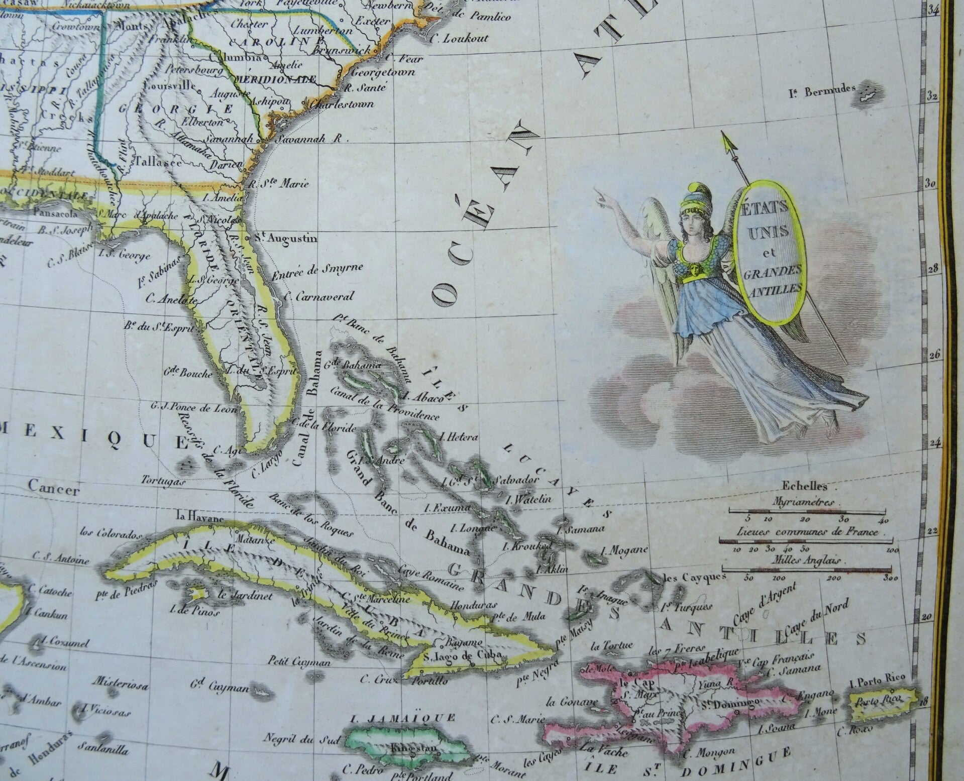
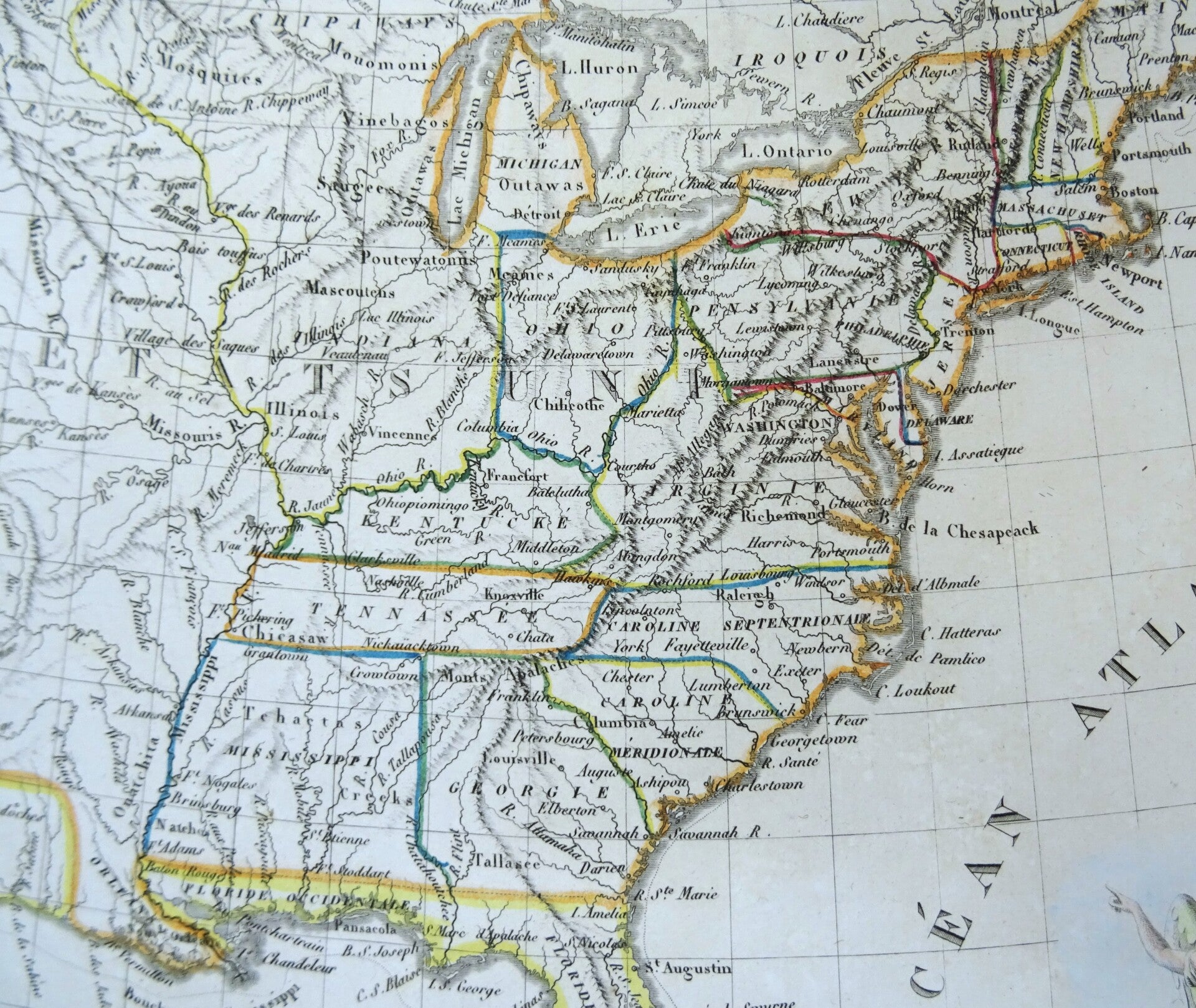
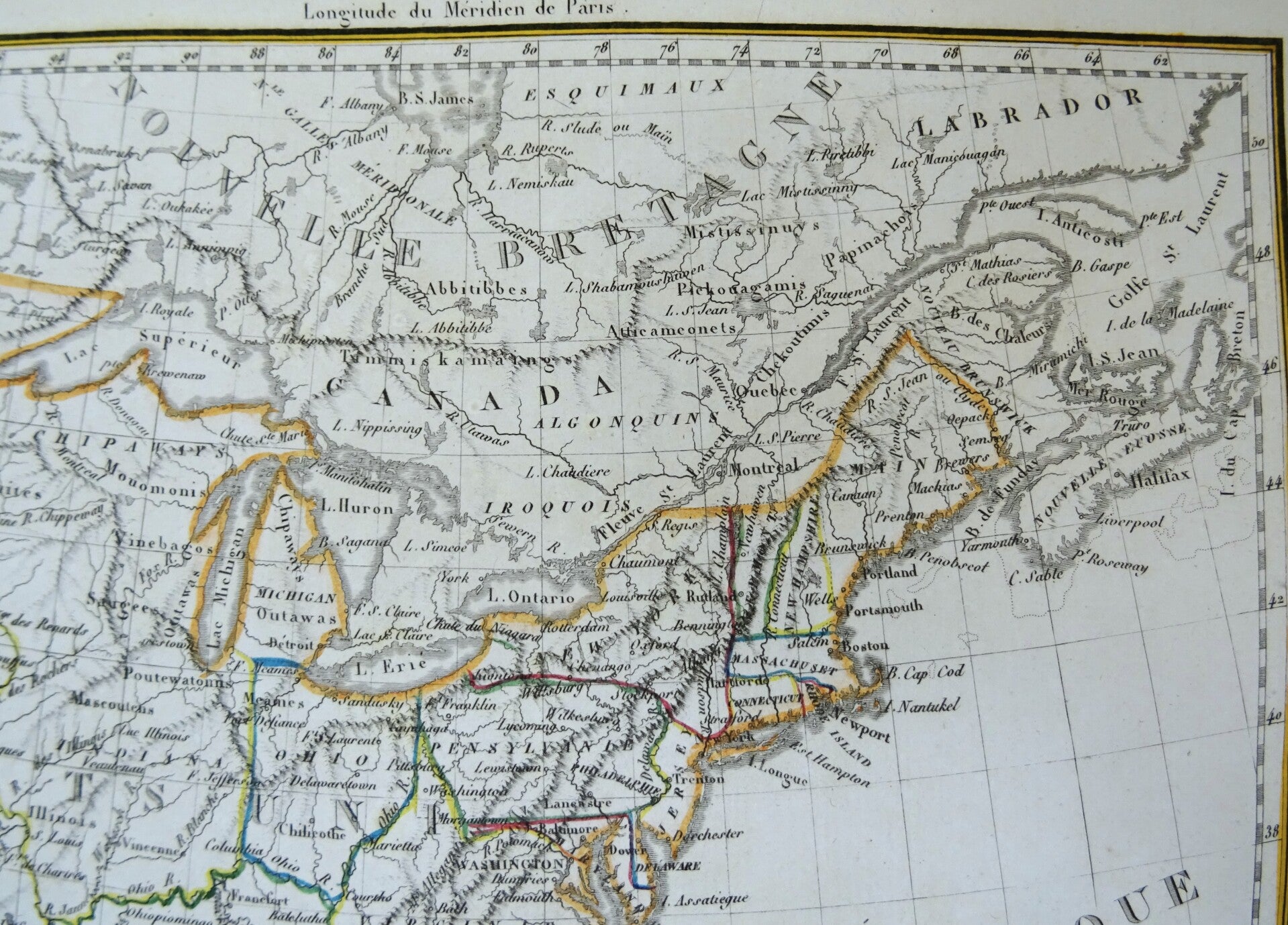
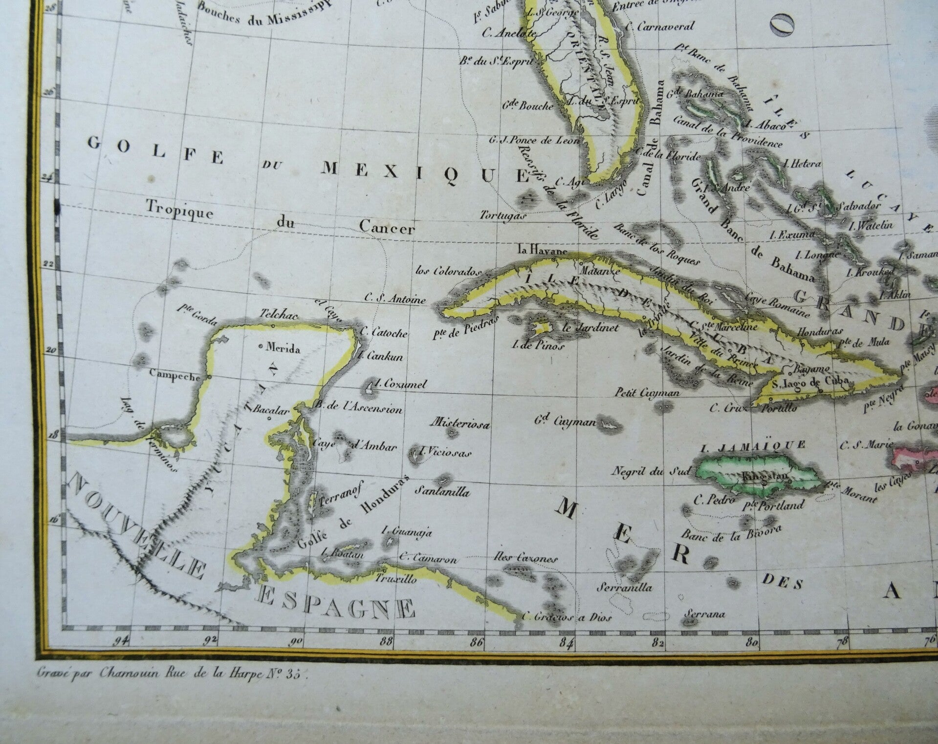
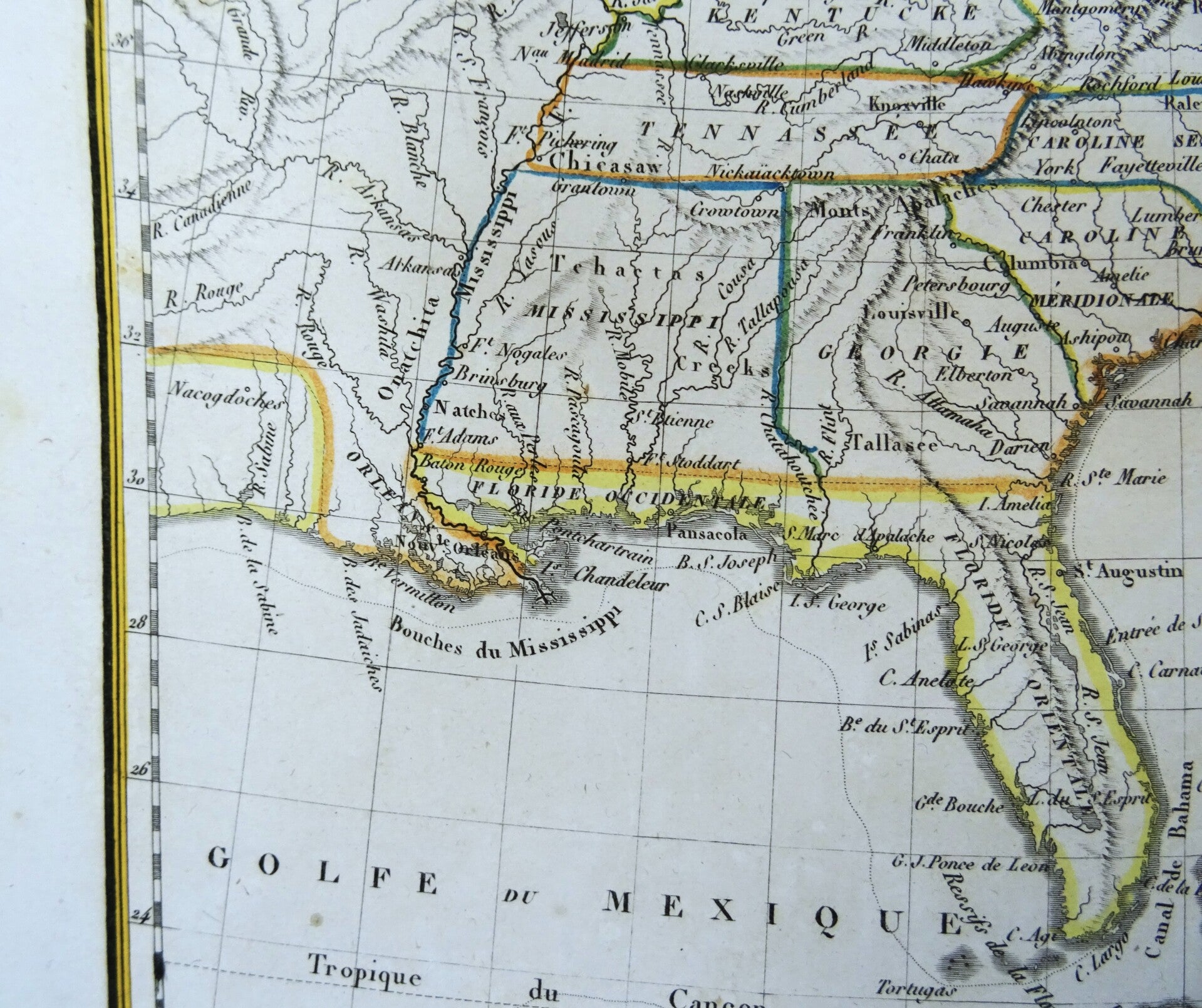
This copper engraved map was created by Conrad Malte-Brun and Pierre Lapie in 1806 and depicts the eastern regions of the United States and the Greater Antilles, including Cuba, Puerto Rico, and Haiti.
The subject matter of the map is both geographical and political, illustrating the territories of the United States and the Caribbean islands, which were of great interest to European powers at the time. The map provides insight into the territorial understanding and geopolitical interests of early 19th-century France, particularly in relation to its former colonies and the expanding United States.
The cultural and historical context of this map is significant. Created shortly after the Louisiana Purchase and during a time of rapid expansion and exploration in the United States, it reflects contemporary knowledge and interest in the New World. The map also highlights the colonial interests in the Caribbean, a region of significant strategic and economic importance due to its sugar plantations and trade routes.
The atlas from which this map originates is noted for incorporating the latest geographical discoveries of the time, including information from the Lewis and Clark expedition.
Published in: Conrad Malte-Brun. Atlas Complet du précis de la Geographie universelle. Dressé conformément au Texte de cet Ouvrage et sous les Yeux de L'Auteur, par M. Lapie. Paris, Francois Buisson, 1812.
Excellent condition. Original outline coloring.
Image 30x22cm, page 35x26cm