West Africa, Sierra Leone, Liberia, Ivory Coast, Ghana, Benin, Gabon... W. Blaeu, 1635, Guinea
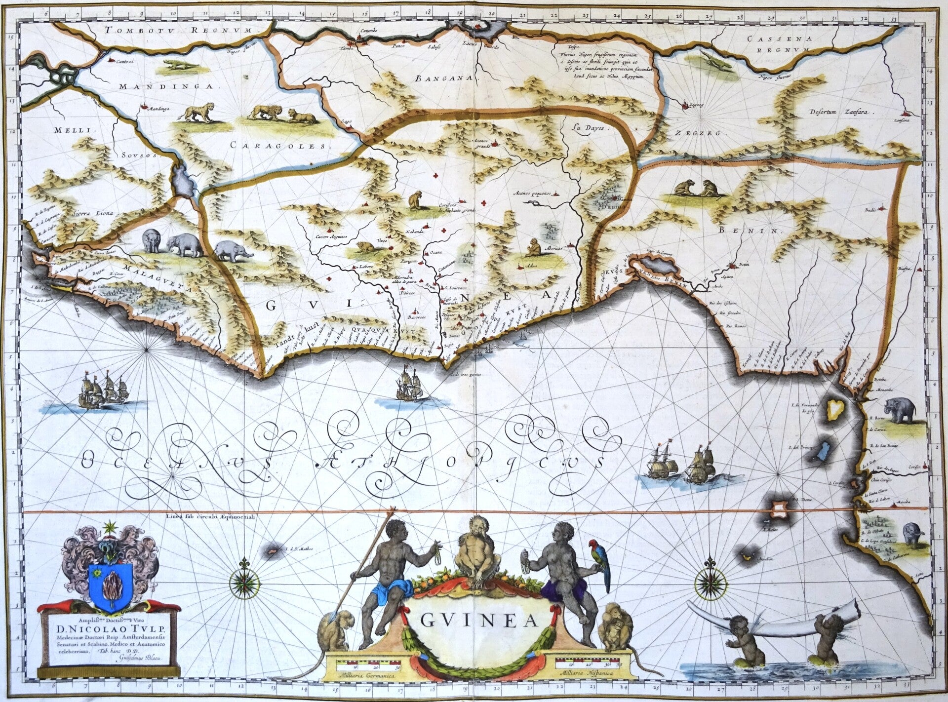
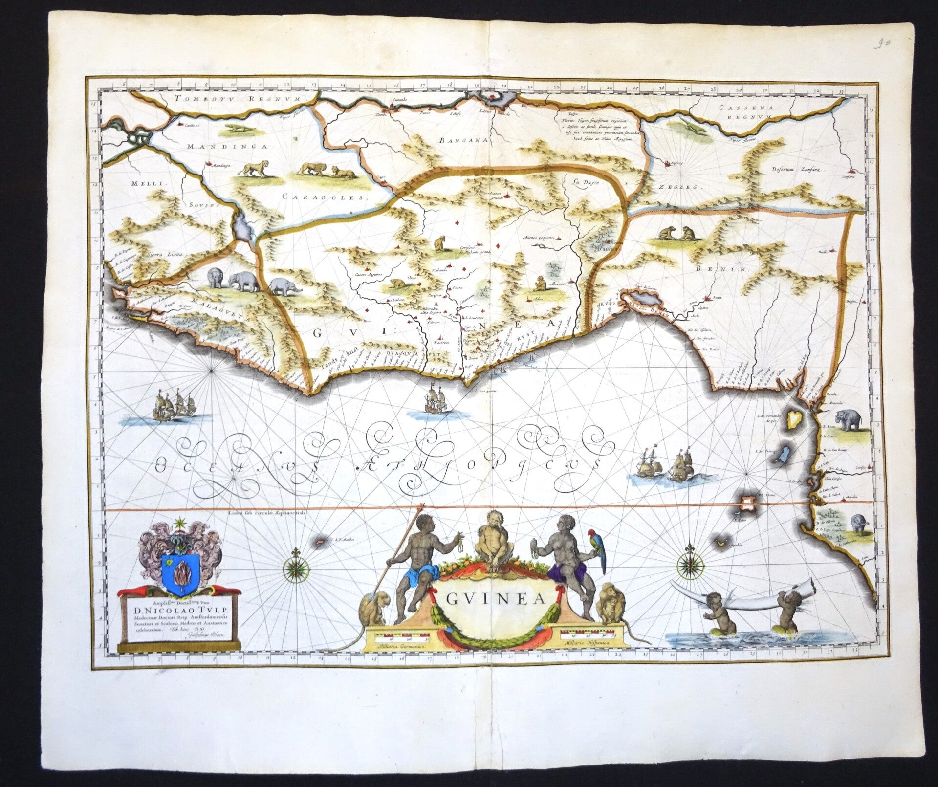
Beautiful 17th century map of part of West Africa from Sierra Leone in the north to Gabon in the south. Published by W. and J. Blaeu in 1635 in Amsterdam in the French edition of their first large atlas (Atlas Novus).
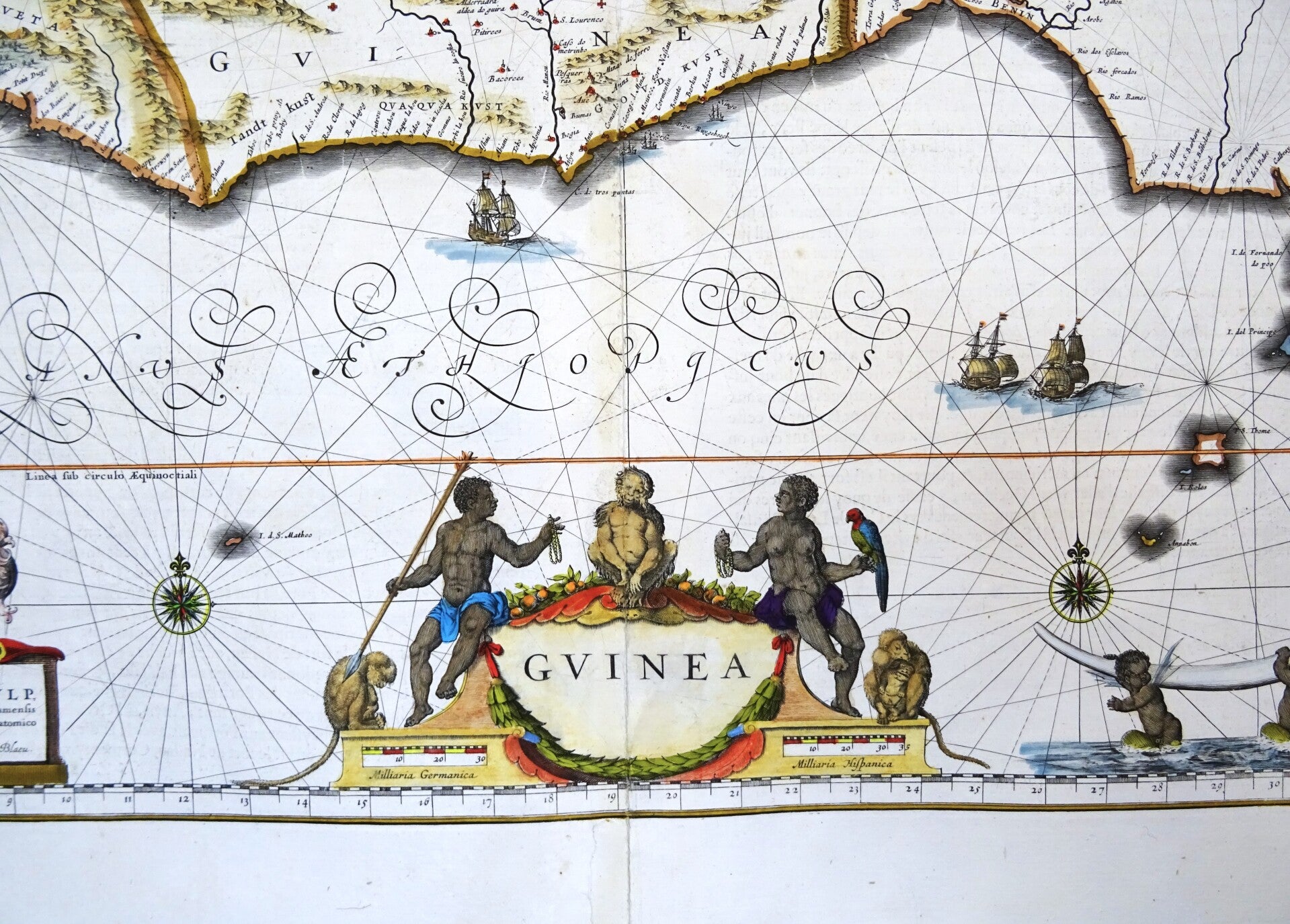
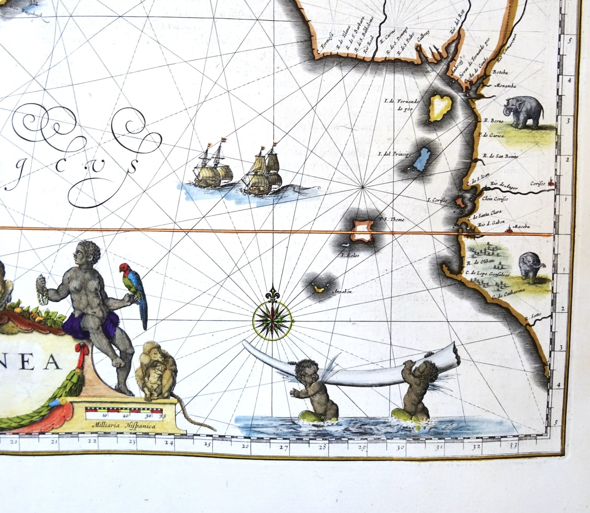
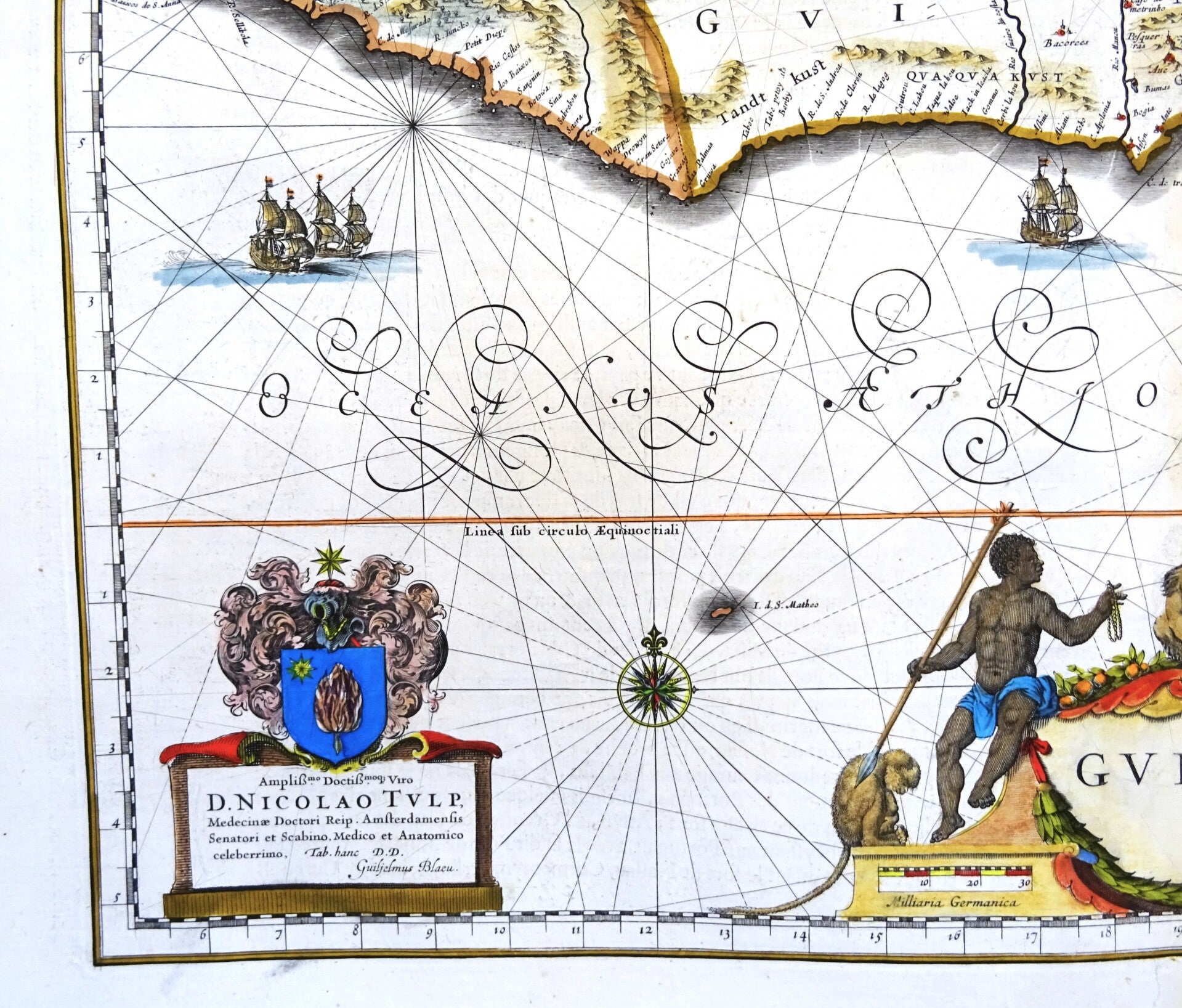
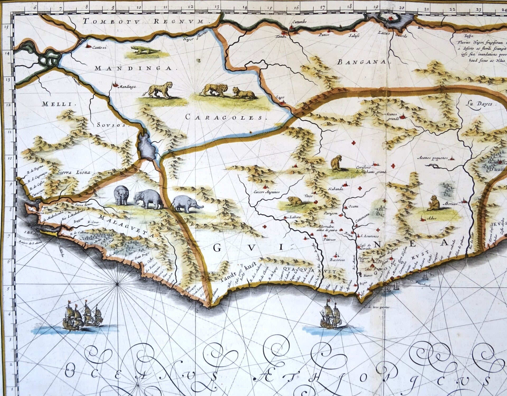
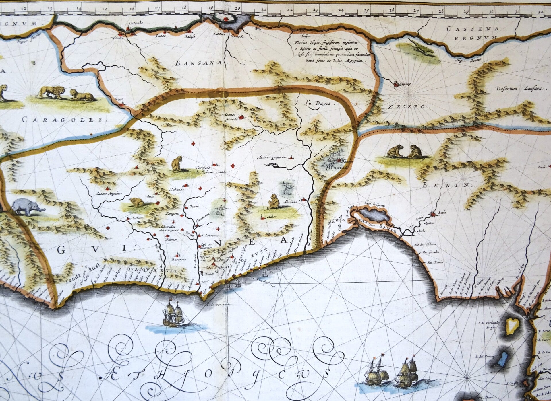
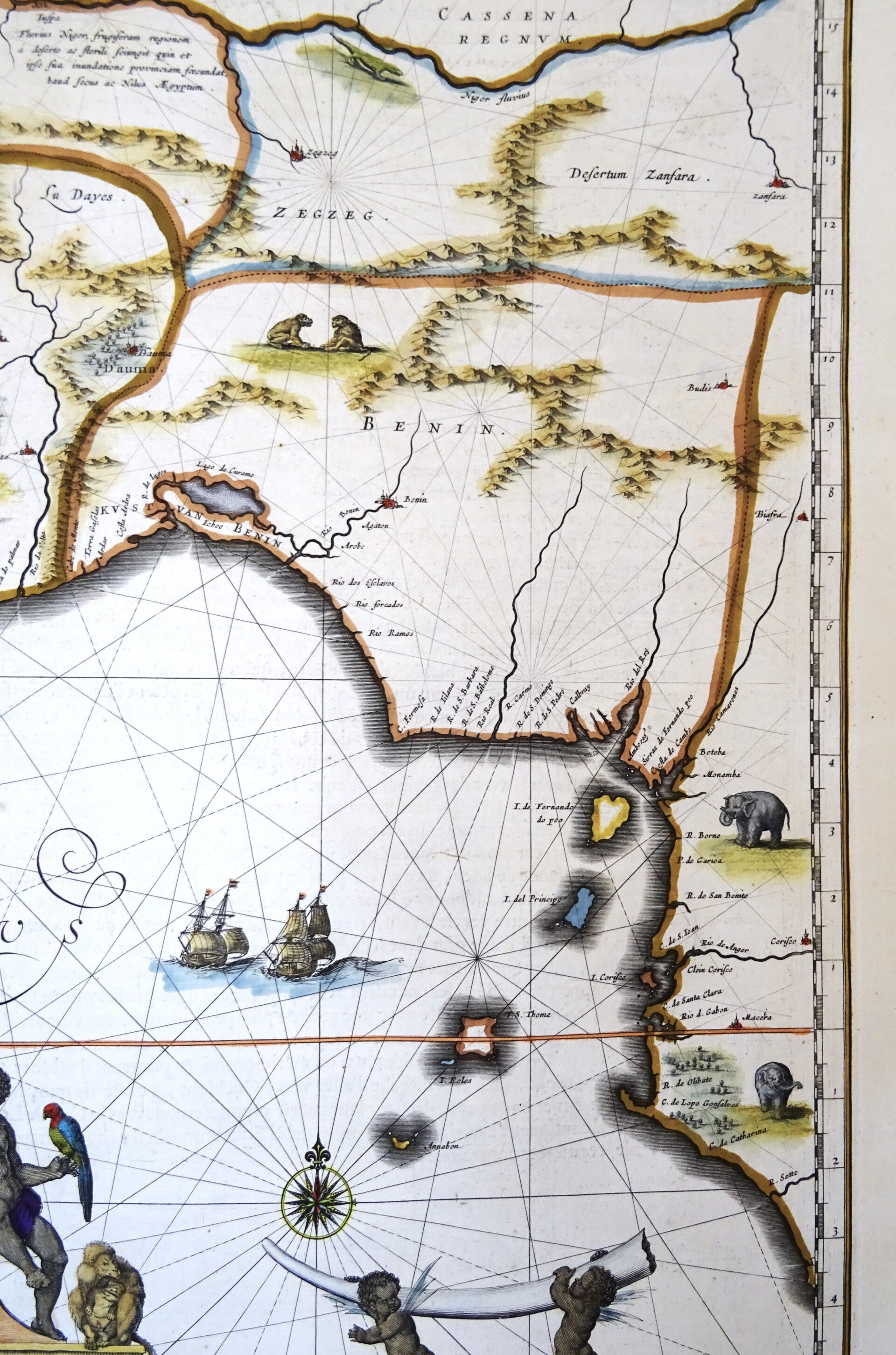
This beautiful map of West Africa is decorated with an elaborate title-cartouche, another two cartouches and several ships and a compass-rose in the sea part. Near the cartouche, we see a depiction of Africans and African fauna (monkeys and a parrot). Various animals have also been drawn on the map, such as elephants, monkeys and lions. At the lower right are two winged black putti carrying an elephant's tusk.
Good condition. Repaired and reinforced in the central fold, with some minimal impact on the image. Some very minor age browning. Otherwise excellent. Wide margins, thick paper, reverse side text in French.
Image 38,5x52,5cm, sheet 49x57cm