North America, USA, Canada, Sea of the West, R. Bonne, 1781, Carte Générale de l´Amérique Septentrionale
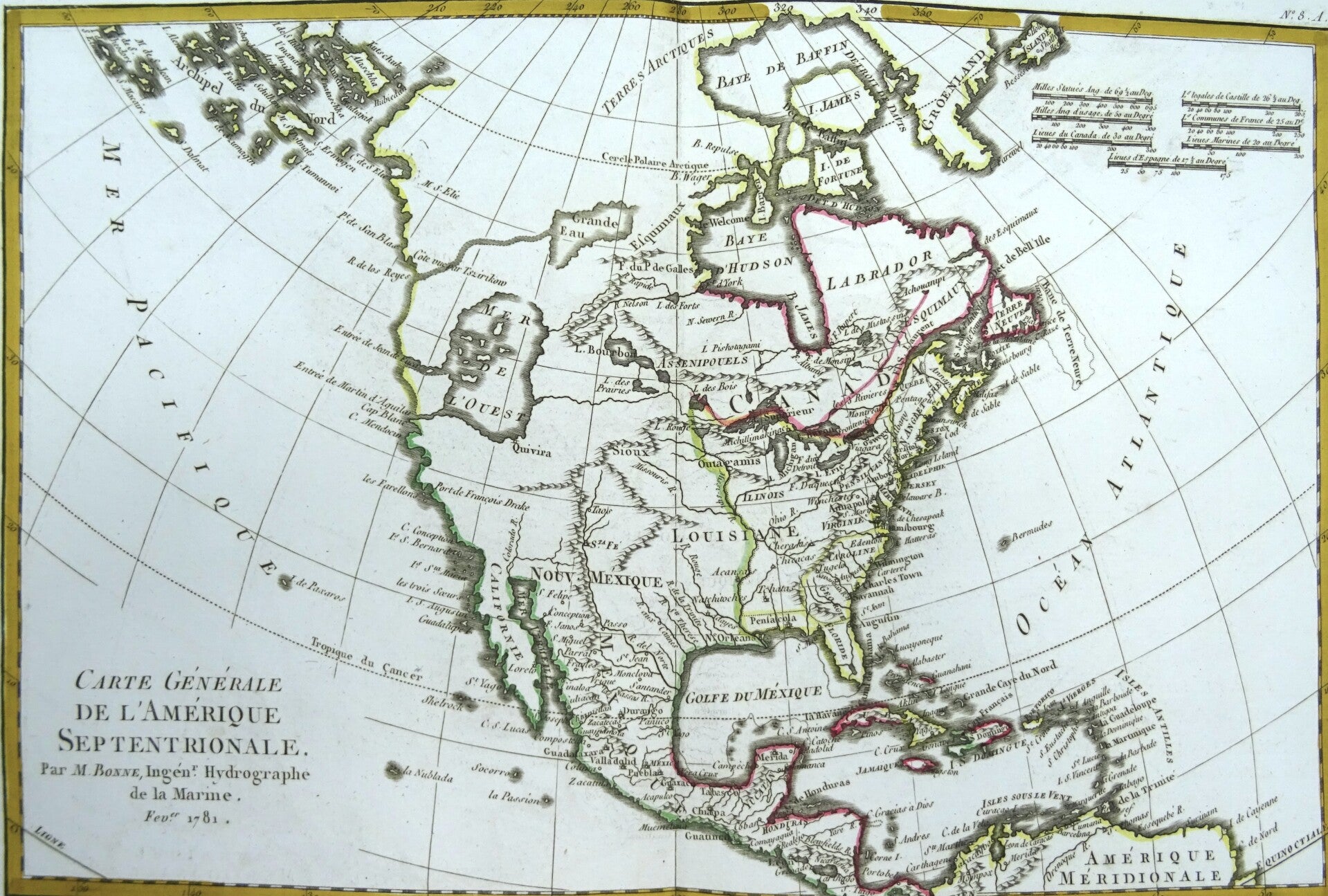
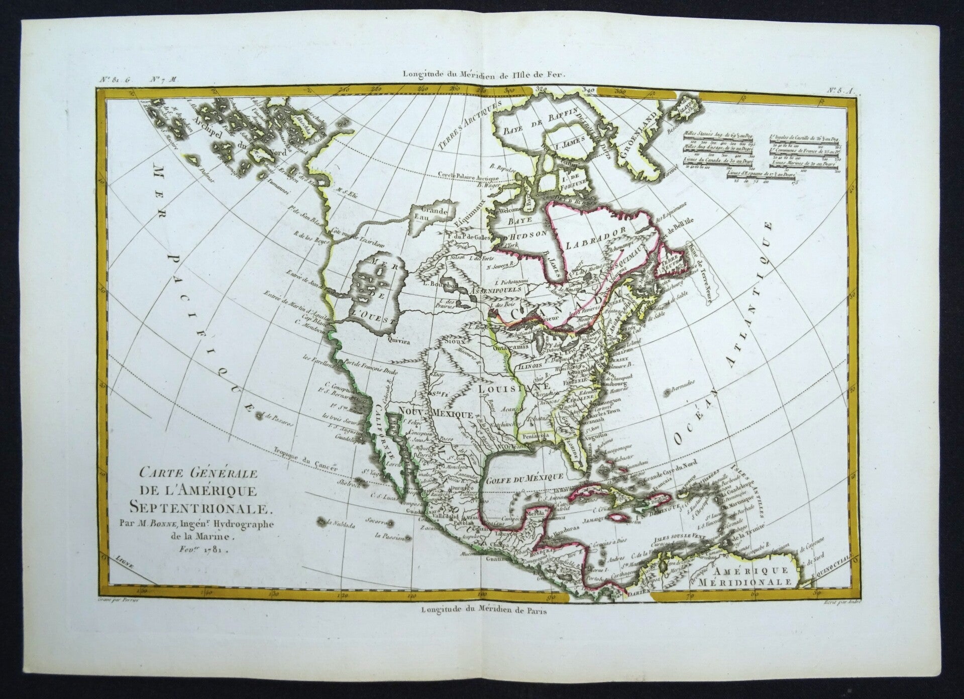
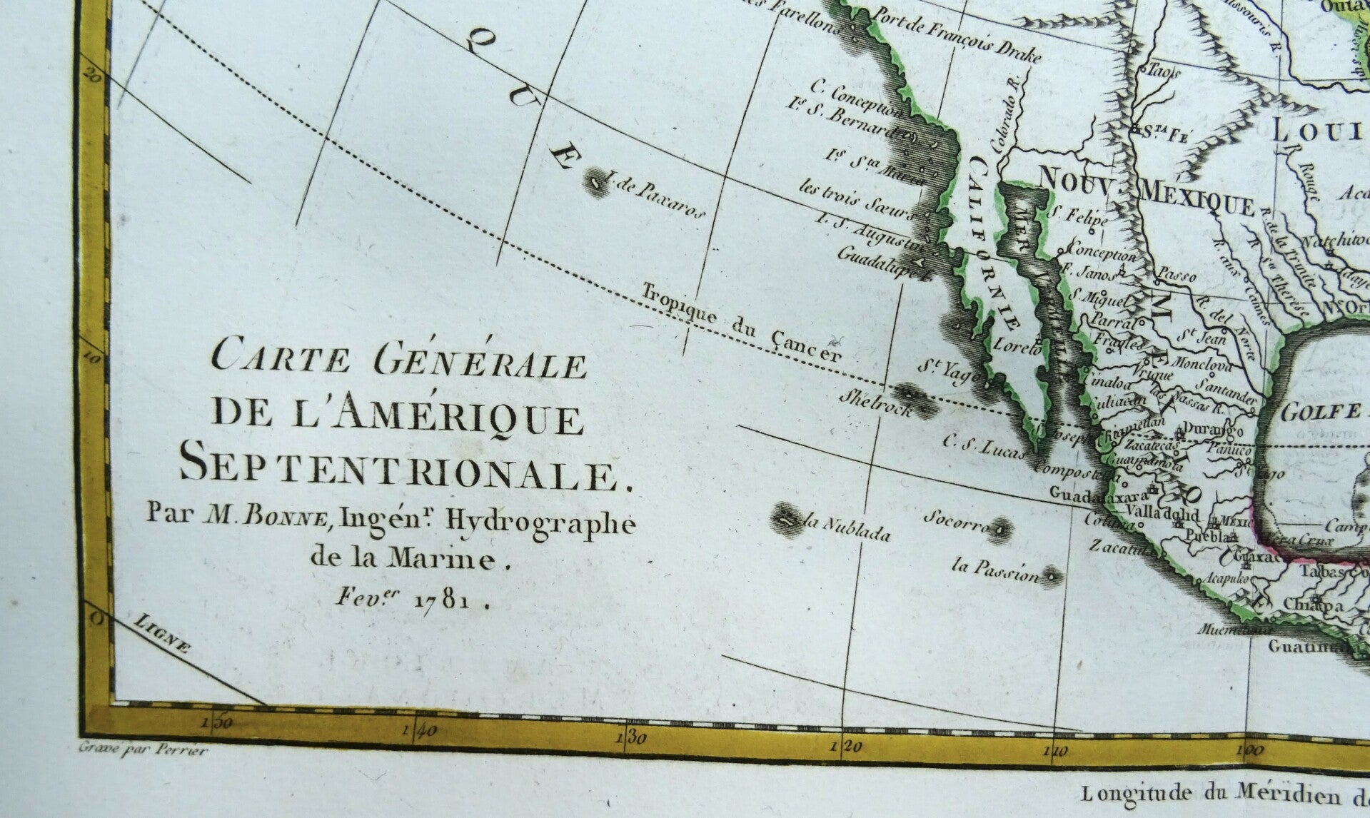
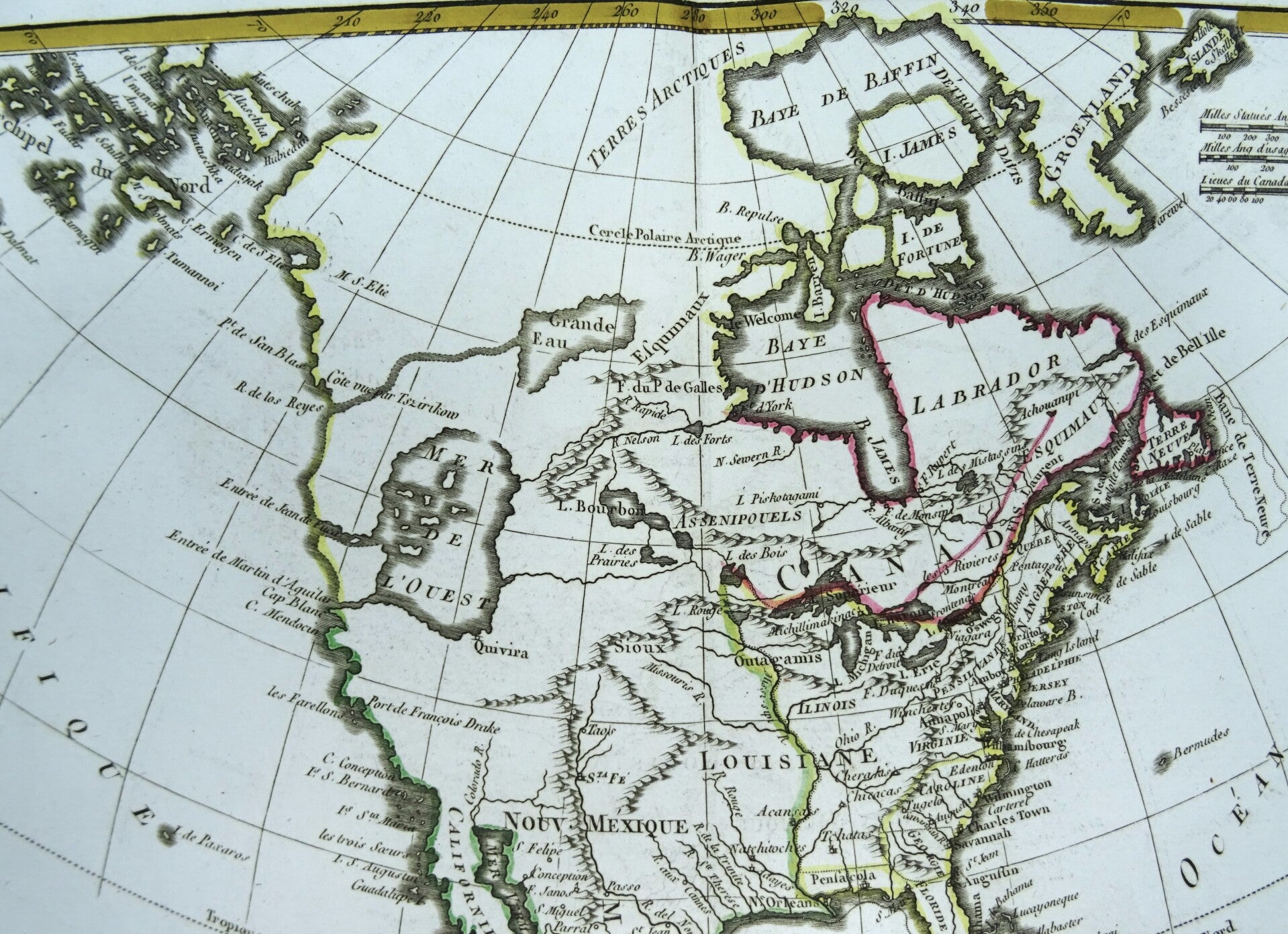
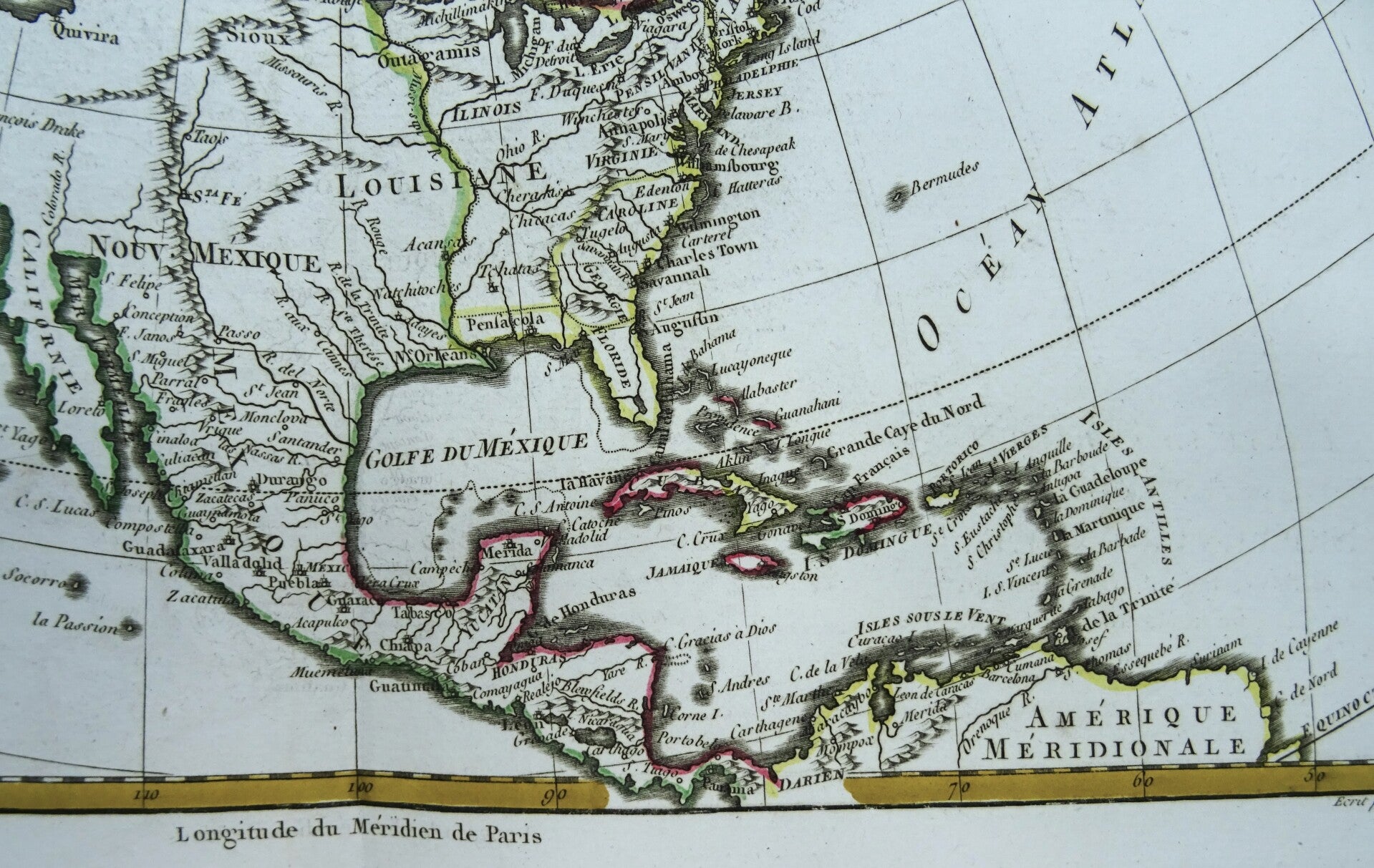
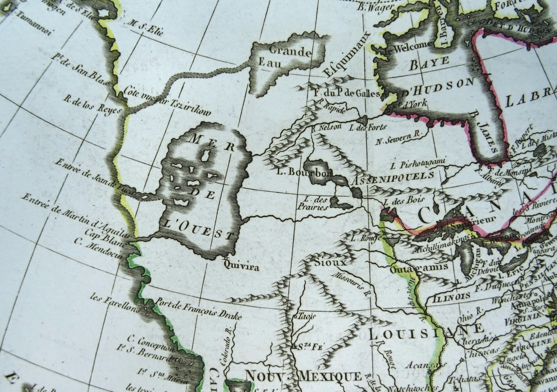
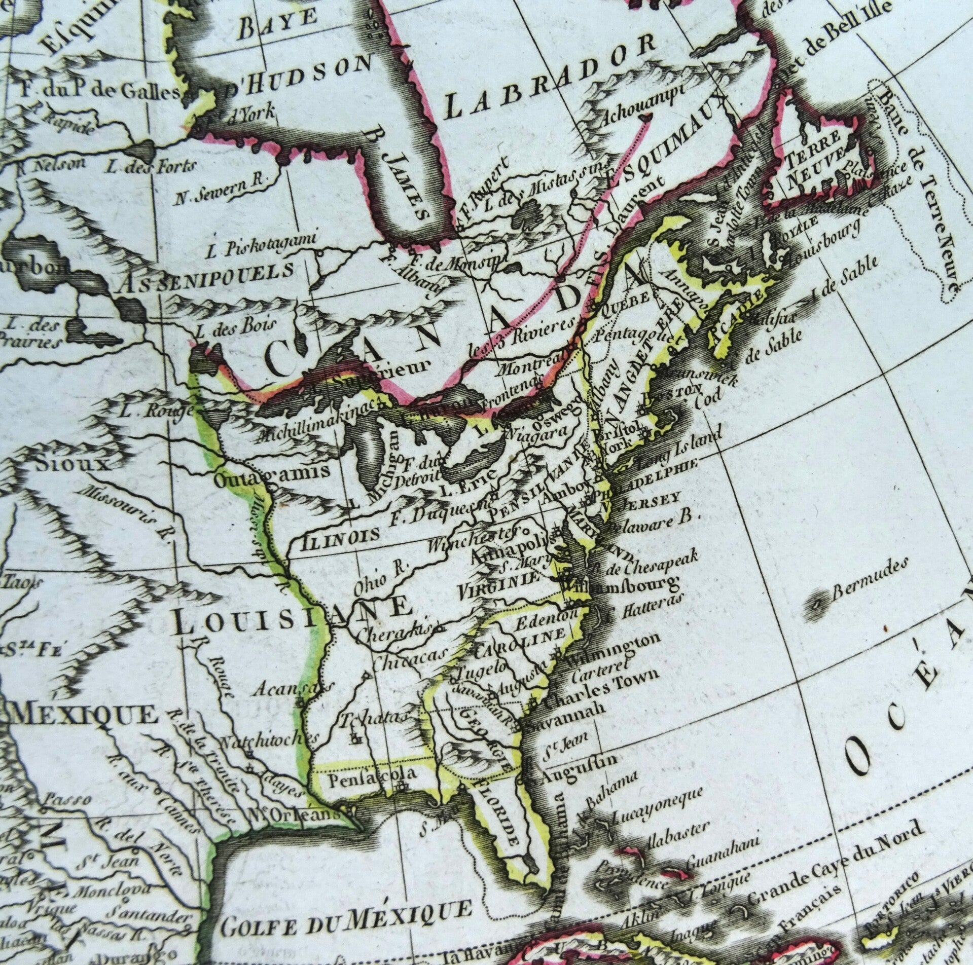
Great map of North America displaying some of the most intriguing cartographic mis-mapping of the late eighteenth century. The most apparent feature is the huge Mer de l' Ouest (Sea of the West), complete with several fictitious islands, and with the fabled wealthy city of Quivira located on its southern shore. This sea is connected to the Pacific by the Entre of Jean de Fuca and the Entre de Martin d' Aguilar. In the middle of Canada is a gigantic Grande Eau from which flows the mythical R. de los Reyes (a remnant of the Northwest Passage theories). Also striking is the treatment of Alaska, shown as a vast group of island, the most prominent of which is named Alaschka.
Made by R. Bonne, Paris.Rigobert Bonne (1727-1794) was an influential French cartographer of the late-eighteenth century. Born in the Lorraine region of France, Bonne came to Paris to study and practice cartography. He was a skilled cartographer and hydrographer and succeeded Jacques Nicolas Bellin as Royal Hydrographer at the Depot de la Marine in 1773. He published many charts for the Depot, including some of those for the Atlas Maritime of 1762. In addition to his work at the Depot, he is best known for his work on the maps of the Atlas Encyclopedique (1788) which he did with Nicholas Desmarest. He also made the maps for the Abbe Raynals’ famous Atlas de Toutes Les Parties Connues du Globe Terrestre (1780).
Excellent condition. Original outline coloring. Thick paper. Clear print. Reverse side blank.
Image 21x32cm, sheet 27x39cm