Antarctica, Australia, South America, Africa, Bellin, 1778, Carte de l´Hemisphere Austral
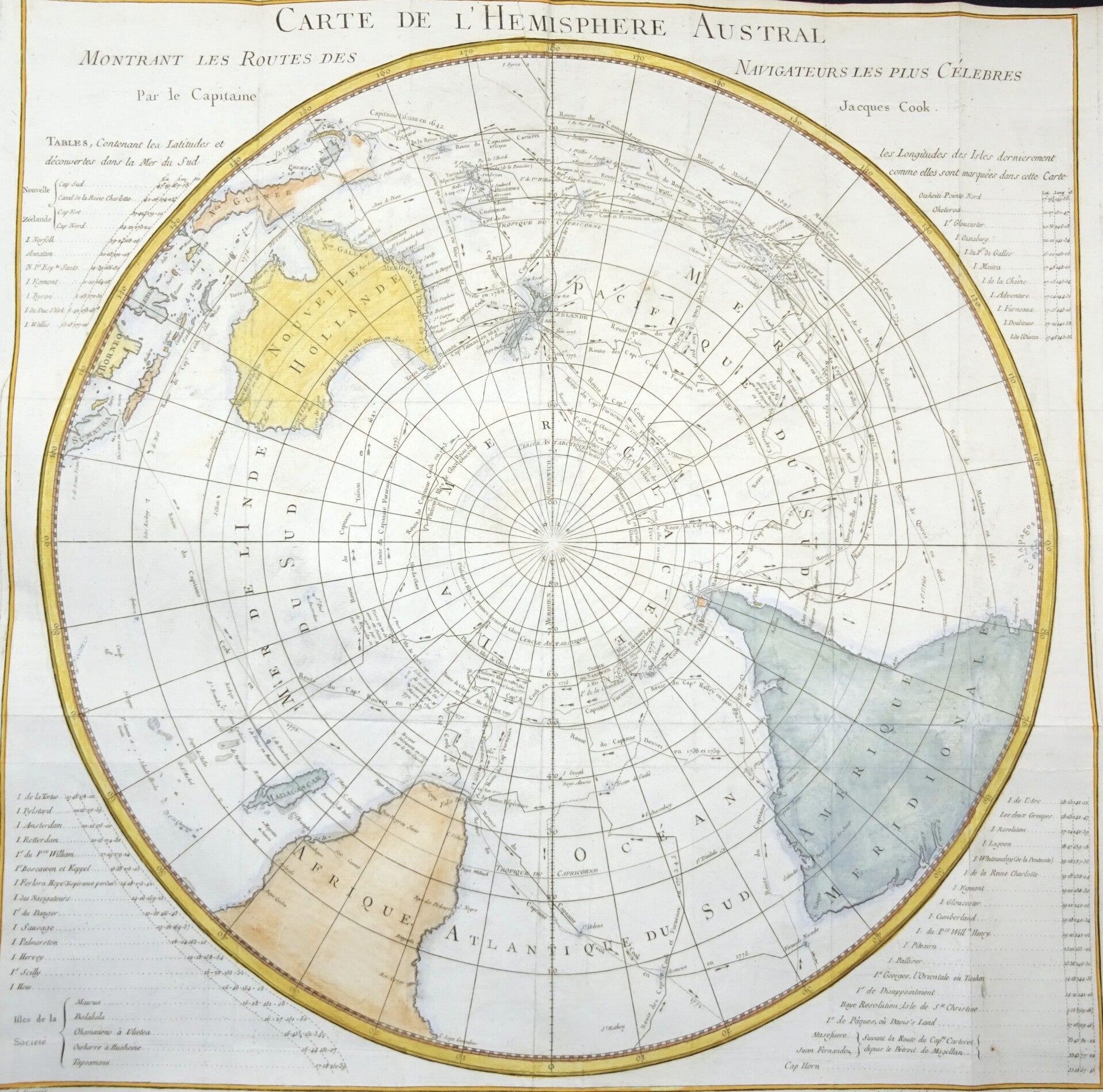
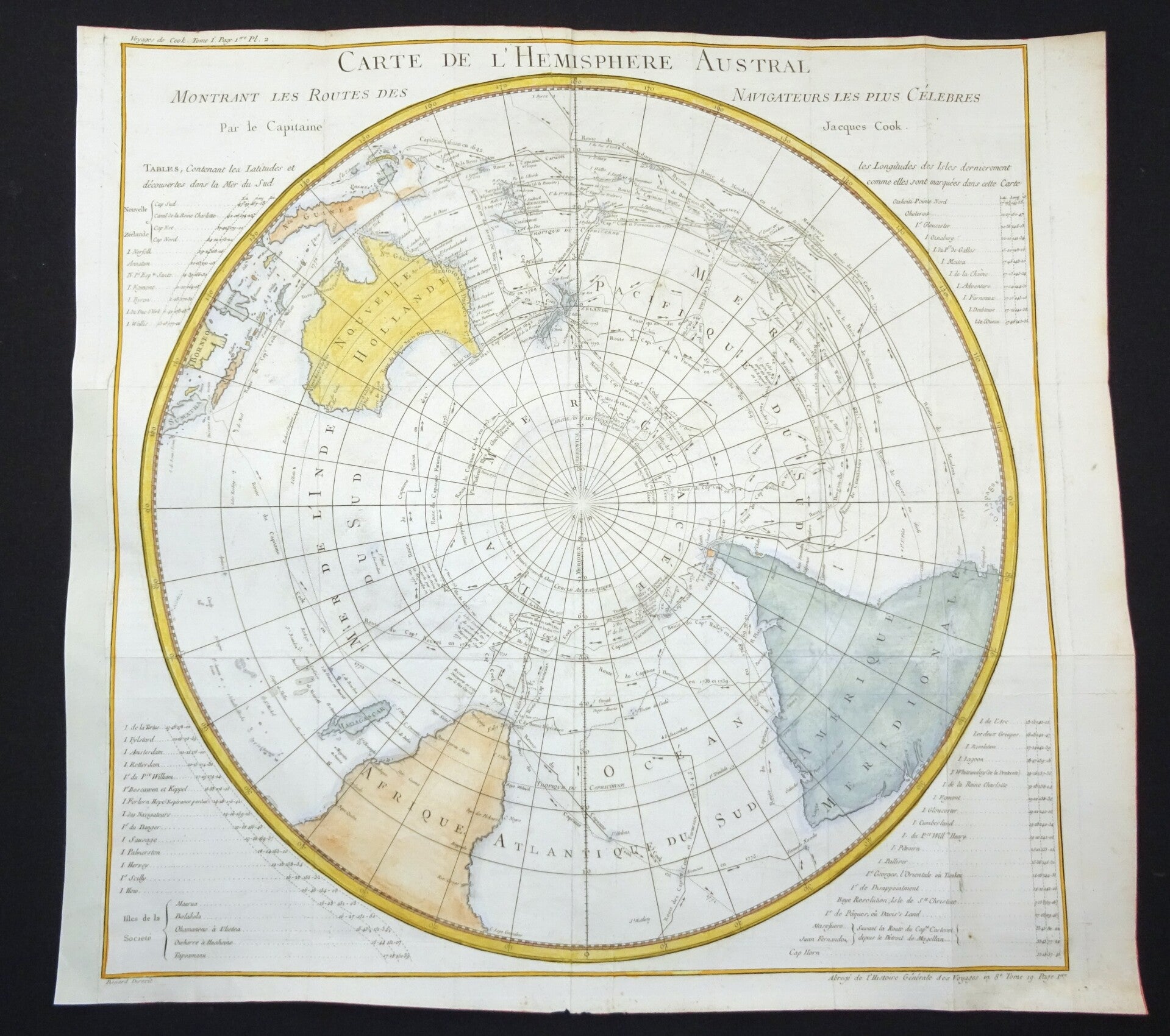
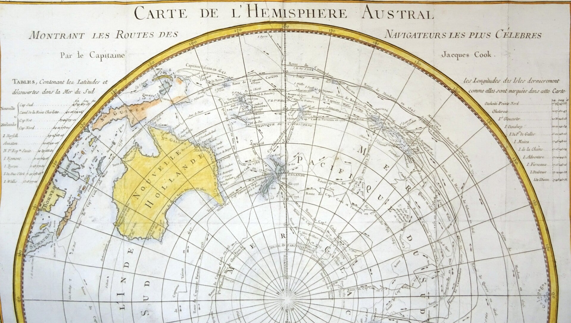
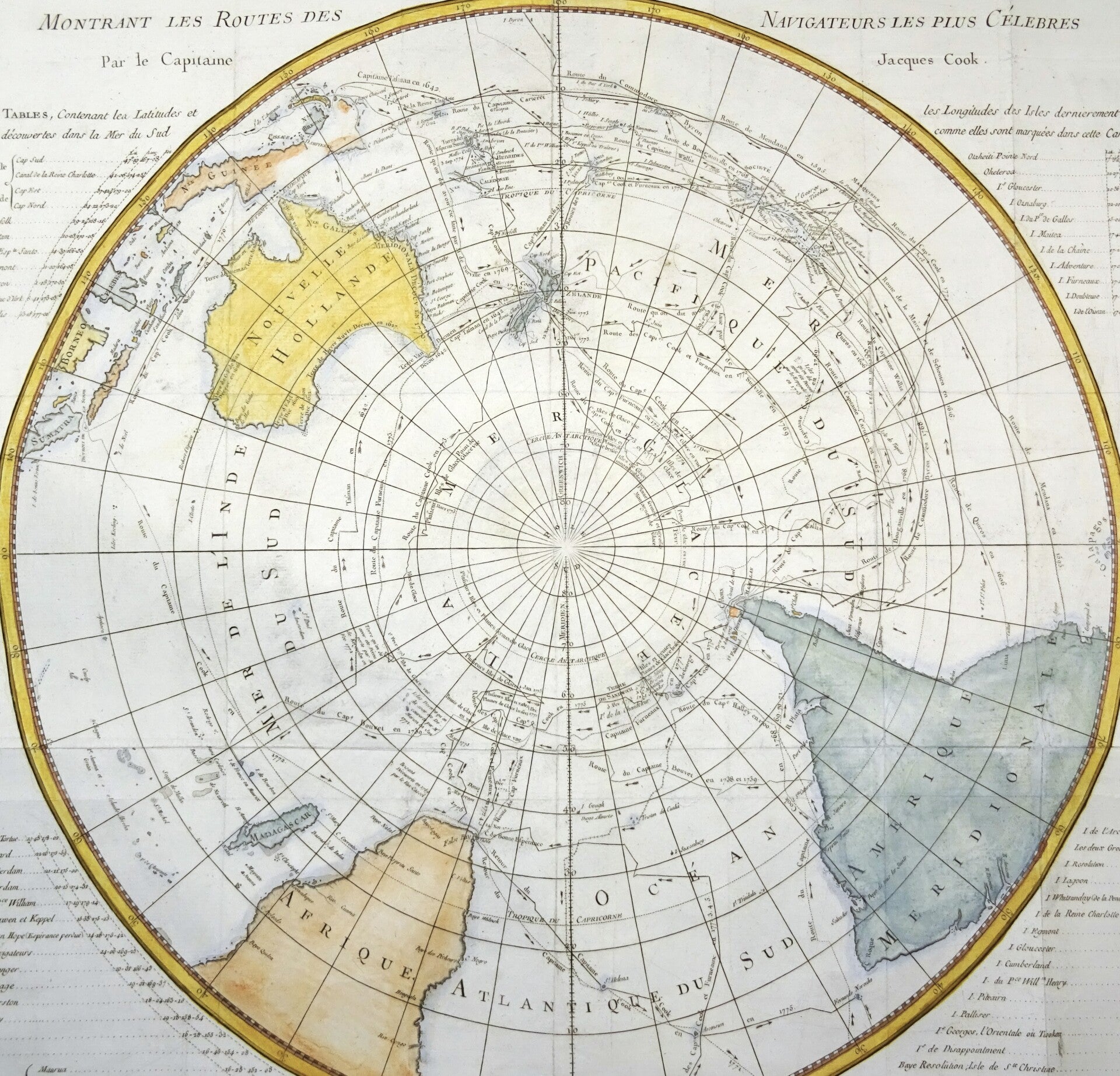
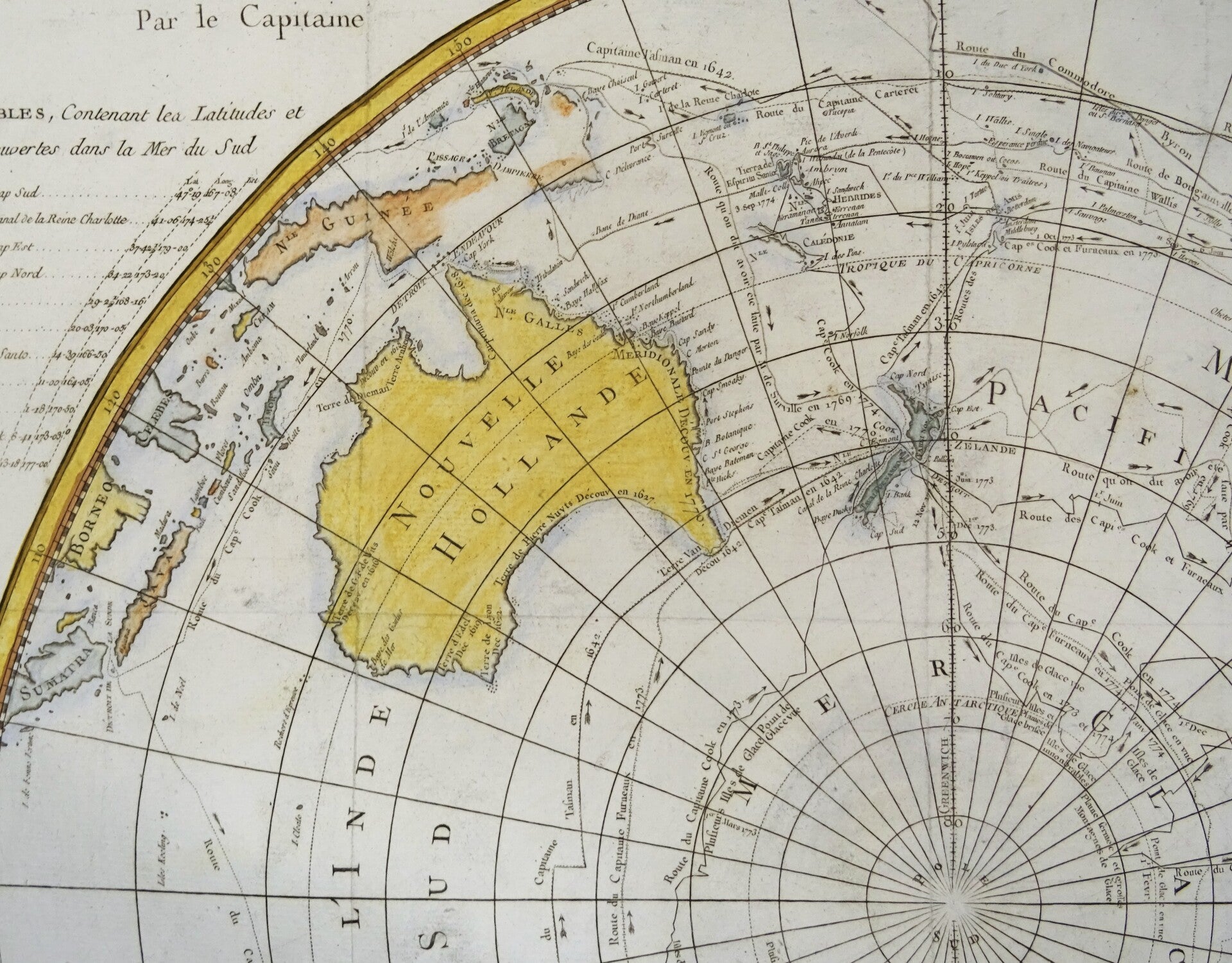
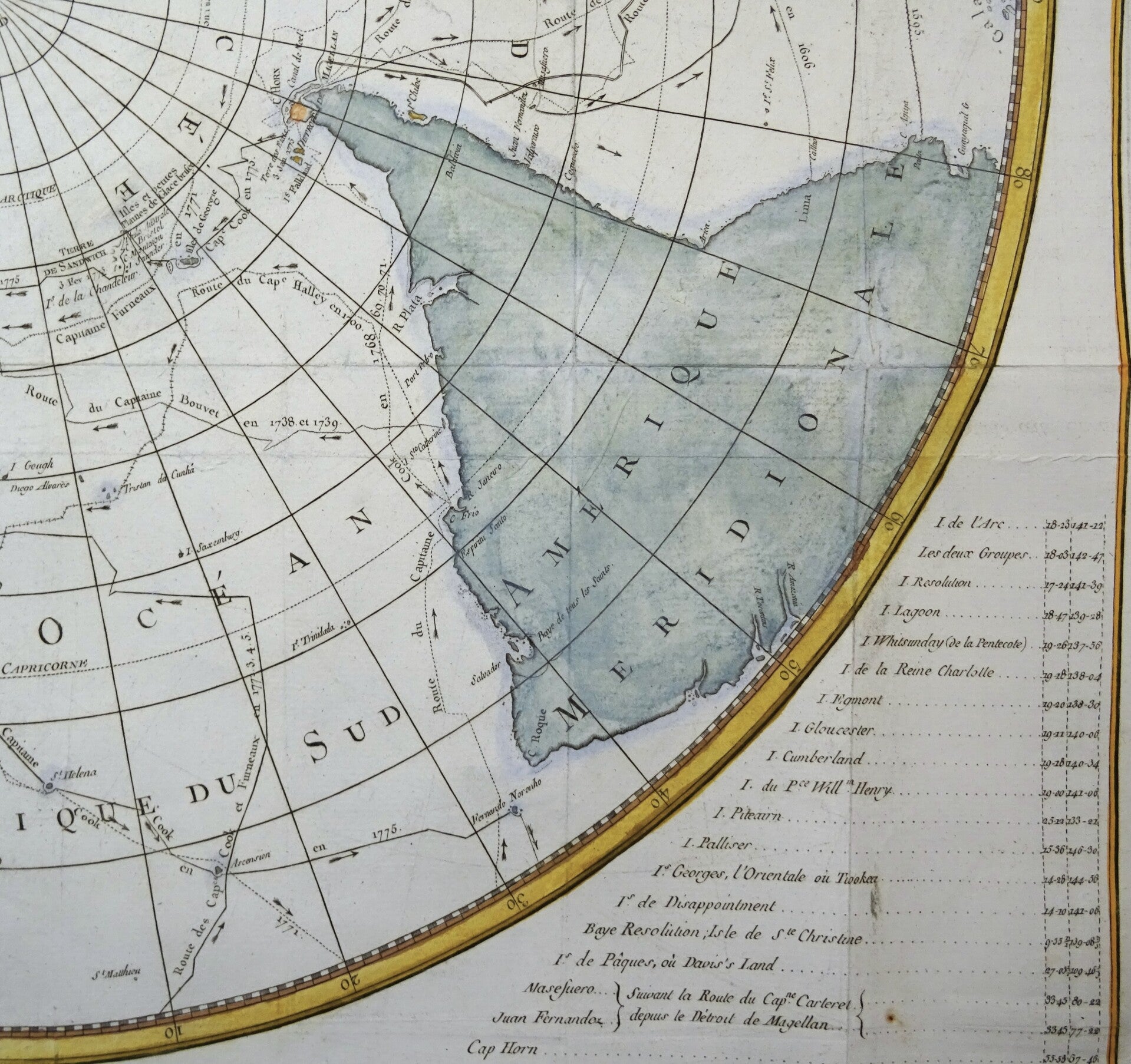
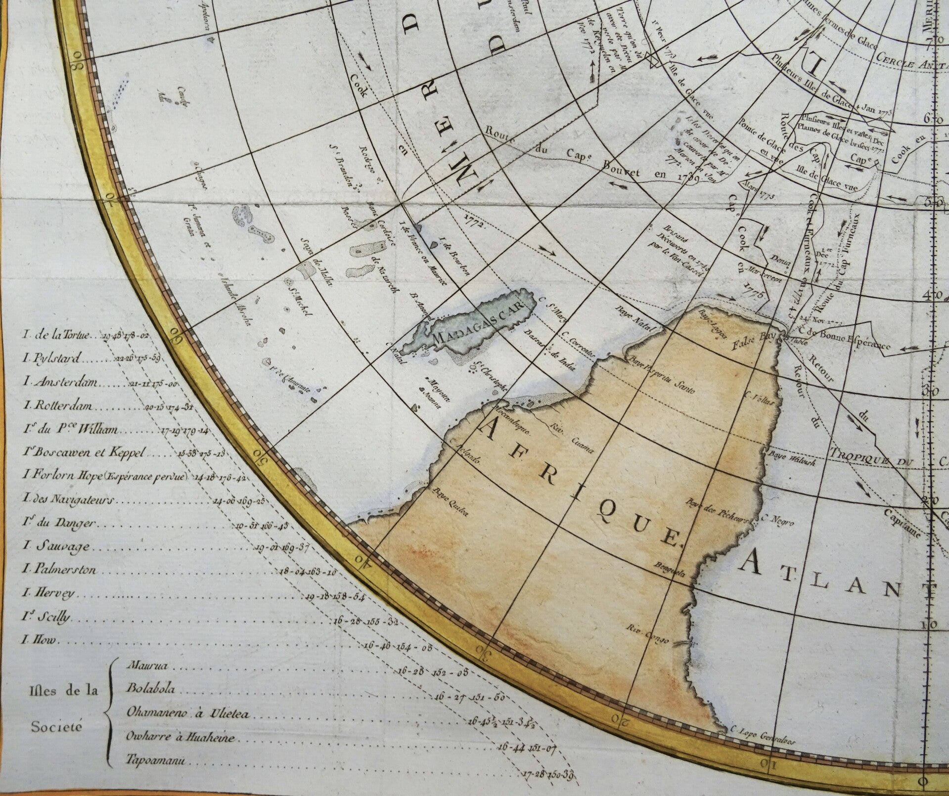
Original antique 1778 copperplate map of the Southern Hemisphere by Jacques Nicolas Bellin, depicting the routes of the world’s most celebrated navigators from 1595 to 1775. This large-format map shows the voyages of Mendaña (1595), Quiros (1606), Le Maire & Schouten (1616), Tasman (1642), Halley (1700), Roggewein (1722), Bouvet (1738–39), Carteret (1767), Wallis (1767), Byron (1768), Bougainville (1768), and Captain James Cook (1770–75), among others.
The map includes detailed coastlines of South America, Africa, Australia, New Zealand, and the Indonesian archipelago, surrounding the Antarctic region. A wealth of navigational tracks, dates, and discoveries are clearly marked, offering a visual record of two centuries of maritime exploration.
Published in the 1778 French edition of Abbé Prévost's ´L'Histoire Generale des Voyages´.
Excellent condition. Thick paper, clear print. Folded as published
Image 58x60,5m, page 53,5x54cm