Hungary, Rumania, Bulgaria, Slovenia, Serbia, 2 maps, R. Bonne, 1781, Royaume de Hongrie.../Pannoniae, Daciae, Illyrici et Moedsiae Tabula Geographica
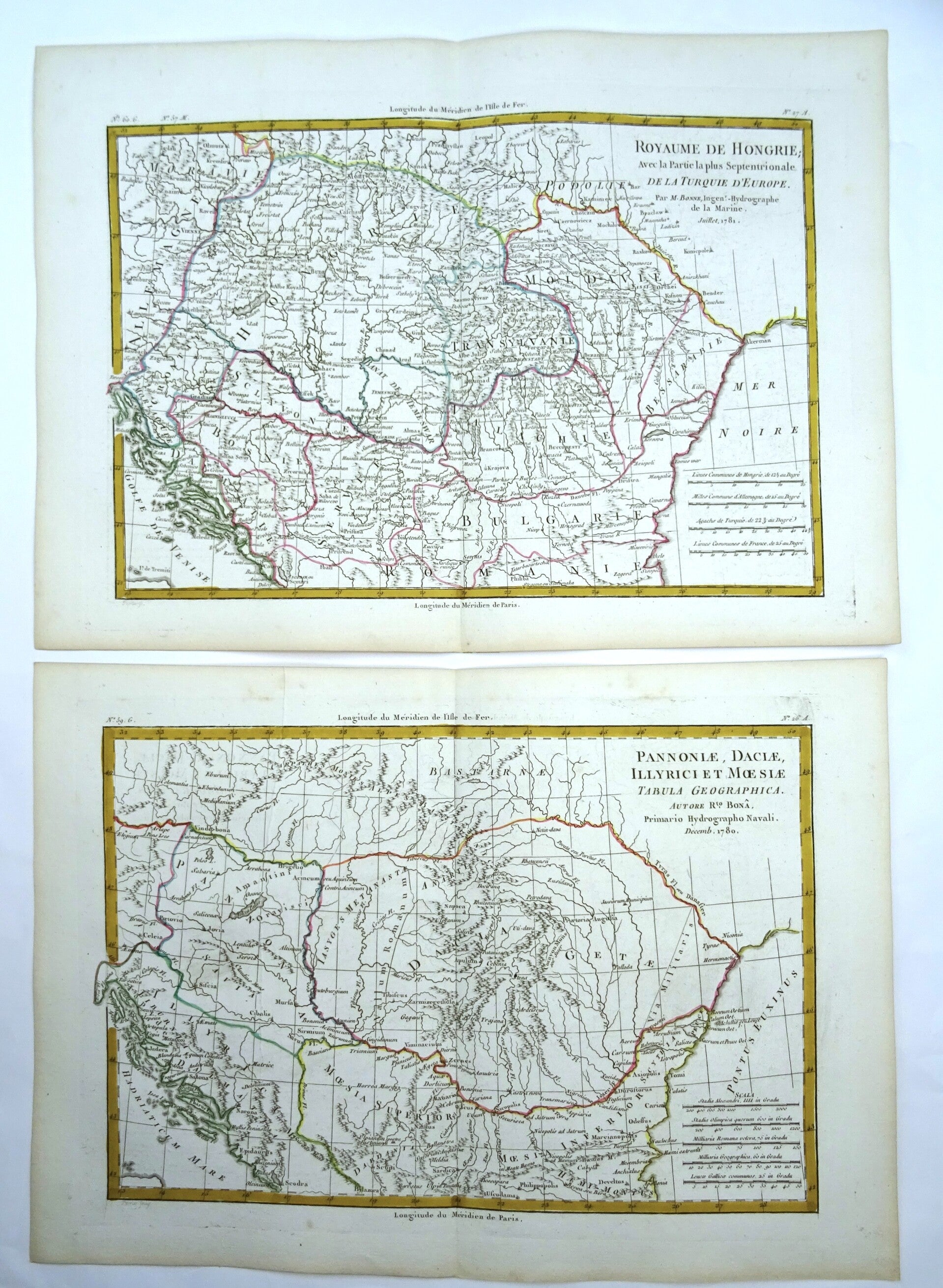
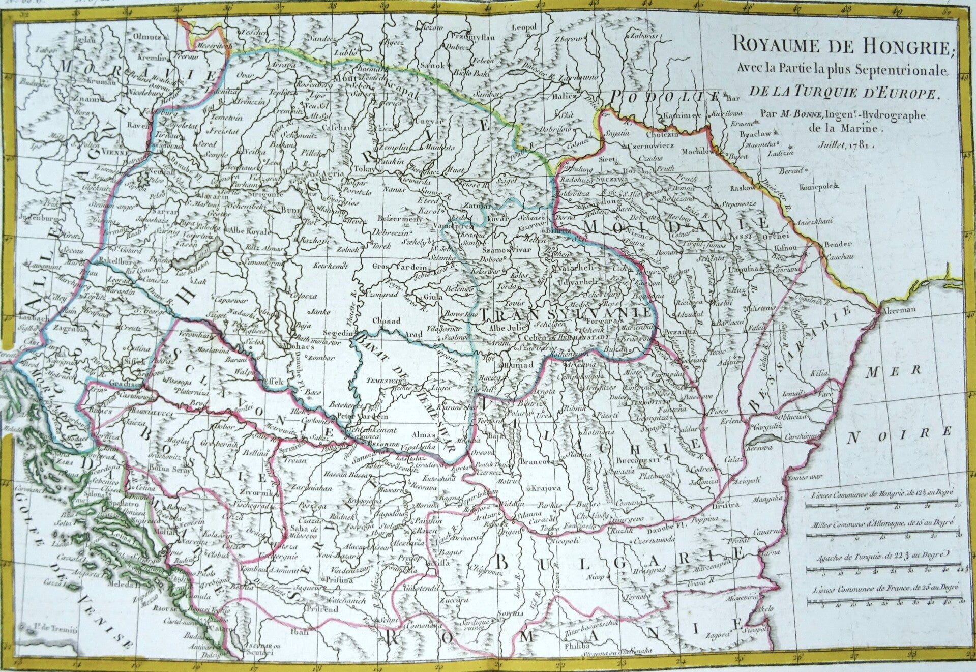
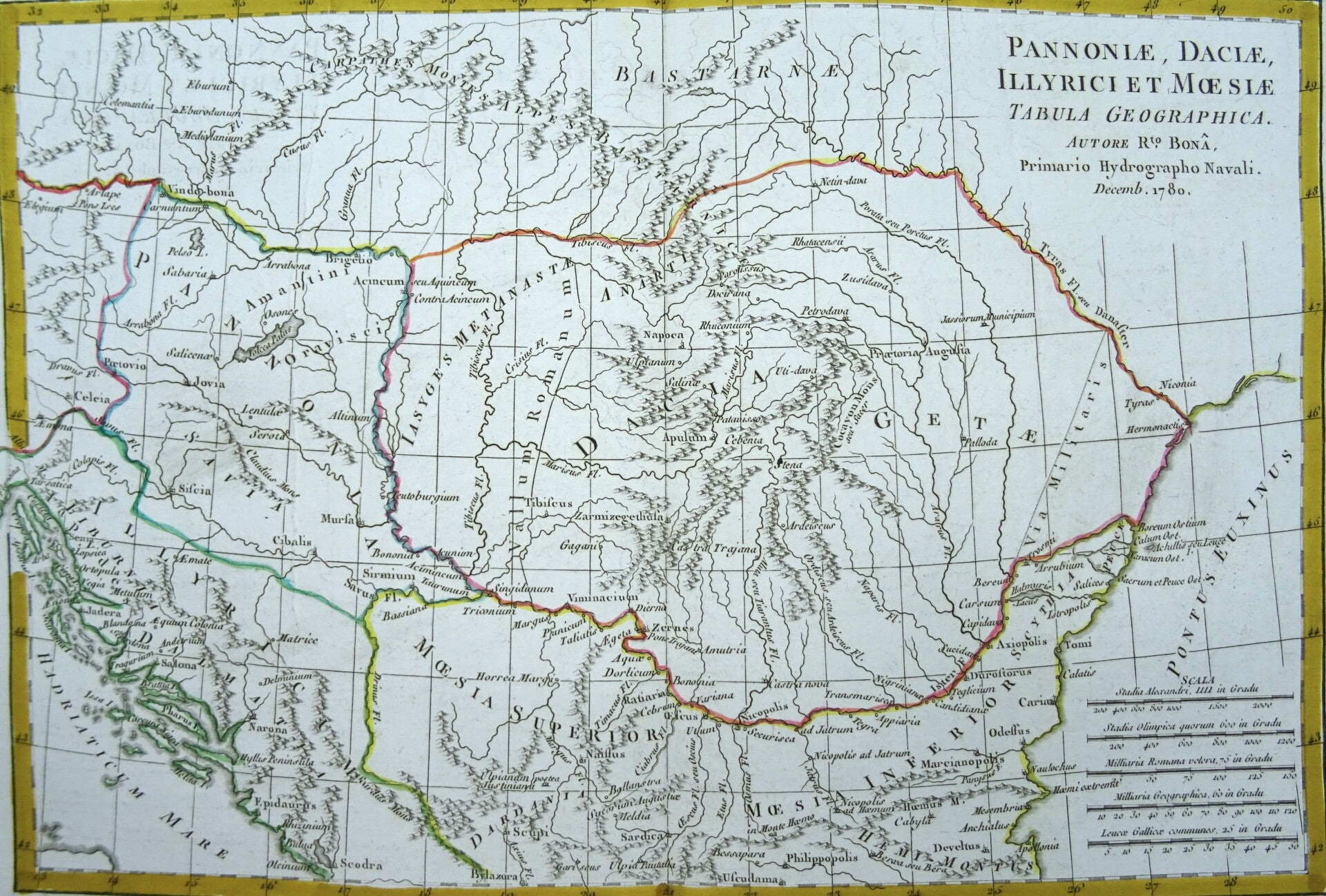
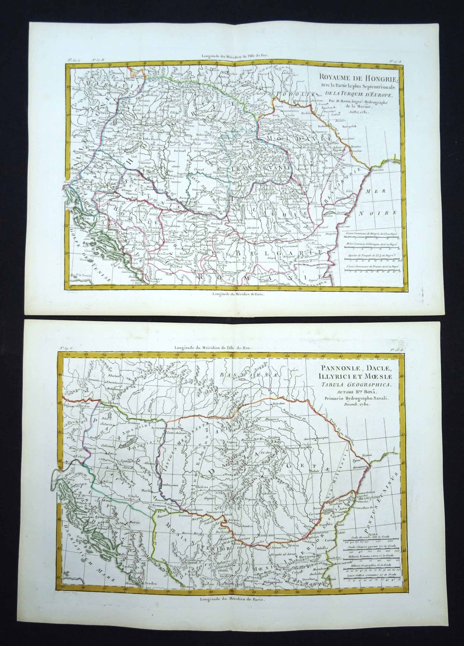
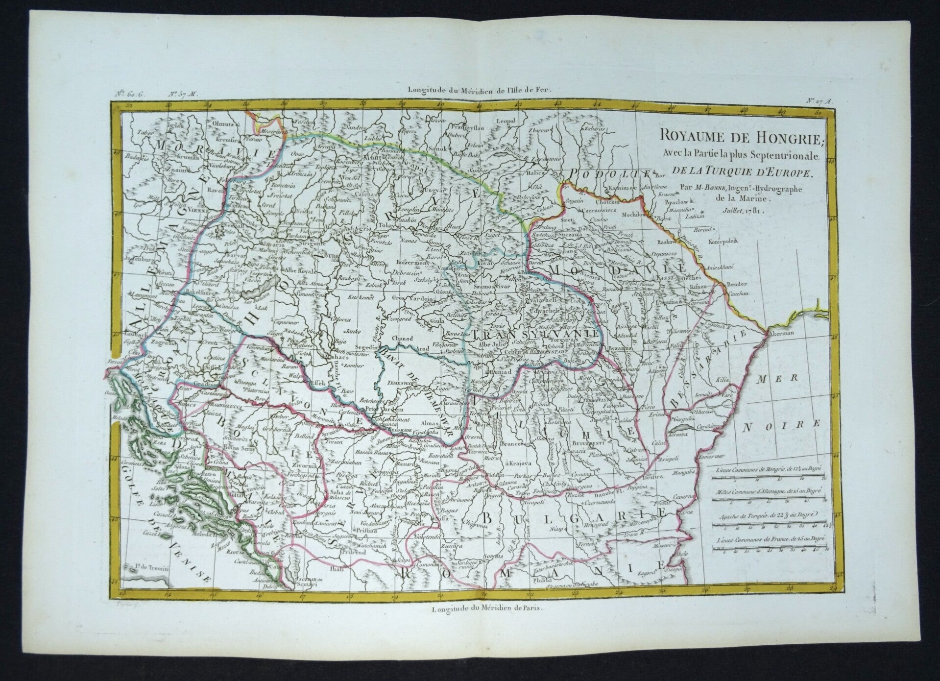
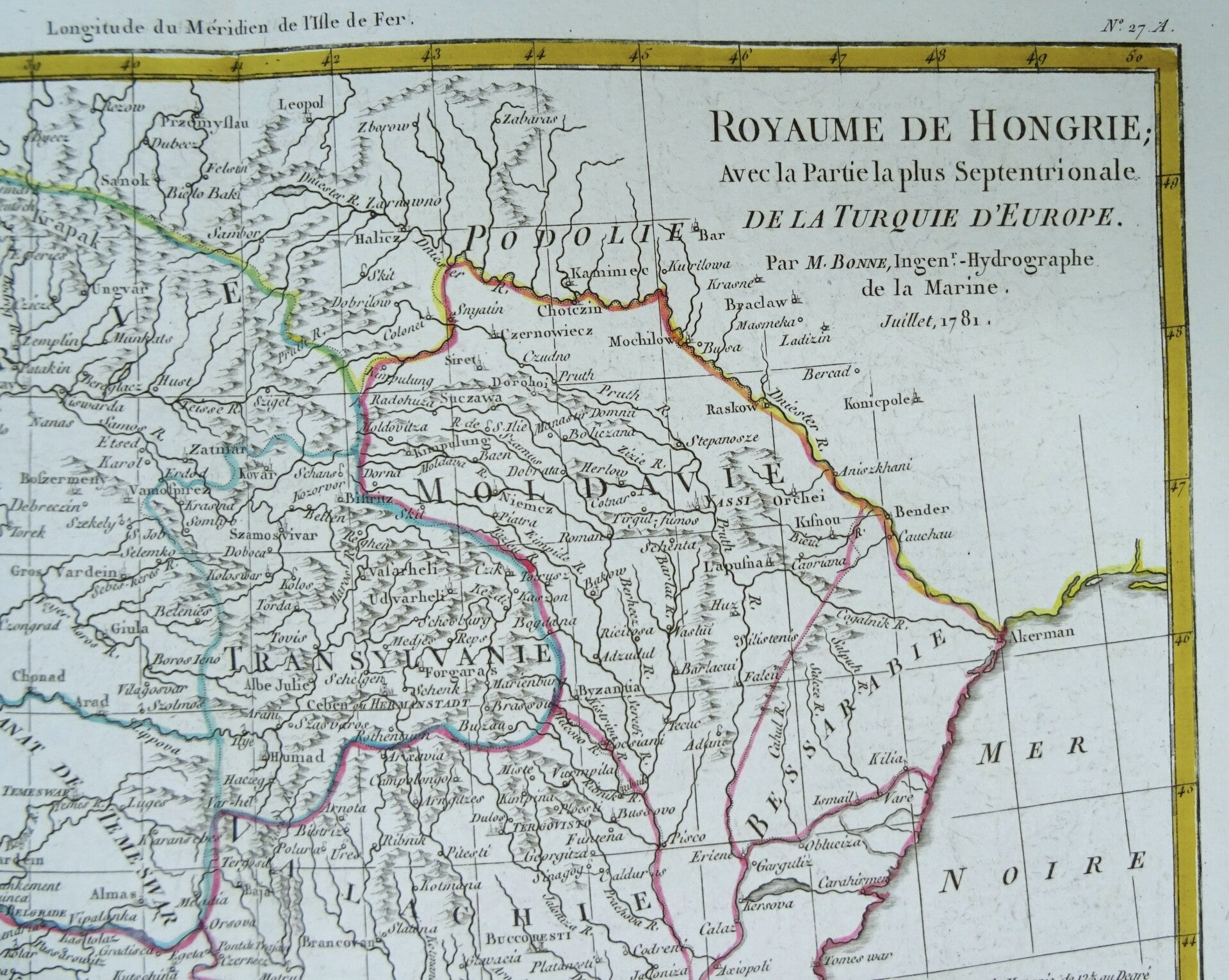
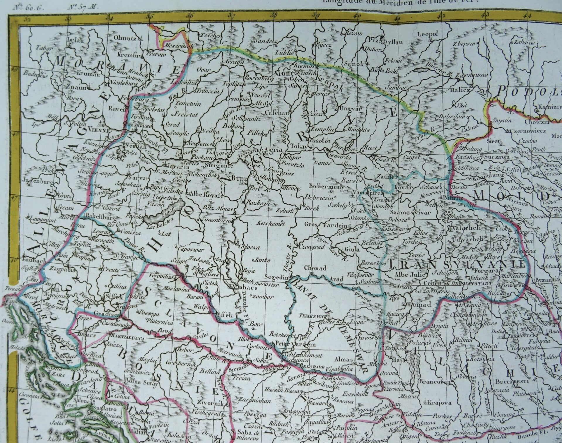
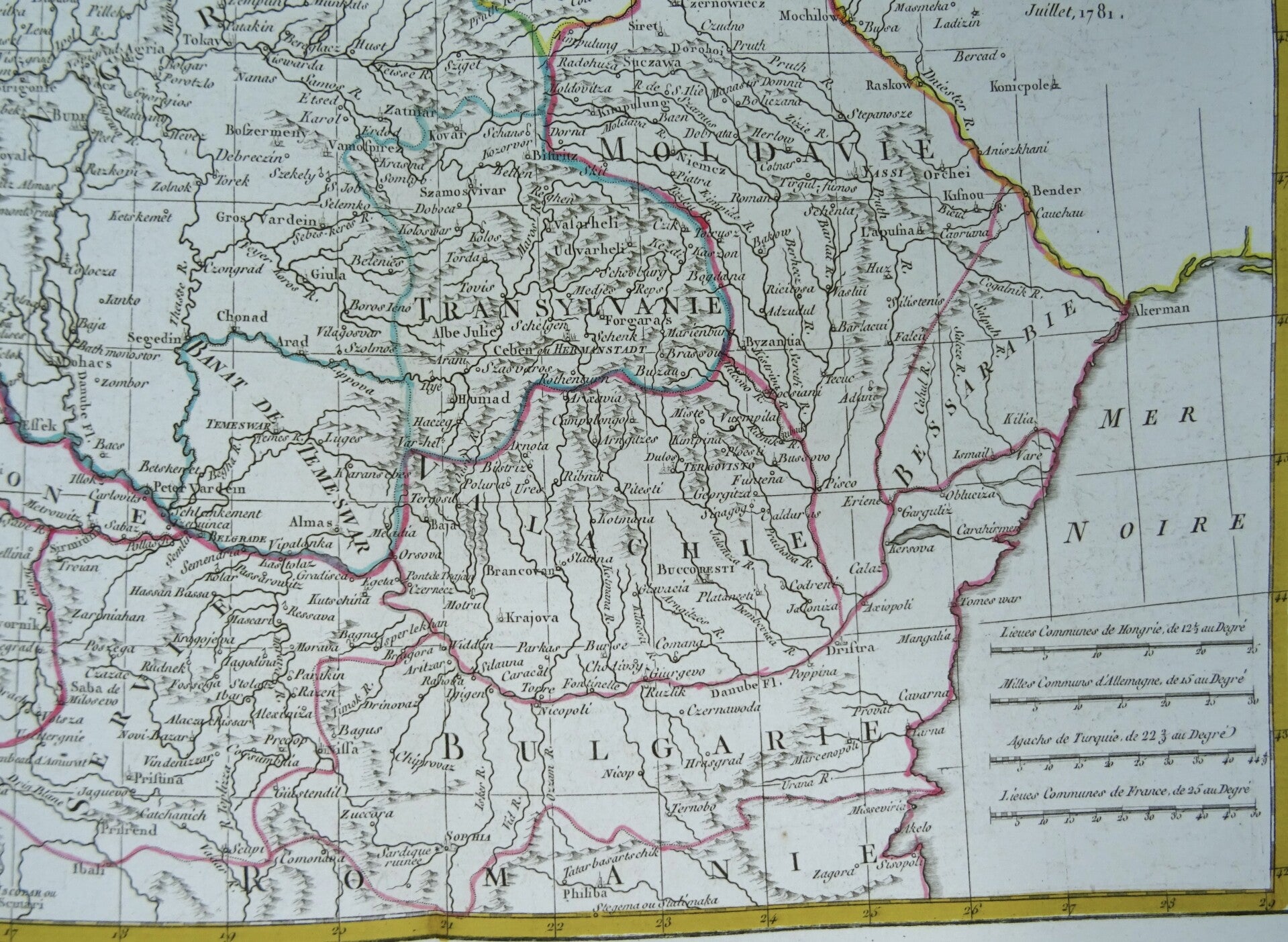
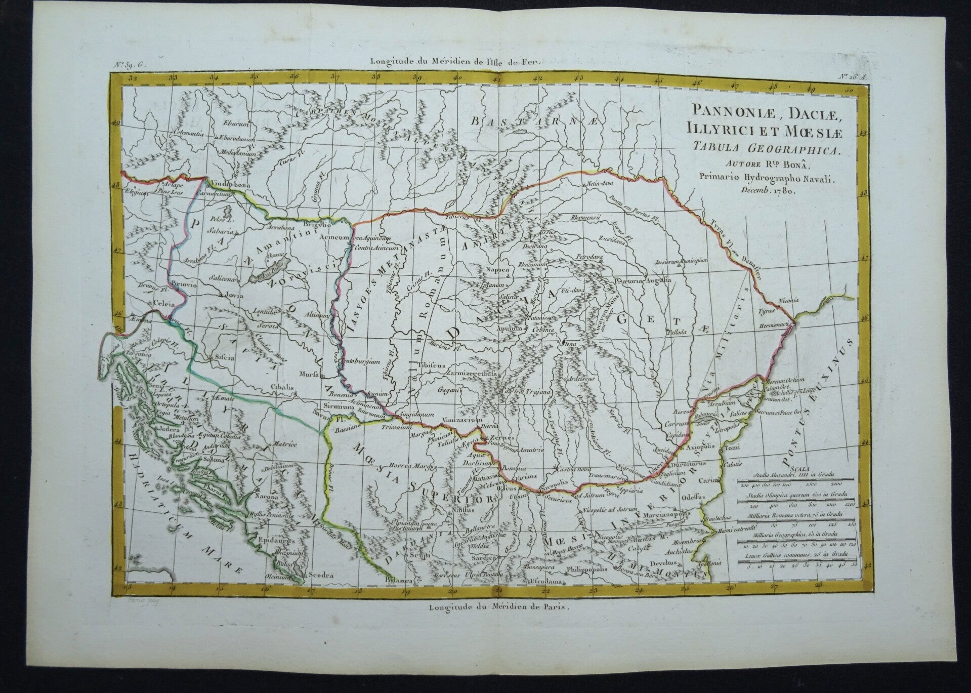
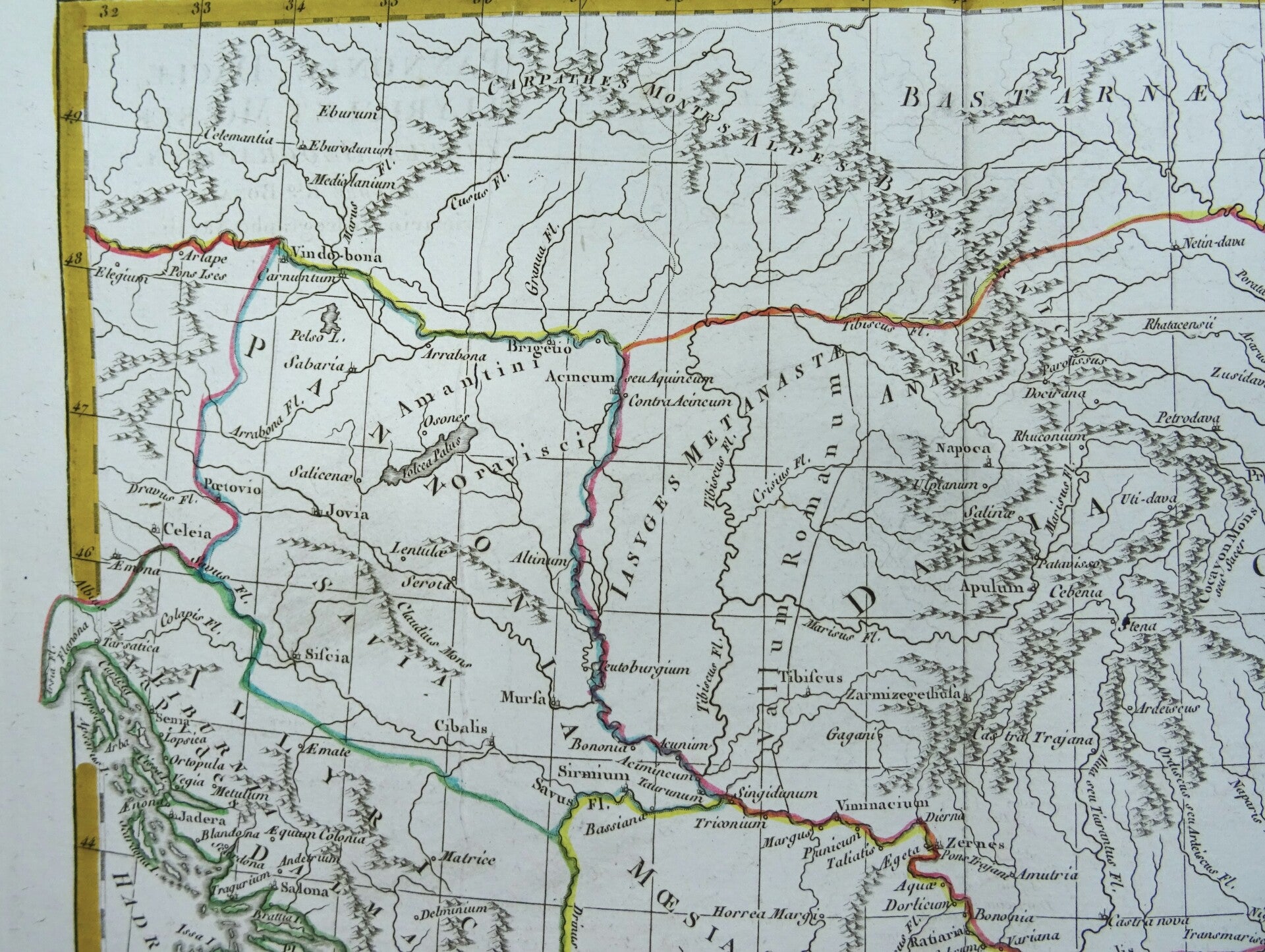
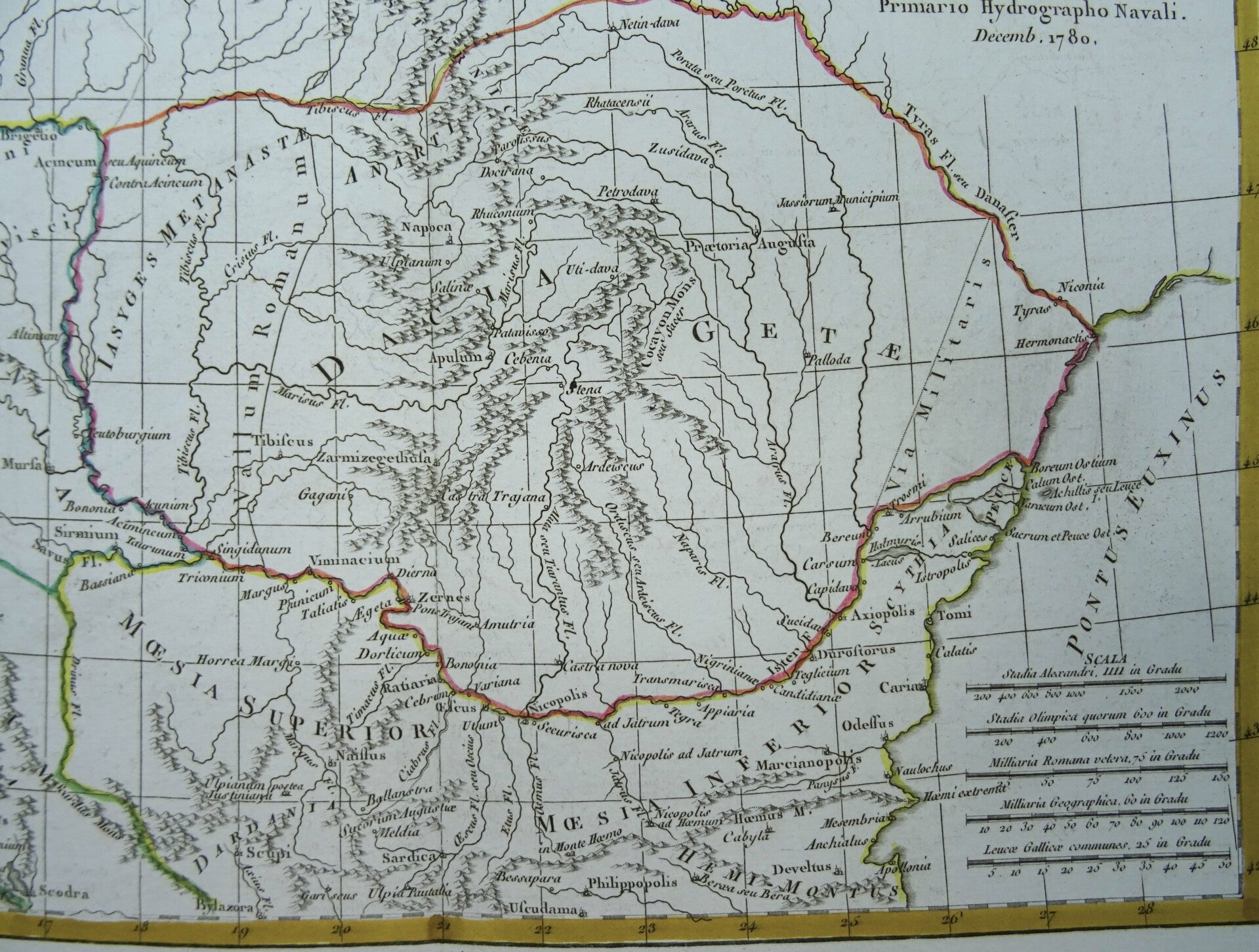
Two beautiful 18th century maps of Eastern Europe (Hungary, Rumania, Bulgaria, Slovenia, Serbia, Moldova Croatia, Bosnia....) as it was in the 18th century and in Antiquity. Shows cities, rivers, regions, coastal features. Topography is depicted pictorially. Dated 1781. Original outline coloring.
Made by R. Bonne, Paris.Rigobert Bonne (1727-1794) was an influential French cartographer of the late-eighteenth century. Born in the Lorraine region of France, Bonne came to Paris to study and practice cartography. He was a skilled cartographer and hydrographer and succeeded Jacques Nicolas Bellin as Royal Hydrographer at the Depot de la Marine in 1773. He published many charts for the Depot, including some of those for the Atlas Maritime of 1762. In addition to his work at the Depot, he is best known for his work on the maps of the Atlas Encyclopedique (1788) which he did with Nicholas Desmarest. He also made the maps for the Abbe Raynals’ famous Atlas de Toutes Les Parties Connues du Globe Terrestre (1780).
Excellent condition. Original outline coloring. Thick paper. Clear print. Reverse side blank.
Images 21x32cm, sheets 27x39cm (2 sheets)