Azores, Canary Islands, Madeira, Cape Verde, Senegal... H. Doncker, 1660, De Vlaamsche en Canarische Eylanden
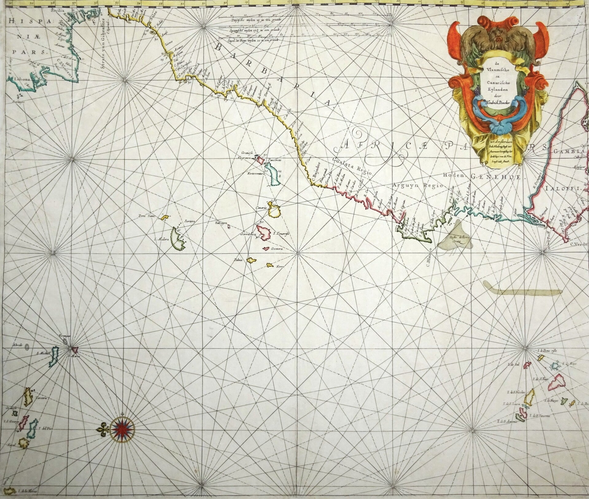
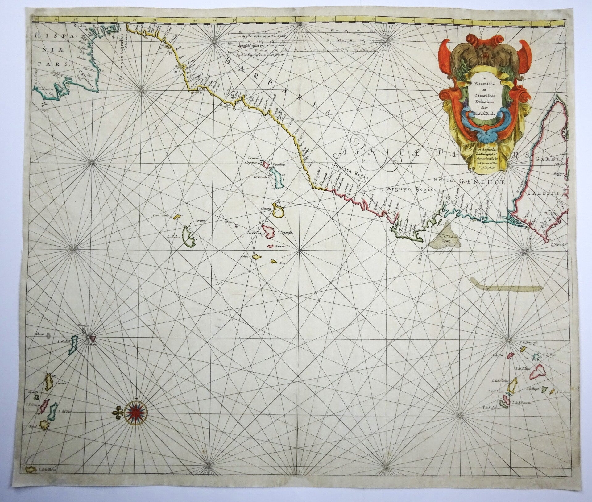
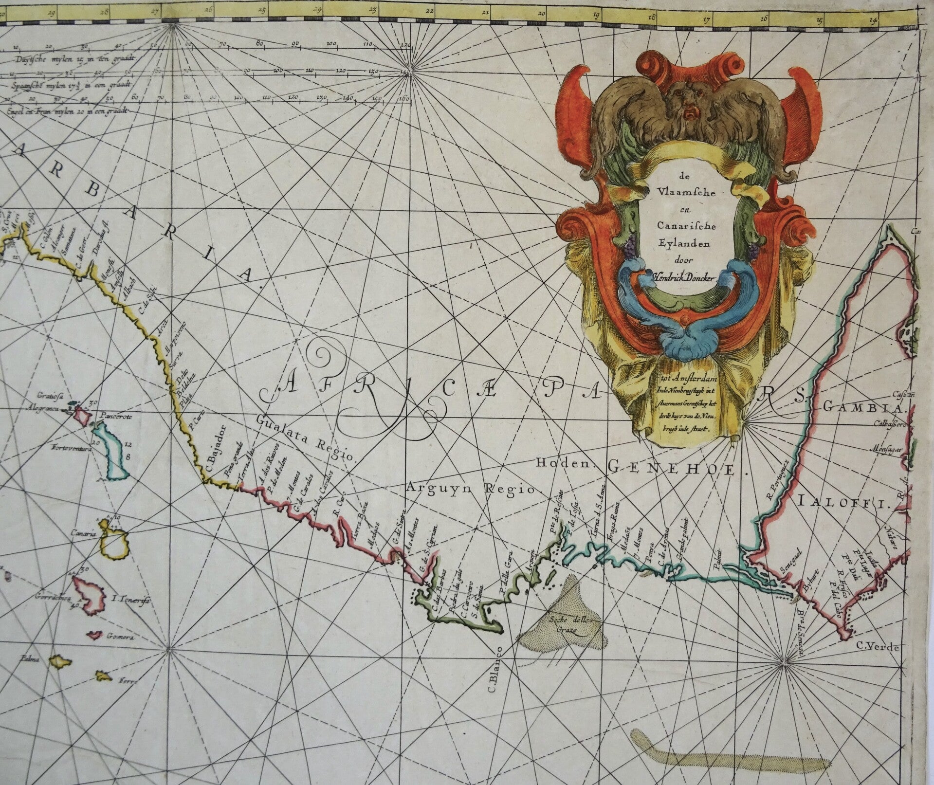
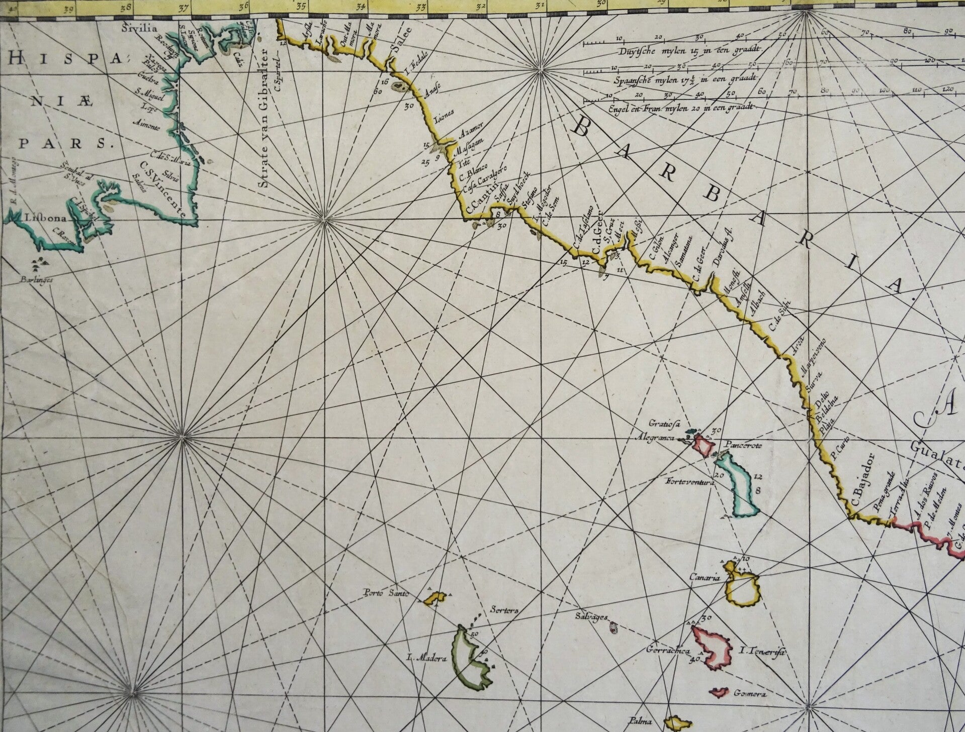
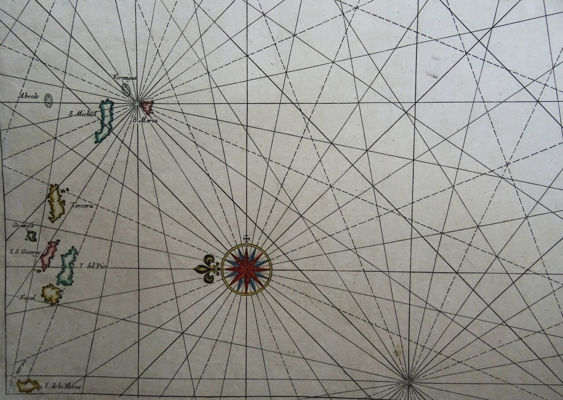
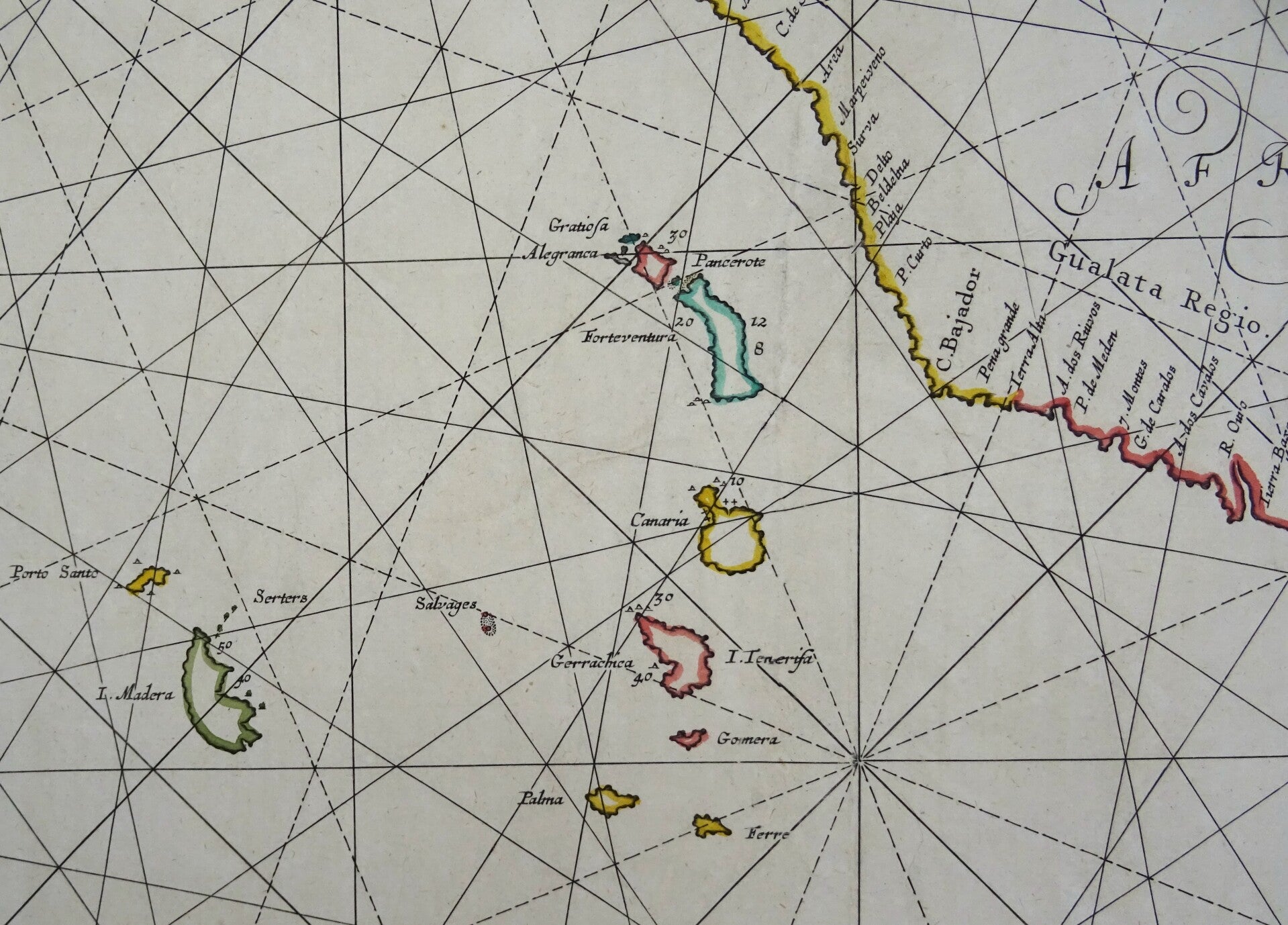
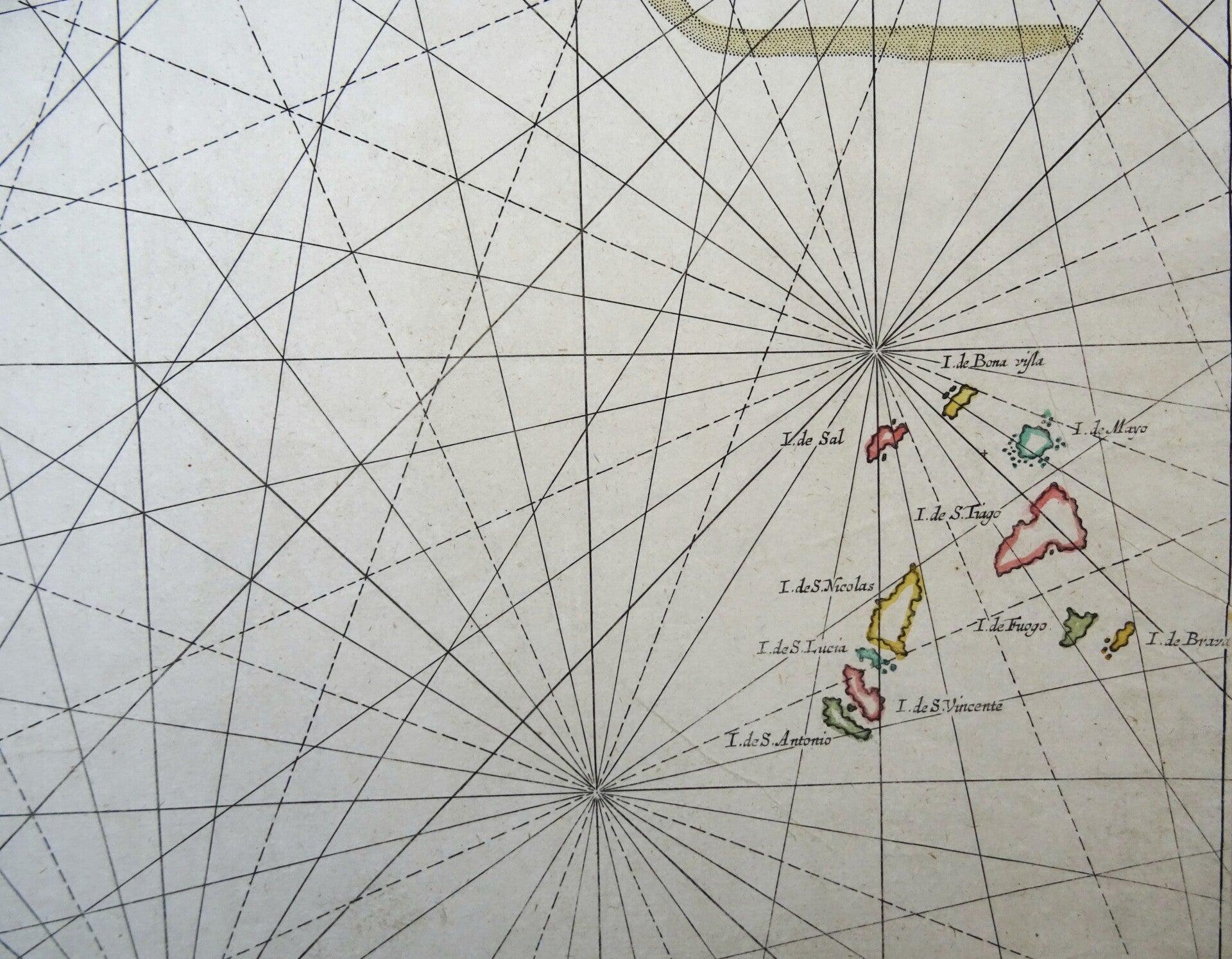
Rare nautical chart of the coast of Spain and Portugal and the Northwest coast of Africa (Morocco, Senegal and Cambia), oriented with the North to the right. Focussing on the different groups of islands: Azores left below, Madeira and Canary Islands in the middle and Cape Verde in the bottom left.
Decorated with a very large decorative title-cartouche and a compass rose.
Doncker's charts were the most up-to-date in the second half of the 17th century. Although there is some similarity to those charts published by Van Loon, Goos, Lootsman, and Doncker, the latter's charts are original.
In 1655, Hendrick Doncker had begun with the publication of a pilot guide, the Lichtende Columne ofte Zeespiegel. In 1659 he published his first sea atlas, the Zee-Atlas of Waeter-waereld, with 19 maps. Between 1659 and 1669, he increased the number of charts from 19 to 30 and in 1669 he came with an edition containing 50, which was soon to be followed by an edition with large maps: the Nieuwe Groote Vermeerderde Zeeatlas, also with 50 charts. This beautiful atlas was reprinted and continually improved for more than 25 years. After the death of Hendrick Doncker in 1699, his son continued the publication and even enlarged and enhanced the sea-atlas.
This map (with a different title) was later also published in ´De Zee-Atlas, Ofte Water-Weereld, Waer in vertoont werden alle de Zee-Kusten Van het bekende des Aerd-Bodems´. by P. Goos, 1666. (Koeman, Goos1B). This edition by Hendrick Doncker is from a few years earlier, also published in Amsterdam.
Excellent condition. Original coloring. Strong paper, clear print. Central fold, as published.
Image 52x61,5cm, sheet 54,5x63,5cm