Spain, Granada, Murcia, Alicante, Morocco... J. van Keulen, 1734, Pascaart van de Zee Kusten van Granada en Murcia...
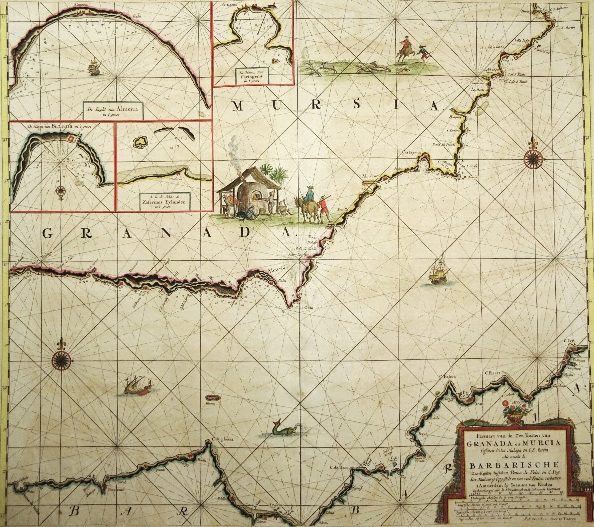
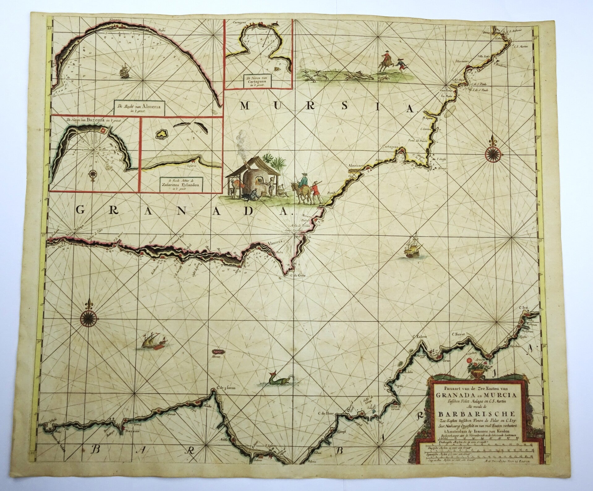
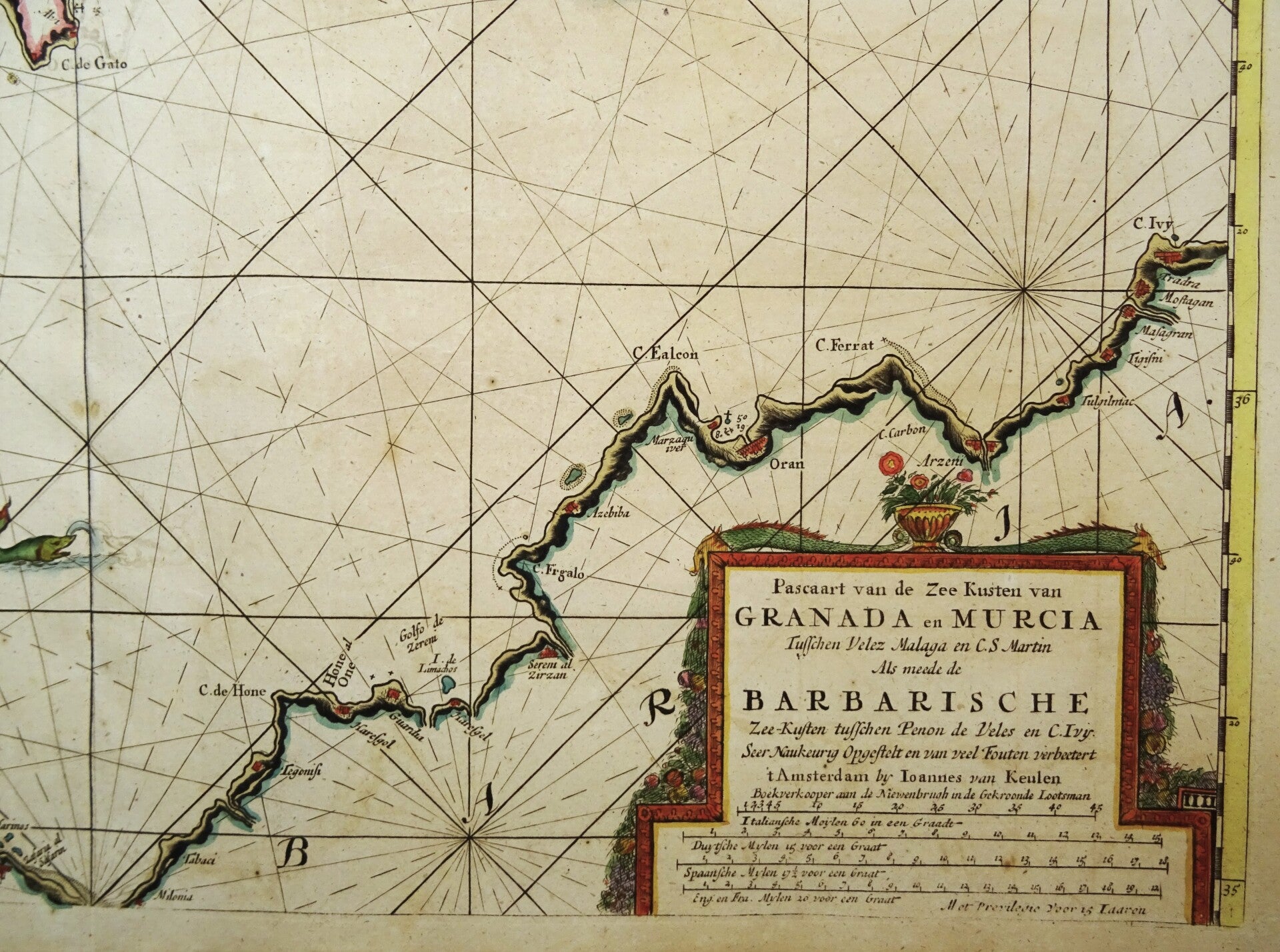
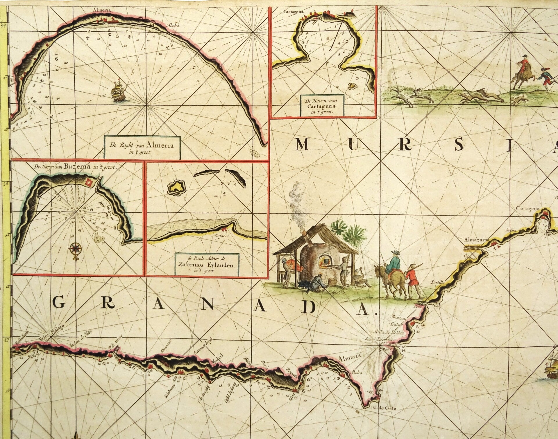
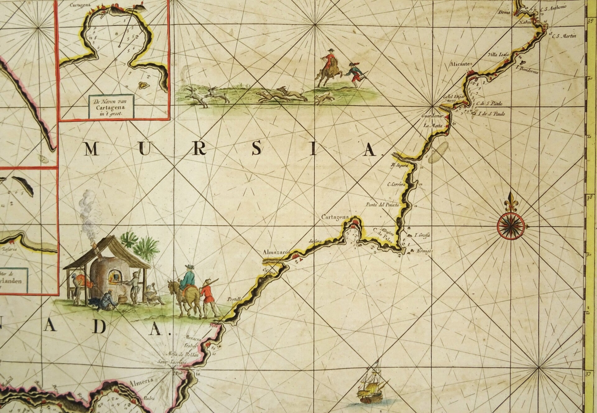
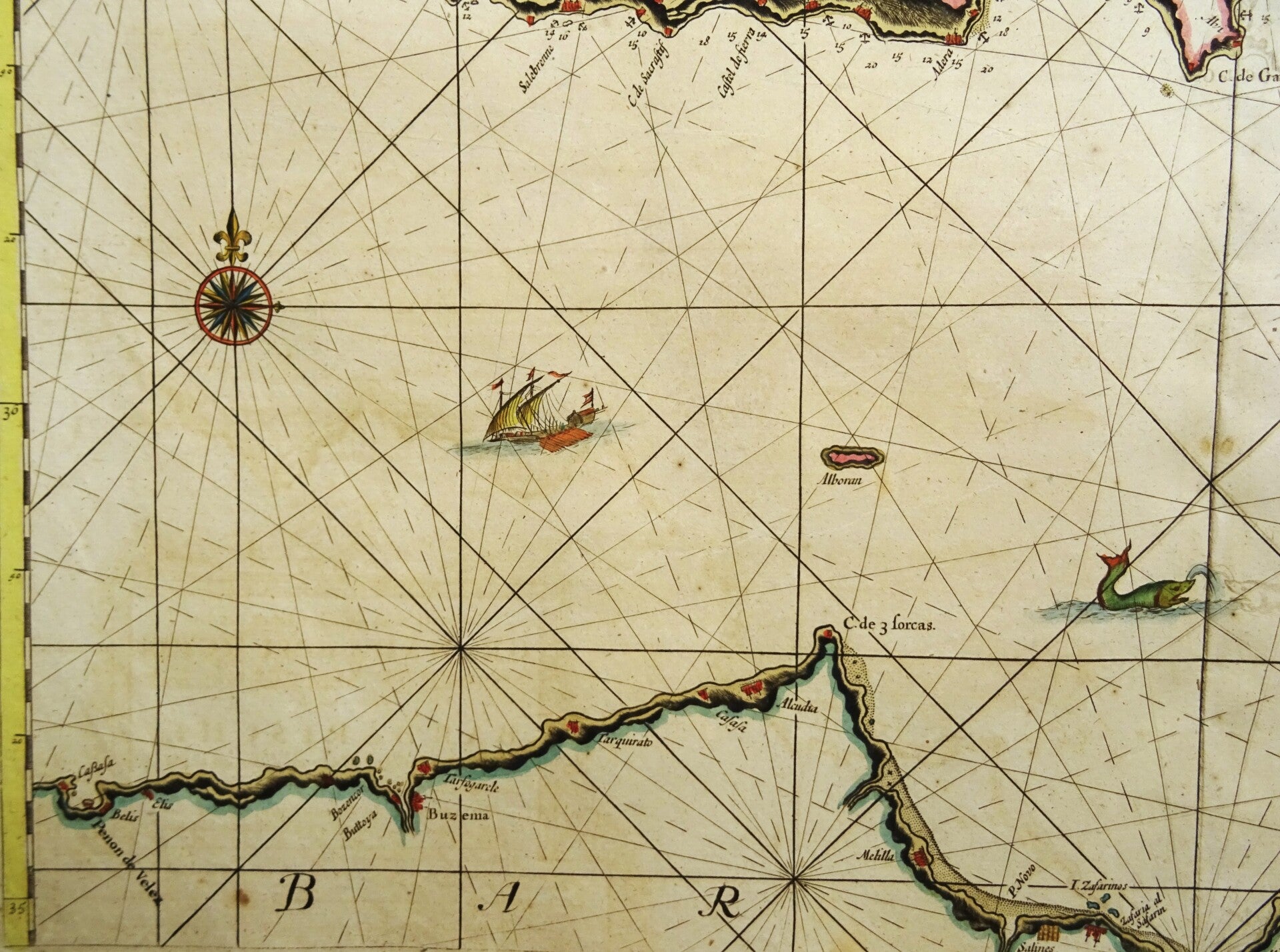
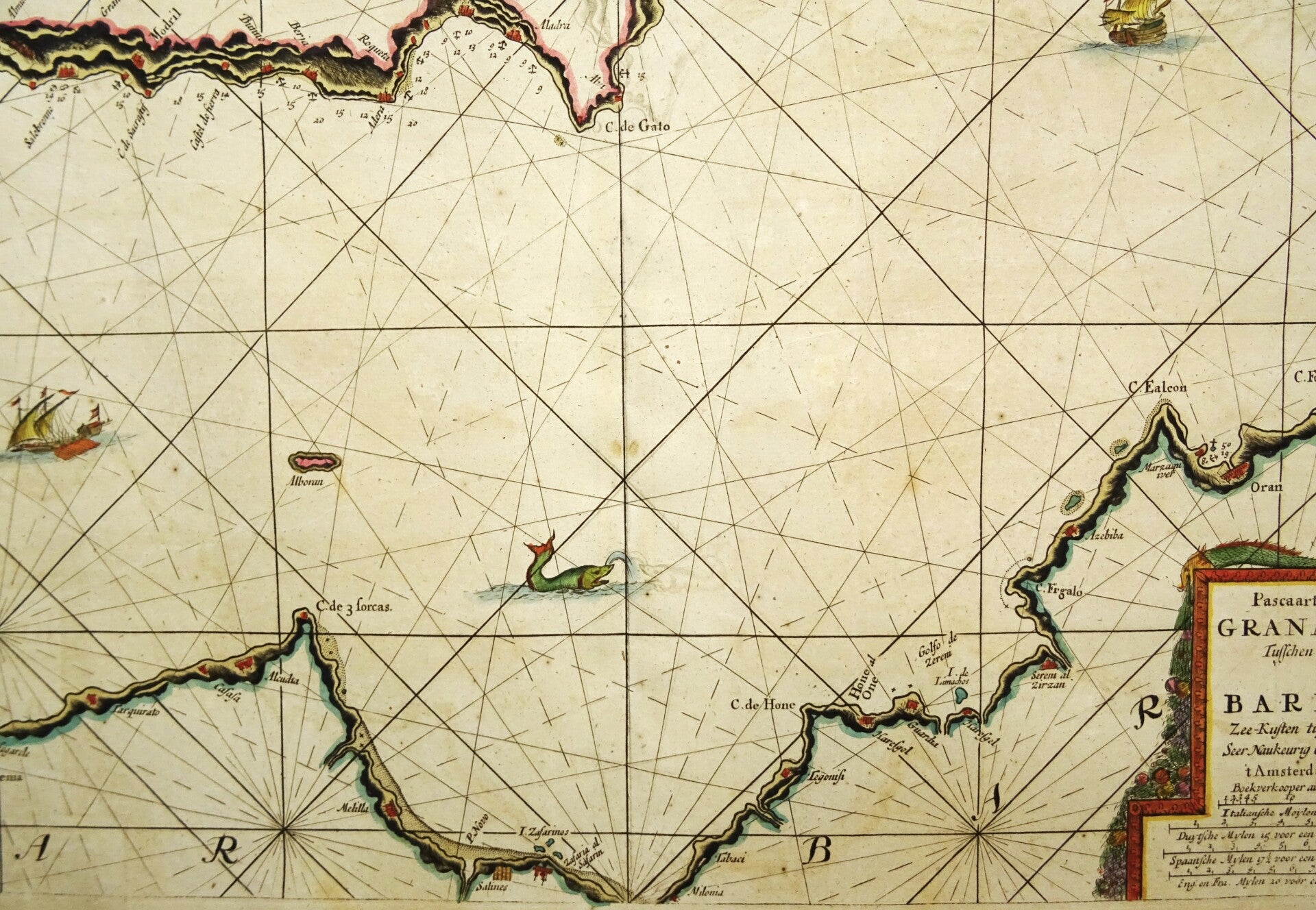
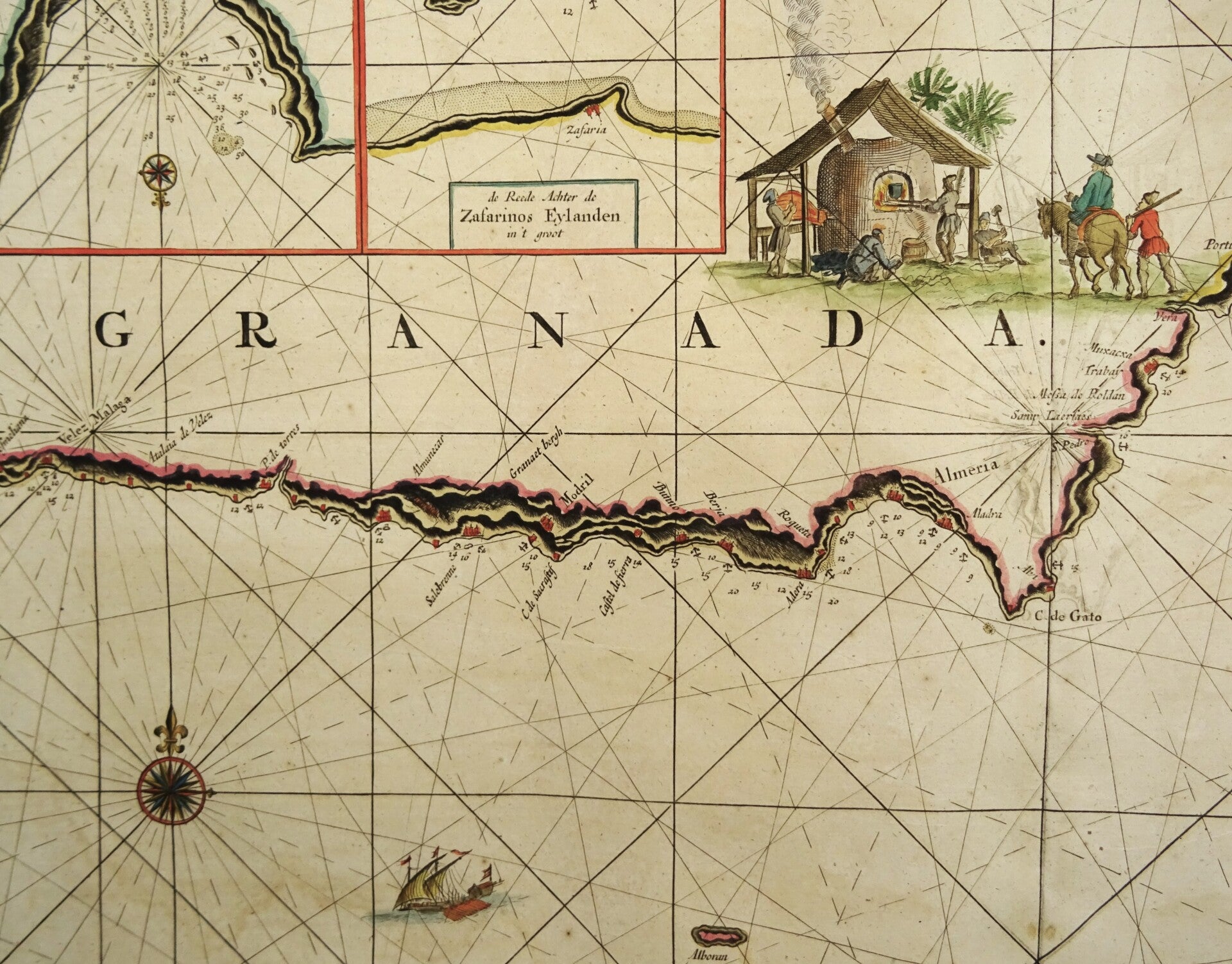
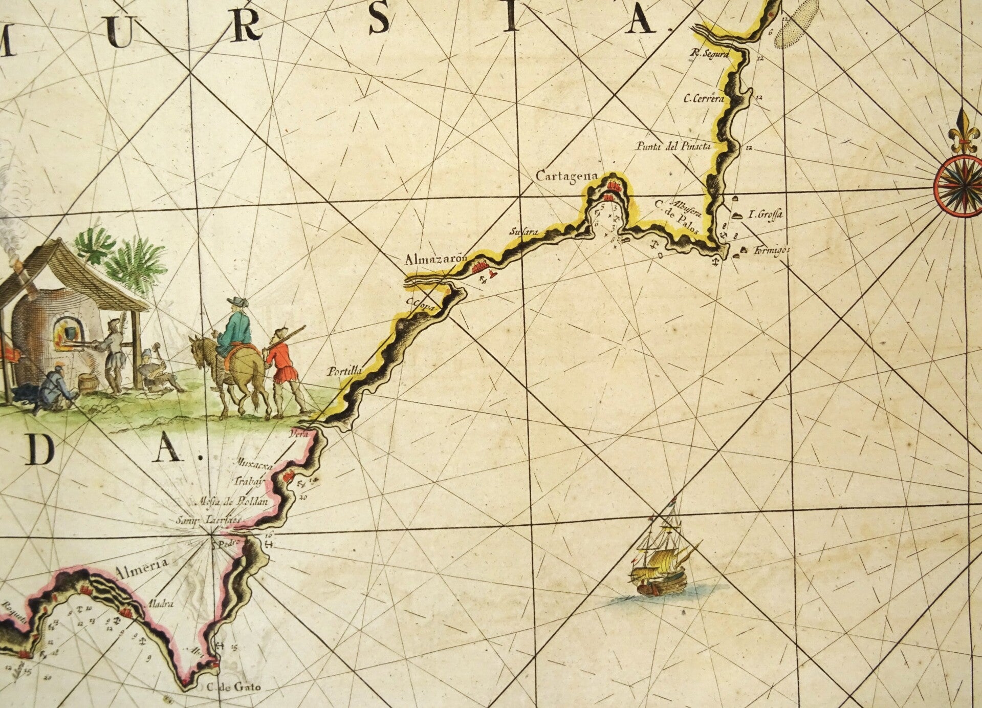
Rare nautical chart of the southeastern coast of Spain, covering the area between Velez Malaga and Denia. Inset maps include the bay of Almeria; Buzema harbor; Zafarinos Islands; Cartagena harbor and Coast from C. Gata to Carabona.
Published around 1734 in 'De Nieuwe Groote Lichtende Zee-Fakkel' by the publishing house of Johannes van Keulen, which continued Van Keulen's work after his death in 1715. The map is most likely based on an earlier map by H. Doncker, whose copper plates came into the possession of Van Keulen after his death.
Johannes van Keulen was the founder of the well-known publishing house that focused on publishing maritime atlases and nautical guides for over two centuries.
The most important publications of the Van Keulens are the 'Zee-atlas ofte Water-werelt' and the nautical guide 'De Groote Ligtende Zee-Fakkel'. Van Keulen was not a cartographer himself; for this, he had enlisted the cooperation of mathematician Claes Jansz Vooght. Vooght is the creator of most of the maps published by Johannes van Keulen. In 1743, the firm Johannes van Keulen was appointed as the permanent mapmaker of the Dutch East India Company (VOC). The firm retained the position of mapmaker until the dissolution of the Company. Even before 1743, the Van Keulen firm acted as a supplier of navigational equipment and charts to the VOC. From 1728 onwards, nautical guides were regularly purchased from them for the crew.
From the beginning of the eighteenth century, the Van Keulen firm possessed large-scale, hand-drawn charts of the VOC territory, of which hand-drawn copies were supplied.
Excellent condition. Original coloring. Strong paper, clear print. Central fold, as published.
Image 51,5x59cm, sheet 53,5x62,5cm