

USA, Caribbean Sea, Central America, W. Blaeu, 1635, Insulae Americanae in Oceano Septentrionali cum Terris adiacentibus
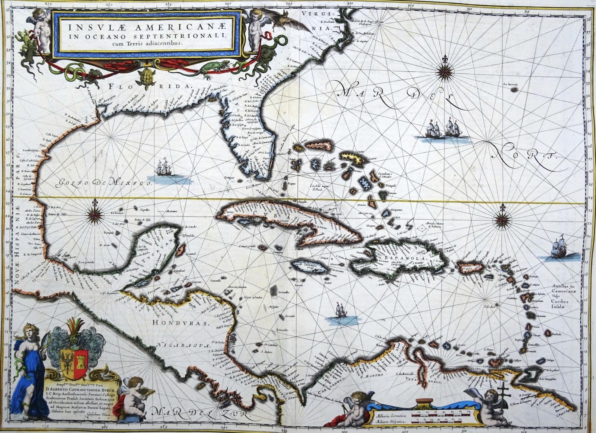
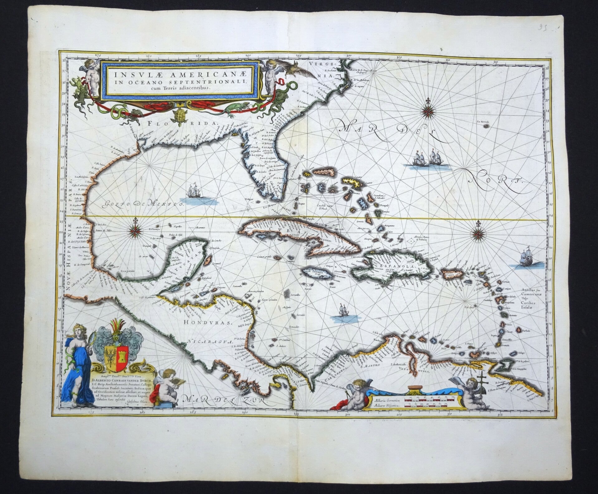
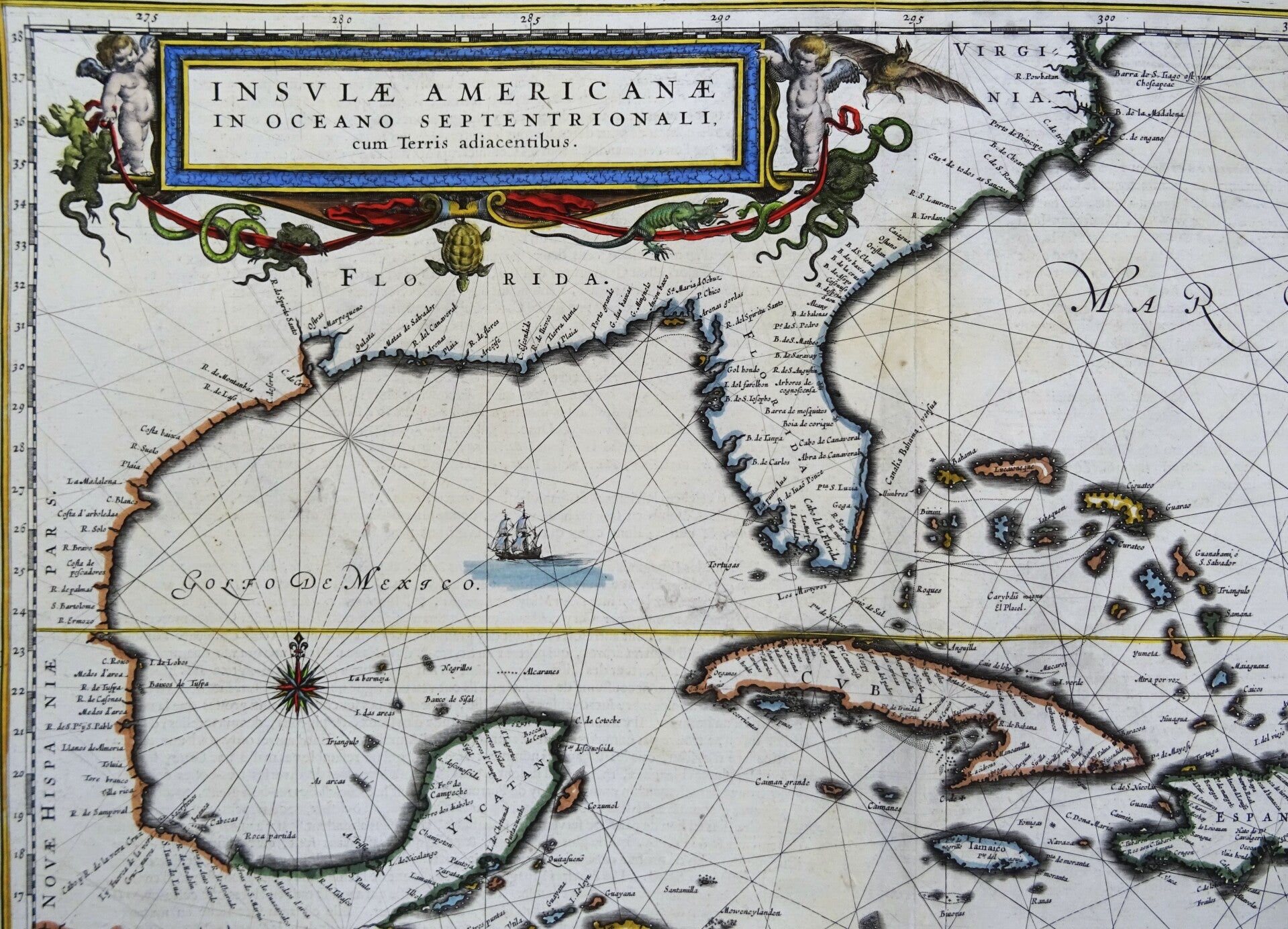
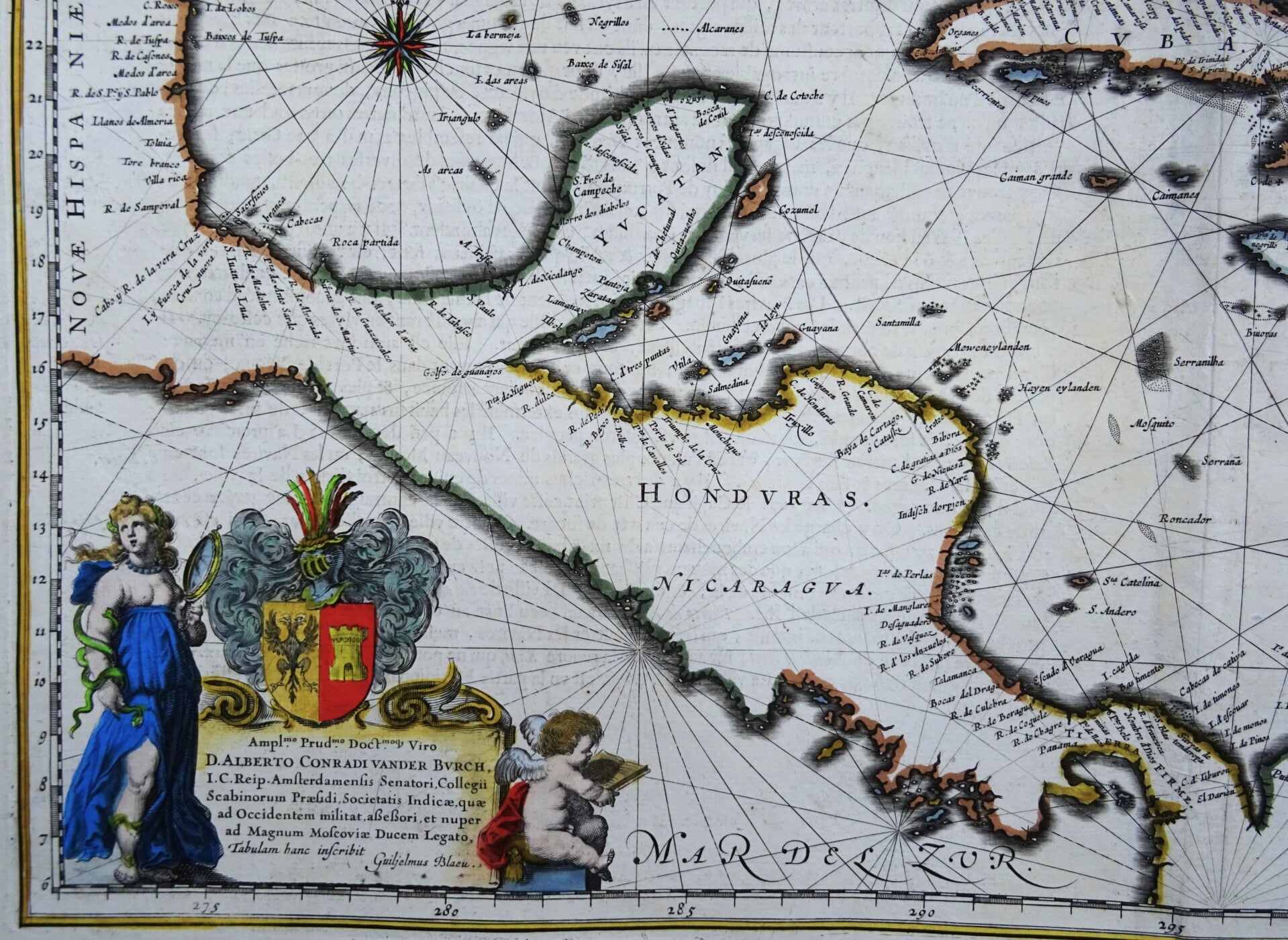
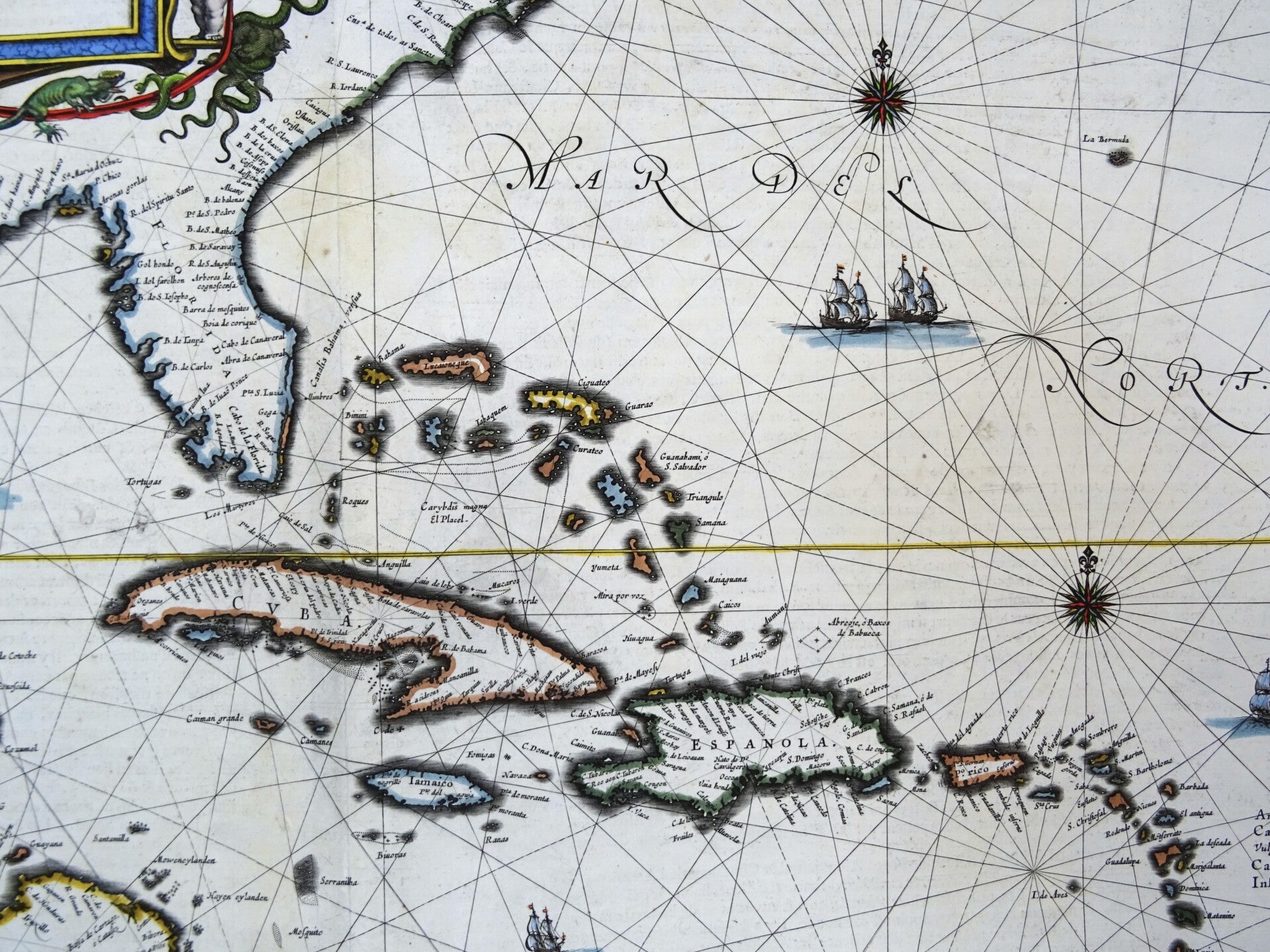
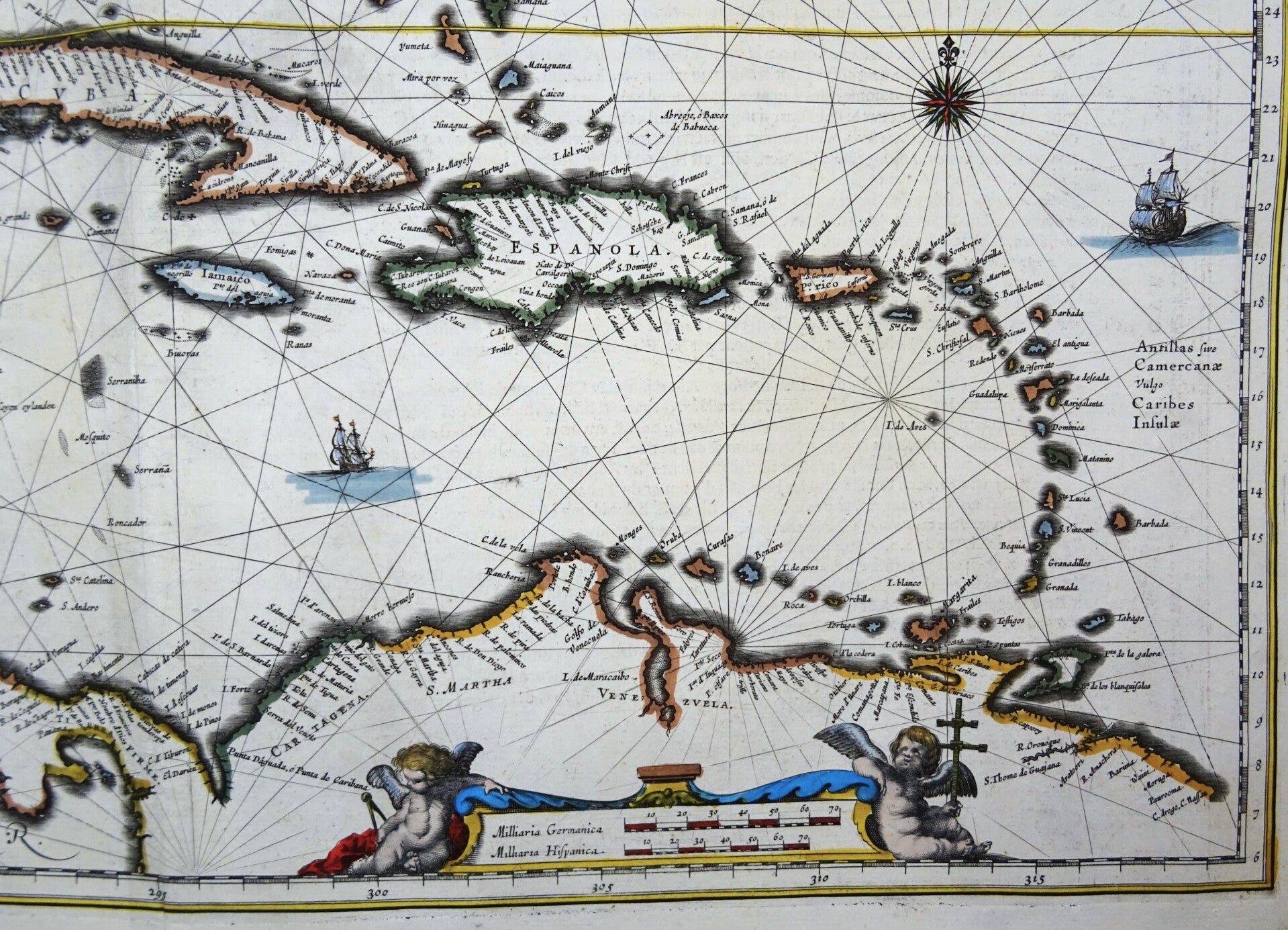
The famous Blaeu map of the Caribbean Sea and surrounding areas of the modern day United States (Florida, Louisiana, Texas…), Mexico, Central America and the northern coast of South America.
Both geographically and aesthetically this map set the standard for the mapping of this region: more than a dozen maps of the region produced later in the 17th century would copy this map, some to the extent of reproducing the title. Blaeu based this work both on his own West Indische Paskaert and Hessel Gerritsz' unacquirably rare and unassailably authoritative De Eylanden Ende Vastelanden Van Westindien op de Noordzee of 1631. The map thus reflects those geographers' commanding knowledge of the Caribbean and the Gulf Coast.
While Blaeu's atlases were certainly not intended for use at sea, the sources for this map were nautical charts intended for navigators sailing for the Dutch West India Company. The geographical detail of the chart reflects its sources in that the interior of its landmasses is left empty: nautical charts were not concerned with matter beyond the coastlines they depicted. The decorative features of the map also emphasize the map's 'chartiness:' the water areas are marked out with rhumb lines, three fine compass roses, and five well-engraved sailing ships.
In addition to its nautical features, the map is embellished with three lovely cartouches. In the lower right, the scale cartouche is flanked with putti playing with navigational tools; in the upper left, the title cartouche's two putti are accompanied by snakes, a turtle, a bat, and an alarming number of iguanas. The dedicatory to Albert Conrad van der Burch (Dutch senator, soldier and diplomat) is surmounted by the dedicatee's arms; to its right, a putto sits reading: to the left, an allegorical female representation of the virtue of Prudence (marked by her snakes, and her mirror) stands; since her face is that of a young woman, the aspect of Prudence invoked here is foresight, and the wise pursuit of long-term goals. Whether this is an actual aspect of the dedicatee's personality, one which the author wished to instill in him, or one with which Blaeu is flattering his dedicatee, is lost to posterity.
Blaeu's signature is prominently engraved in the lower left.
This early edition of this map was published in the first French edition of "Atlas Novus," the atlas by William Blaeu, Amsterdam, 1635.
Good-Very good condition. Some minor repairs and reinforcements, mainly of the central fold, with minimal impact on the image. Some very minimal age browning. Otherwise excellent. Thick paper, clear print and wide margins. Reverse side text in French
Image 38x52cm, sheet 50x58cm