Iceland, Bellin, 1761, Carte de l´Islande
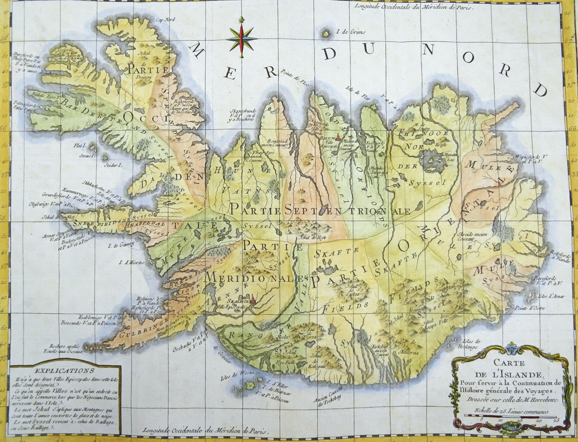
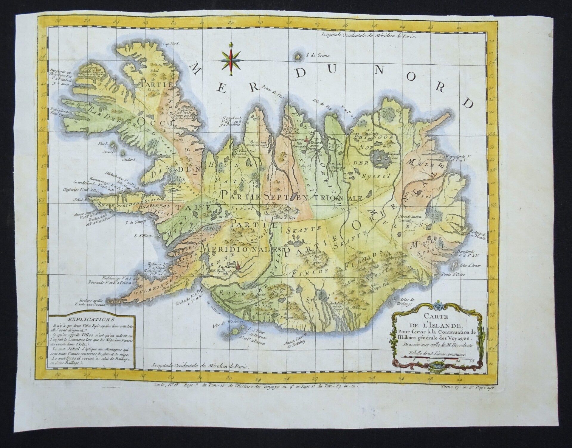
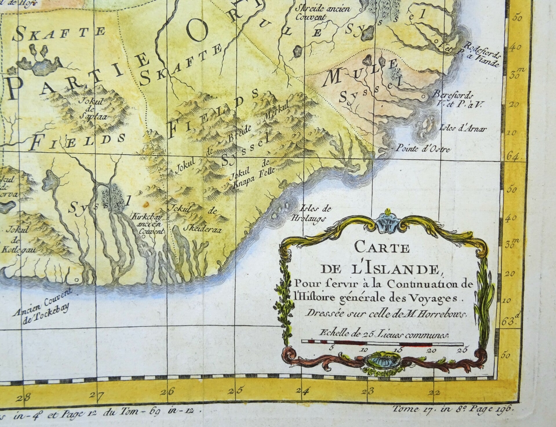
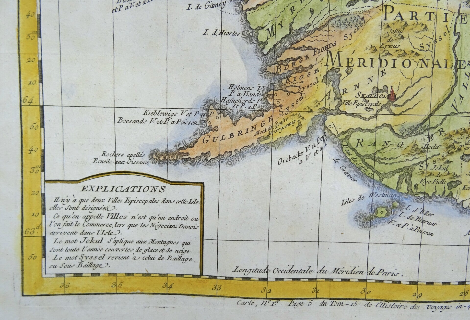
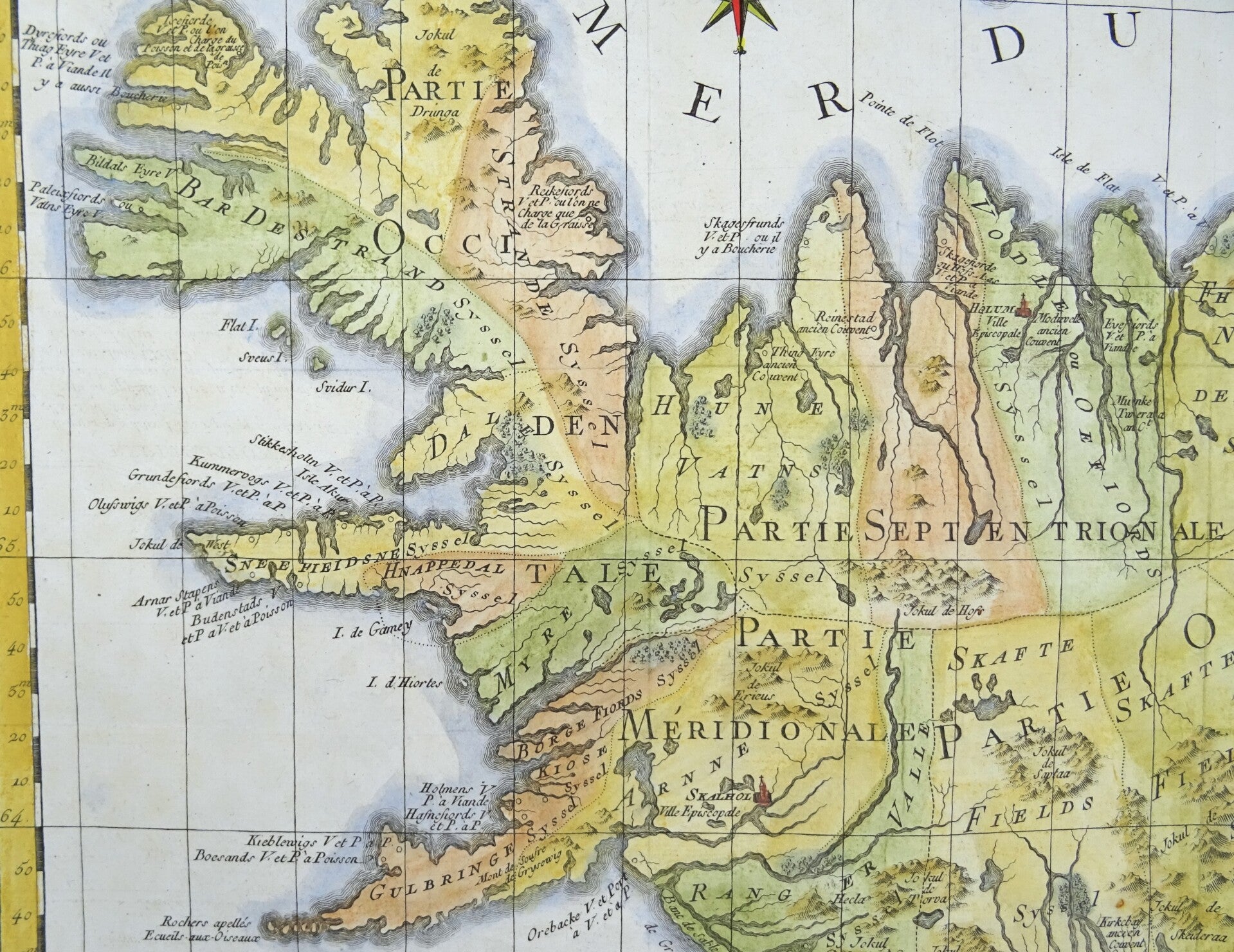
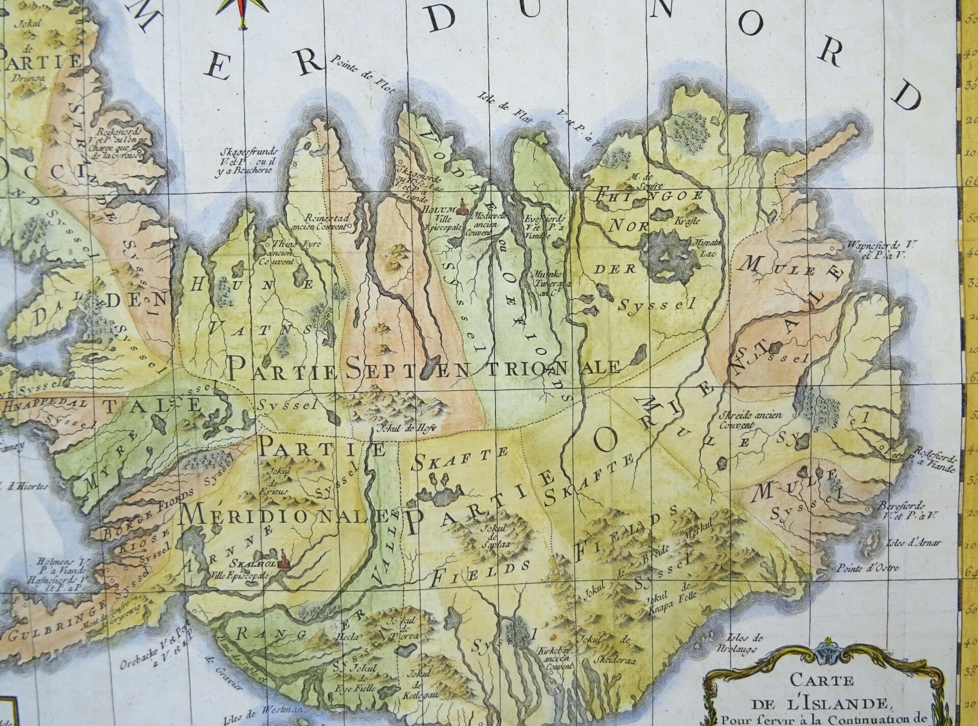
This is a 1761 Jacques-Nicolas Bellin map of Iceland. The map depicts the entirety of the island and divides it into four regions. Numerous rivers are illustrated, as are groups of mountains. Two 'villes episcopales' are noted, Skalhol and Helum, which an explanation in the lower left corner states are simply places were business takes place when Danish traders arrive on the island. Several locations along the coast are identified.Title cartouche with scale stick lower right. A compass rose at the top. Bottom left a frame with explanation.
The map is engraved on copperplate and published in volume 18 of Antoine de Prevost, 'Histoire générale des voyages', Paris, 1761.
Excellent condition, folds as published, narrow but sufficient top margin, thick paper, clear print.
Image 30x38cm, sheet 33,5x45cm