USA, Louisiana, Alabama, Florida, Texas, New Mexico… Bellin, 1757, Carte de la Floride de la Louisiane et Pays Voisins
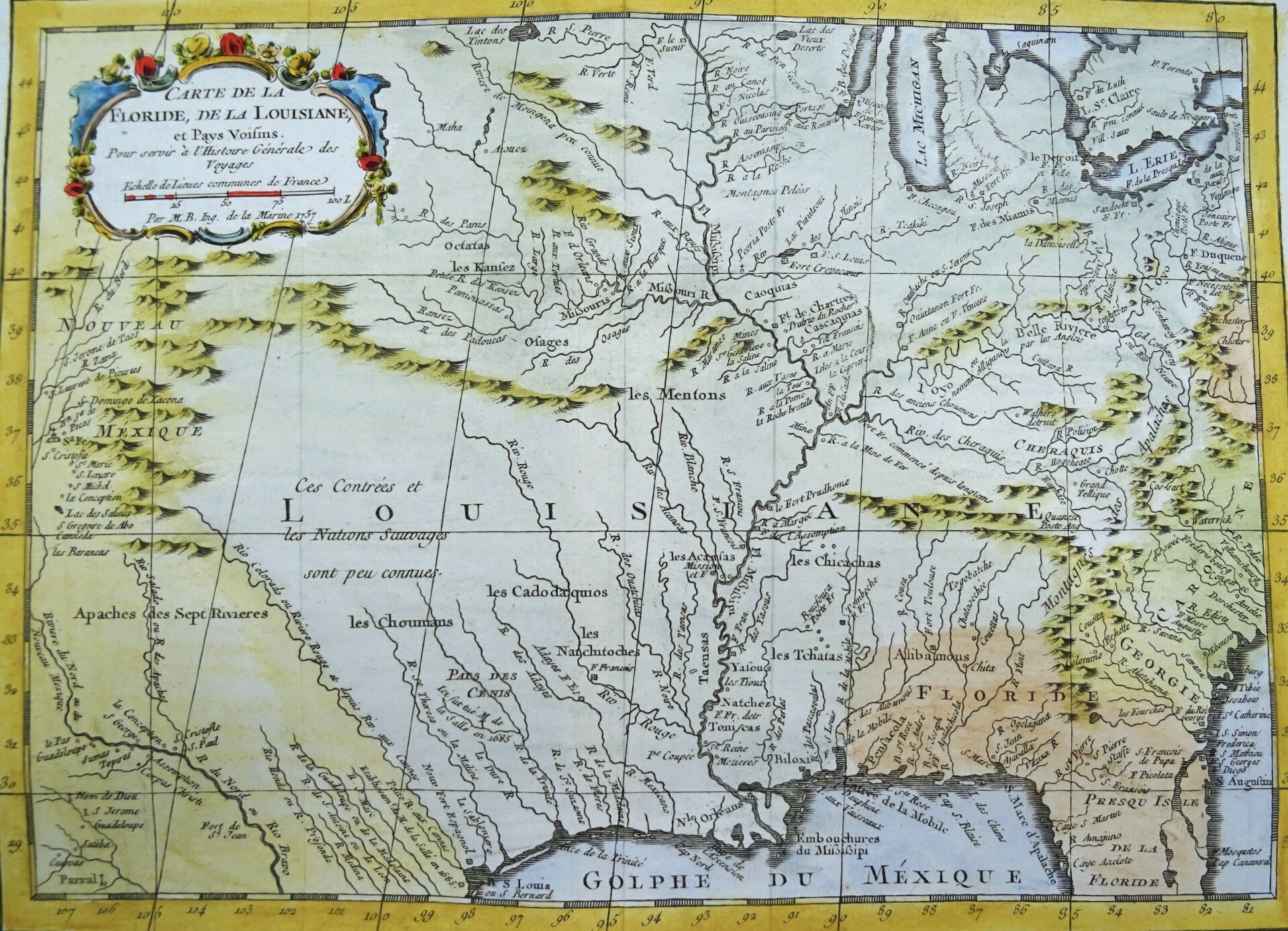
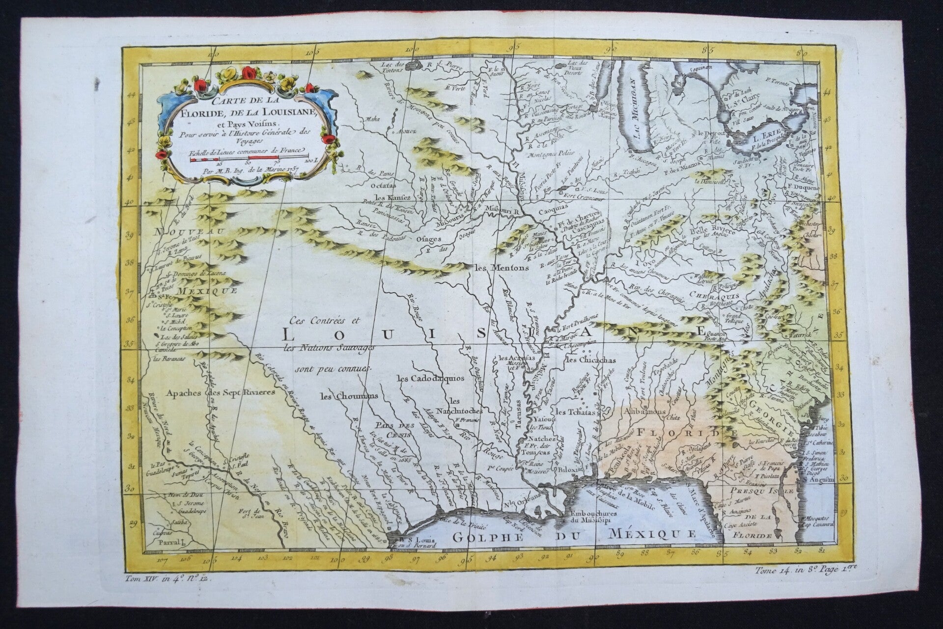
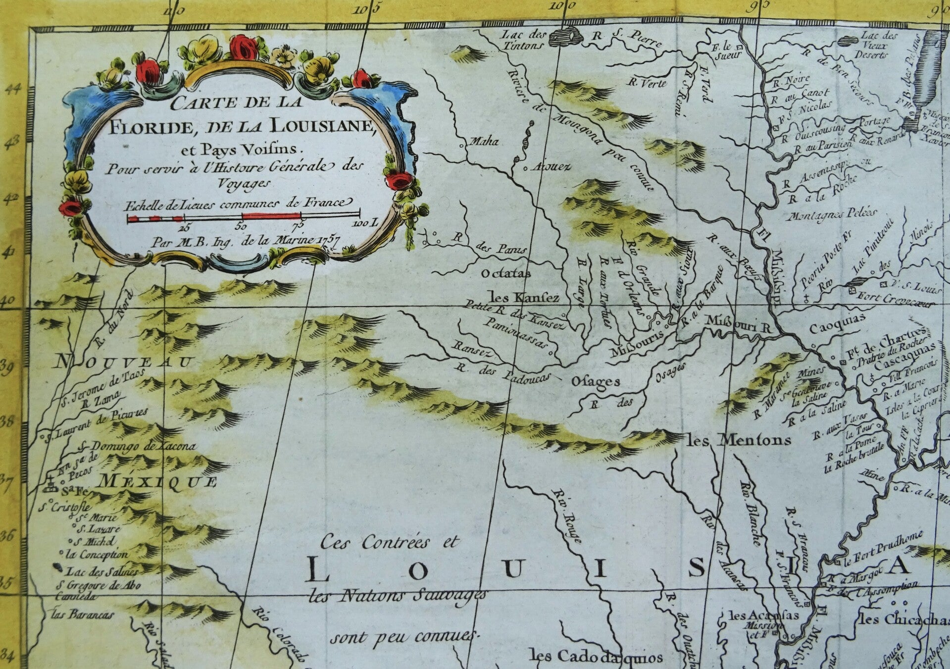
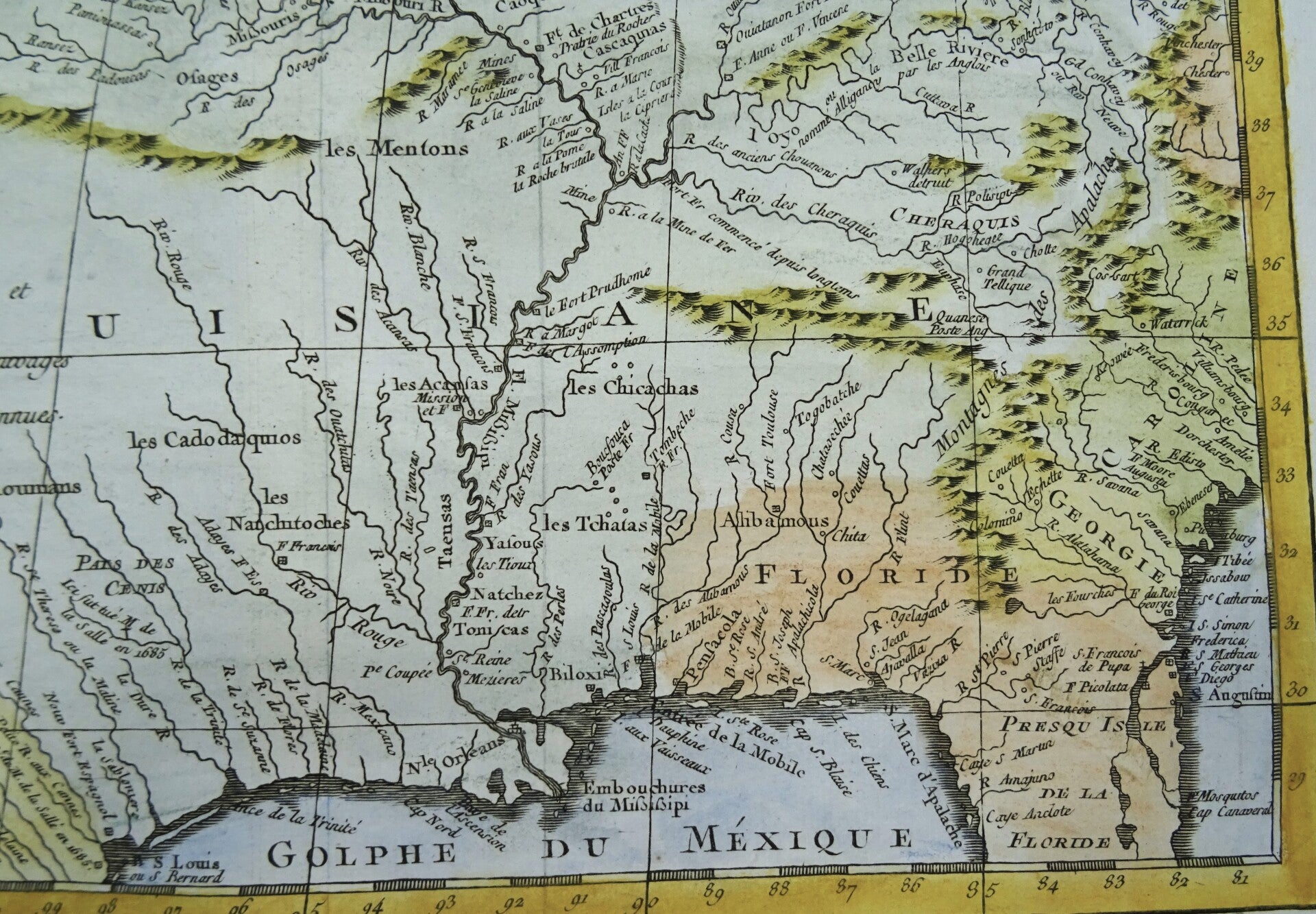
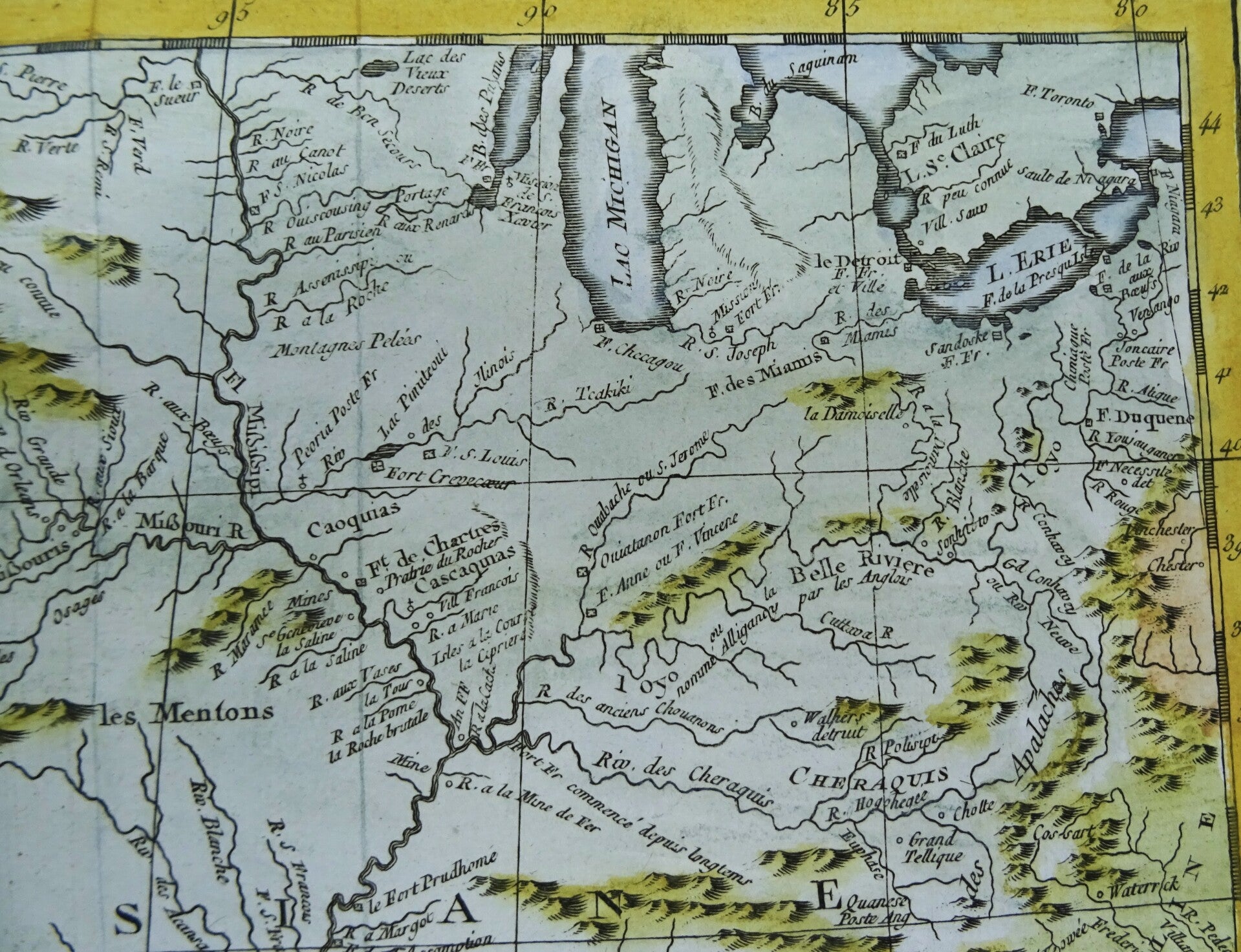
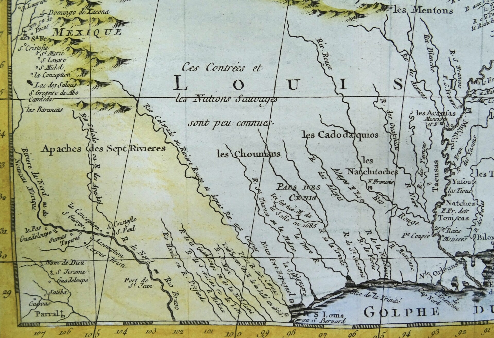
This beautiful 1757 hand colored map by French cartographer Jacques-Nicolas Bellin features the central part of the United States between the Gulf of Mexico and the Great Lakes. It shows an area bounded by the Great Lakes, Pennsylvania, the Carolinas, Georgia, Florida, the Gulf Coast, the Rio Grande, New Mexico and the Mississippi and its tributaries.
It is an important early map of Louisiana under the French after De L'Isle's monumental map of the region. The claims of the French of a very large part of what nowadays is territory of the USA reached far beyond what they ended up controlling in reality.
The map identifies geographical features, various rivers, trading posts and fortifications. Many Indian tribes and settlements are identified throughout.
Published in the 1757 French edition of Abbé Prévost's ´L'Histoire Generale des Voyages´.
Excellent condition. Central fold, as published
Image 22x30,5m, page 25x38cm