USA, North/South Carolina, Georgia, Virginia…. Bellin, 1757, Carte de la Caroline et Georgie
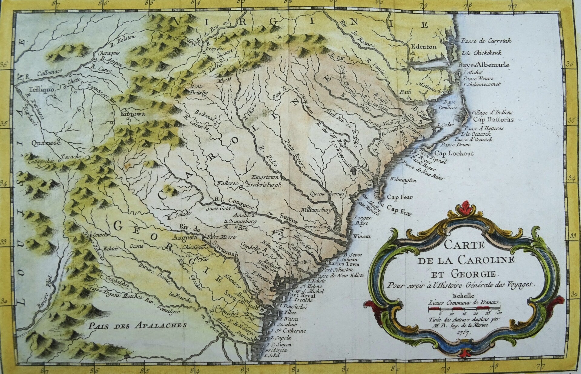
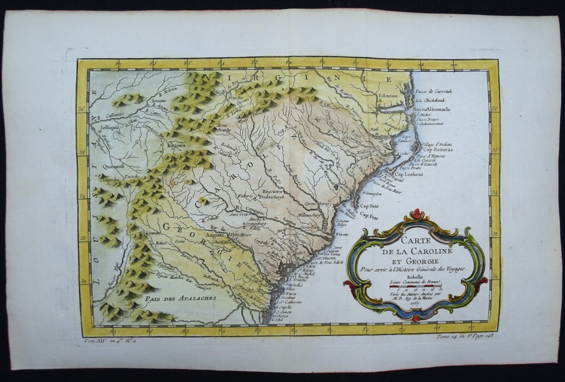
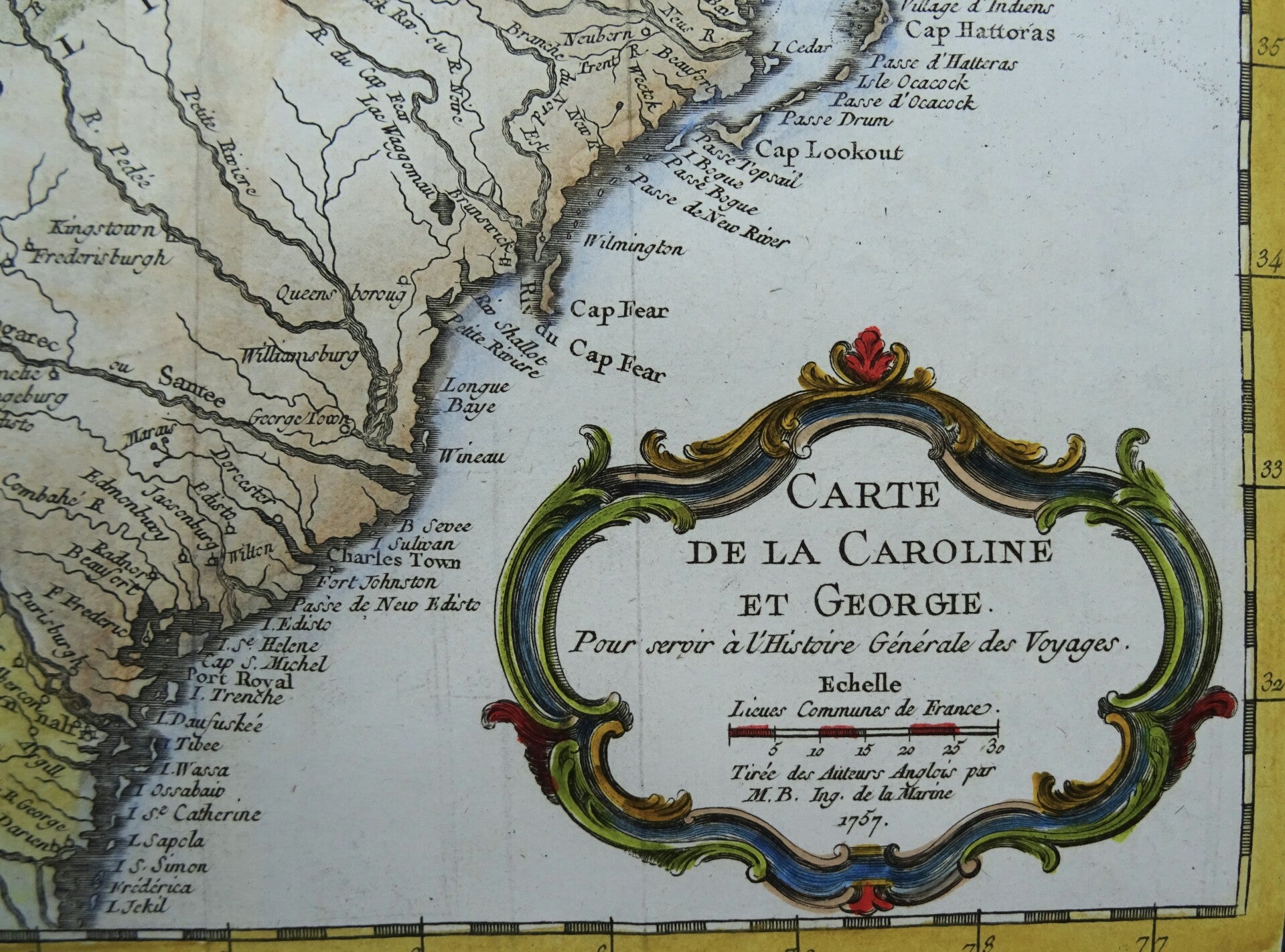
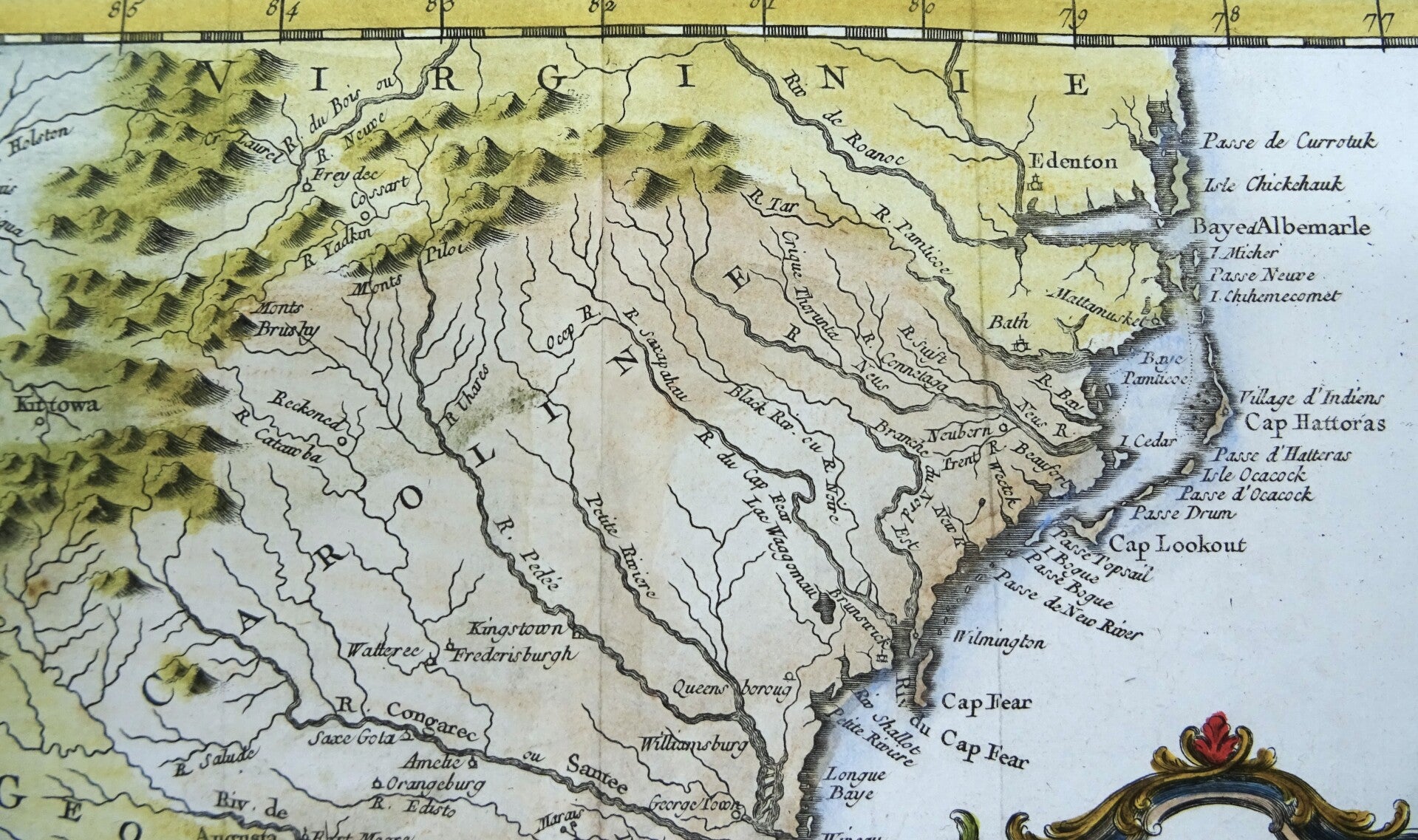
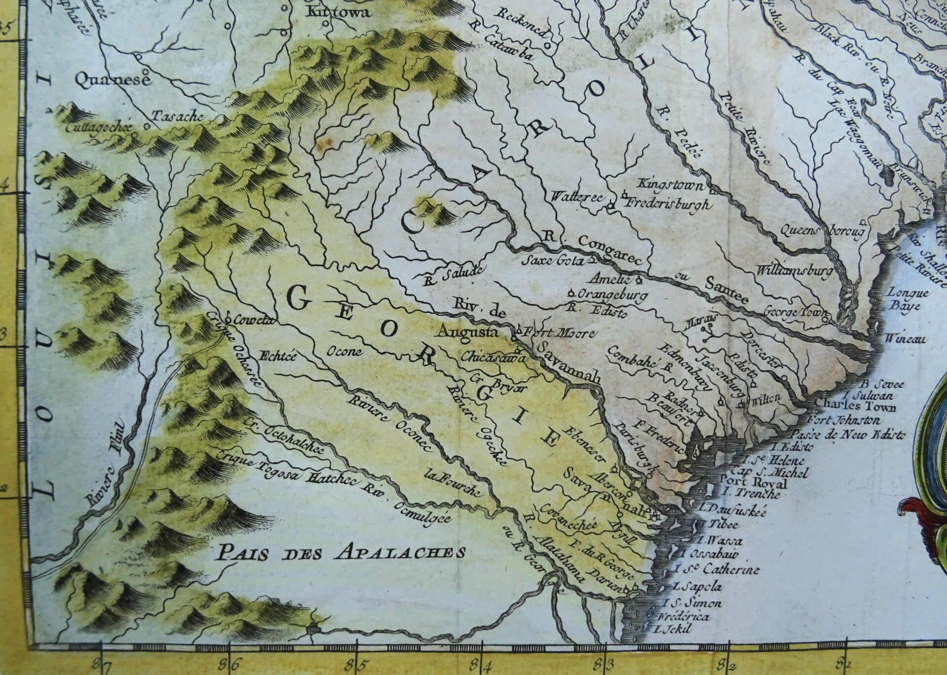
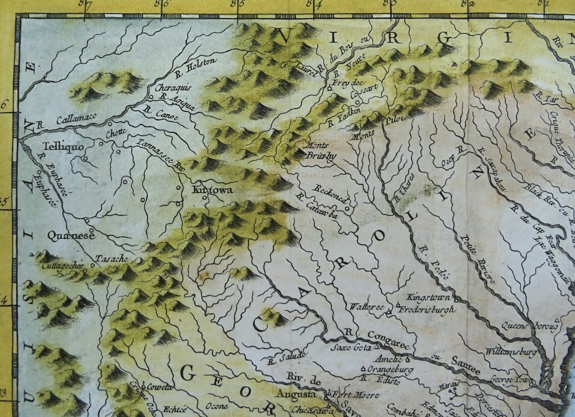
This beautiful 1757 hand colored map by French cartographer Jacques-Nicolas Bellin features the central part of the East Coast of the United States. It shows the colonies from Albemarle Sound to the Alatahama River. It probably owes its origin to the 1752 map of the region by Emanuel Bowen. Numerous English settlements along the coast and Indian villages are located throughout, including a number west of the Appalachian Mountains. There is more detail in the area west of the Blue Ridge Mountains than in many other maps of the period. A rudimentary course of the Tennessee River is traced in the western section of the map.
The map identifies geographical features, various rivers, trading posts and fortifications. Many Indian tribes and settlements are identified throughout.
Published in the 1757 French edition of Abbé Prévost's ´L'Histoire Generale des Voyages´.
Excellent condition. Central fold, as published
Image 19x29m, page 25x38cm