USA, New England, New York, New Jersey, Pennsylvania… J.N. Bellin, 1757, Carte de la Nouvelle Angleterre Nouvelle Yorck et Pensilvanie
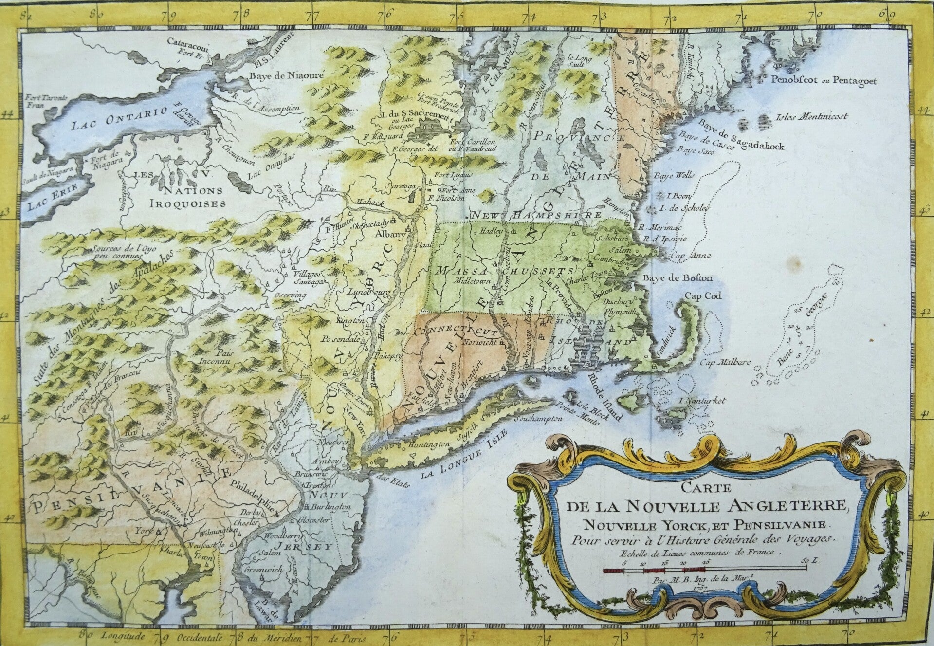
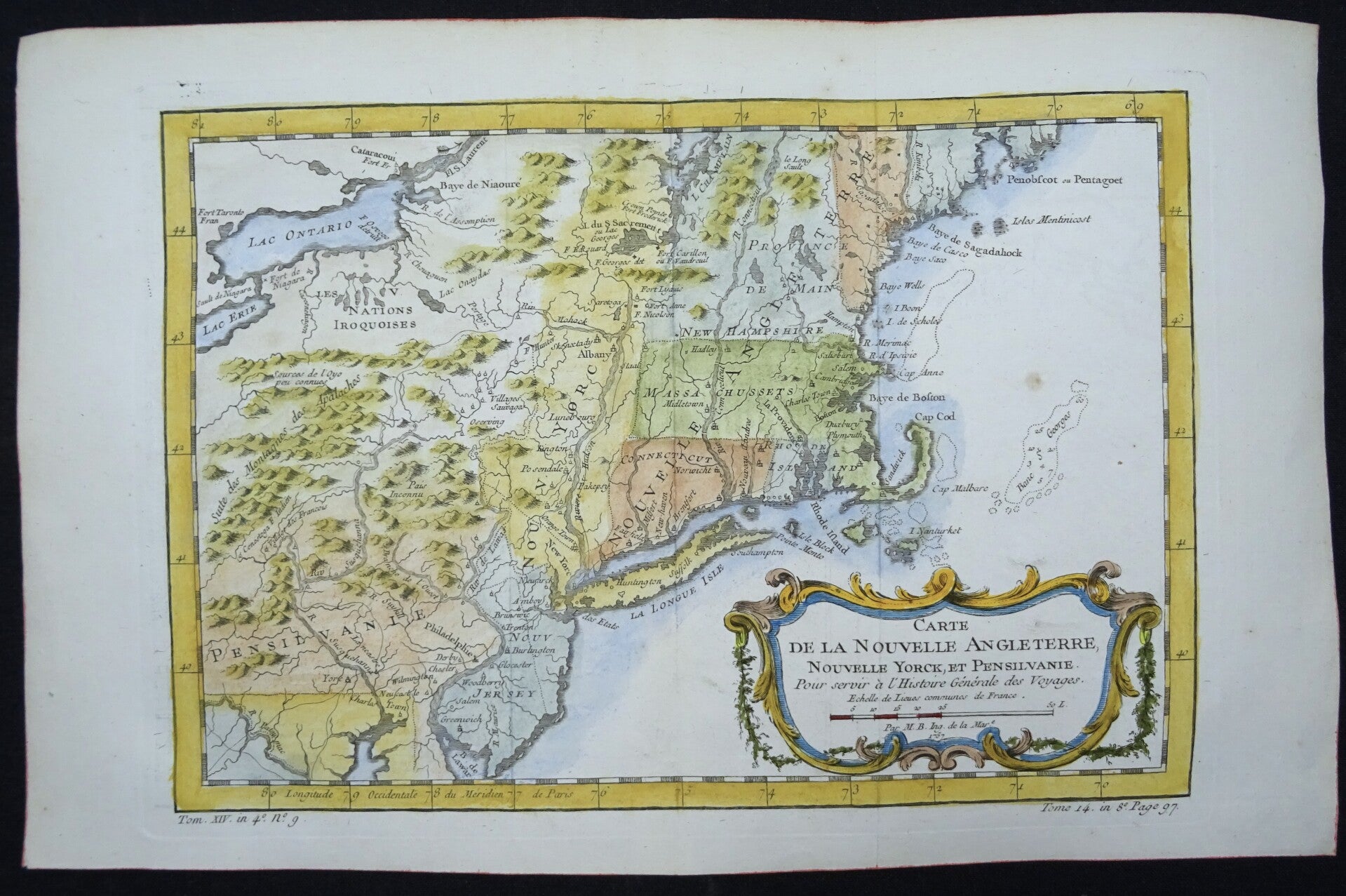
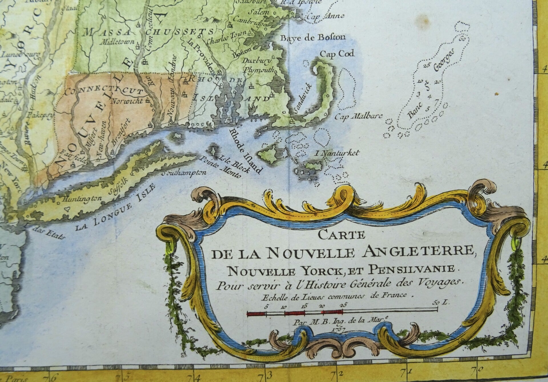
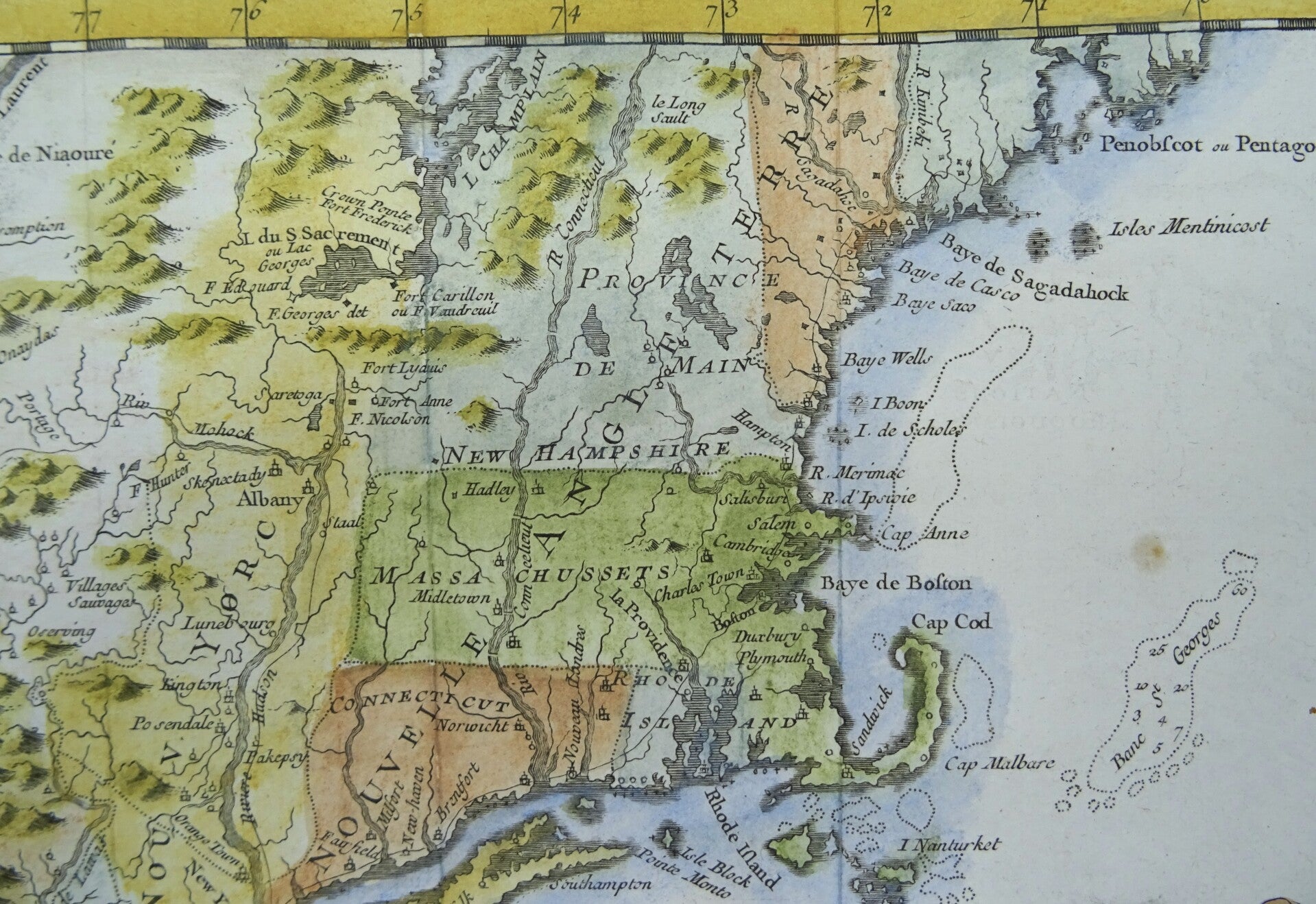
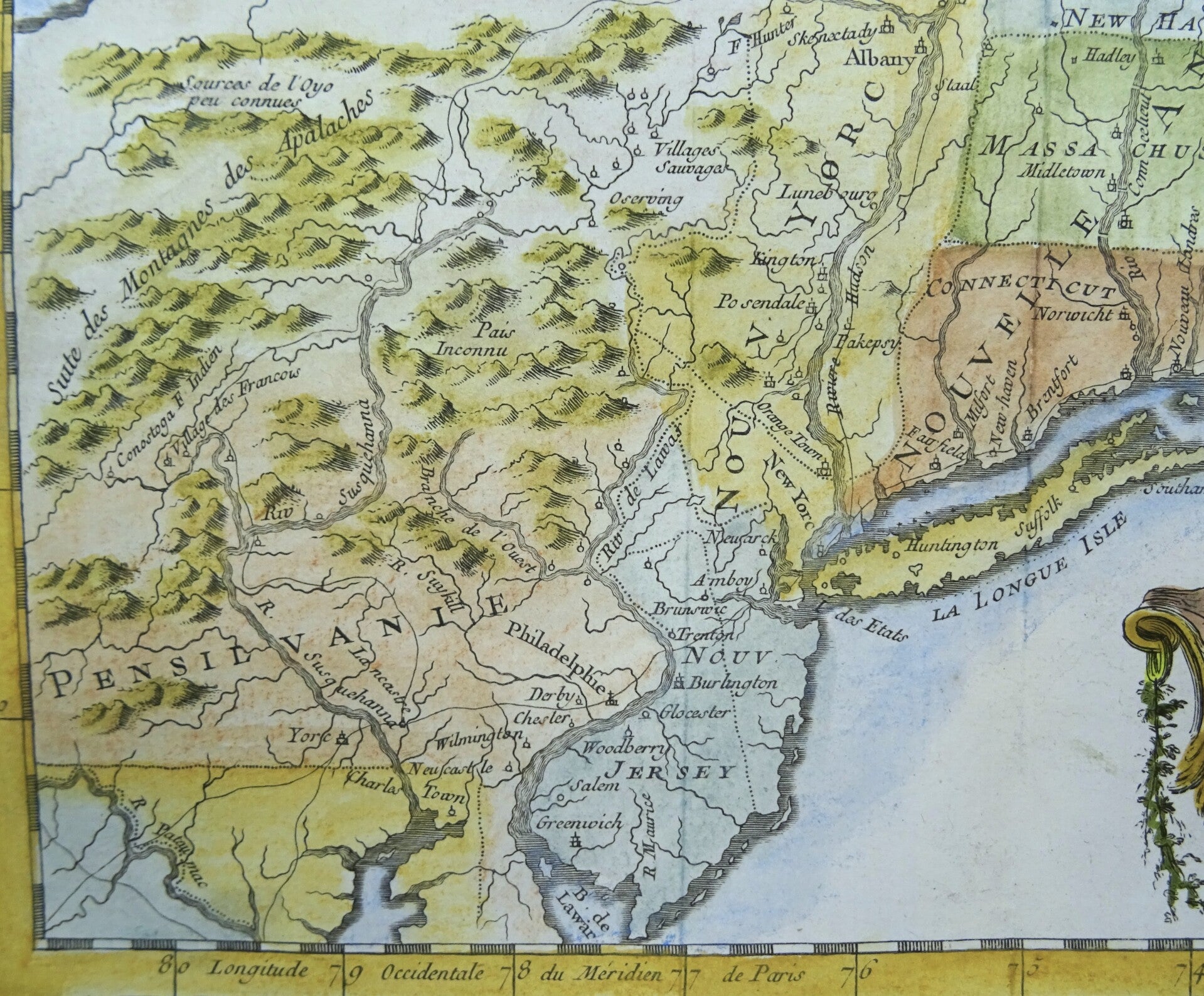
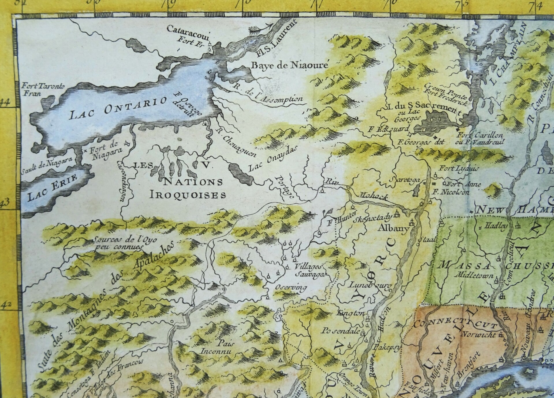
This beautiful 1757 hand colored map by French cartographer Jacques-Nicolas Bellin features New England, New York and Pennsylvania. The map covers the northeast showing New York, New Jersey, Connecticut, Massachusetts, New Hampshire, Rhode Island, Vermont and parts of Maine, Maryland and Pennsylvania. Extends from the Penobscot Bay to Lake Erie and from Lake Ontario to the Chesapeake Bay. The map identifies geographical features, various rivers, trading posts and fortifications. Many Indian tribes and settlements are identified throughout.
This map was issued at the time of the French and Indian War. Curious French villages are identified just west of the Susquehanna River - evidence of the French intent to occupying western Pennsylvania that led to the French and Indian War.
This map was drawn by Jacques Nicolas Bellin and published as plate no. 9 in volume 9 of the 1757 French edition of Abbé Prévost's L'Histoire Generale des Voyages.
Excellent condition. Central fold, as published
Image 19x29m, page 25x39cm