USA, Washington DC, Virginia, Delaware, Maryland, Chesapeake, Pennsilvania, New Jersey…. Bellin, 1757, Carte de la Virginie, de la Baye de Chesapeack…
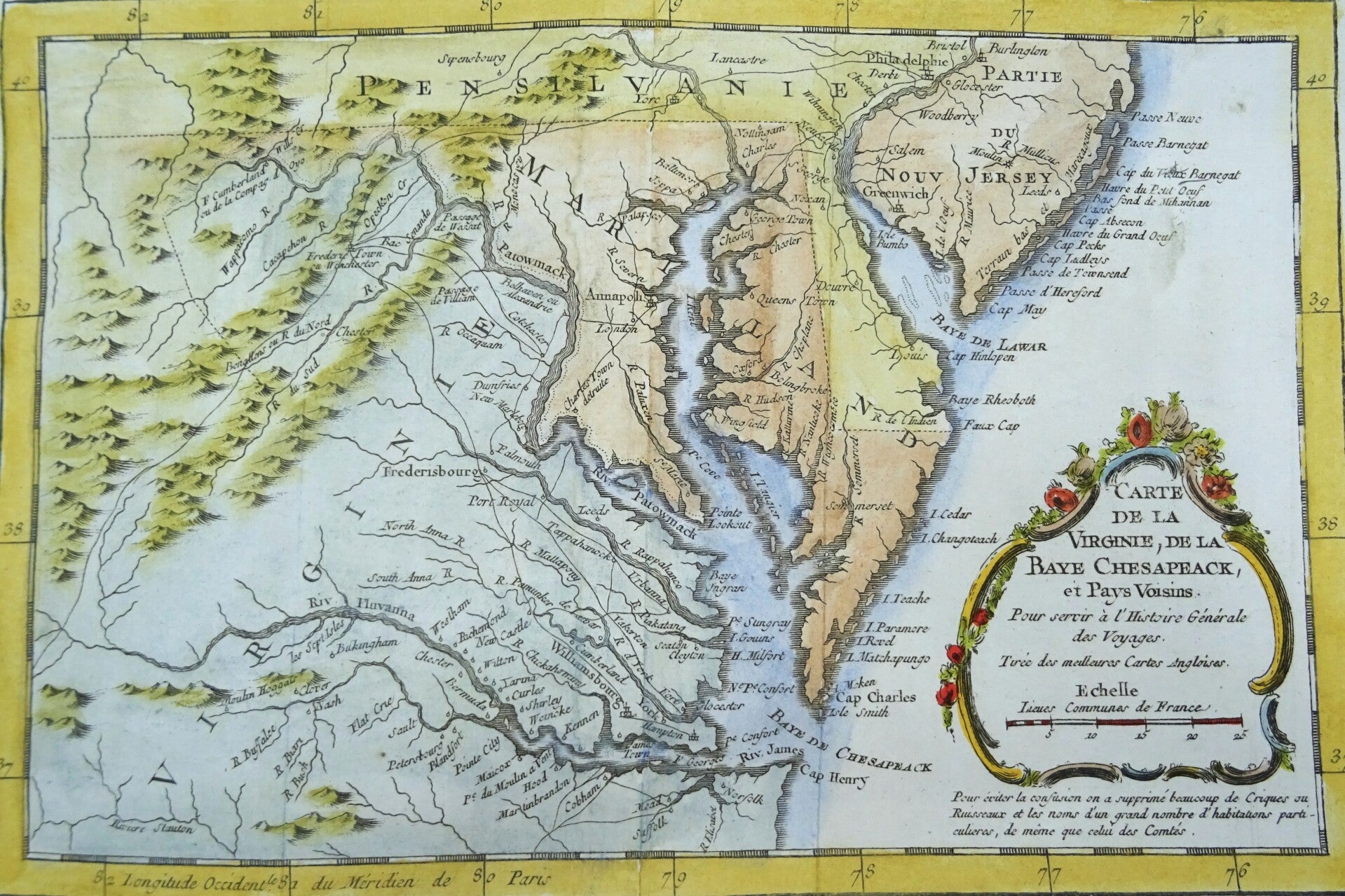
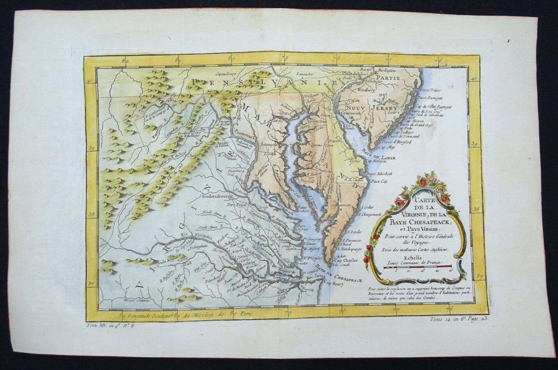
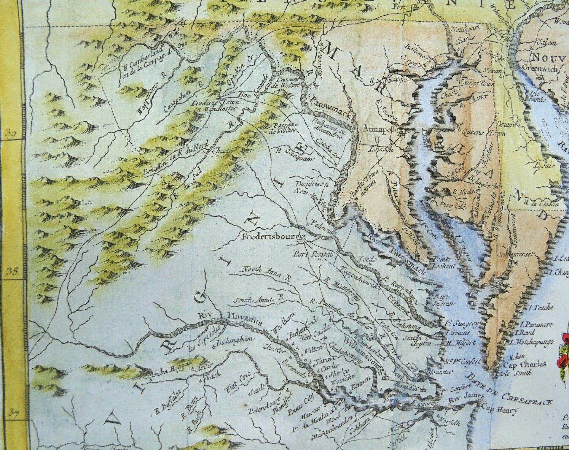
This beautiful 1757 hand colored map by French cartographer Jacques-Nicolas Bellin features a part of the East Coast of the United States.
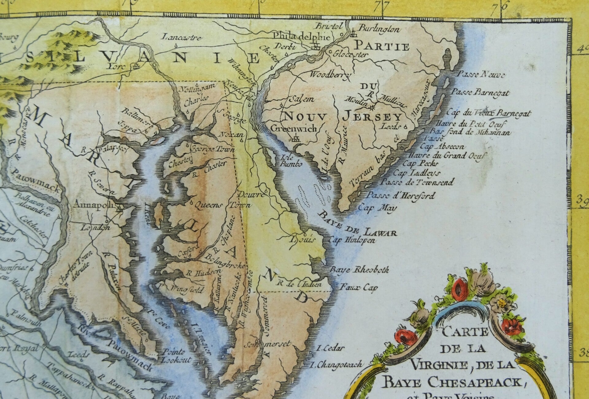
It shows the area of the Chesapeake Bay, Virginia, Maryland, Delaware (immediately prior to the settlement between Penn and Lord Baltimore, with Delaware properly shown as part of Pennsylvania), and contiguous regions.
Bellin's map covers from Cape Henry north to the Susquehanna River and Burlington, New Jersey and inland as far as the Appalachian Mountains. The Chesapeake Bay is shown in full, as are many of its river estuaries. The map notably includes the Chesapeake Bay's western watershed, luring potential colonists with the promise of large navigable rivers and rich fertile lands.
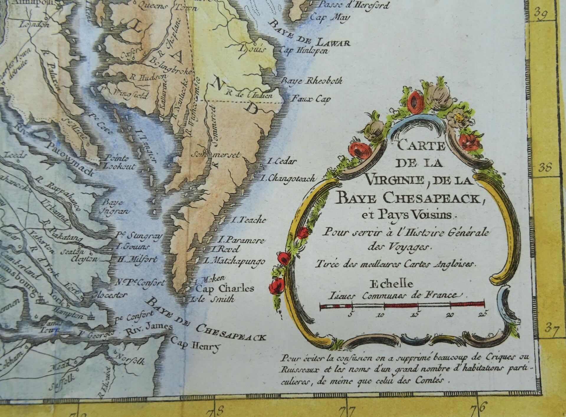
In the title cartouche Bellin cites that this map is derived from the 'best English maps' (Turee des Meilleures Cartes Angloises). In this he can only be referring to the Fry-Jefferson map of 1753. Such is apparent from the cartographer's inclusion of Moulin Hoggats (Hoggett's Mill) on the upper Appomattox River. This mill first appeared on the Fry-Jefferson map and did not subsequently reappear on another published map until the present issue.
The map shows towns, roads, villages, churches, meeting houses, rivers, mountains, inlets, islands and a host of other details. A nice map of the region, issued just prior to the start of the French & Indian War. This is 1 of 3 nearly identical maps of the Chesapeake region by Bellin. The others don´t include the name "Virginie" or do include the name "Mari-land" in the title,respectively.
Published in the 1757 French edition of Abbé Prévost's ´L'Histoire Generale des Voyages´.
Excellent condition. Central fold, as published
Image 19x29m, page 25x38cm