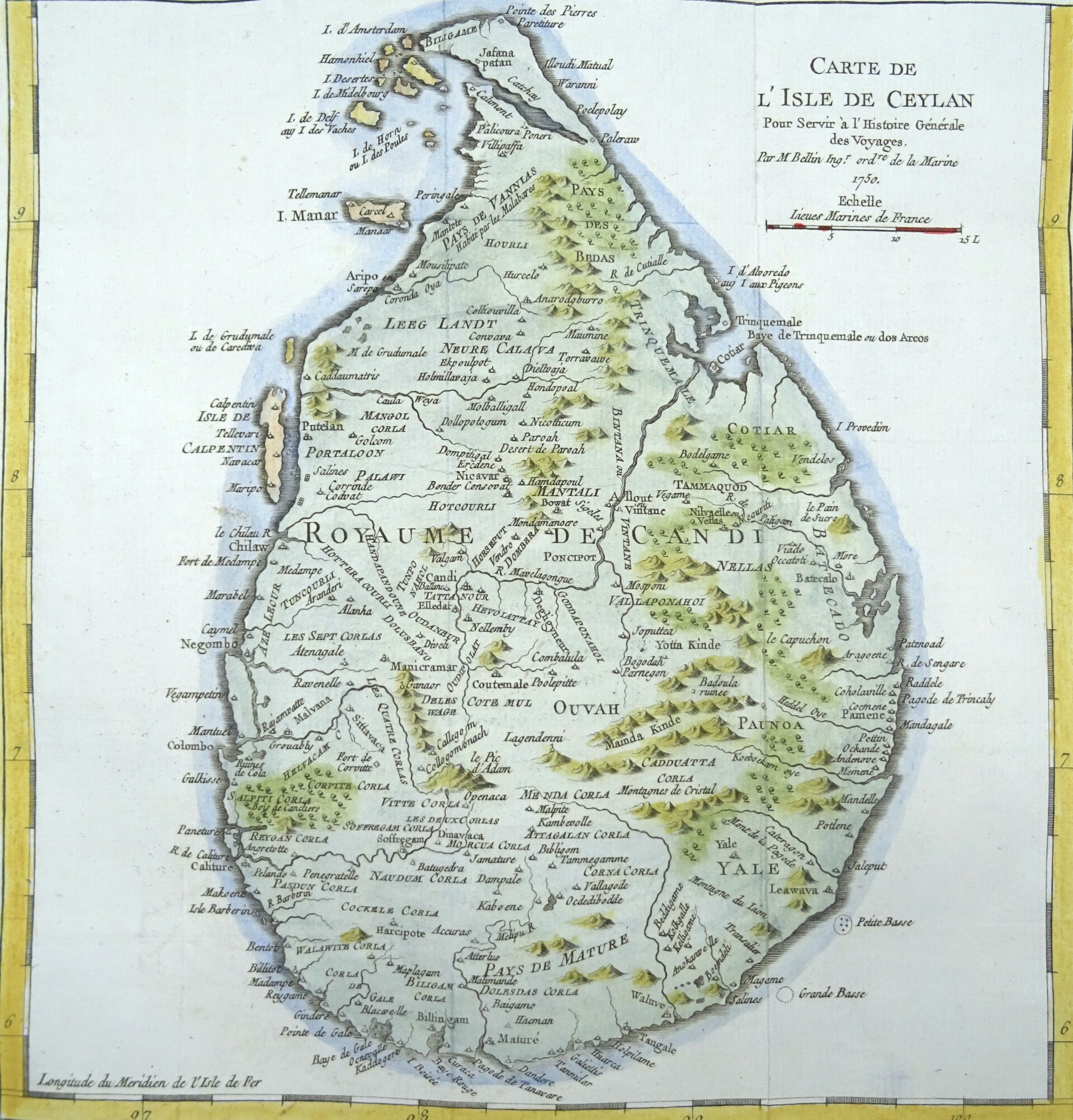
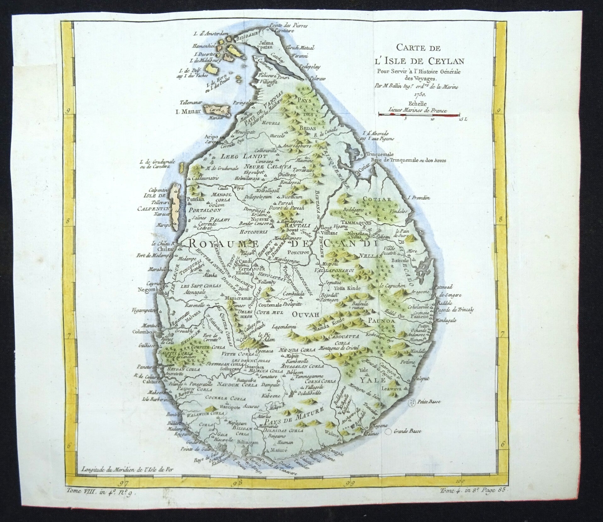
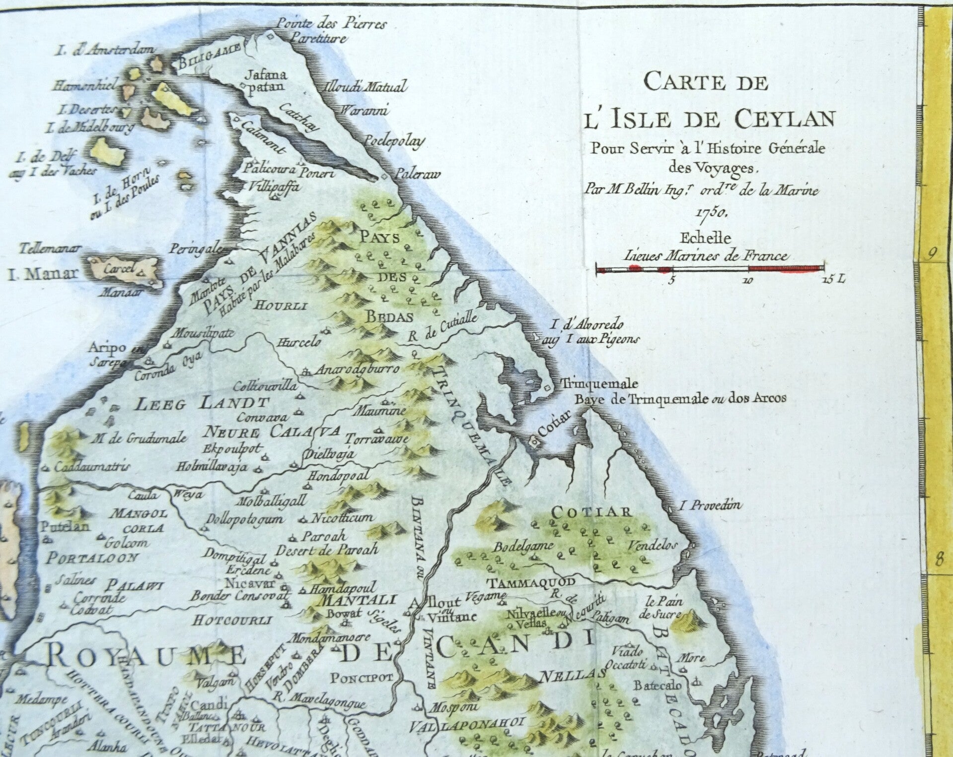
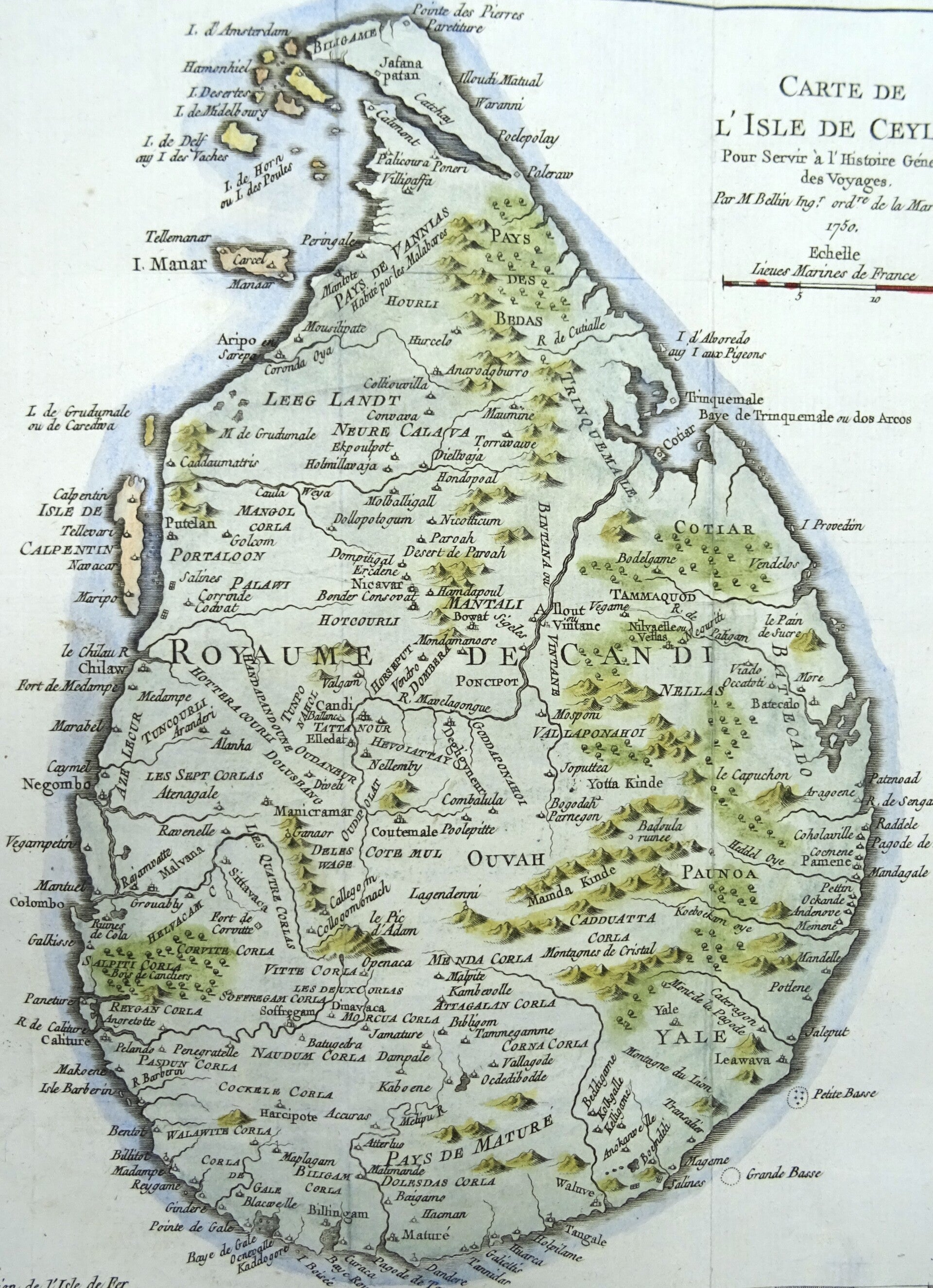
Sri Lanka, Ceylon, J.N. Bellin, 1750, Carte de l´Isle de Ceylan
€79.00
Item number:
26 16 BF
Detailed map of the island of Ceylon (modern day Sri Lanka) in the 18th century while largely being under control of the Dutch East Indies Company, V.O.C.
Not only showing the coastal towns, but also very good detail inland of mountains, rivers, towns and villages.
Published in 1750 in Paris in ‘Histoire Generale des Voyages’.
Excellent condition, folds as published.
Image 25,5x24,5cm, sheet 27x31,5cm