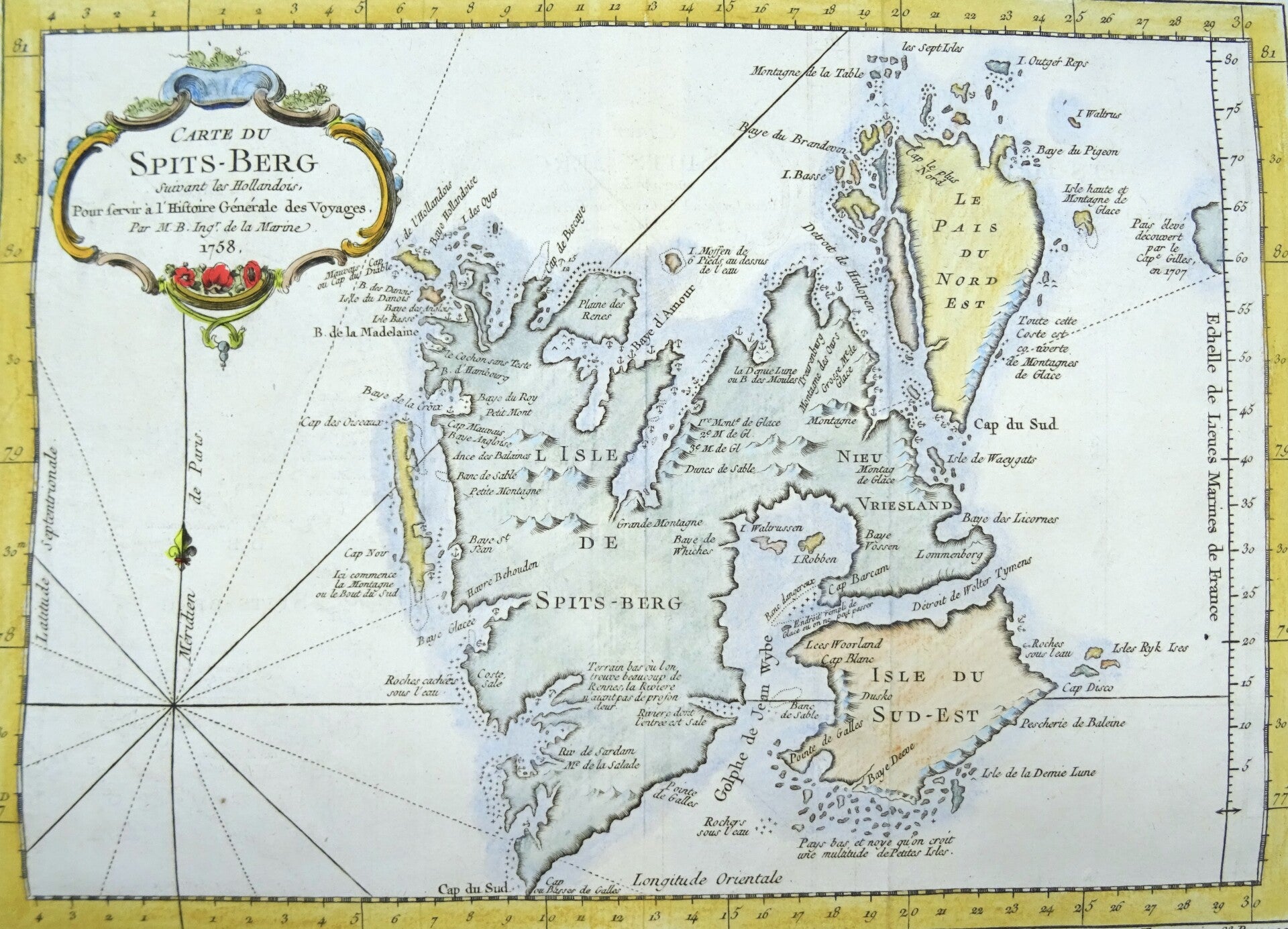
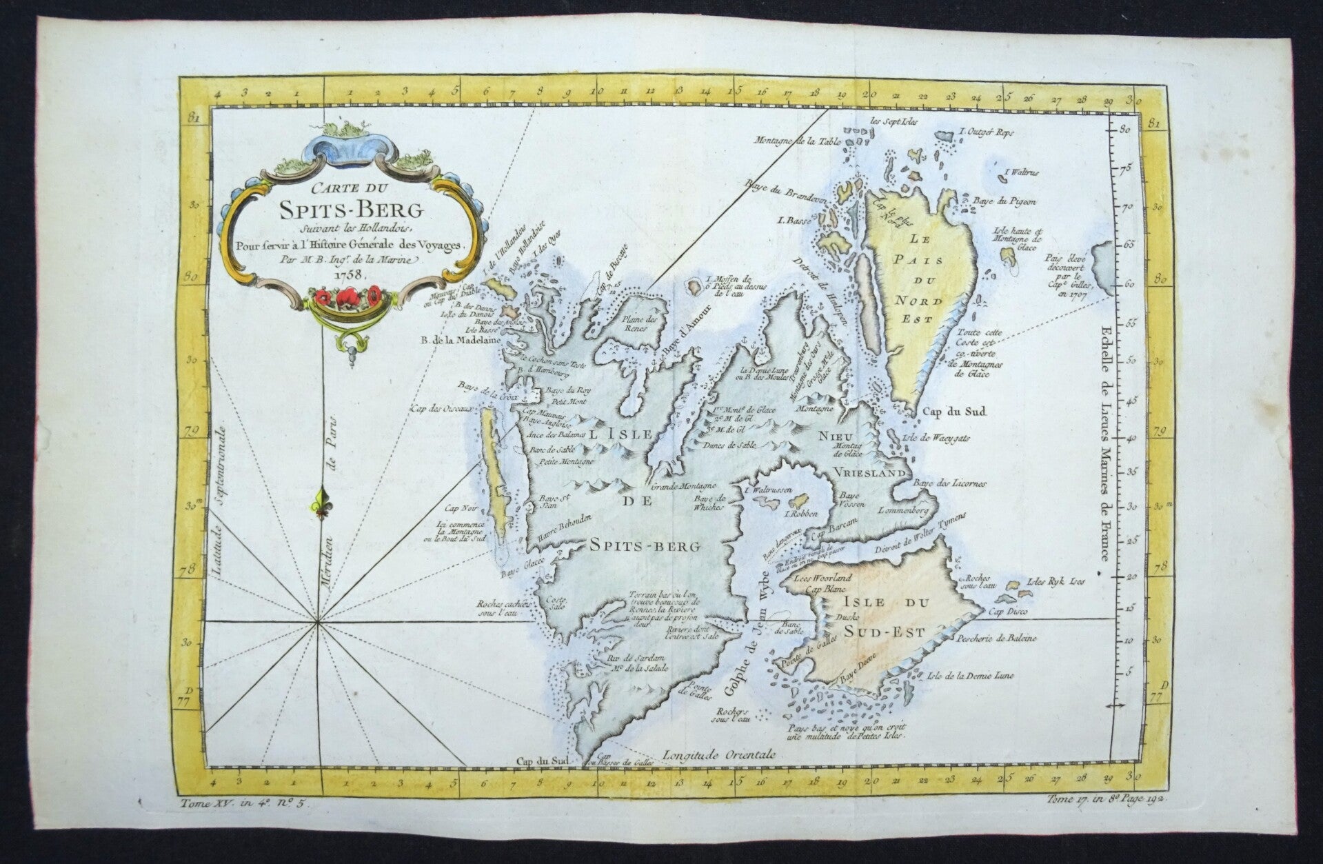
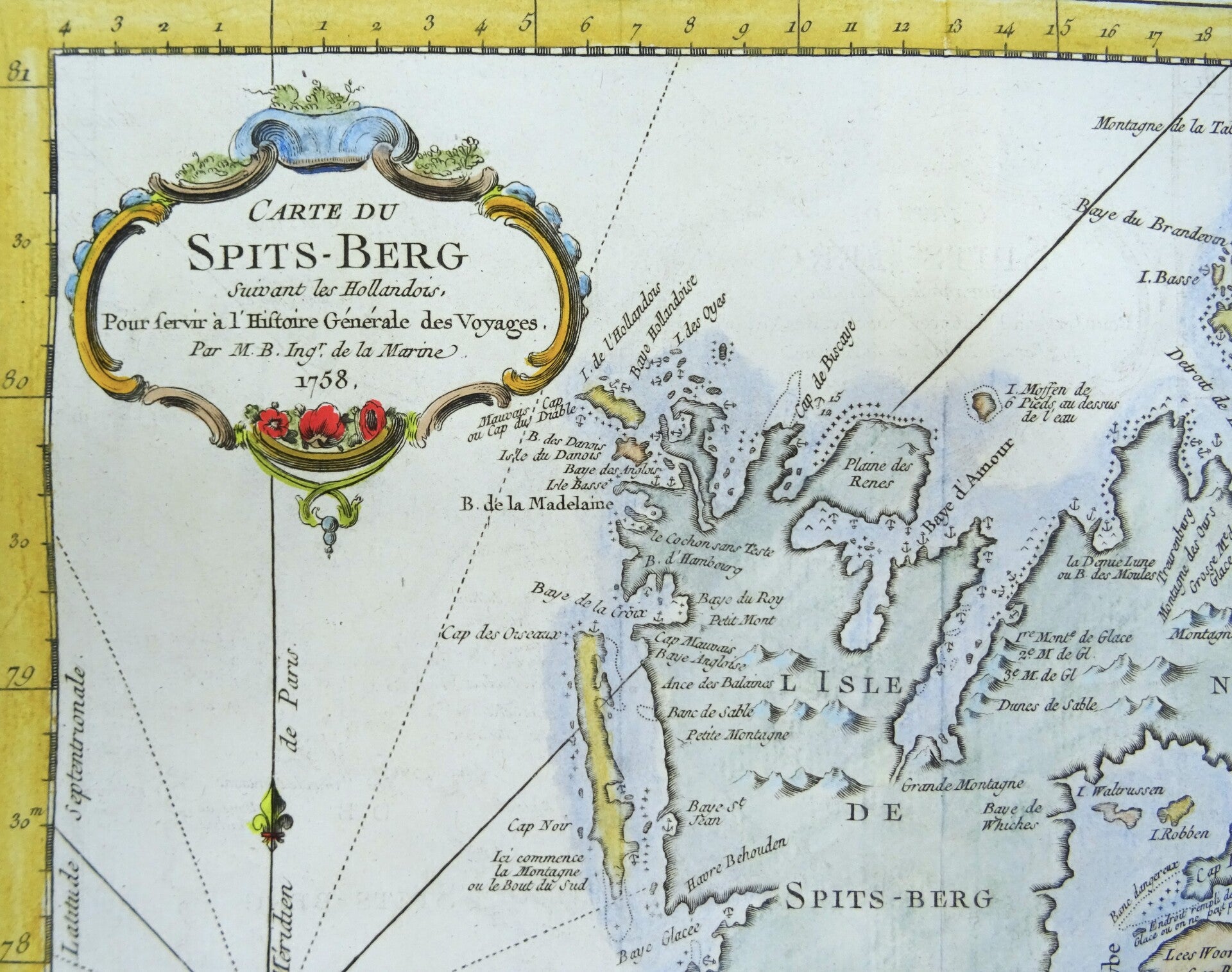
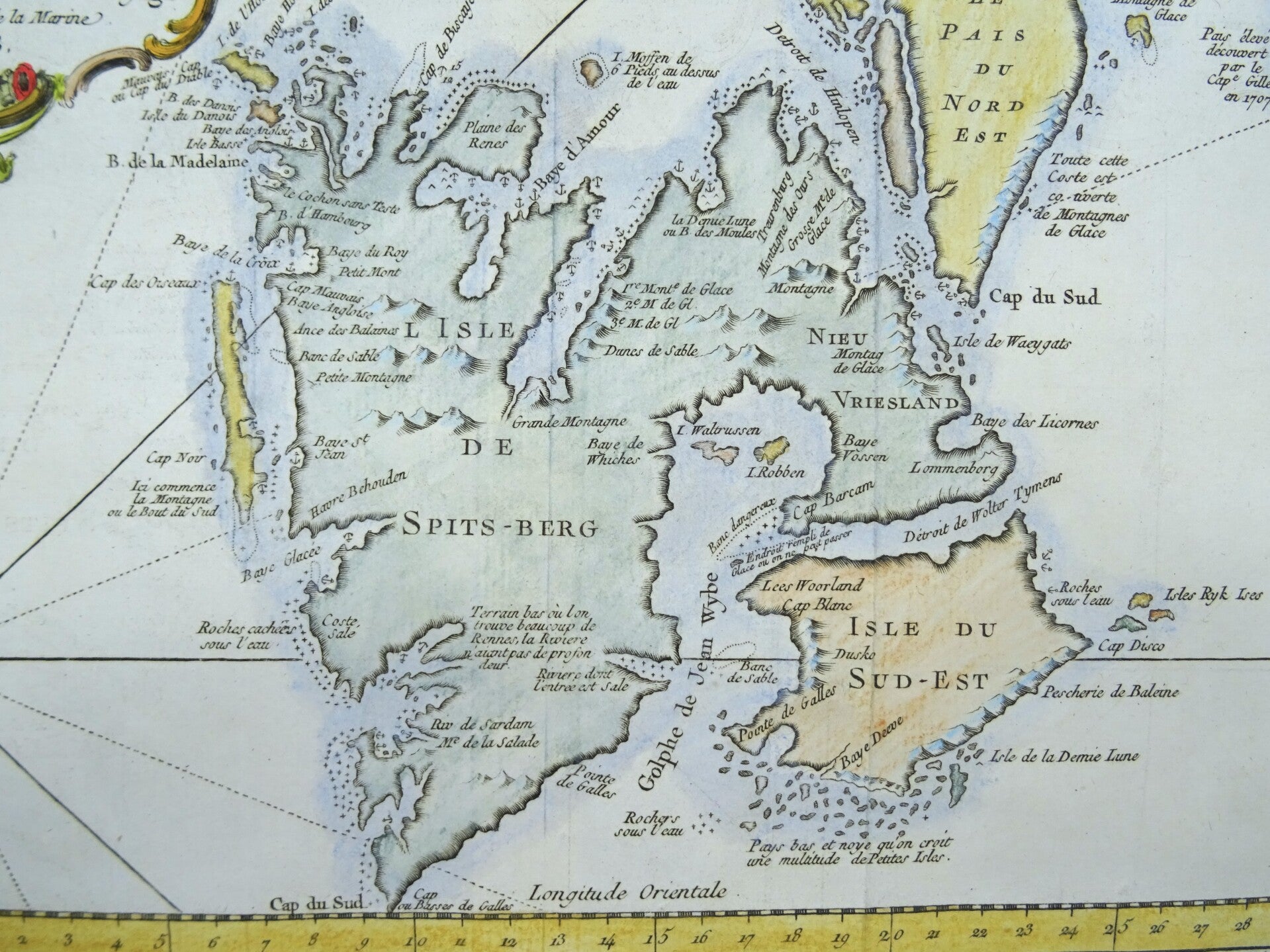
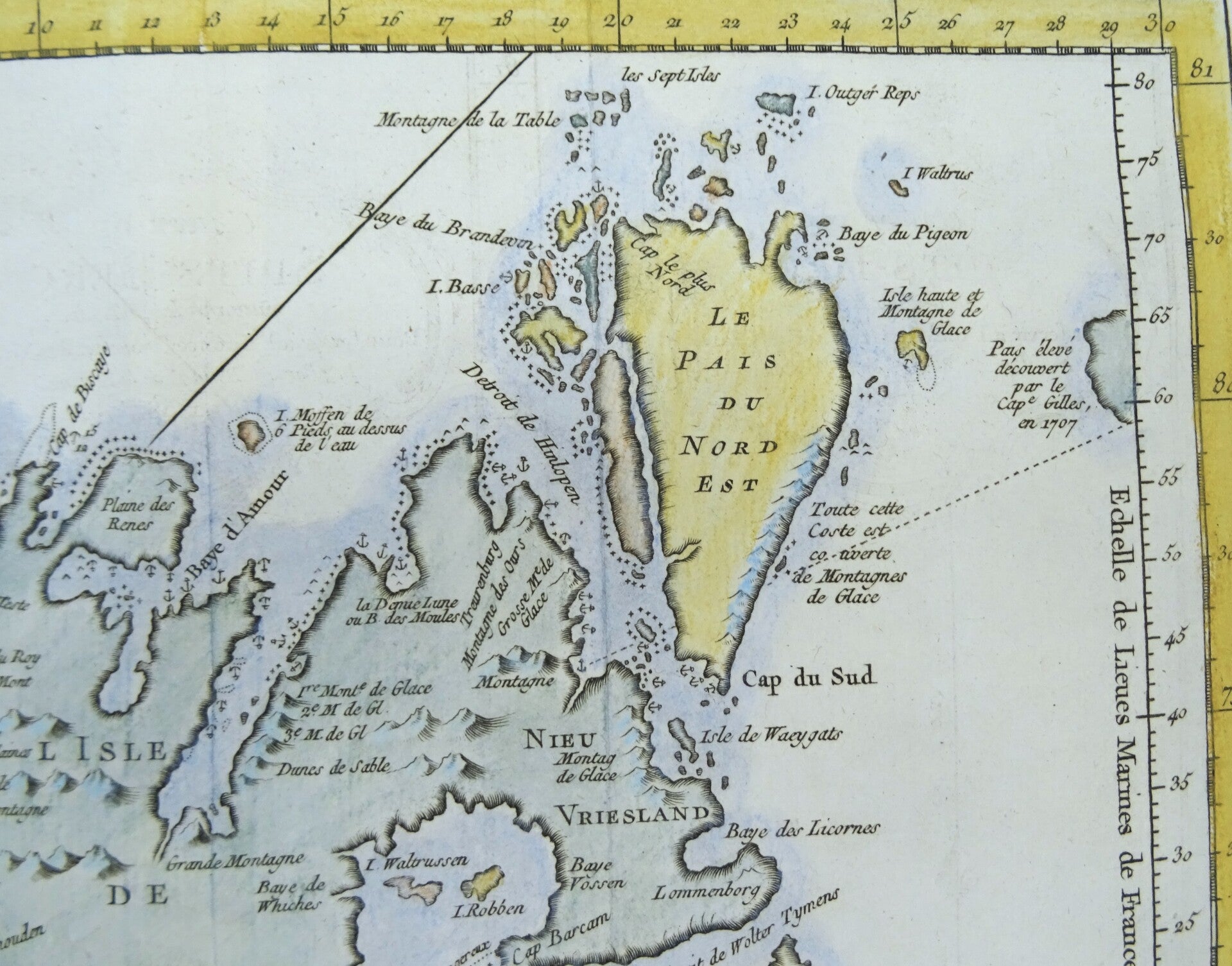
Norway, Svalbard, Spitsbergen, Polar Sea, Bellin, 1758, Carte du Spits-Berg
€79.00
Item number:
26 16 BB
Beautiful copy of the Bellin map of the Spitsbergen archipelago, derived from maps by Dutch cartographers. Published for the first time in Paris in 1758 in 'Histoire Generale des Voyages'.
Very good condition. Folds as published. Ample margins. Clean paper. Reverse side blank.
Image 21,5x30cm, page 25x38,5cm