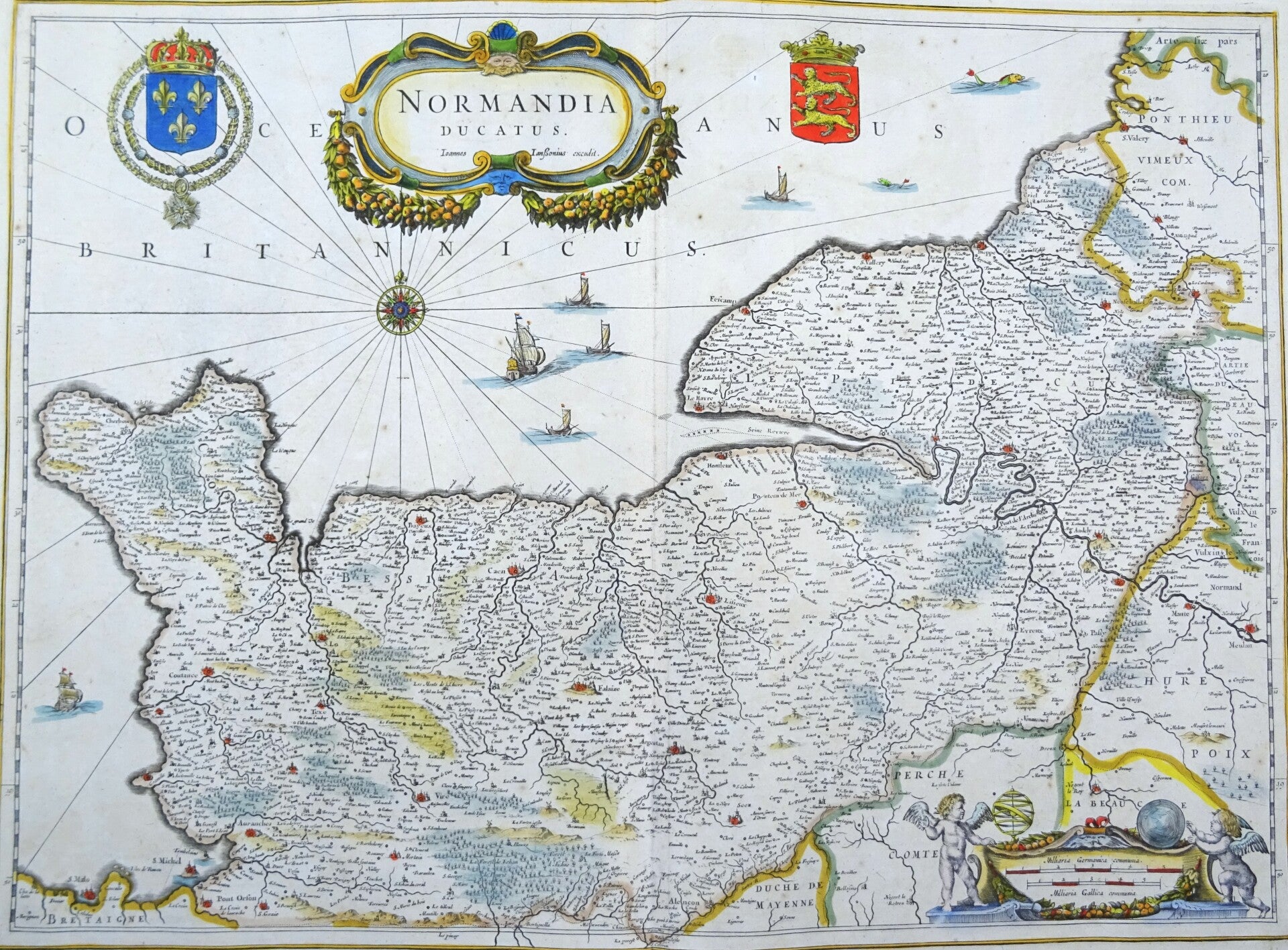
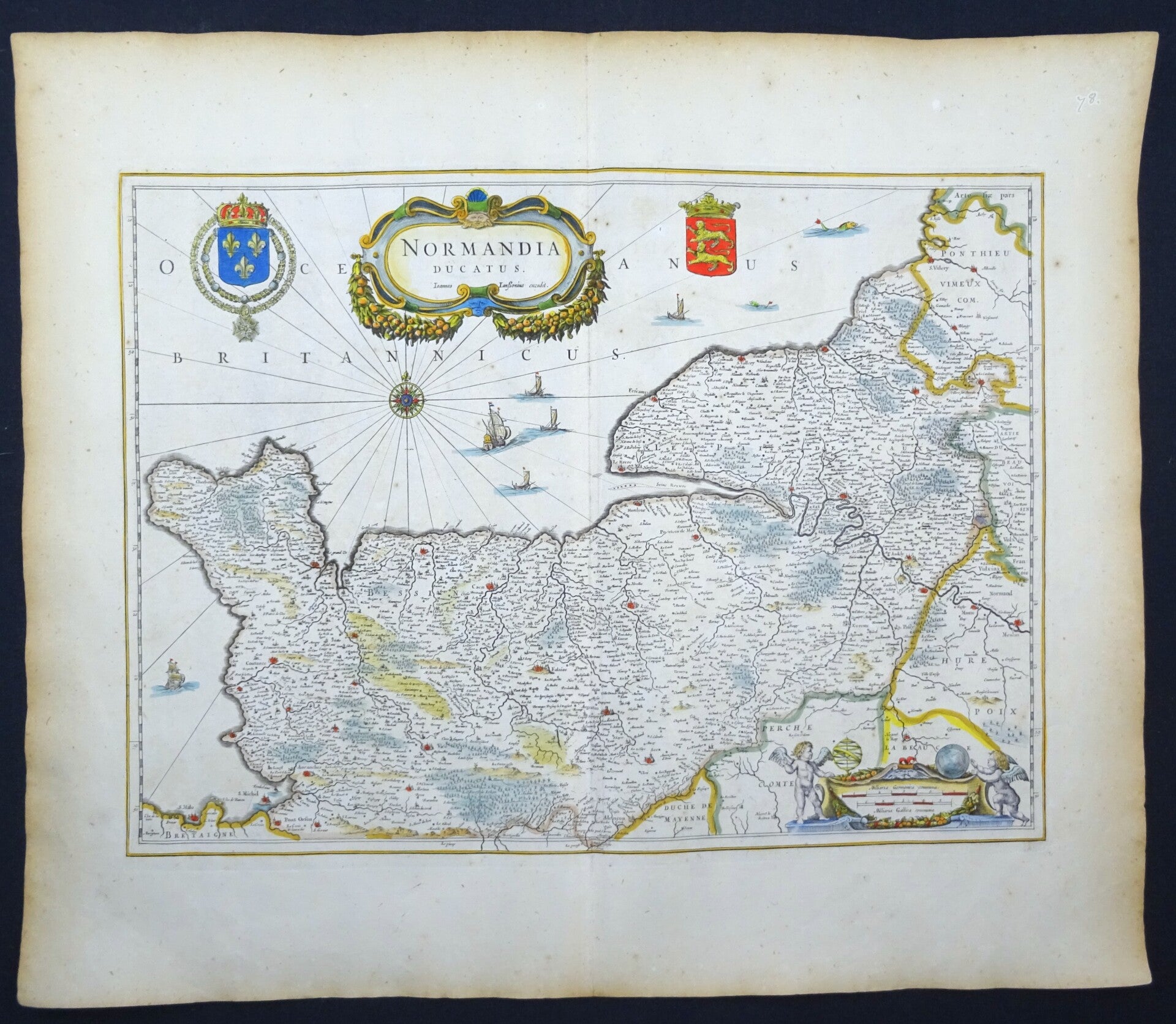
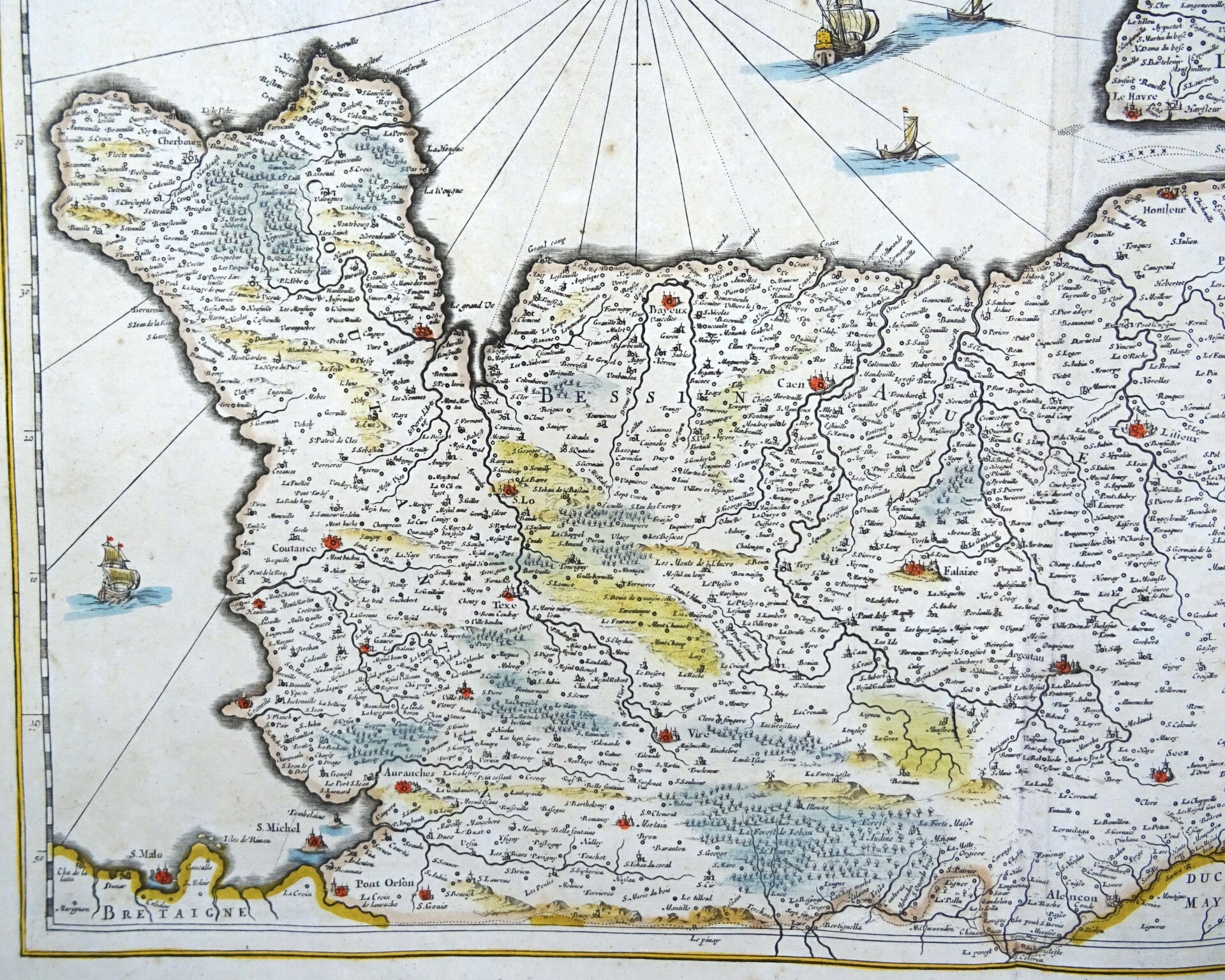
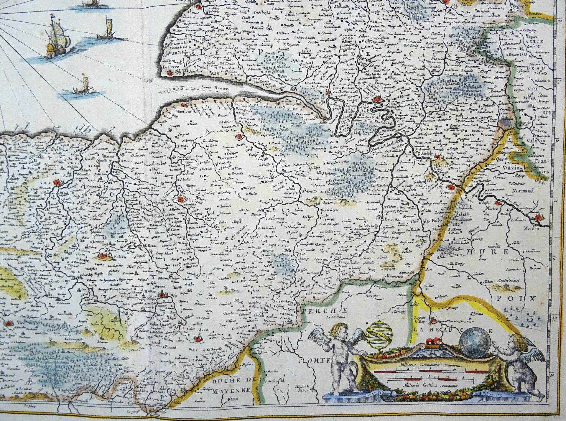
France, Normandy, large map Janssonius, 1680, Normandia Ducatus
€189.00
Item number:
25 21 CN
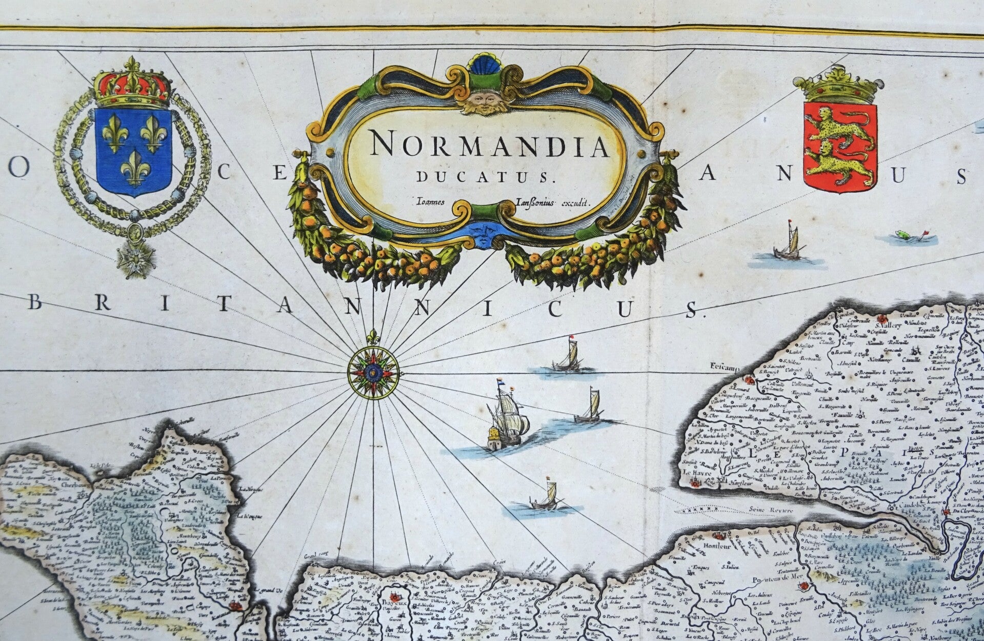
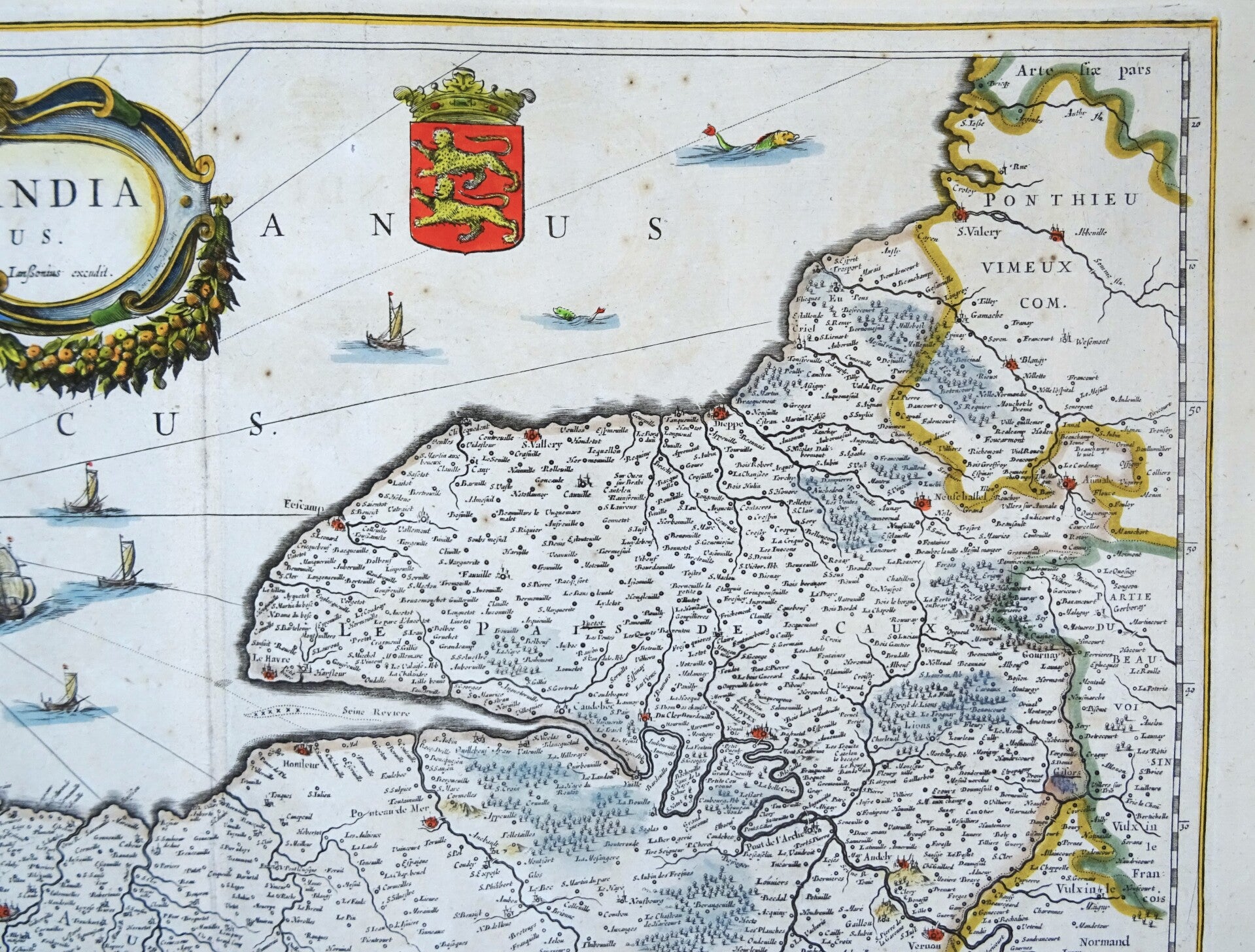
Stunning and one of the most decorative maps of Normandy by Janssonius. Decorated with arious ships and coats of arms of Normandy and the French king.
The map was first published around 1650 in the Atlas Maior by Janssonius, Amsterdam. This edition is from around 1680 (without text on the back).
Very good condition. Very wide margins. Nice hand coloring.
Image 35x51,5cm, sheet 53,5x60cm