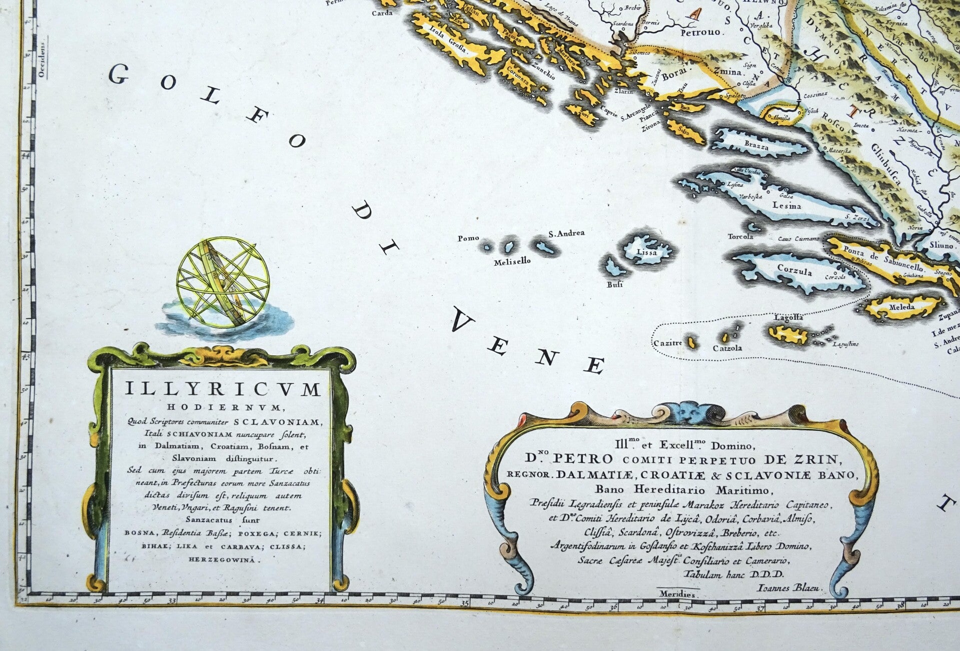
Croatia, Slovenia, Bosnia, Serbia, Montenegro.. J. Blaeu, 1661/1680, Ilyricum Hodiernum, Quod Scriptores communiter Sclavoniam, Itali Schiavoniam nuncupare solent, in Dalmatiam, Croatiam, Bosnam, et Slavoniam distinguitur. ... Ioannes Blaeu.
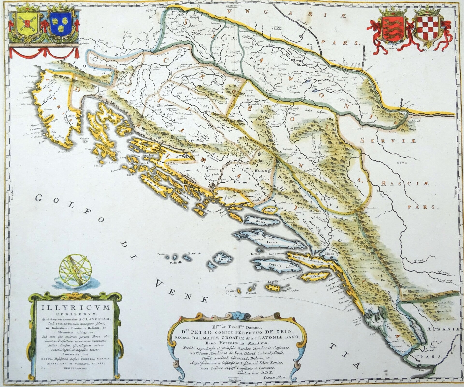
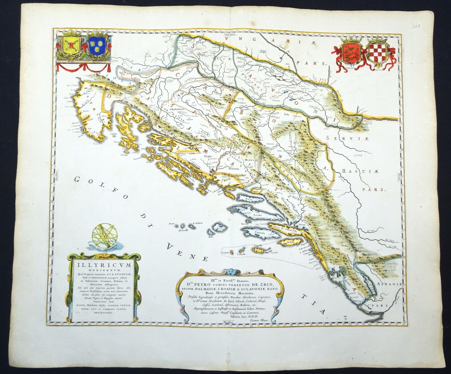
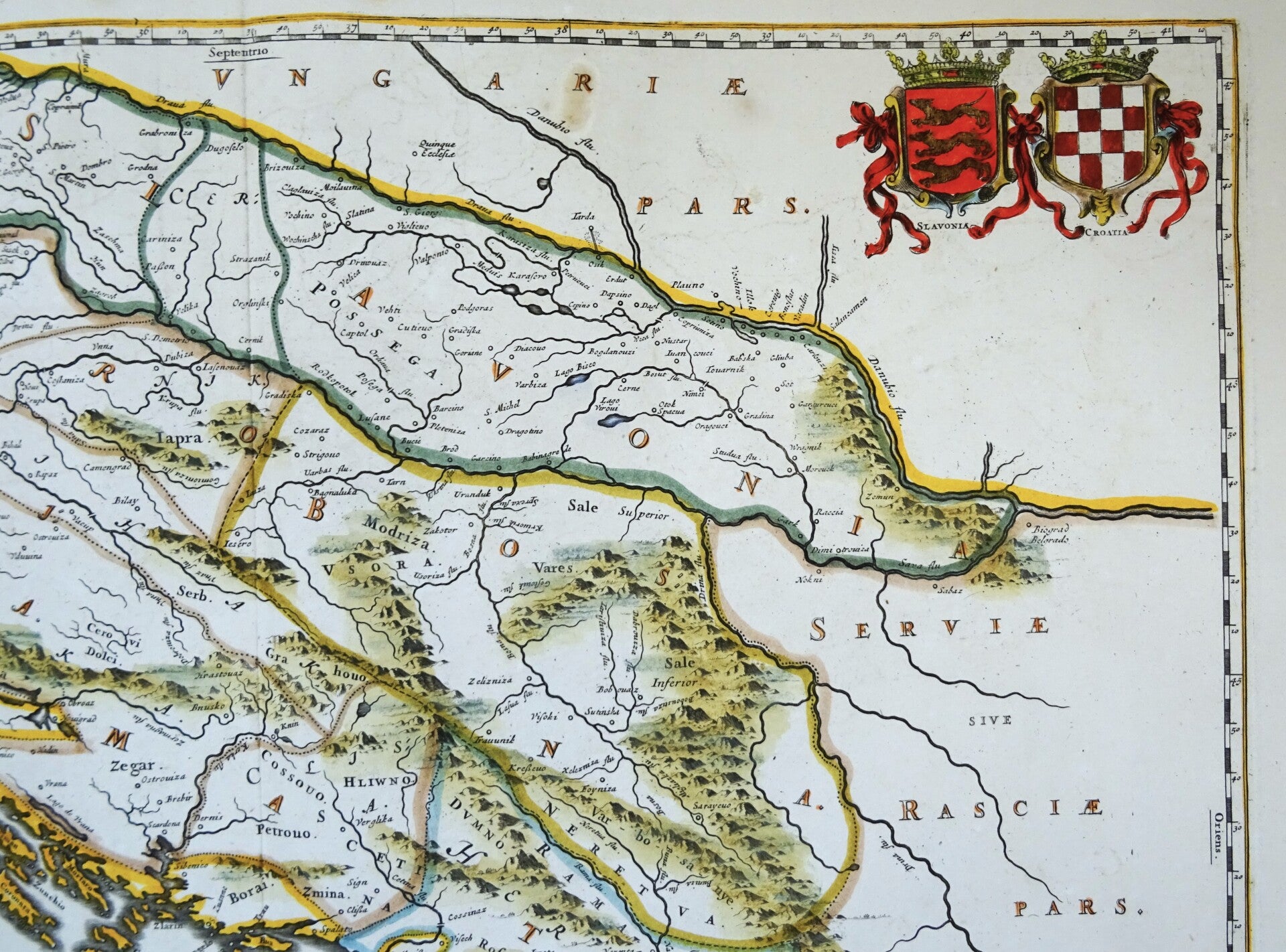
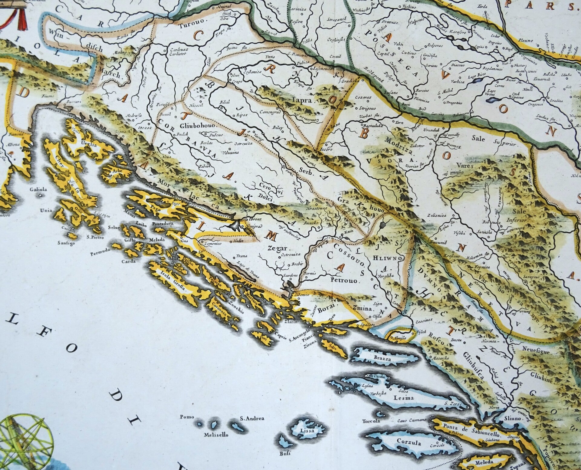
This is a scarce Joan Blaeu map of the Dalmatian Coast and the interior of modern day Slovenia, Croatia, Bosnia. Montenegro and Serbia. Signature of Joan Blaeu in the lower part of the map.
This map only first appeared in the 1661 Spanish edition of Blaeu's Atlas Maior and is therefore quite scarce on the market. This is an edition of around 1680, without text on the back.
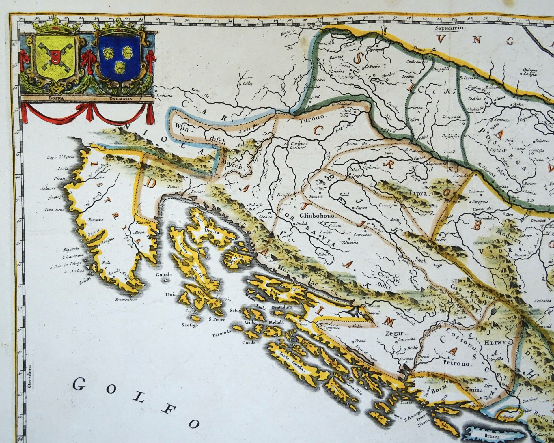
This splendid and rare map of the Dalmatian region of Croatia, Bosnia and Herzegovina marked an important advance in the mapping of this region. It was first issued in 1661 (without a dedication) during a period of relative peace between the House of Hapsburg and the Ottoman Empire, who long contested the region. It was one of six maps in this historical work written by the Croatian historian, Ivan Lucius, head of the Illyrian College in Rome. This educational institution was charged with the preparation of Catholic priests from the Slavic population to counter Protestantism, re-establish a union with Orthodox Christians, and to preach in Ottoman territories. The map took over two years to prepare, incorporated a significant amount of local knowledge, and delineated the Slavic regions that made up contemporary Illyria. This is the second state, which includes the dedication to Péter Zrinyi, Ban of Croatia. This dedication is particularly interesting because at the time, Zrinyi was involved in an anti-Hapsburg conspiracy with several members of the Protestant Hungarian nobility and he was executed shortly after the map's publication. The map includes the arms of Bosnia, Dalmatia, Slavonia and Croatia.
Joan, or Johannes, Blaeu (1596-1673) was the son of Willem Janszoon Blaeu. He inherited his father's meticulous and striking mapmaking style and continued the Blaeu workshop until it burned in 1672. After his father's death in 1638, Joan and his brother, Cornelis, took over their father's shop and Joan took on his work as hydrographer to the Dutch East India Company.
Joan also modified and greatly expanded his father's Atlas novus, first published in 1635. All the while, Joan was honing his own atlas. He published the Atlas maior between 1662 and 1672. It is one of the most sought-after atlases by collectors and institutions today due to the attention to the detail, quality, and beauty of the maps.
Excellent condition
Image 44x53cm, sheet 52,5x63cm