Middle East, Holy Land, Cyprus, Palestine, Israel, Syria, Jordan.. Ruscelli, 1599, Soria et Terra Santa Nuova Tavola.
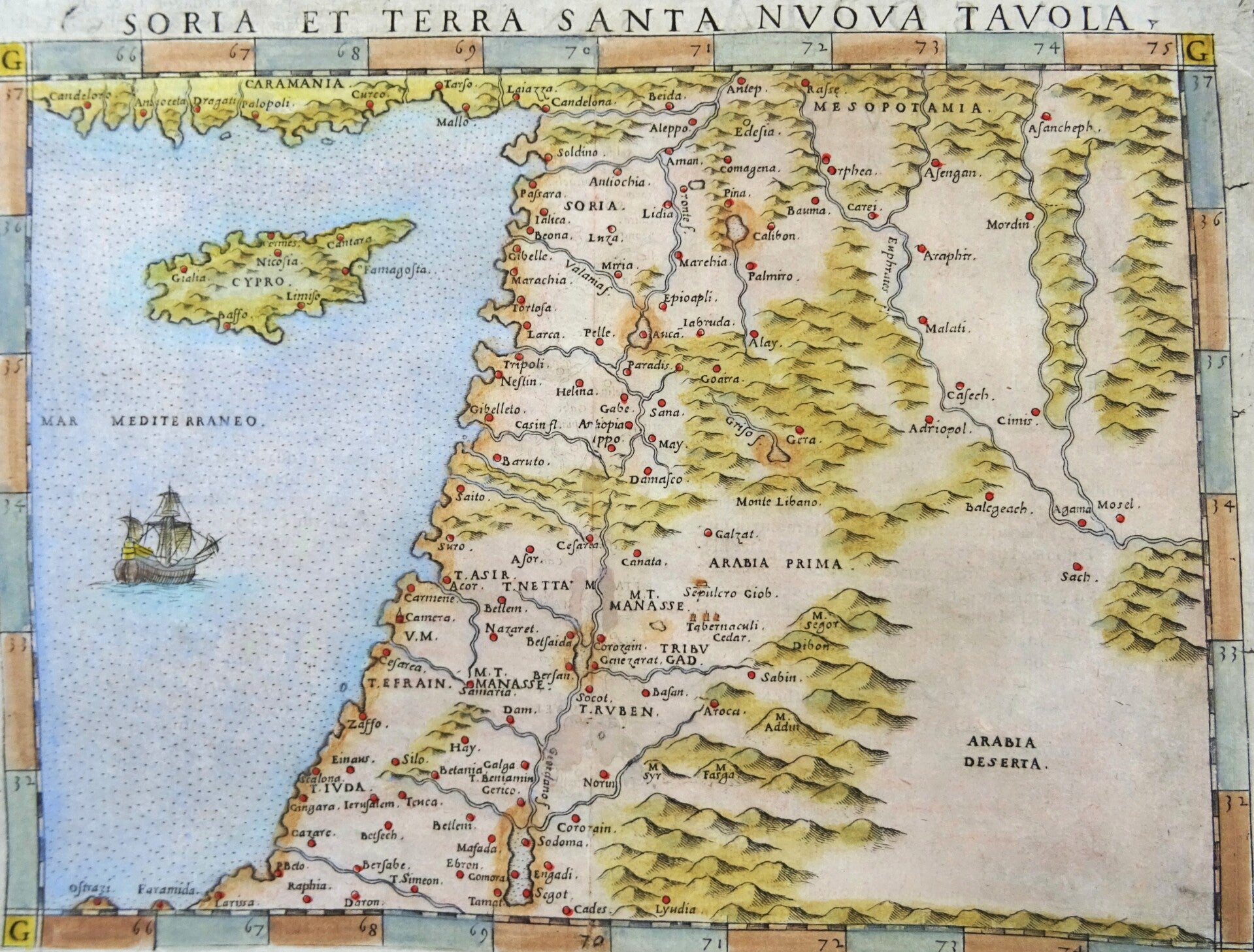
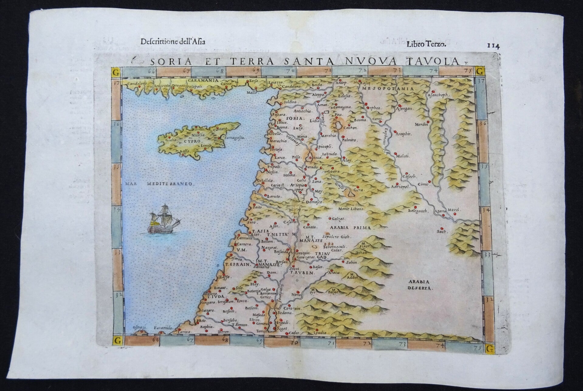
This is a handsome 1599 example of Girolamo Ruscelli's 1561 / 1574 map of the Holy Land and Cyprus. It is an enlarged, more finely-engraved iteration of Giocomo Gastaldi's 1548 Soria e Terra Sancta nova tabula.
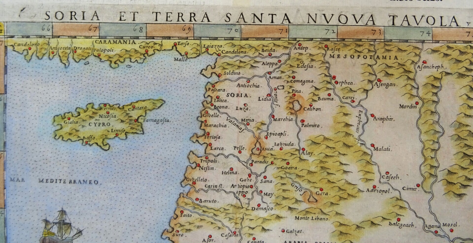
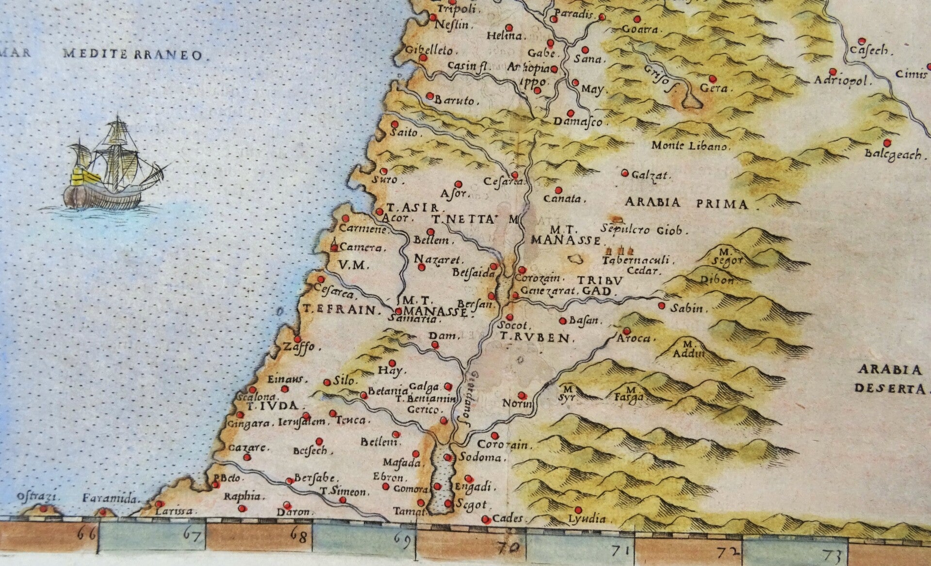
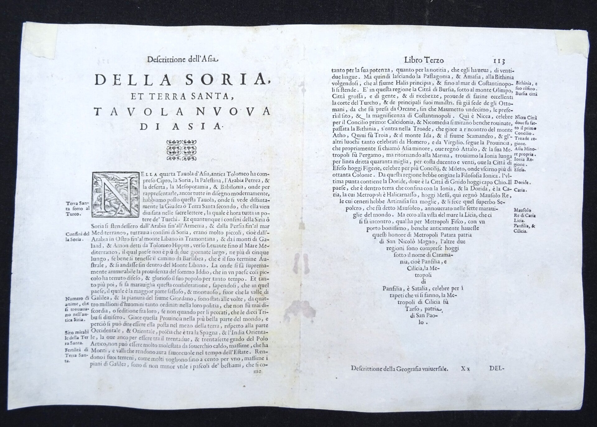
The map covers the Mediterranean coast from Larissa in the south to 'Candeloro' on the coast of Asia Minor. Cyprus is shown in reasonable detail, with seven cities including Famagusta and Nicosia. Inland, the map depicts Syria and Palestine on both sides of the Jordan, divided amongst the Twelve Tribes of Israel. Detail extends to the Sepulcher of Job, Mount Lebanon, and the Cedar Tabernacles of Gad and Manasse. It extends eastwards beyond the Euphrates River to include Desert Arabia, although there is no specific detail available there.
The map was engraved by Giulio Sanuto for inclusion in Ruscelli's La geografia di Claudio Tolomeo Alessandrino, and the plate appeared in all editions of that work. The separate map is cataloged in nine institutional collections, although it does appear on the market from time to time. The maps of the 1561 edition were engraved two-to-a-plate, and consequently, the platemark runs off the edge of the sheet at top for the 1561, 1562 and 1564 printings of the work. Afterward, the plates were divided, and examples from 1574 onwards, as here, exhibit a platemark all around the map. Furthermore, the plate shows considerable evidence of reworking, in many cases simplifying the form of the mountains to improve the clarity of the image. In 1599, a ship was added to the Mediterranean. The present example conforms typographically the 1599 edition, with the ship in the Mediterranean.
Image 18x24cm, page 24x35,5cm
Good condition, some small professional repairs in the area of the central fold, with minimal impact on the image. Otherwise excellent. Clear print, ample margins. Text in Italian.