France, Germany, Switzerland, Alsace, Rhine, Strasbourg, Bern, De Rossi / Cantelli da Vignola, 1690, L'Alsazia divisa nel Langraviato dell'Alta e della Bassa Alsazia
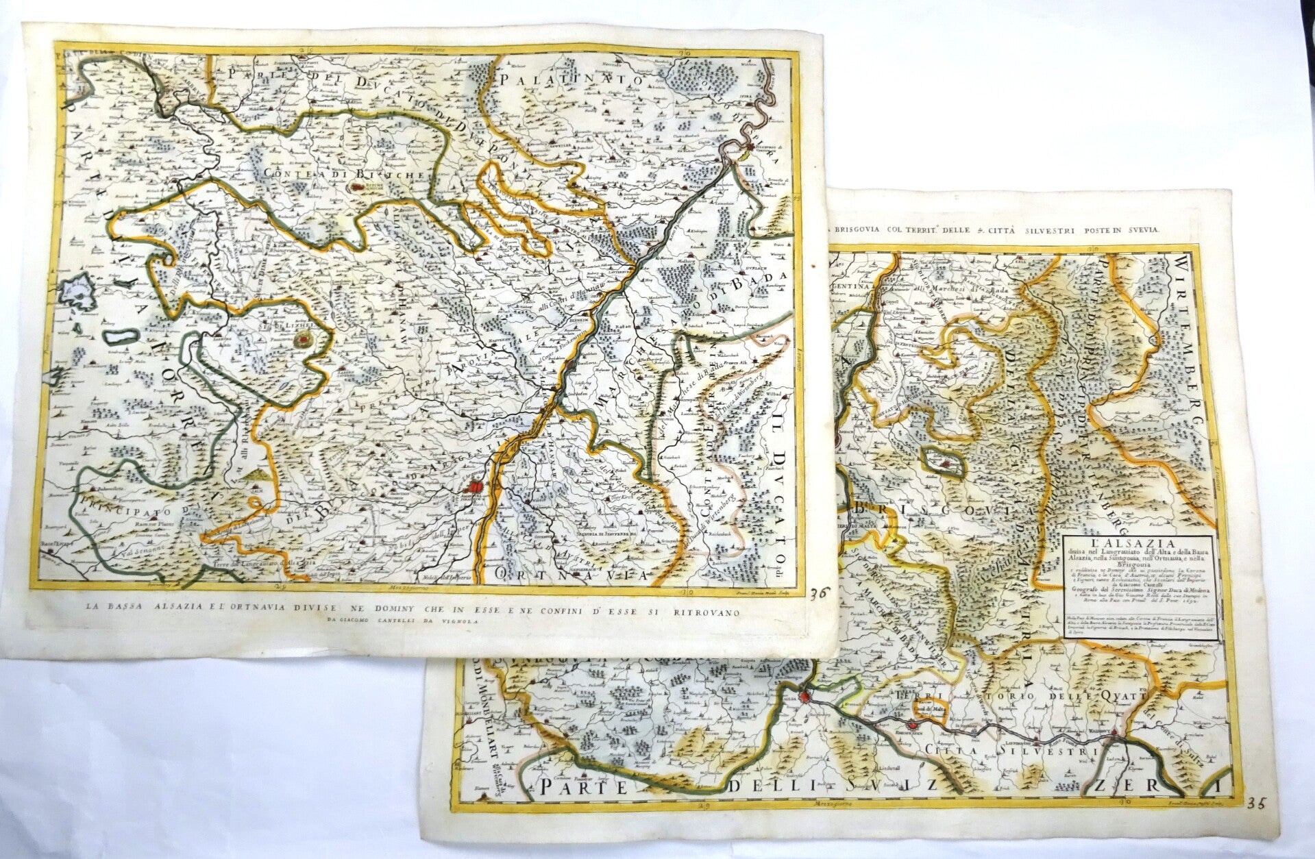
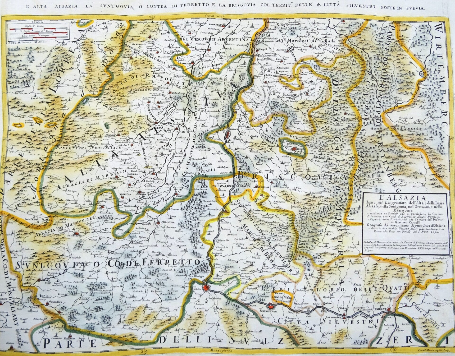
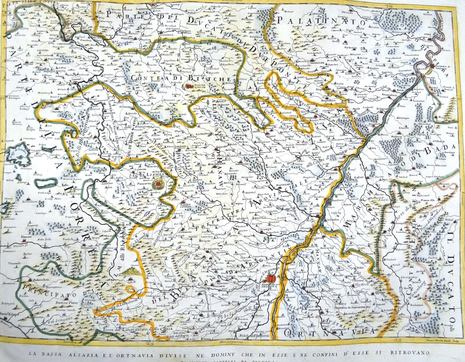
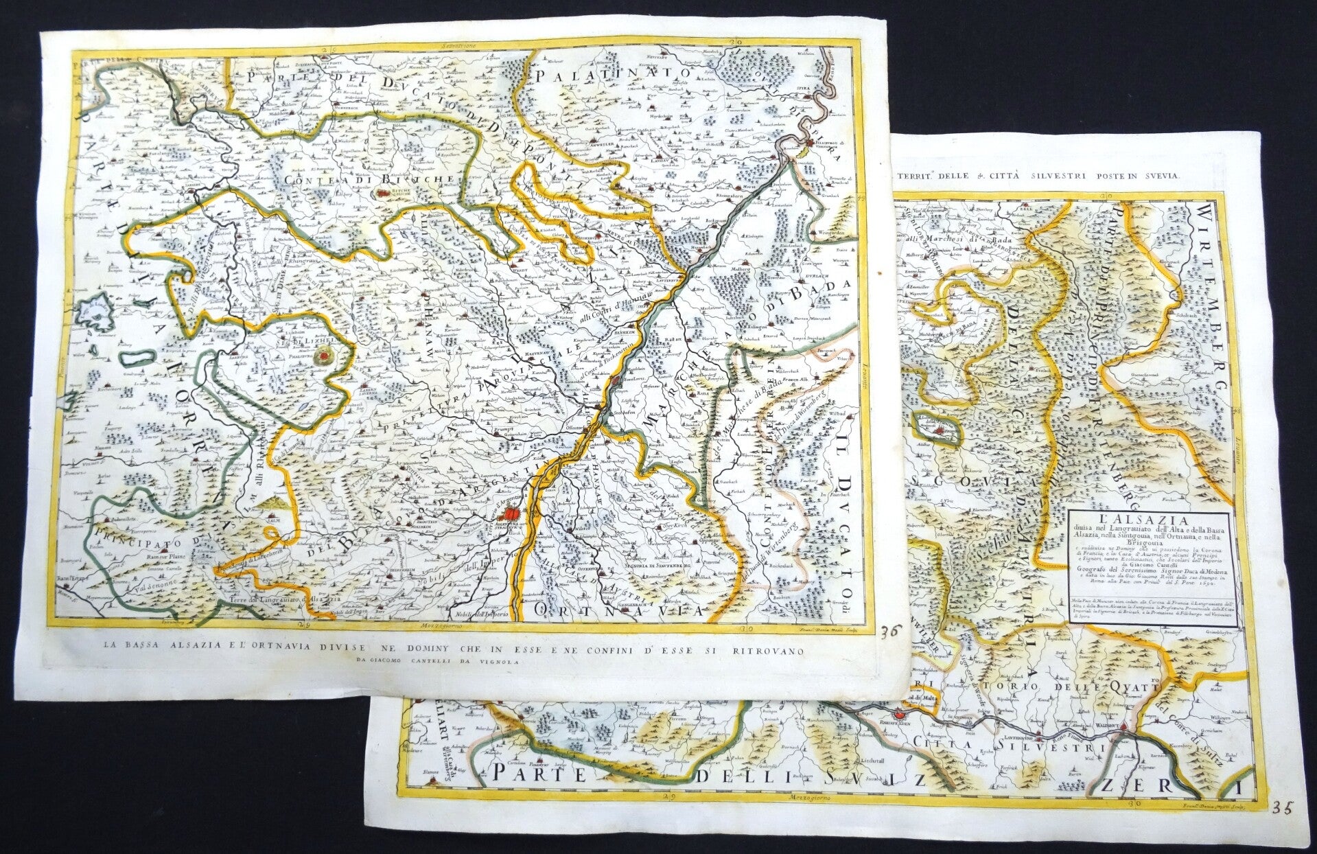
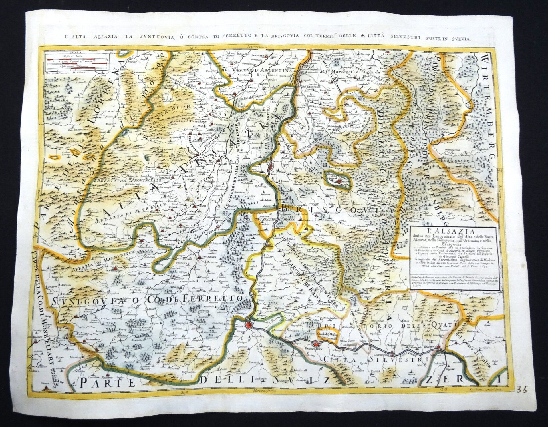
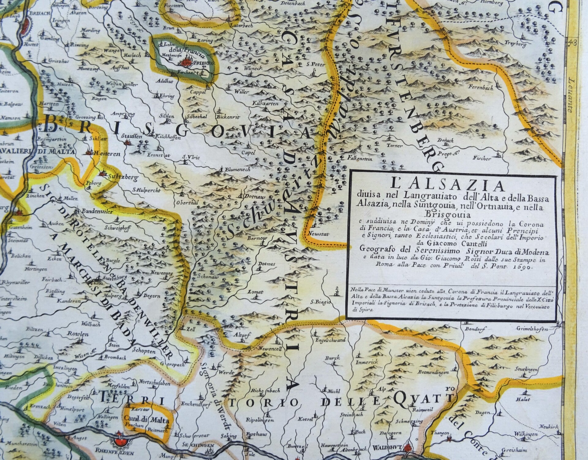
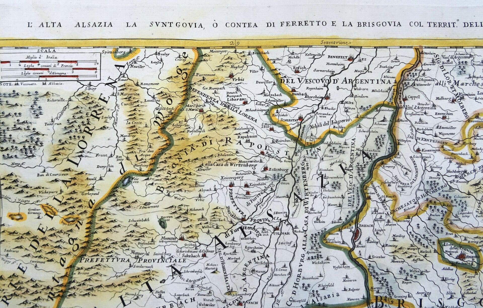
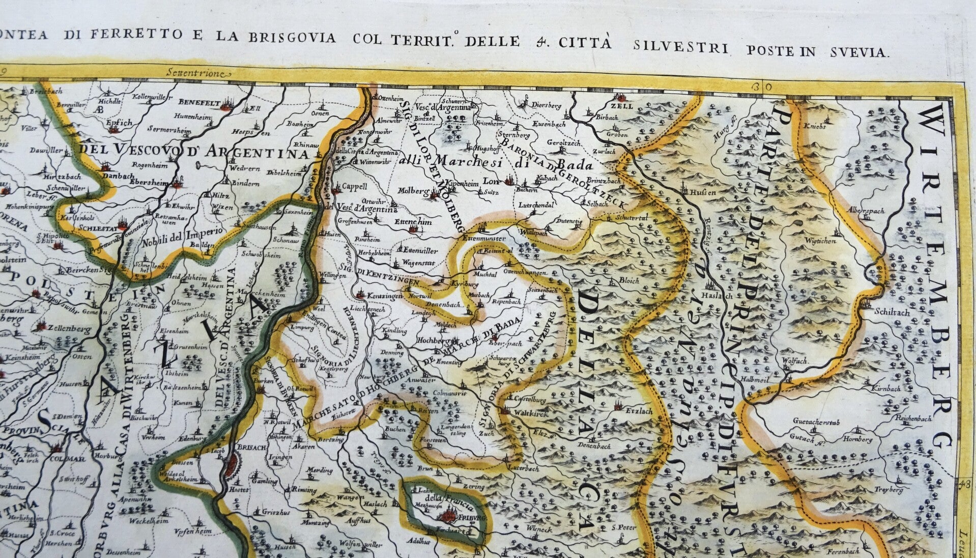
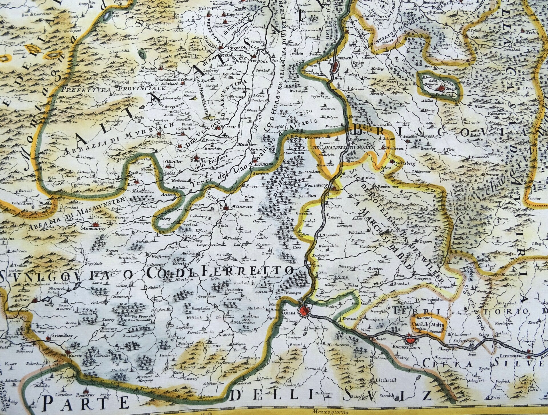
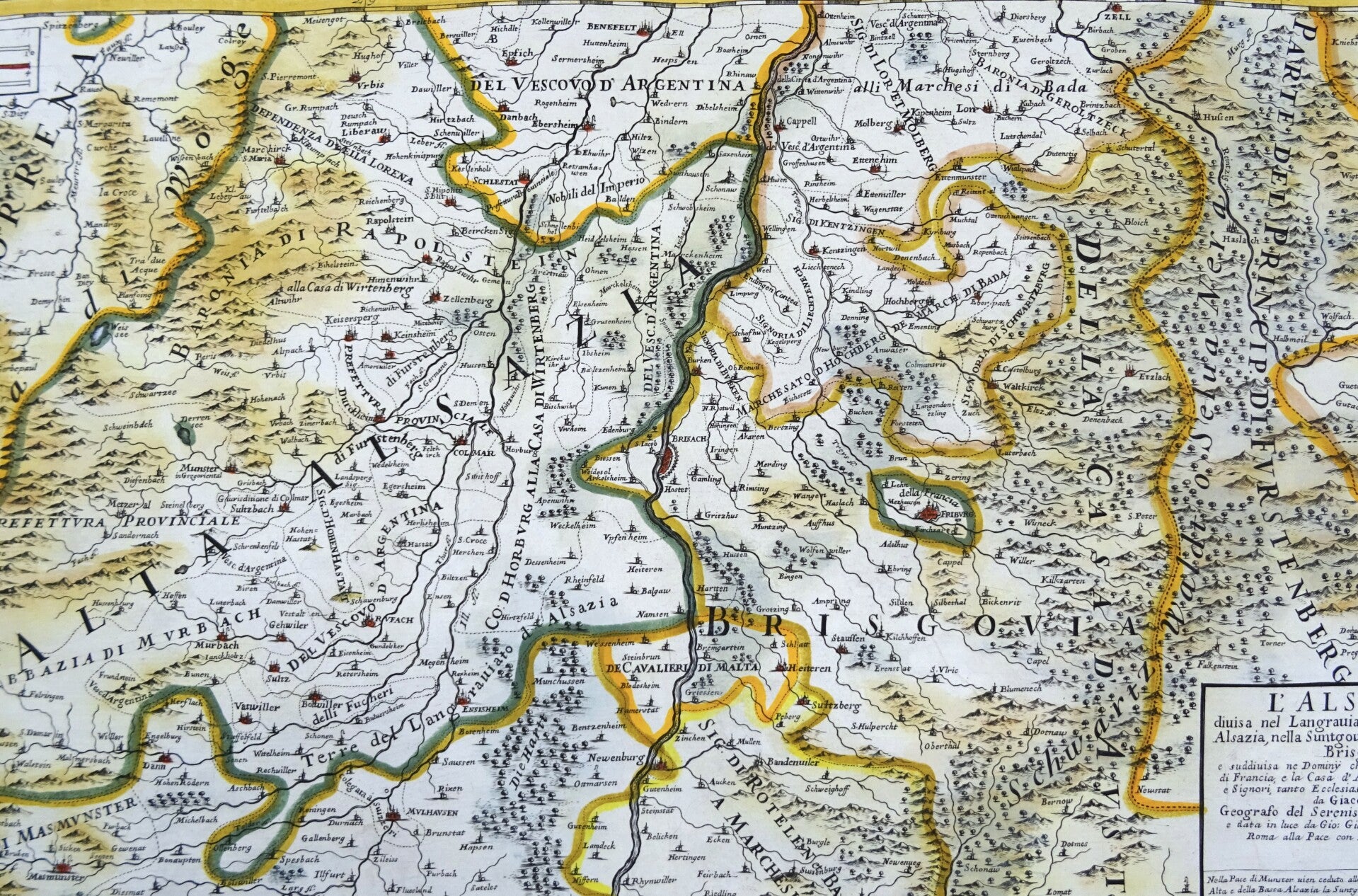
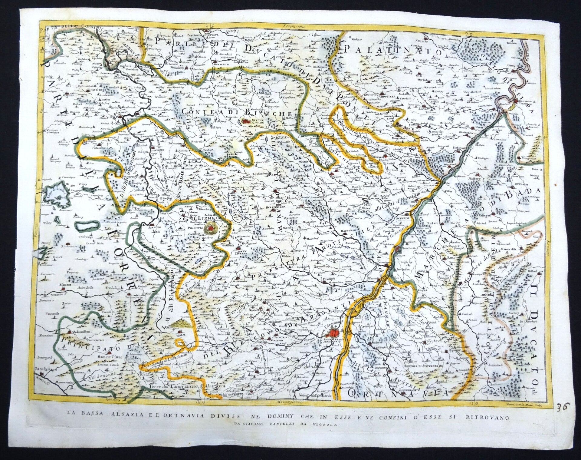
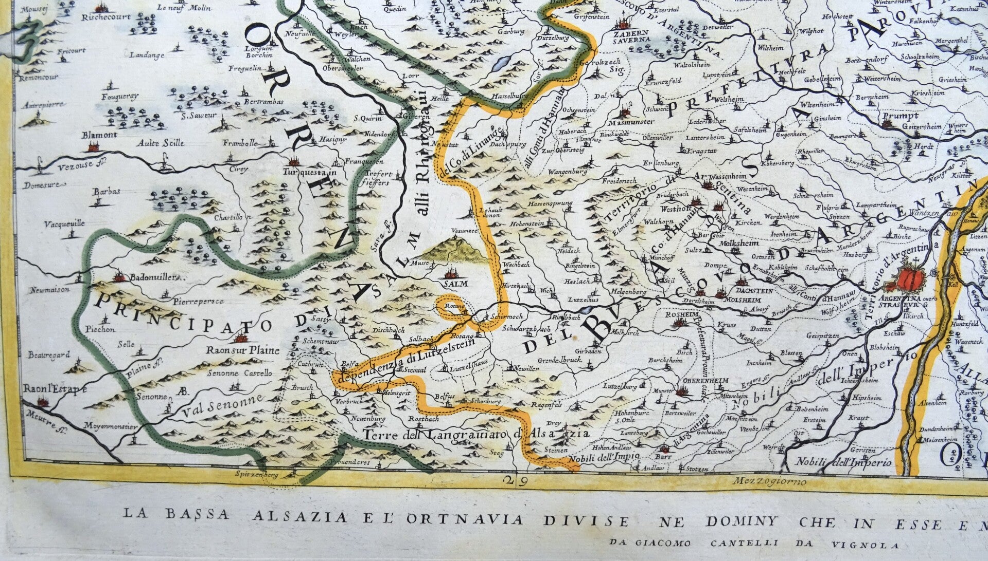
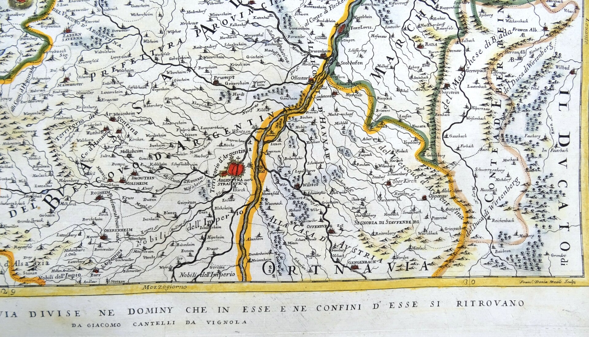
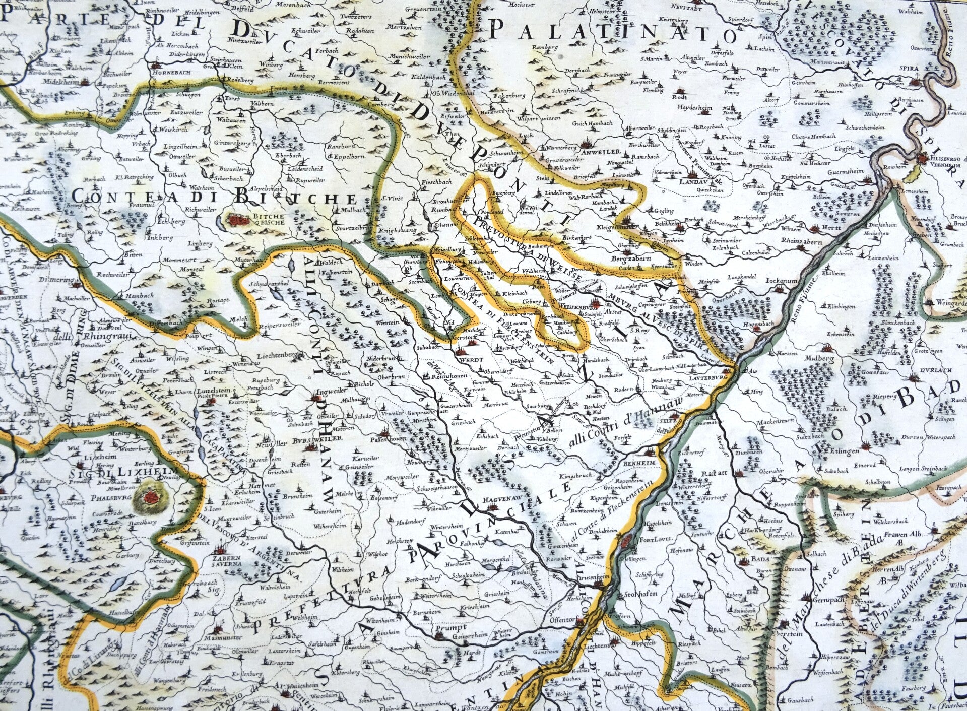
Very large antique map (double page) of ALSACE, centered on Rhine river, by Giovanni Giacomo de Rossi (1627-1691) and Giacomo Cantelli da Vignola (1643-1695). The map is engraved by Franc. Donia Messis.
Map of Alsace on two separate sheets, beautifully colored. Published in "Mercurio geografico overo Guida Geografica in tutte le parti del Mondo conforme le Tavole Geografiche del Sansone Baudran de Cantelli. Published under the direction and care of Gio. Giacomo de Rossi in his printing house in Rome at the Pace all'insegna di Parigi con Priu: del S. Pont," published in Rome at the end of the 17th century.
Very good condition. Clear print, ample margins, some minimal age browning. Consists of two large sheets.
Images 42x57cm, sheets 48x61cm (2 sheets)