Pacific Ocean, Philippines, Indonesia, Taiwan, Japan, China, Korea… Bellin, 1746, Suite de l´Ocean Oriental…
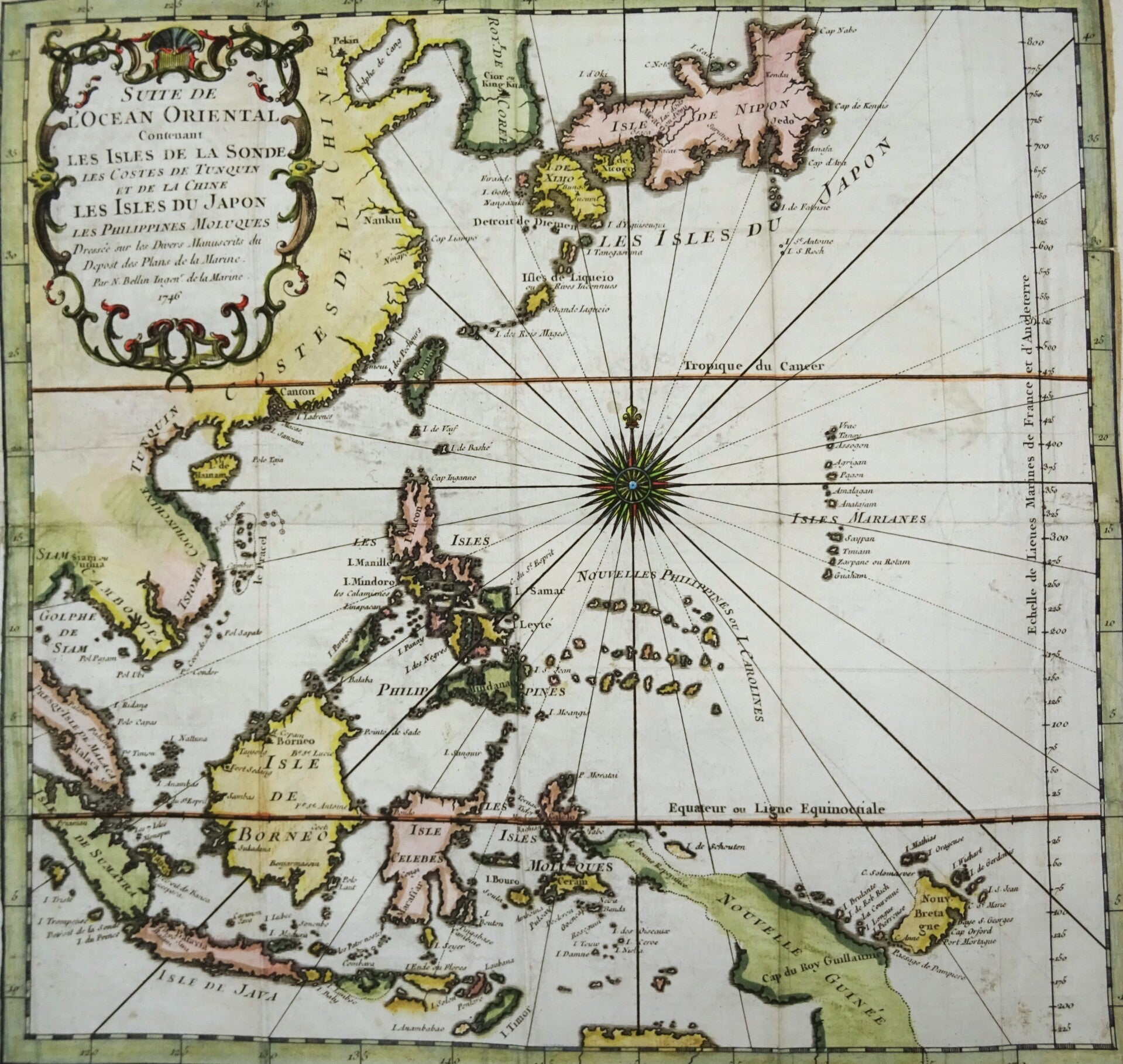
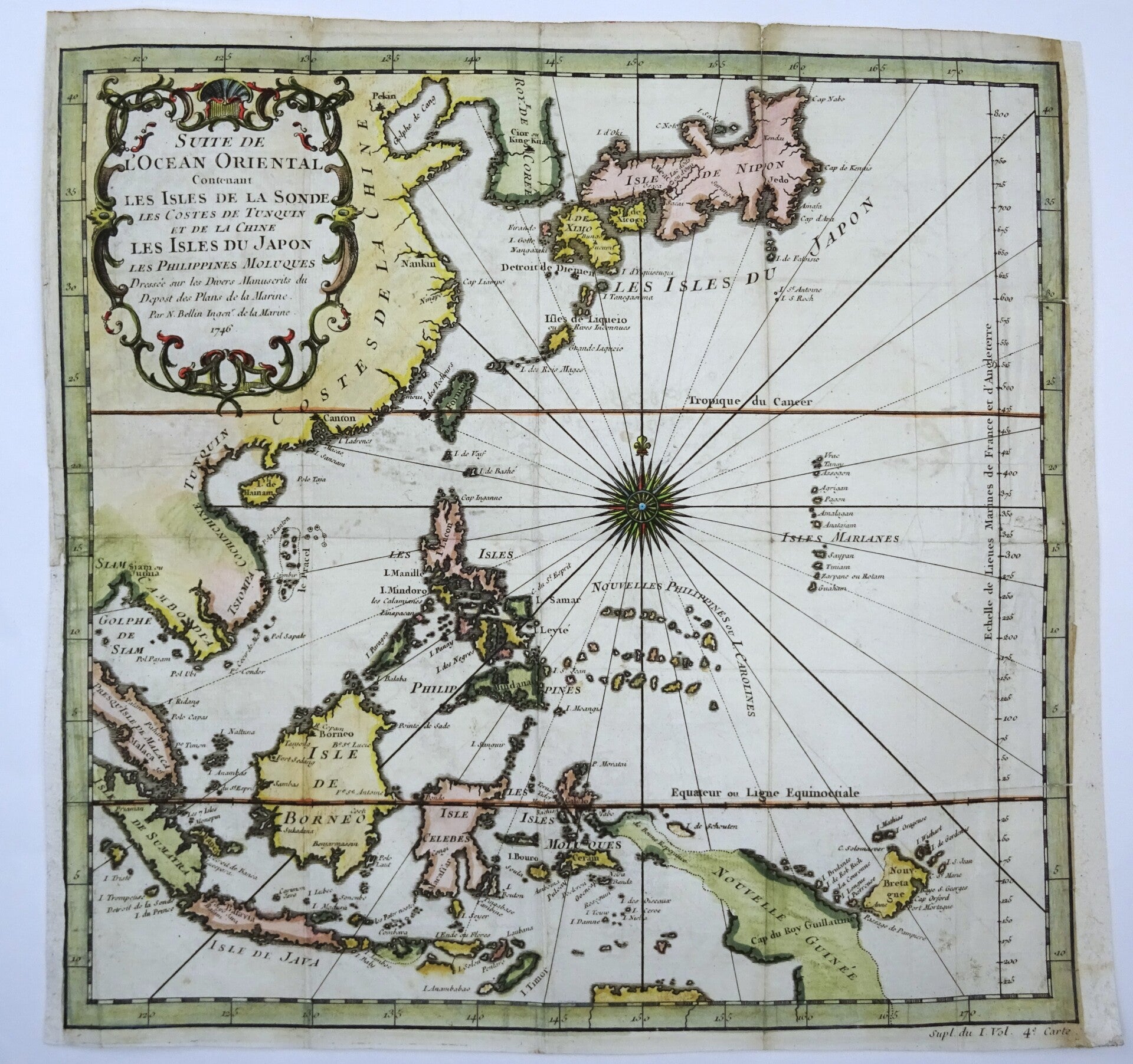
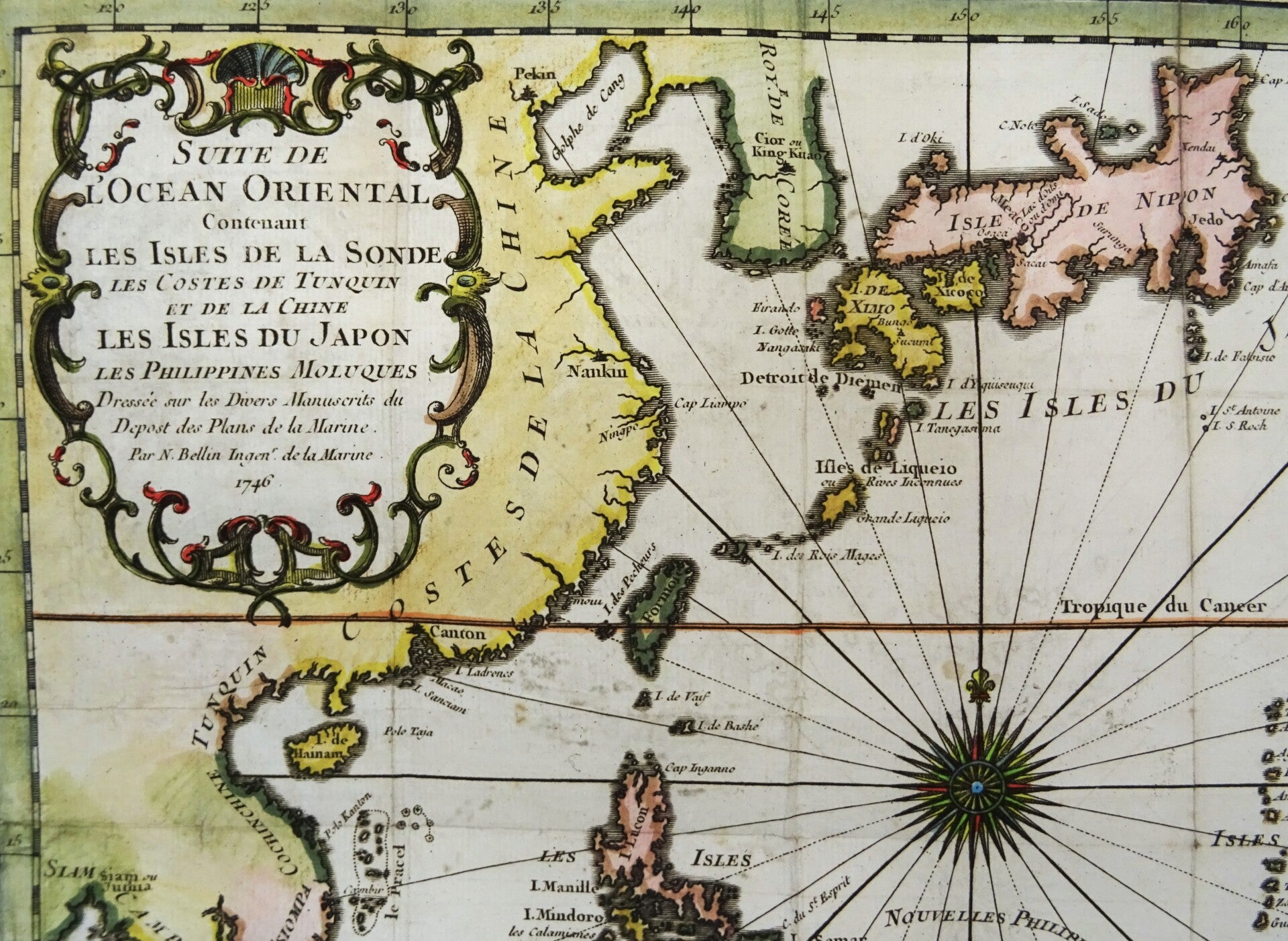
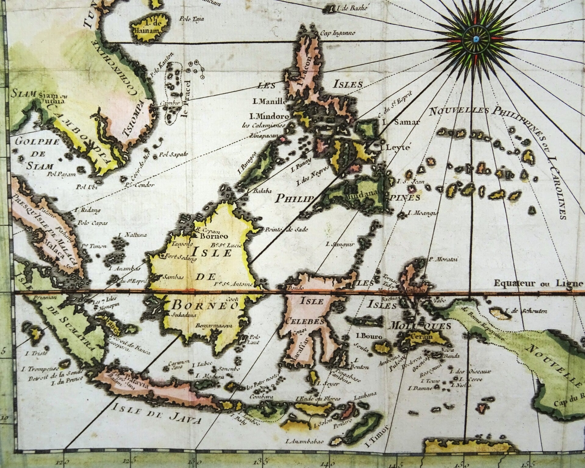
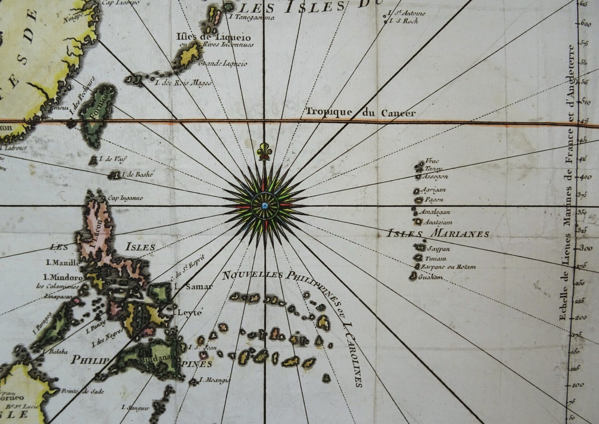
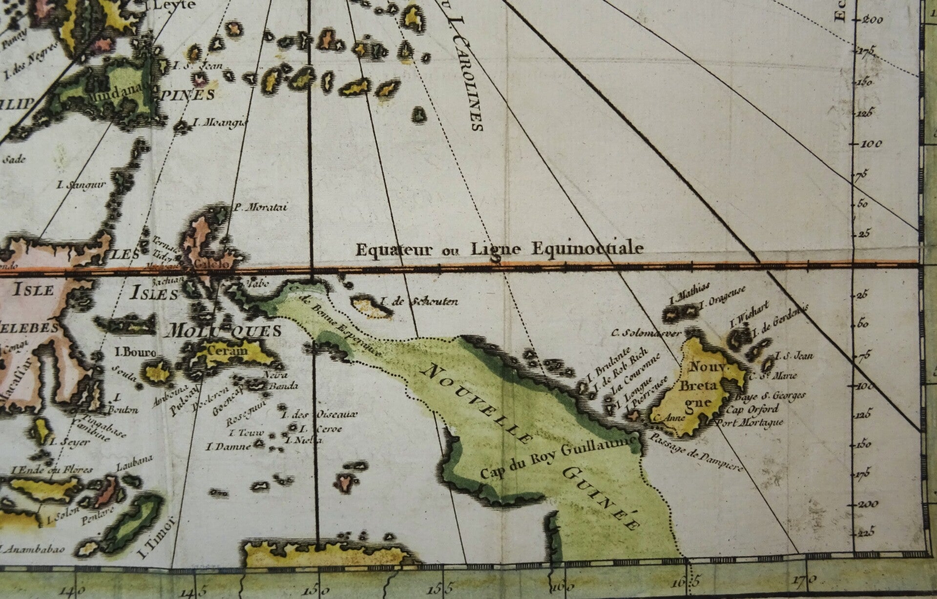
Rare 18th century copper engraved map of the western part of the Pacific Ocean, with Japan and Korea in the upper part, the Philippines in the middle, the coast lines of China and Indochina to the left and Indonesia in the lower part. In the right bottom corner a still not completely charted New Guinea is visible, with a possible connection to the mainland of Australia suggested.
Map by J.N. Bellin. Published in 1746 in Paris in´Histoire generale des Voyages ou nouvelle collection de toutes les relations de voyages par mer et par terre´.
Reasonable-good condition. Some minor reinforcements on the back on some folds and in the left margin, not impacting the image. Clear print. Beautiful hand coloring. Folds as published. The map will be shipped folded on the original folds to avoid damage during transport.
Image 31x29,5cm, page 30,5x32cm