World map, Bellin, 1748/1778, Essay d´une Carte Reduite …Globe Terrestre
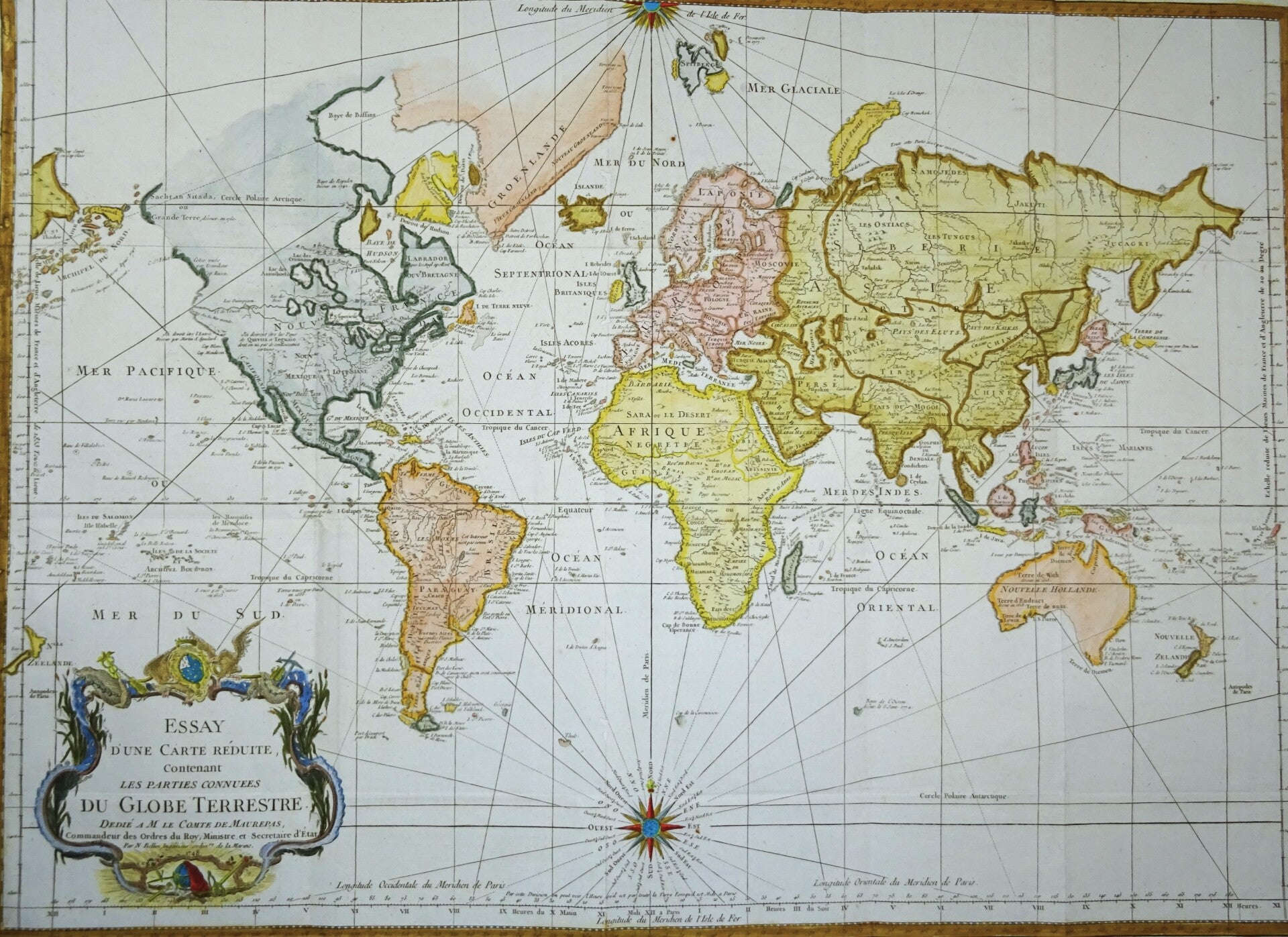
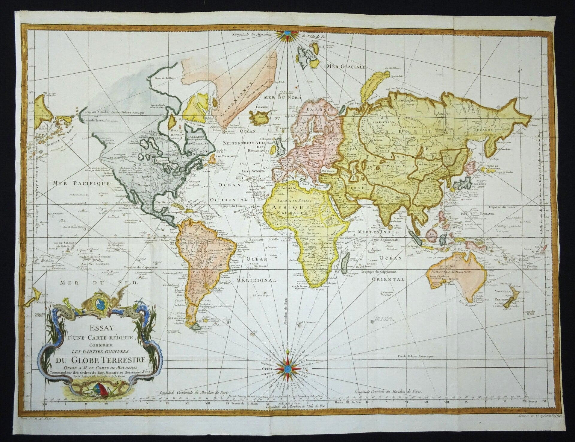
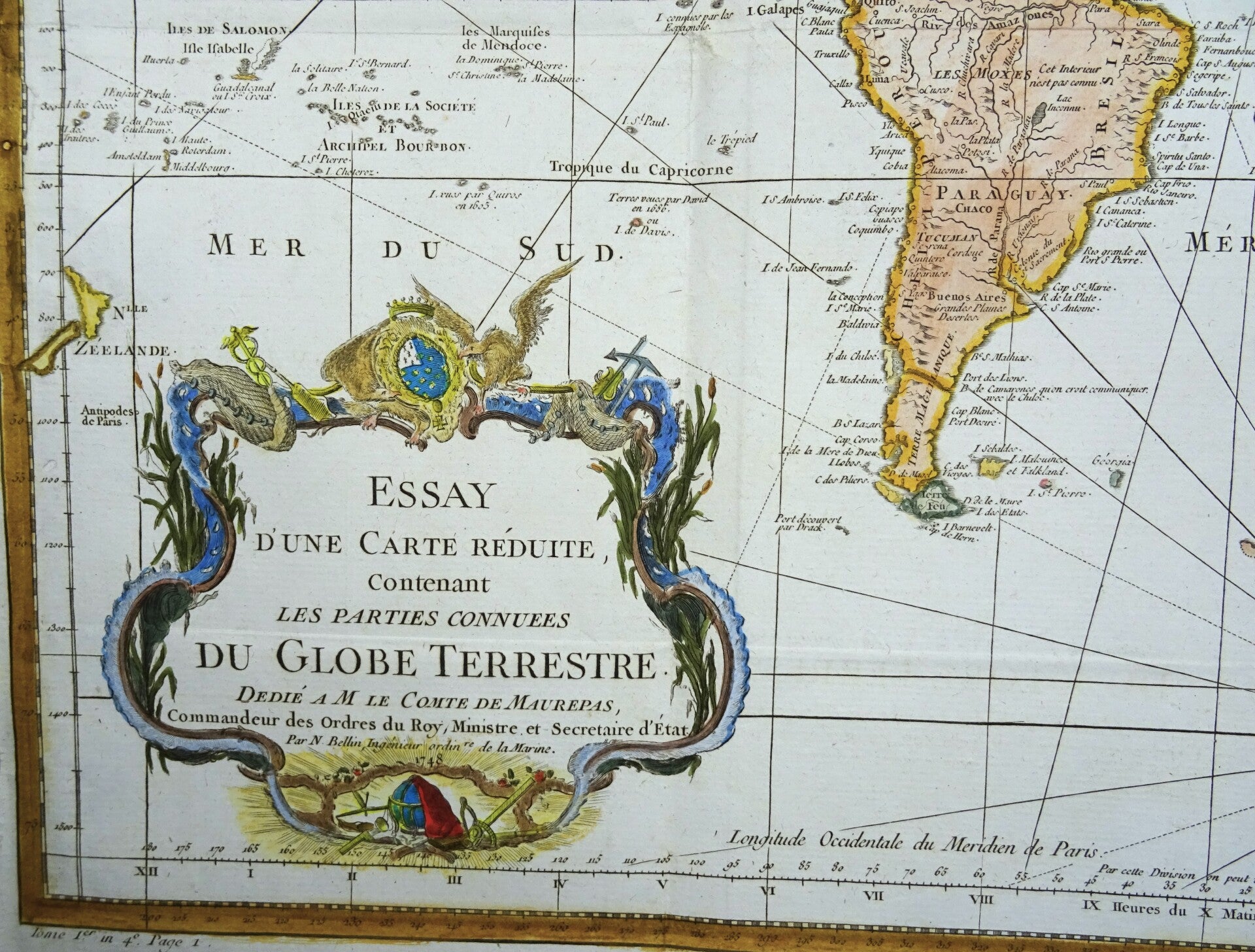


Late edition of Bellin's influential mid-eighteenth century map of the world
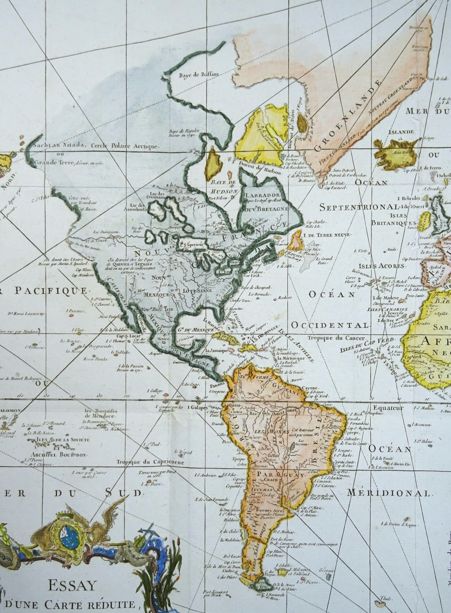
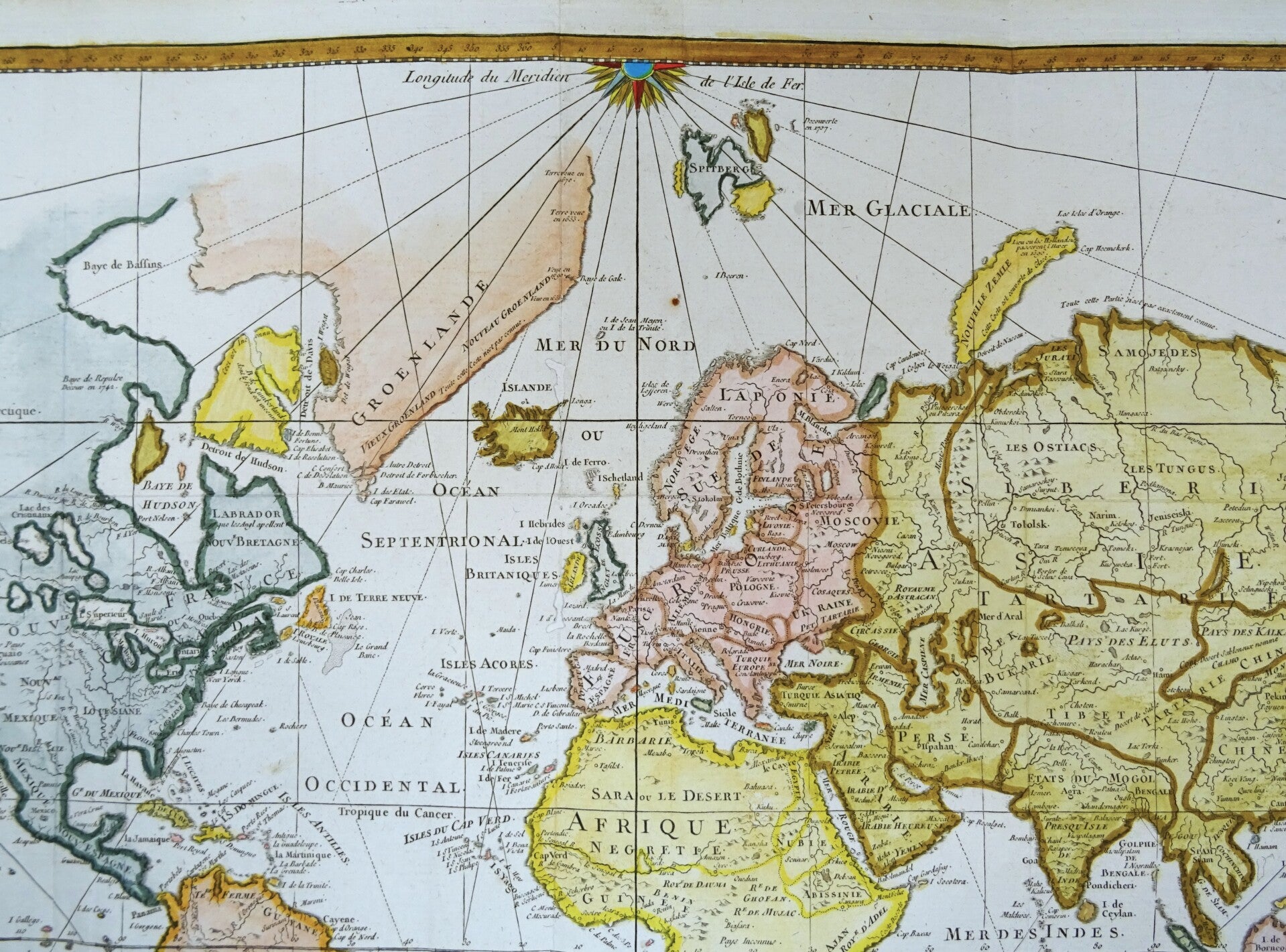
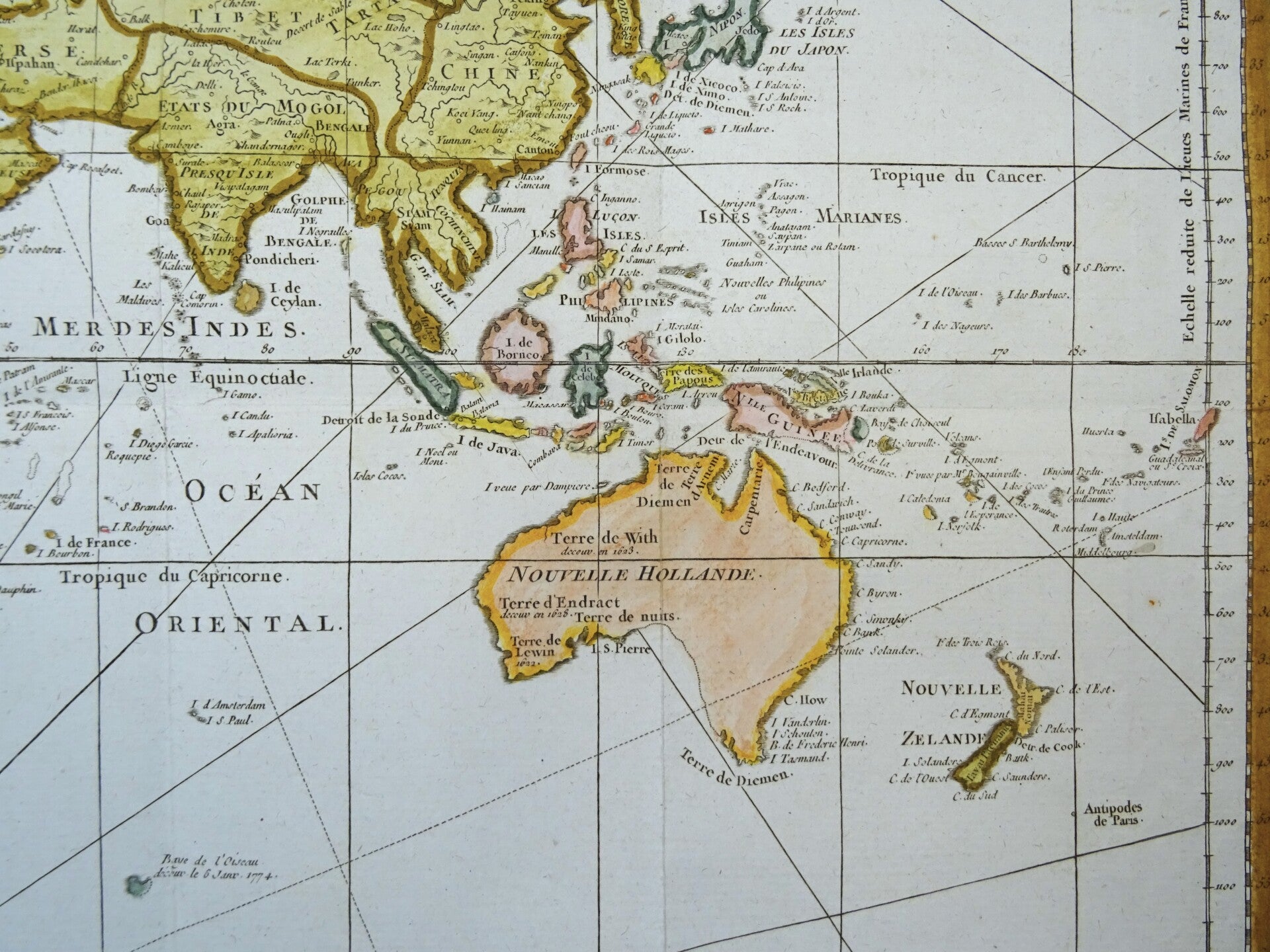
The map was first published in Paris in 1748 by Jacques-Nicolas Bellin (1703-1772). Bellin would periodically update and reissue these maps to reflect the latest discoveries. This last edition also shows many of the discoveries by James Cook near Australia and New Zealand, but not yet the later discoveries of the West Coast of America. This places the map around the late 1770´s.
North America is still shown with a very pronounced River of the West connecting through a series of rivers and lakes from Lake Superior to the Pacific - representing the elusive Northwest Passage. A portion of the Asian coastline is depicted a short distance from the supposed western coast. The Russian discoveries in the North Pacific are not yet shown, although there is a note about the voyages of 1743.
This edition is noteworthy for its correct projection of Australia and New Zealand. Australia is no longer attached to New Guinea, as was common cartographic before that time, but it still has tentative shorelines connecting it to Van Diemen's Land, modern Tasmania. New Zealand is well mapped.
Good condition. Folds as issued. Reverse side blank. Several closed wormholes, with minimal impact on the image and some small repairs in the margins. Right margin narrow (as published).
Image 50 x 68cm on sheet of 54 x 71cm