Africa, East Africa, Central Africa W. Blaeu, 1635, Aethiopia Superior vel Interior vulgo Abissinorum sive Presbiteri Joannis Imperium.


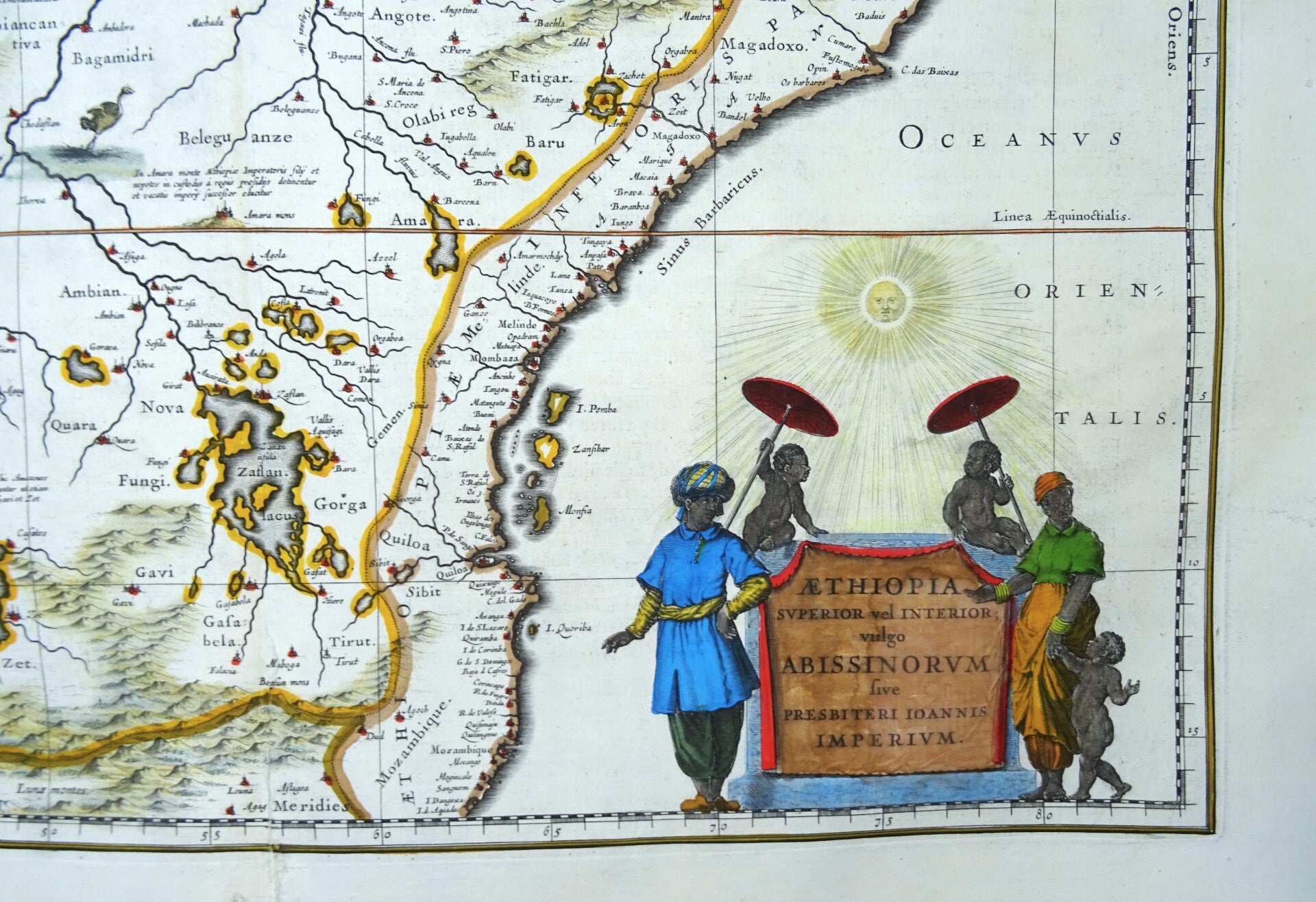


The famous folio sized Blaeu map of East and Central Africa and the fictitious kingdom of Prester John.
The map shows a major section of central and eastern Africa including Mozambique north to present day Sudan. The map contains numerous rivers, villages and settlements throughout, and is highly embellished with elephants, ostriches and other animals within the map, as well as the decorative cartouche.
The two Ptolemaic lakes of Zaire and Zaflan are in the lower portion of the map. Lake Niger, and the supposed course of the Niger River, is shown flowing westward.
This map is based on Ortelius' map of Prester John of 1573. The myth of Prester John, the good Christian King of Africa waging his own crusade and defeating the enemies of Christianity, was based upon earlier legends of the Crusaders and is a fascinating piece of early mythological cartographic history.
Prester John
One of the most important geographic enigmas of the Medieval and early modern periods was the kingdom of Prester John. The legend of a Christian Kingdom lost among Muslim lands was popular from the twelfth century and continued long into the seventeenth. Prester John was supposedly descended from one of the three magi. Over time, the utopian kingdom of Prester John came to house a bevy of other fantastical objects, including the Fountain of Youth.
The idea of a Christian King, a Presbyter John, of immense wealth had been circulating since the mid-twelfth century, part of the rumors that swirled around the Crusades. The story received a boost from a mysterious letter sent to the Byzantine Emperor Manuel I. The letter, supposedly written by John, describes his power, faith, and lands. The letter circulated ca. 1165 and survives in nearly 100 medieval manuscript copies. Initially, Europeans thought Prester John’s kingdom was in India, and later in Central Asia. Finally, in the early modern period, the search shifted to Africa, specifically in Christian Ethiopia.
The story and the desire to find the kingdom was ubiquitous across Europe for centuries, losing steam only in the seventeenth century when antiquarians found that the Prester John story had no convincing ties to Ethiopia. Its popularity testifies to the anxieties within the Christian faith during an epoch when Christianity was fighting for survival in the Middle East, and when Christian Europe was often in conflict with Muslims in the Ottoman Empire and was encountering Indigenous peoples, and their religious systems, around the world.
This early edition of the map was published in the first French edition of "Atlas Novus," the atlas by William Blaeu, Amsterdam, 1635.
Good condition. Some repairs and reinforcements of the lower part of the central fold, with minimal impact on the image. Otherwise excellent. Thick paper, clear print and wide margins. Reverse side text in French
Image 38,5x49cm, sheet 50x58cm