Germany, Nuremberg, Bavaria Janssonius, 1640, Territorium Norimbergense


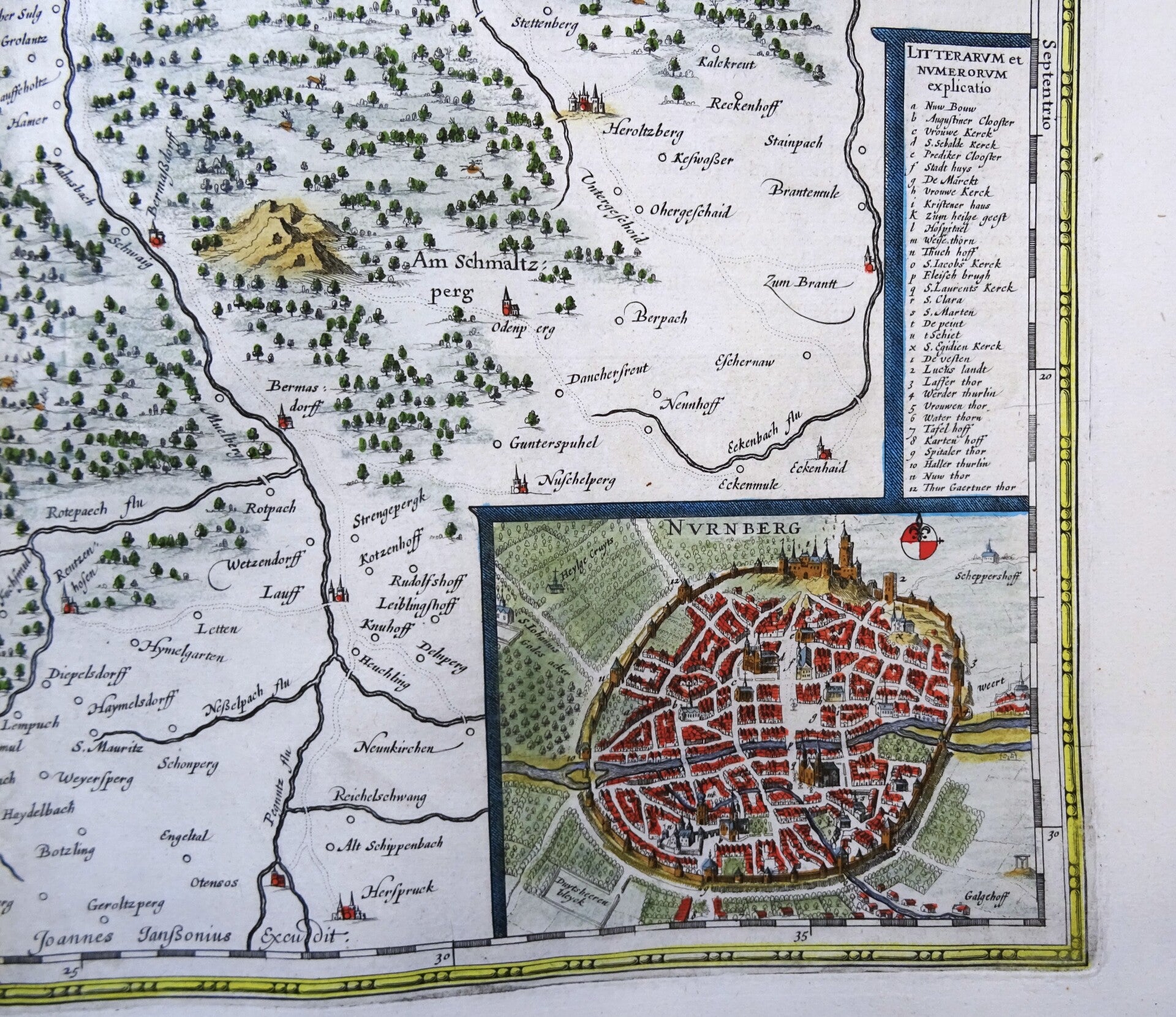


Striking and highly detailed interesting unusual copper engraved map showing the greater Nuremberg area and is bordered by the Rednitz River to the west, Erlangen to the north, Hersbruck (Pegnitz) to the east, and Katzwang/Schwarzenbruck to the south. A bird's-eye view of the city of Nuremberg is shown at the bottom right (9 x 11.5 cm), with a legend above.
The dedication at the top left is "Nobilissimis Amplissimis Consultissimisque Viris Dominis D. Consulibus totique Senatui inclytae reipublicae Norimbergensis dedicabat Guiljelmus Blaeuw." A large, decorative title cartouche, "Territorium Norimbergense," with a coat of arms and a putto with trumpets, below a mile marker (Mensura Milliarÿ, Milliaria Gallica communia). French text on the verso.
Map made by J. Janssonius and published in Amsterdam in a French edition of his atlas, around 1640.
Reasonable-good condition. Some minimal age browning and repairs in the central fold, with some minimal impact on the image (see pictures). Central fold reinforced on the back. Wide margins, clear print. Beautiful hand coloring.
Image 36x46,5cm, sheet 48x57,5cm