Brazil, Recife, large panorama Montanus / Van Meurs, 1671, Mauritiopolis


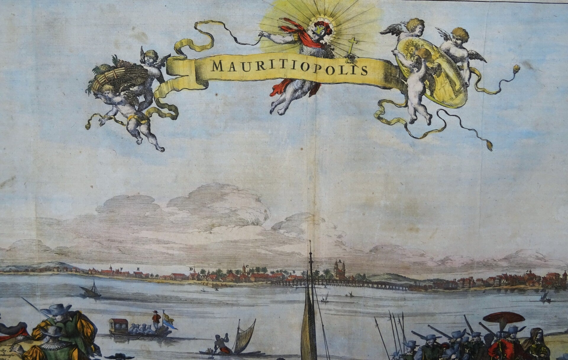


A very large panoramic view of the city of Recife, in the Pernamboco region of northeastern Brazil. This finely detailed panorama of Mauritsstaad depicts a lively scene in the foreground of European traders trading with the indigenous population. Saints and putti hold aloft the banner of the title. Mauritsstaad, now part of Recife, was once the capital of Dutch Brazil and a vital trading center.
Recife, formerly known as Mauritiopolis, by Arnoldus Montanus (1625-1683), published in 1671. Recife began as a collection of fishing huts, inns, and warehouses on the delta between the Capibaribe and Beberibe rivers in the Captaincy of Pernambuco, sometime between 1535 and 1537, during the earliest days of the Portuguese colonization of Terra de Santa Cruz, later called Brazil, on the northeastern coast of South America. It was a settlement of colonial fishermen and a waystation for Portuguese sailors and passing ships. The city is named after the long Recife reef that runs parallel to the coastline surrounding the harbor. The reef is not, as is sometimes claimed, a coral reef, but a consolidated ancient beach, now as firm and hard as stone.
Recife was the capital of New Holland (Dutch Brazil) in the 17th century, founded by the Dutch West India Company and then called Mauritsstad (Mauritiopolis). However, the city was recaptured by the Portuguese in 1654 after their victories at the First and Second Battles of Guararapes.
This view appeared in John Ogilby’s seminal atlas "America: Being the Latest, and Most Accurate Description of the New World," published in London in 1671. Ogilby’s work is an English translation of Arnoldus Montanus’ "Die Nieuwe en onbekende Weereld. . . ," which was produced in Amsterdam earlier the same year. Considered the first encyclopedias of the Americas, both texts are richly illustrated with maps, views and portraits.
In the late 1630’s Holland attempted to reassert its claim over Brazil by establishing a series of forts along the coastline. It is one of the best documented colonies because of the expedition led by Prince Maurits of Nassau, who attempted to assemble an intellectual court in the New World. He brought with him a group of highly accomplished artists, mapmakers, and scientists to record the mysteries of Brazil. They included the celebrated painter Frans Post, and the astronomer George Markgraf, who produced the first serious study of the southern sky. Post painted a wealth of images of the Brazilian landscape and the surrounding vegetation and wildlife. His works are some of the earliest European paintings of Brazil and were eagerly reproduced in print by Dutch engravers.
Very good condition.
Image 28x54cm, page 31x56cm