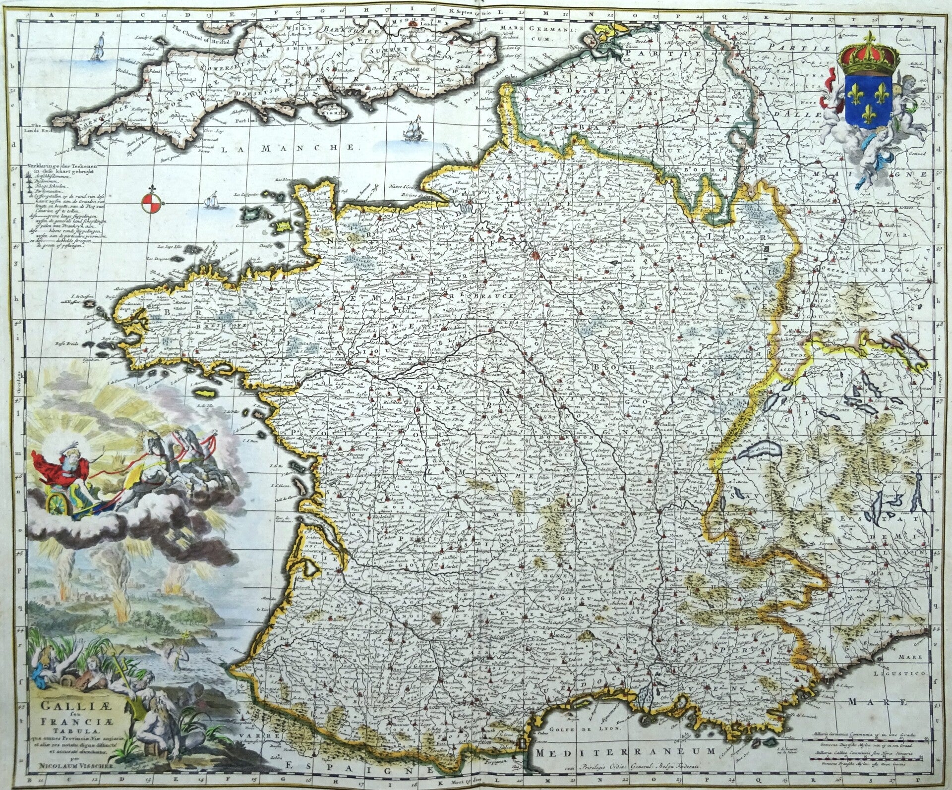
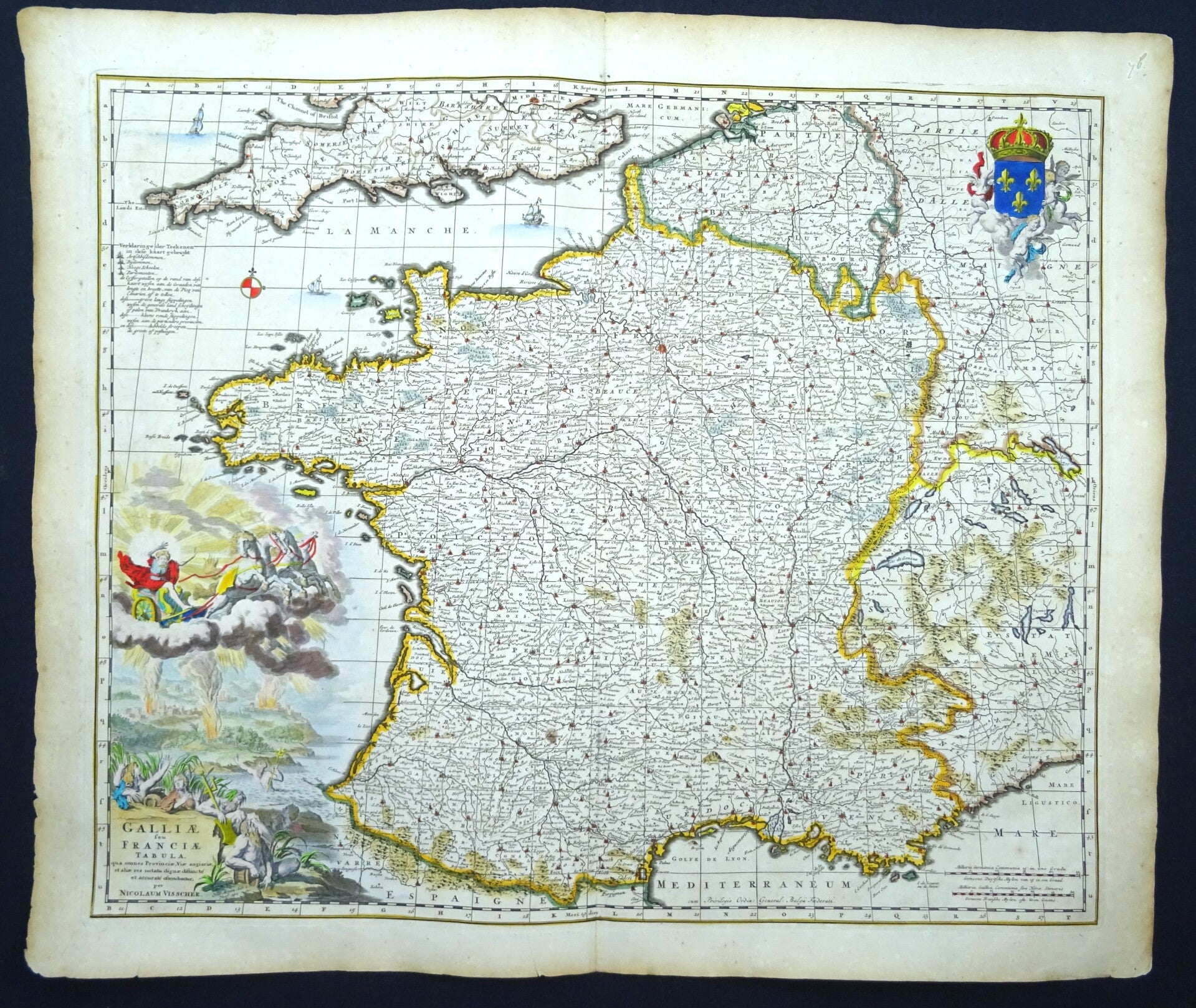
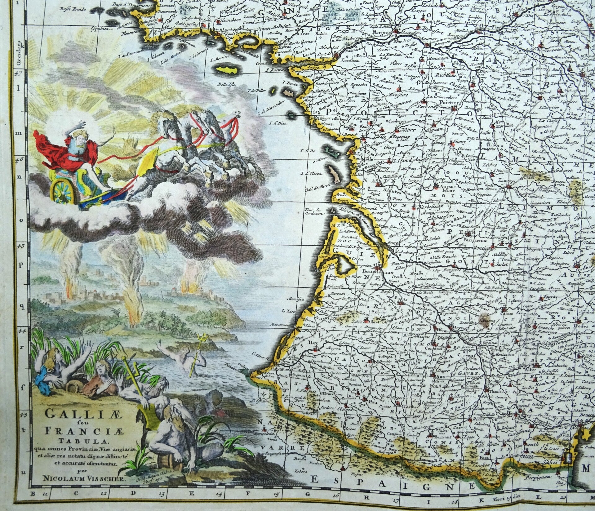
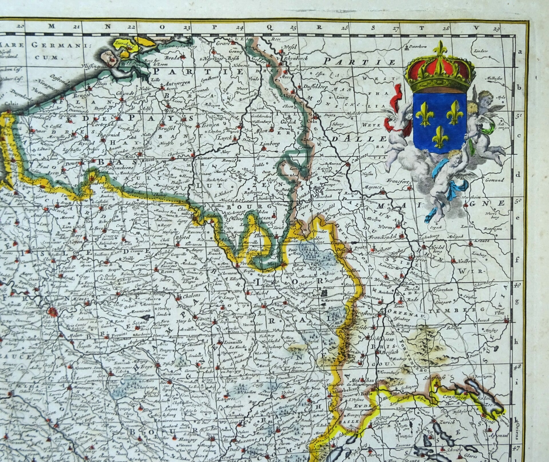
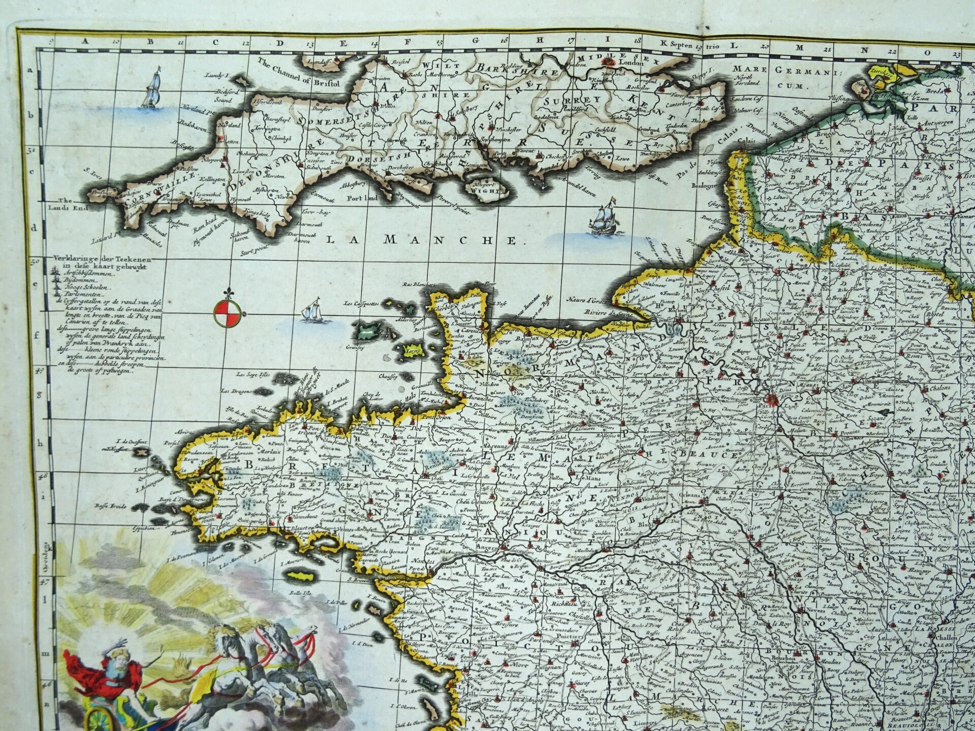
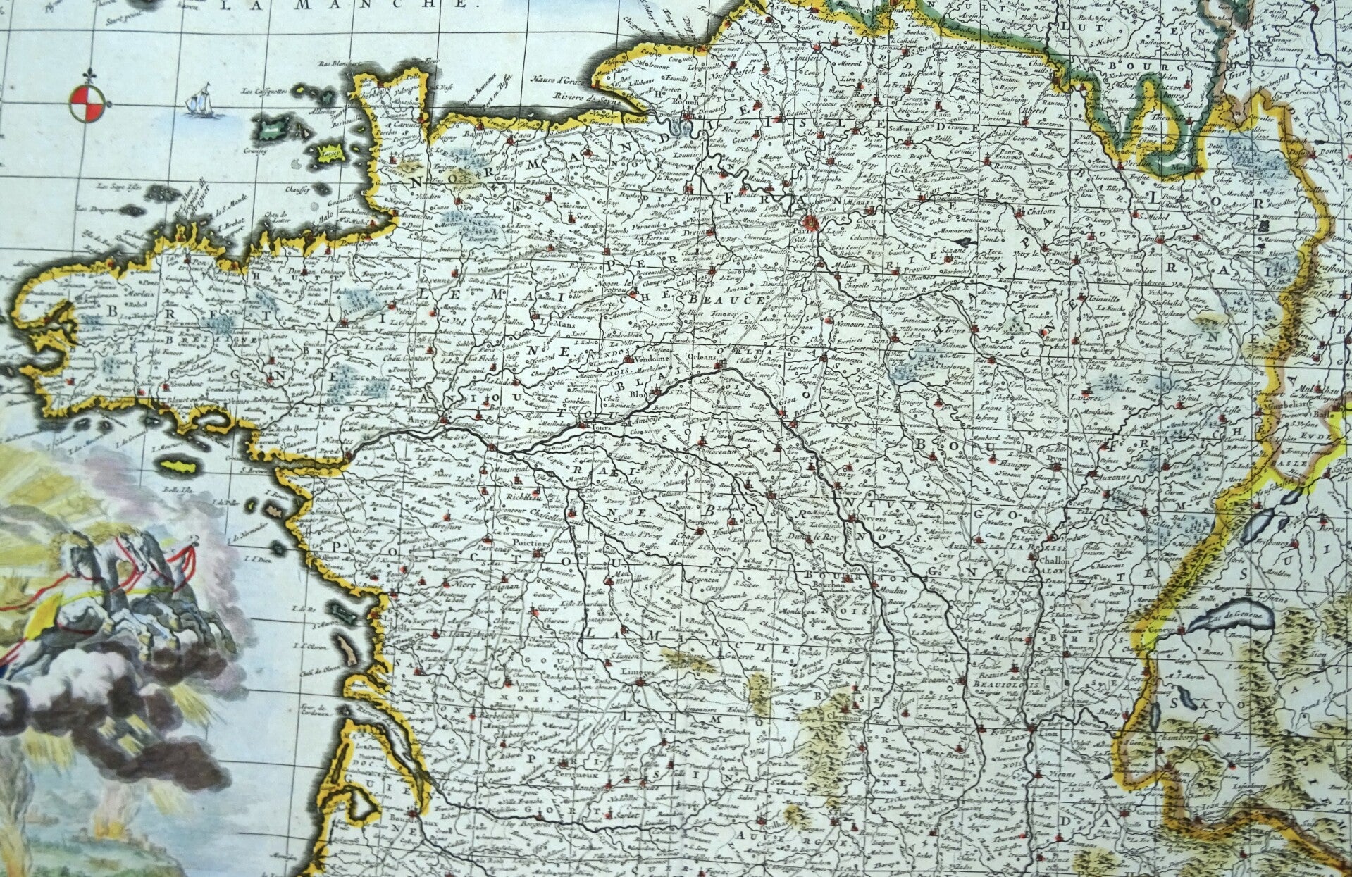
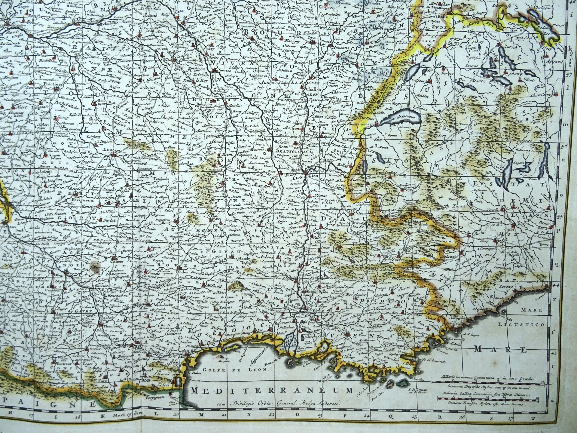
France, N. Visscher, 1690, Galliae seu Franciae tabula

€129.00
Item number:
25 21 CL
Image 47x56cm, sheet 53,5x63,5cm
Large folio sized copper engraved 17th century map of France published by Dutch cartographer Nicolaes Visscher. The map shows France in great detail as well as parts of England, Spain, Italy, Switzerland, and Germany. The bottom left corner features a spectacular cartouche with color engravings of Neptune, Mercury, and a female representation of France.
Excellent condition. Very thick and crisp paper. Strong print. Beautiful hand coloring. Reverse side blank.