Netherlands, Katwijk, Brittenburg Guicciardini / Nicolas, 1609, Ruinarum Arcis Britannicae Apud Batavos Typus

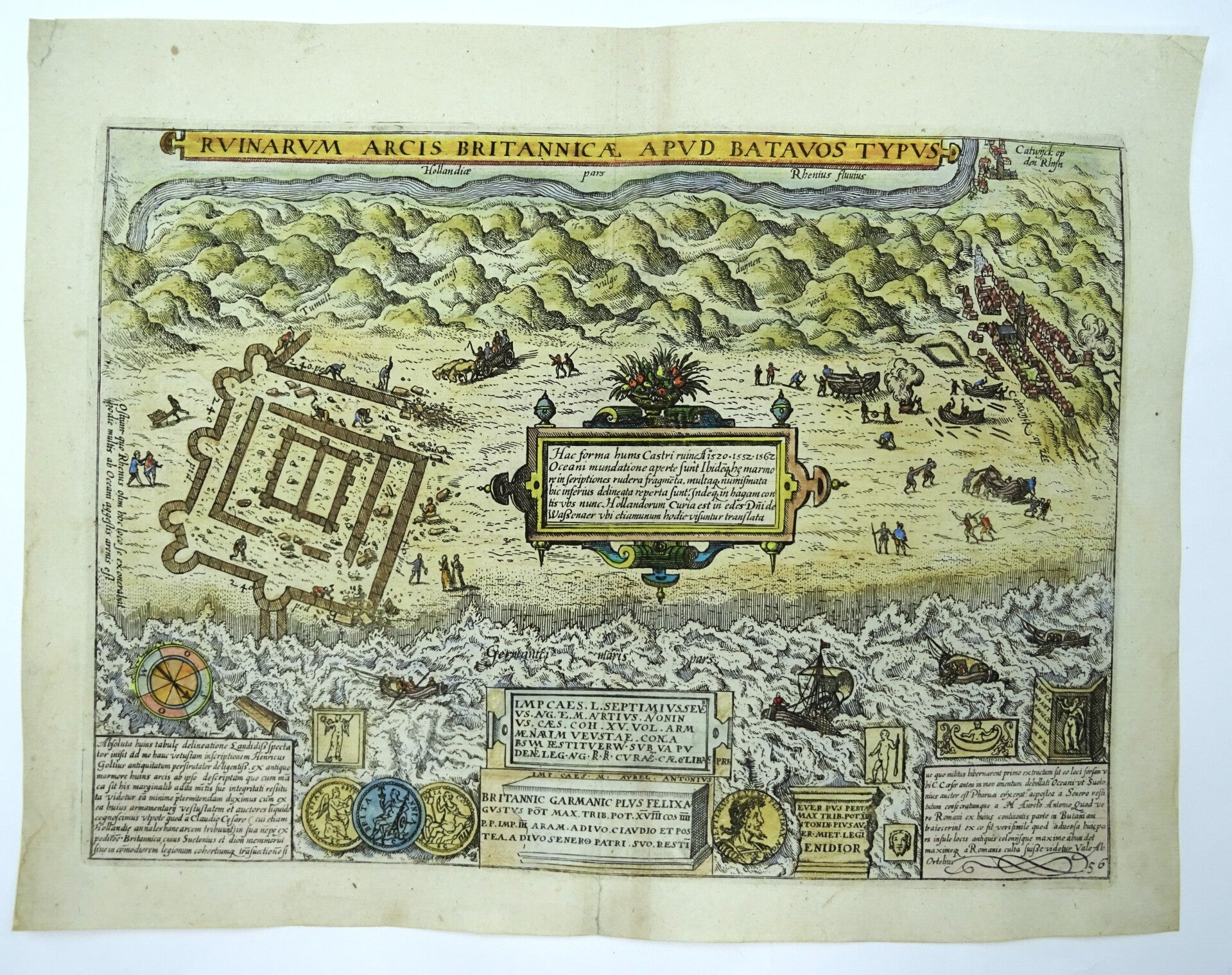
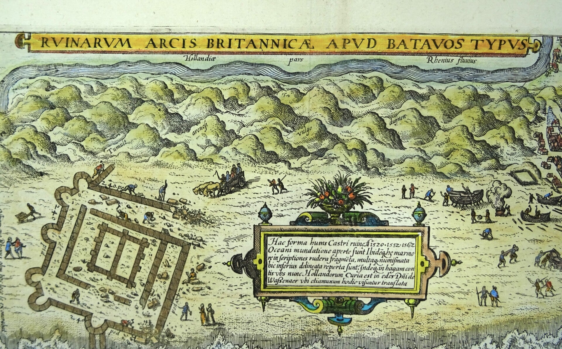
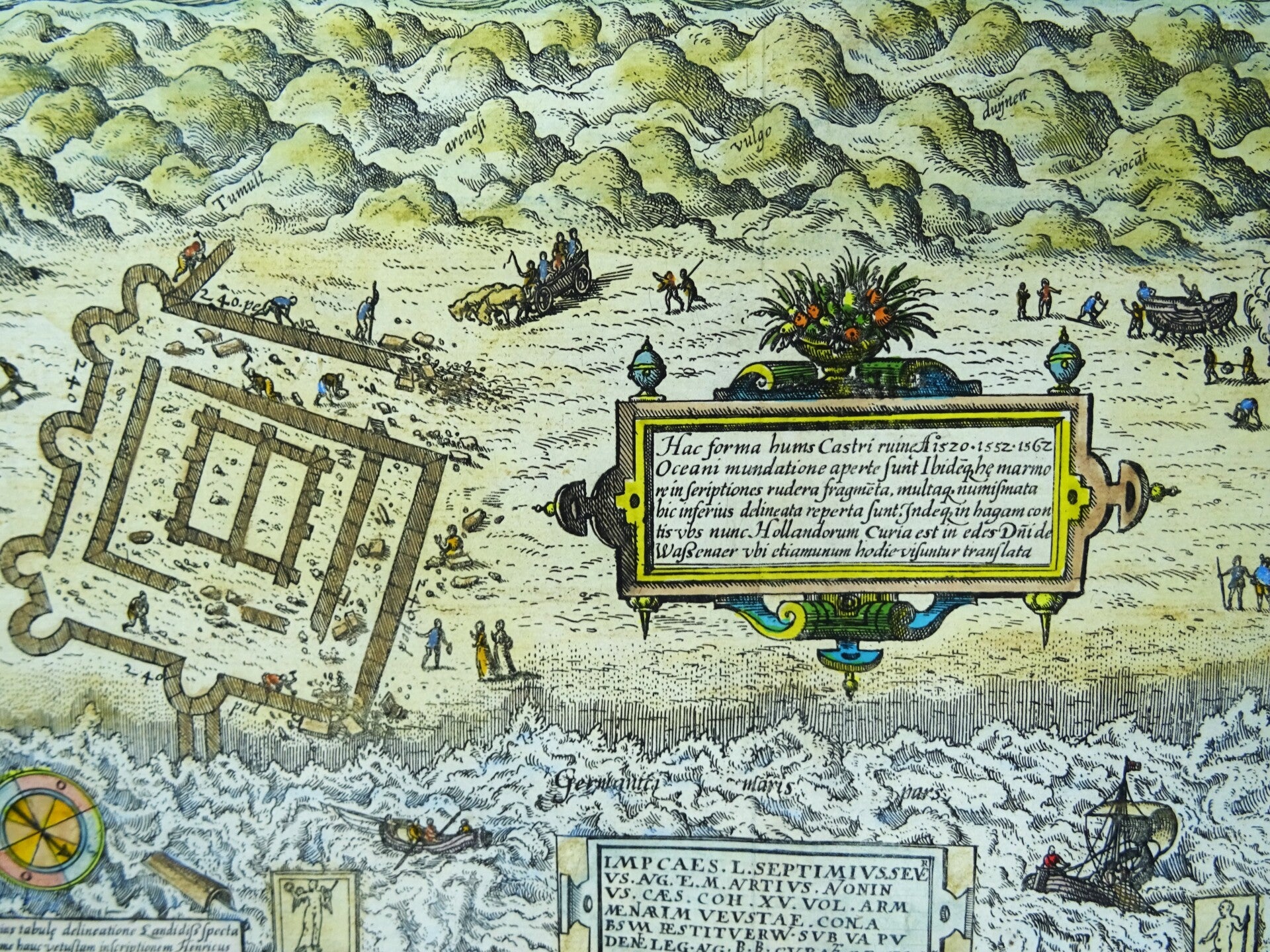

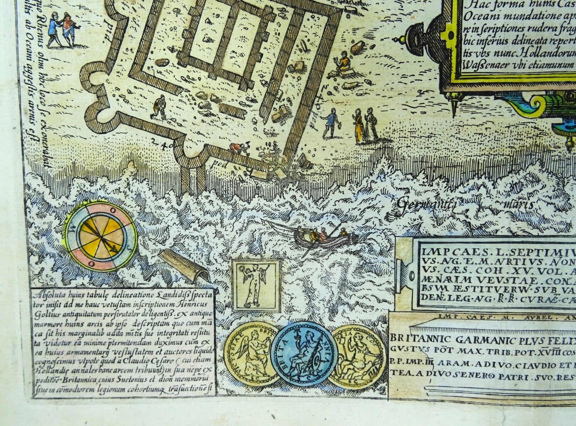
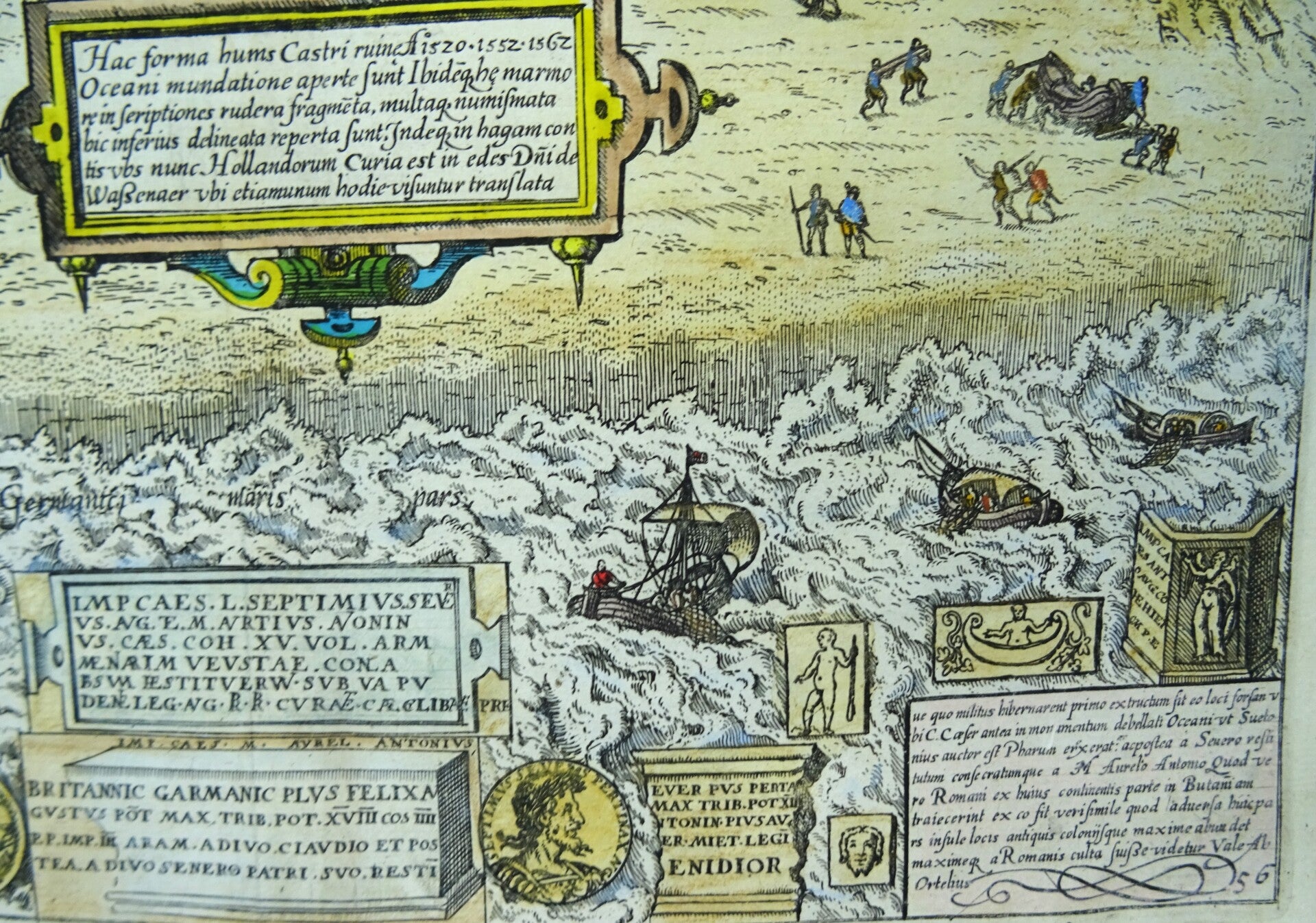
Beautiful map of the ruins of the Roman fort Brittenburg. Brittenburg is the ruin of a Roman limes fortification that was visible on the beach between Katwijk aan Zee and Noordwijk aan Zee after storms in the 15th, 16th, and 17th centuries. It is most likely the location of the westernmost fort of the Roman limes at the mouth of the Rhine and was known as Lugdunum Batavorum. The fort was subsequently (partially) demolished, disappeared into the sea, and washed away.
In the lower corners are frames with Latin text. Also shown are various seals, coins, and texts at the bottom. A compass rose is shown in the lower left. Katwijk aan Zee is shown on the right, and Katwijk aan den Rijn is shown in the upper right.
Published in 1609 (Amsterdam) by Nicolas in ´Description de touts les Pays-Bas, autrement
appellez la Germanie Inférieure ou Basse Allemagne, par messire Loys Guicciardin...´
Excellent condition. Crisp and clean paper, clear print.
Image 22,5x31,5cm, sheet 28x35,5cm