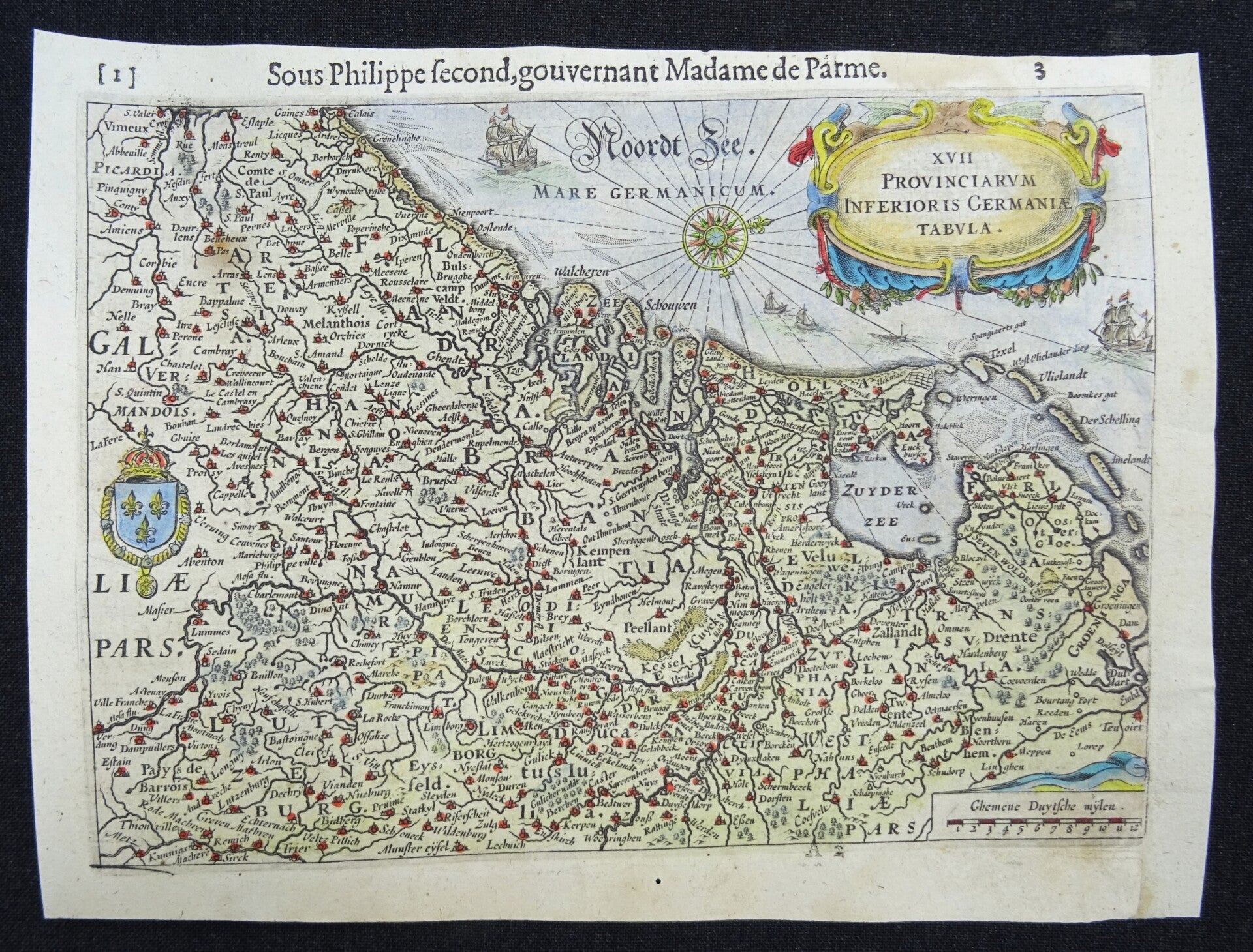
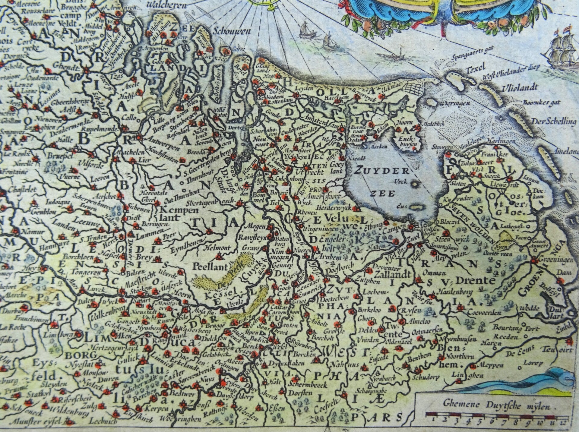
Netherlands, Belgium, Luxemburg, Baudartius, 1622, XVII. Provinciarum Inferioris Germaniae Tabula


€149.00
Item number:
24 22 BJ
Lovely small map of the 17 Provinces of the Low Countries (modern day Netherlands, Belgium, Luxemburg and part of Northern France). The North is towards the right. Decorated with title cartouche top right, coat of arms of France on the left, scale stick bottom right and a compass rose in the North Sea.
The map is a small version based on the impressive map by Hondius, and is published in 1622 in "De Nassausche Krijghen, (.)" Willem Baudartius.
Very good, right margin extended with antique paper, otherwise excellent. Never folded. Clear print. Text on reverse side in French.
Image 14,5x20cm, page 16,5x22cm