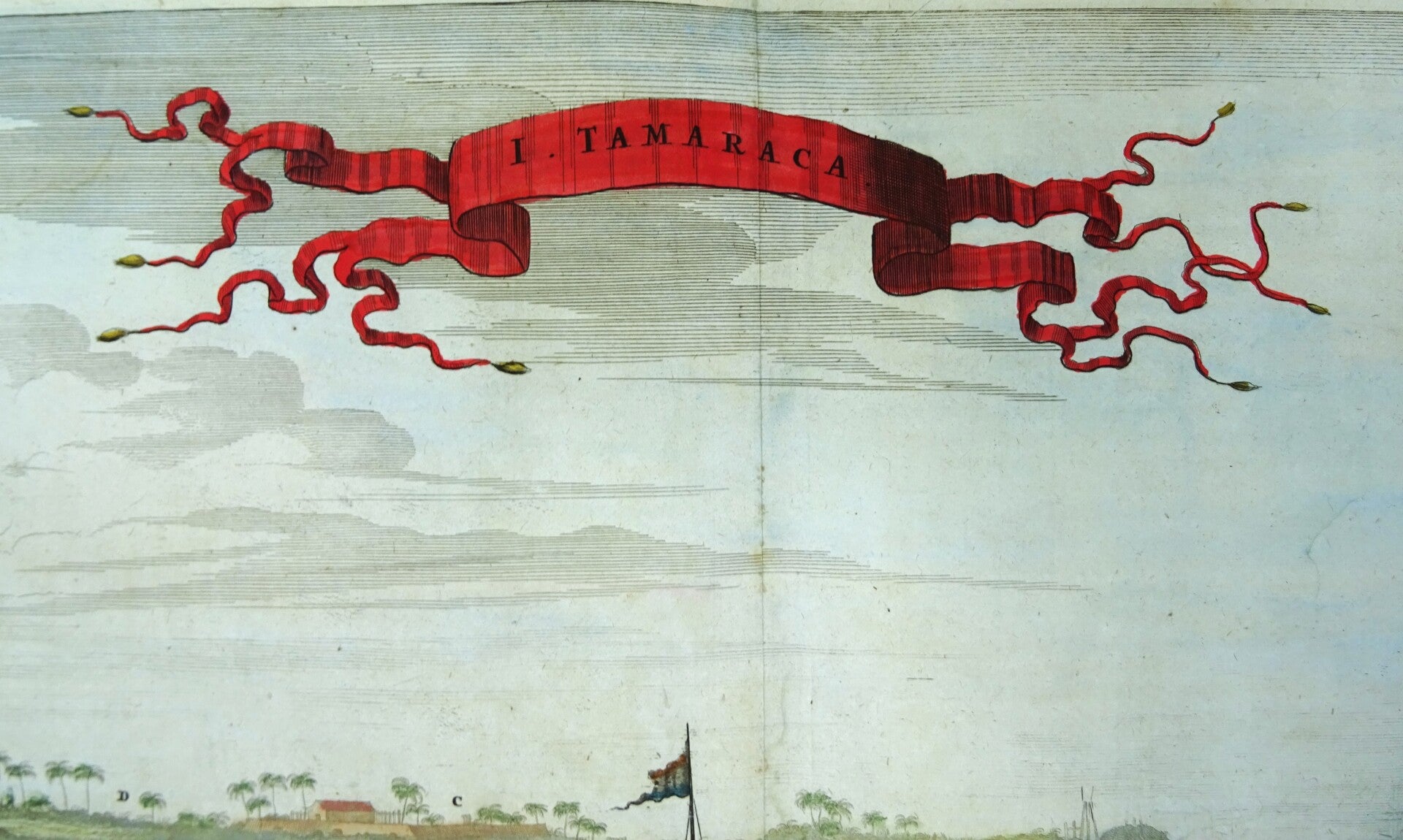
Brazil, Ilha de Itamaracá, Pernambuco, Montanus / Van Meurs, 1671, I. Tamaraca.
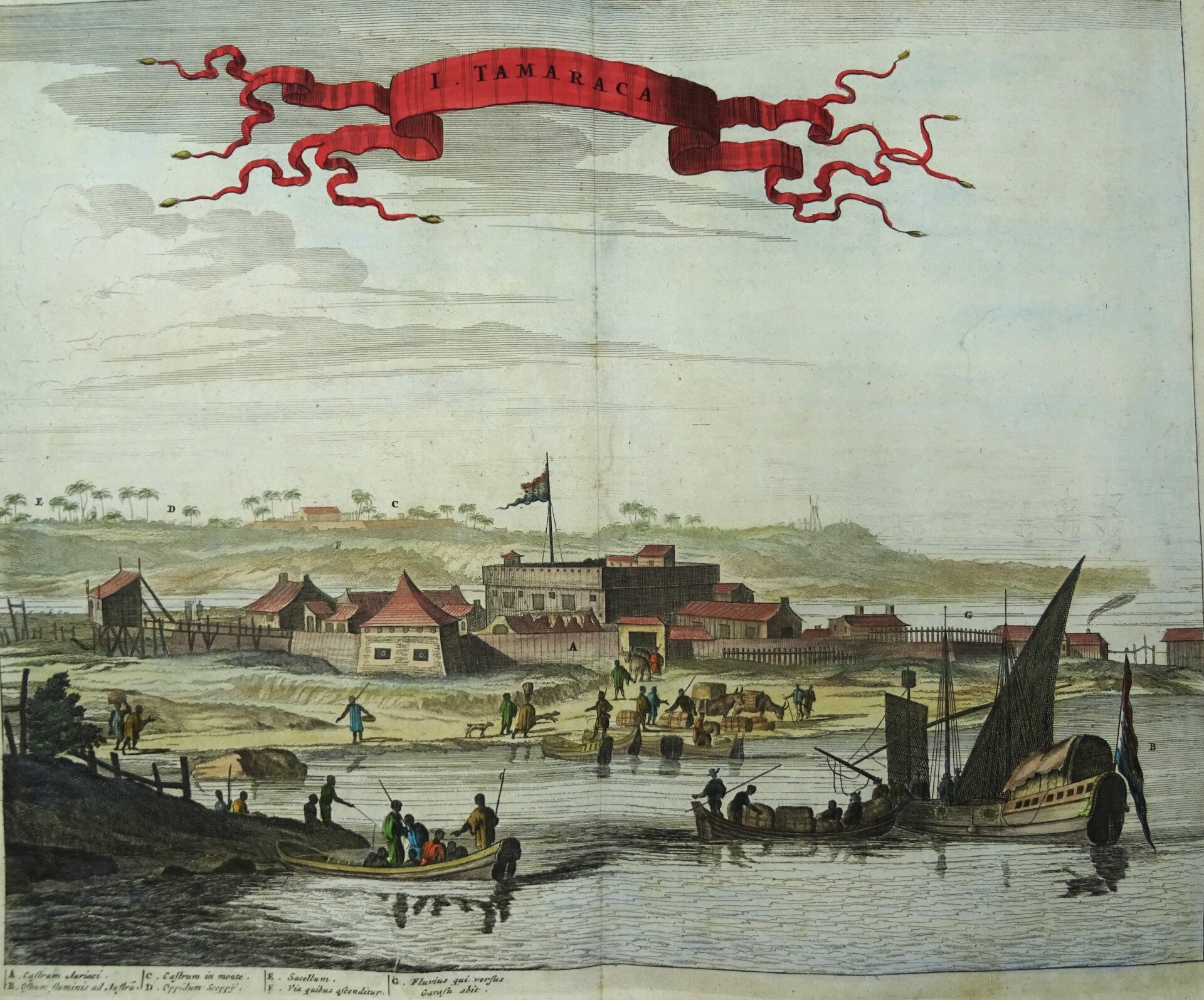
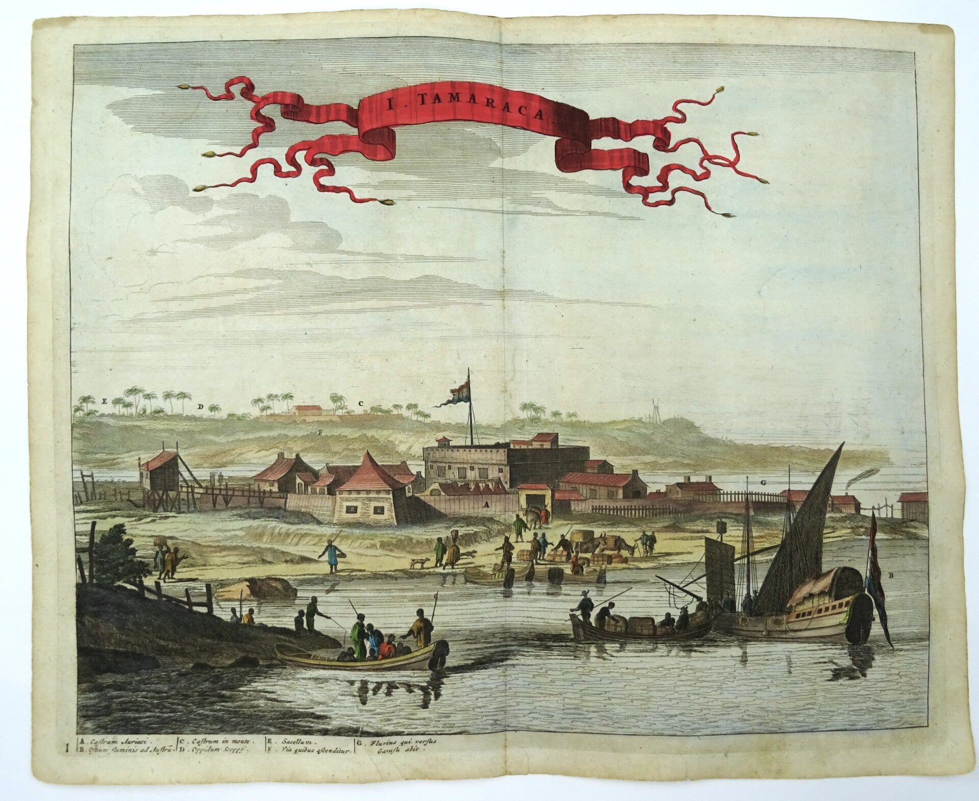
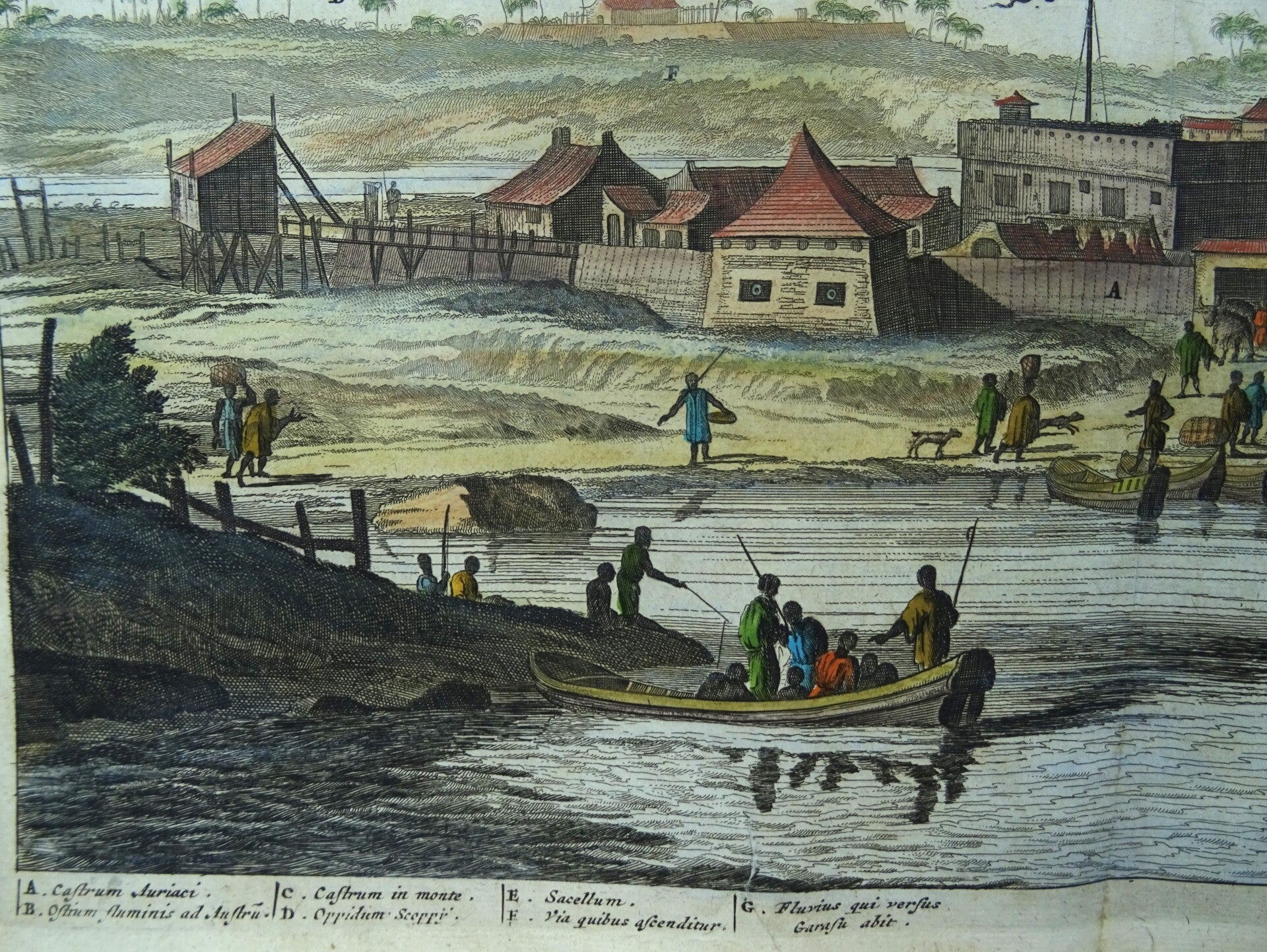
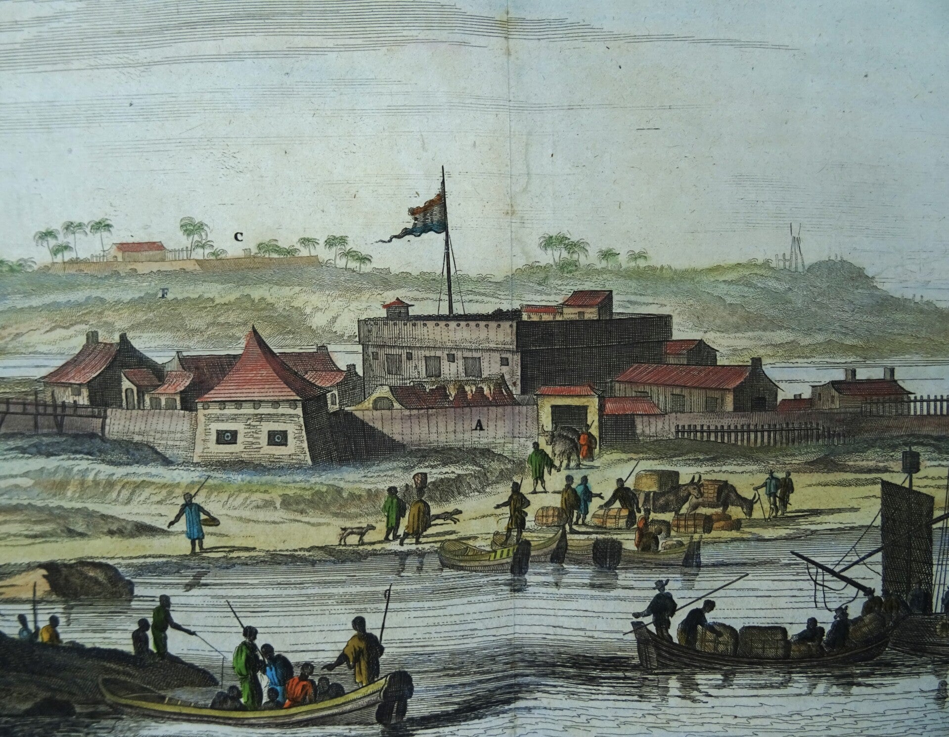
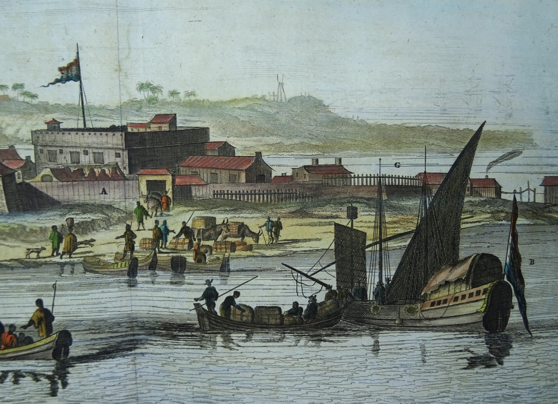
A large view of the Dutch fortress Oranje (Orange), on the island of Itamaraca, in the state of Pernambuco, Brazil.
A key below the image identifies sites of interest. Title on top.
The Fort of Santa Cruz de Itamaracá (Holy cross of Itamaracá), popularly known as Fort Orange, is located on Itamaracá Island on the north coast of the state of Pernambuco in Brazil.
In the context of the second Dutch invasions in Brazil, it was originally a small island (now lost) in front of the tip of the Southeast Itamaracá Island, where the bar dominated the southern channel of Santa Cruz.
This detailed engraving is inspired by a painting by Post executed in 1639. This view appeared in John Ogilby’s seminal atlas "America: Being the Latest, and Most Accurate Description of the New World," published in London in 1671. Ogilby’s work is an English translation of Arnoldus Montanus’ "Die Nieuwe en onbekende Weereld. . . ," which was produced in Amsterdam earlier the same year. Considered the first encyclopedias of the Americas, both texts are richly illustrated with maps, views and portraits.
In the late 1630’s Holland attempted to reassert its claim over Brazil by establishing a series of forts along the coastline. It is one of the best documented colonies because of the expedition led by Prince Maurits of Nassau, who attempted to assemble an intellectual court in the New World. He brought with him a group of highly accomplished artists, mapmakers, and scientists to record the mysteries of Brazil. They included the celebrated painter Frans Post, and the astronomer George Markgraf, who produced the first serious study of the southern sky. Post painted a wealth of images of the Brazilian landscape and the surrounding vegetation and wildlife. His works are some of the earliest European paintings of Brazil and were eagerly reproduced in print by Dutch engravers.
Very good condition.
Image 28x34cm, page 31x37,5cm