India, Pakistan, Nepal, Bangladesh... J. Janssonius, 1680, Magni Mogolis Imperium

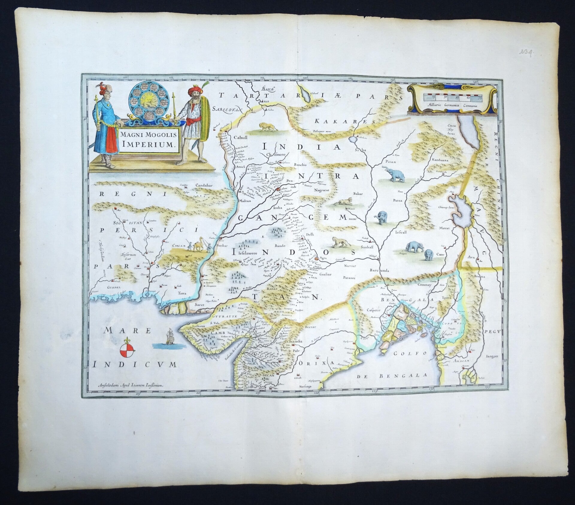
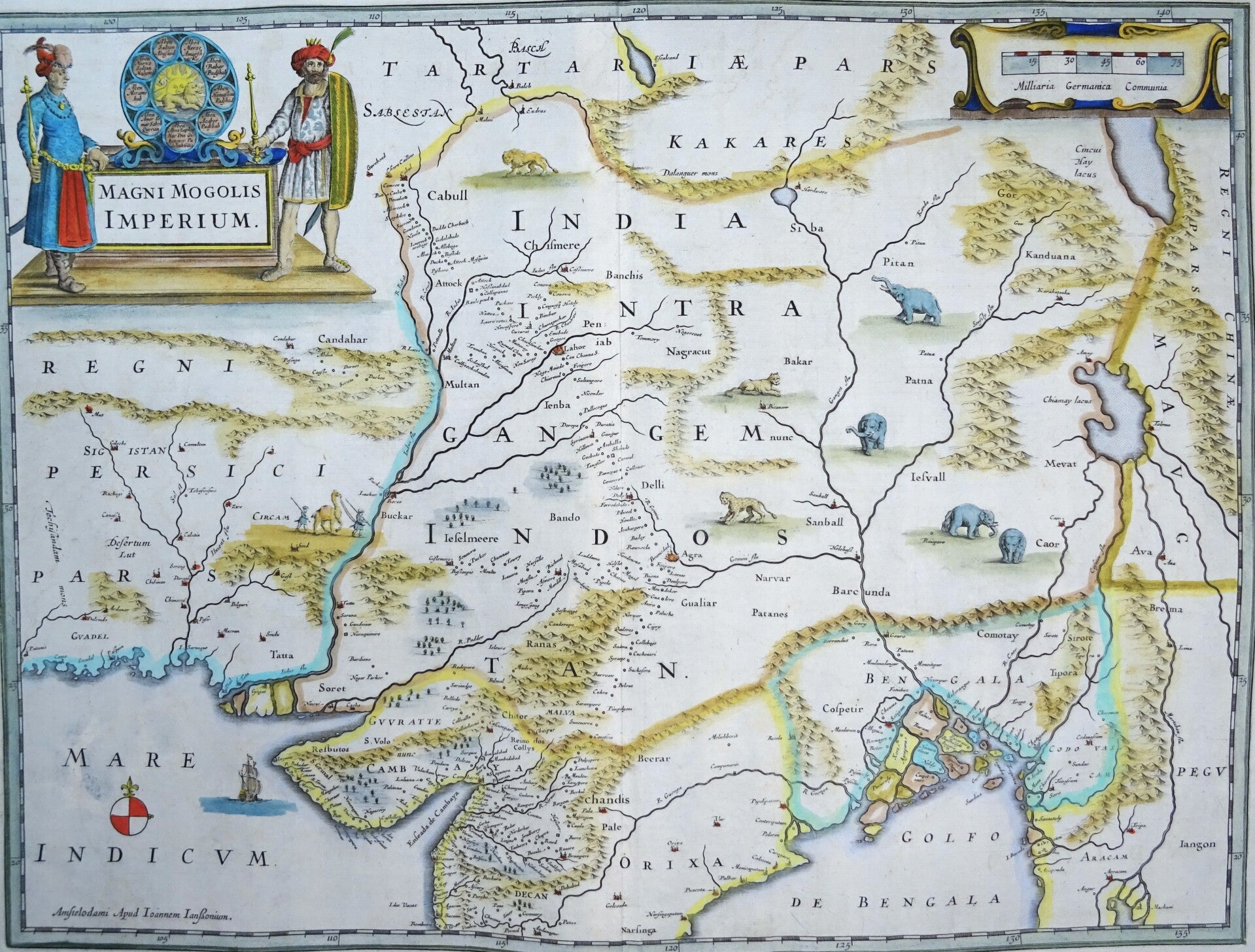
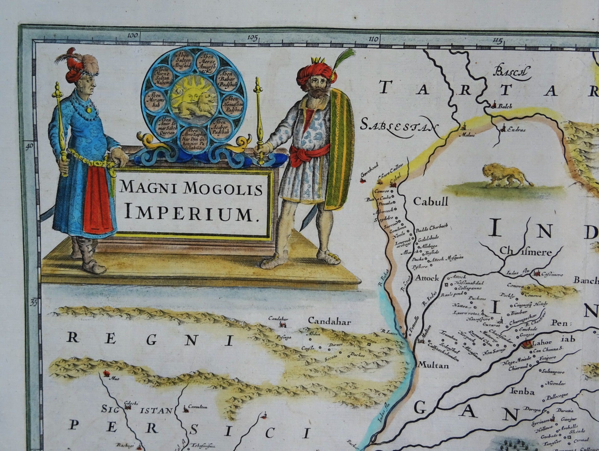
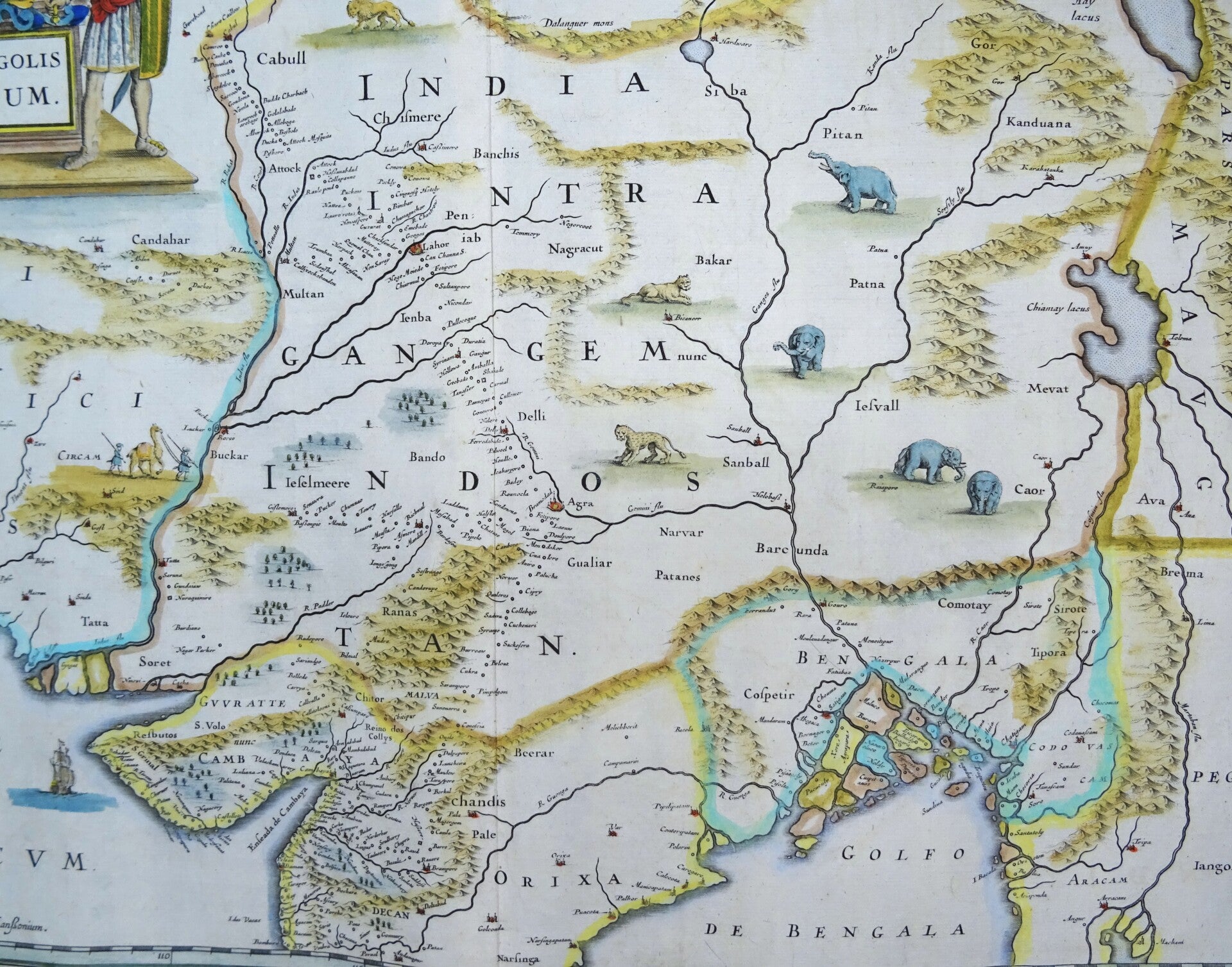
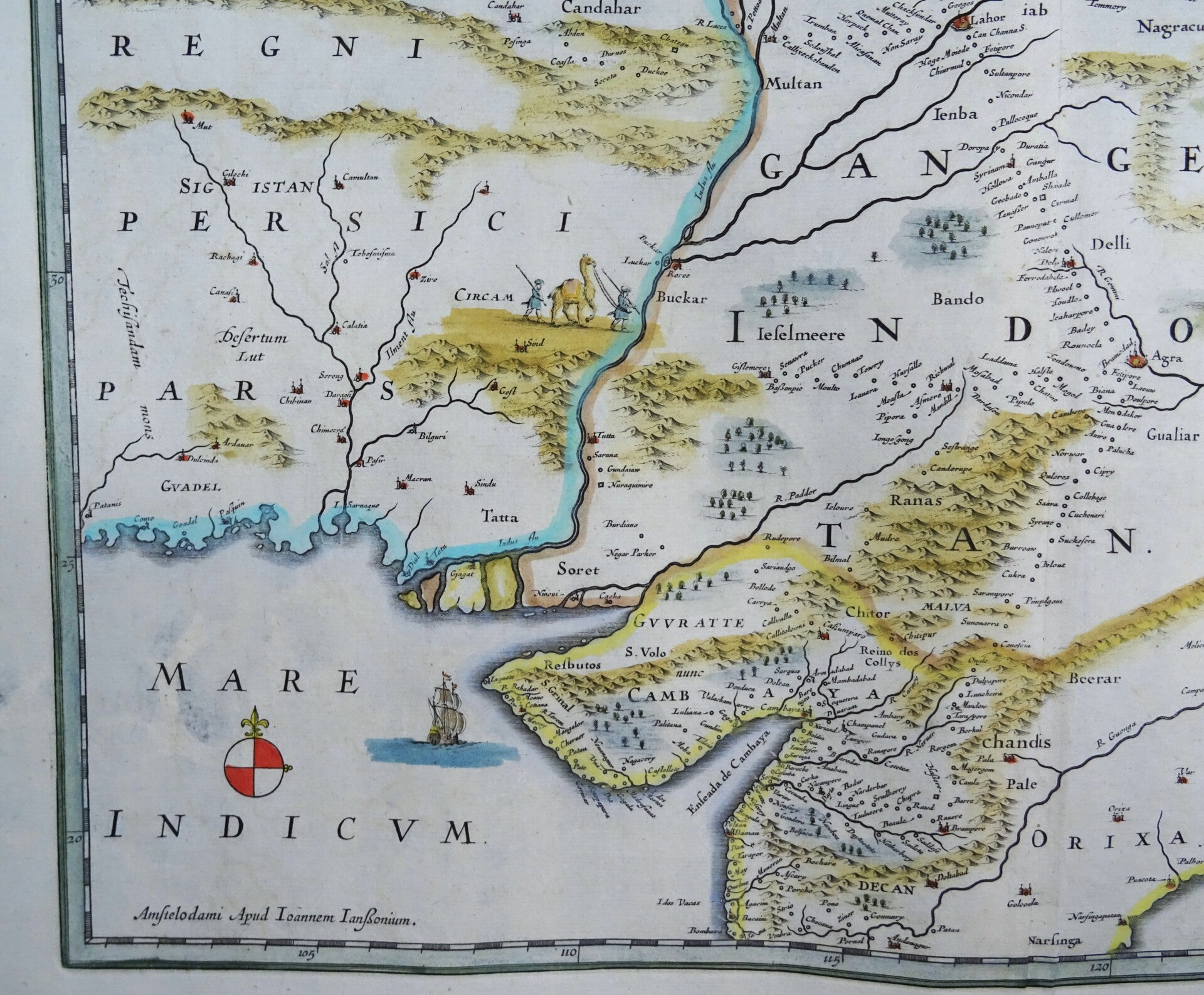
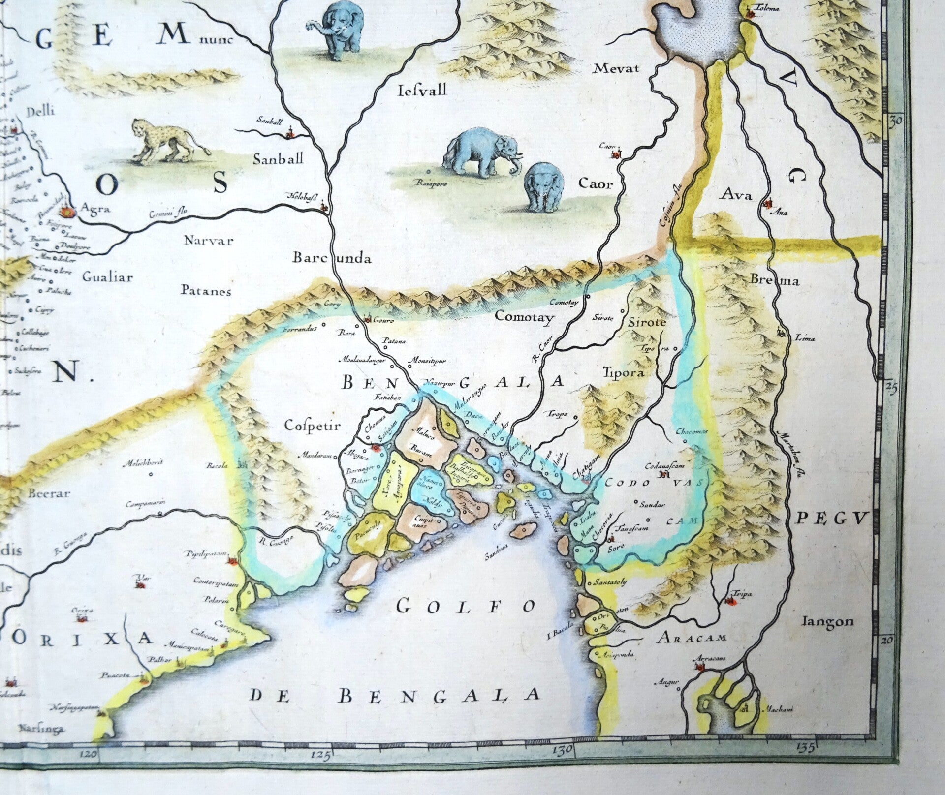
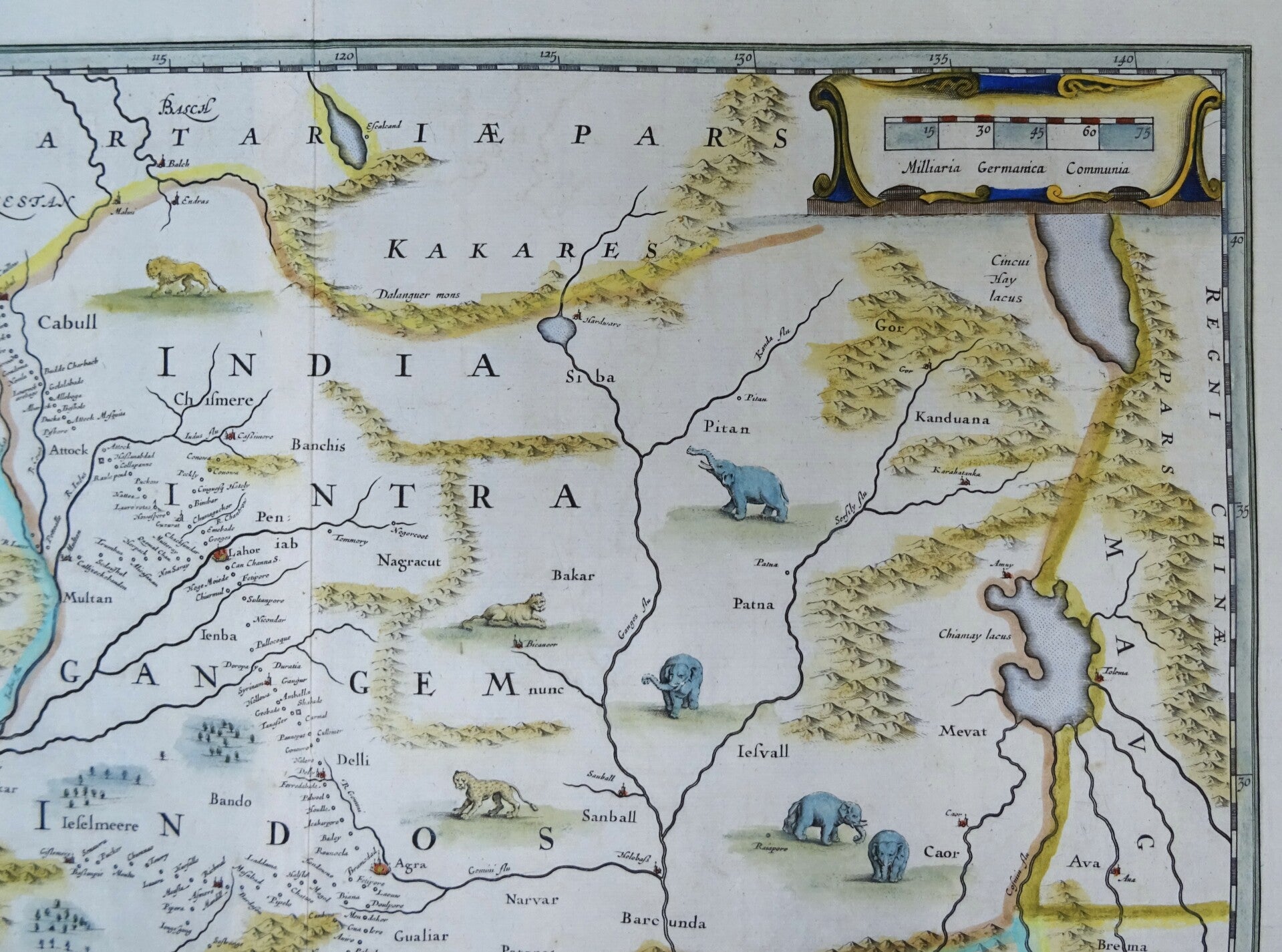
This is an attractive, original color example of Jan Jansson's map of the Mughal Empire of Northern India. It is the most attractively engraved of the 17th century maps derived from the unacquirable Baffin / Roe map. It features the first accurate mapping of the Indus River, as well as western and central India. At its heart, the map reveals the vital trade routes between the chief cities of Gujarat, Agra, Jaisalmer, and their linkage the Silk Road center of Kabul.
Centered on the Mughal capital of Agra, it covers the Indus and Ganges River valleys, from Kabul to Orissa and Deccan, and from Persia to Bengal. Lahore, Kabul, Peshawar (Pishore) and Gujrat (Guzurat) are named, as is Kashmir (Chismere and Cassimere.) While the map does not show roads, it does show the network of towns, waystations and caravanserai built to support the bustling trade system. In particular, it reveals the administrative route linking the Imperial palaces at Agra and Lahore.
This - and virtually every seventeenth century map of northern India - was based on William Baffin's Indsostan, the first English map of India, made based on the travels and geographical information of Sir Thomas Roe, the British East India Company's ambassador to the Mughal Empire. Roe and Baffin are thought to have worked on their map during Roe's 1619 return to England aboard the ship Anne Royal, following Roe's tenure as ambassador. Baffin, formerly an arctic exploer, was employed as a surveyor by the East India Company and served as a Master's Mate on Anne Royal. Roe was tasked to produce a map of the Empire in India, compiling geographical data on 37 cities. Baffin added these to the map with difficulty, as he needed to reconcile Roe's data with his own charts and others that remained authoritative. Their 1619 manuscript survives in a single copy in the British Library and the map was published that year, itself surviving in only a single example at the British Library. Despite its present prohibitive rarity, the map's influence was monumental. The Dutch mapmakers Blaeu, Hondius, and Jansson copied it, and it is in their atlases that it was most broadly disseminated.
This edition of the Janssonius map (his signature is printed in the lower left corner) was published around 1680 in Amsterdam.
Ref: OCLC 7457915. Van der Krogt, P. C..
Early Maps of India, cfplate 10, pp. 44-53.
Excellent condition
Image 36,5x49cm, page 53x62,5cm