Russia, Ukraine, Belarus, Poland, Baltic states... W. Blaeu, 1635, Tabula Russiae


The famous Blaeu map of Russia and Eastern Europe, showing the area between the Baltic Sea, the Polar Sea, the Black Sea and the Caspian Sea. Two inserts (map and view): Moscow and Arkhangelsk.
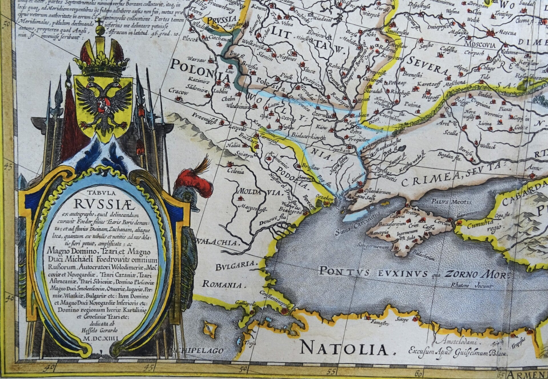
The map is based on Hessel Gerritsz's map of Russia, first issued 1613 and then adapted and published by Blaeu after he acquired the plate following Gerritsz's death in 1632. The top left corner has an inset plan of Moscow with a 17-point key; on the right is a prospect of Archangel, Russia's only northern port until the founding of St Petersburg in 1700. Three figures in Russian dress stand above. The title is within a martial cartouche. Extending west to east from Emden to Aspachan and north to south from Langenos to Trapesus.
This edition was published in the first French edition of "Atlas Novus," the atlas by William Blaeu, Amsterdam, 1635.
Good condition. Waterstain in the top part of the sheet, mainly affecting the margin and a small portion of the top of the image. Some repairs and reinforcements of the central fold, not affecting the image. Otherwise excellent. Thick paper, clear print and wide margins. Reverse side text in French
Image 42,5x54cm, sheet 50x58cm