France, Poitou, Île de Ré, Île de Olerón, Île de Noirmoutier, La Rochelle, Nantes... W. Blaeu, 1635, Pictaviae Ducatus Descriptio Vulgo le Pais de Poictou

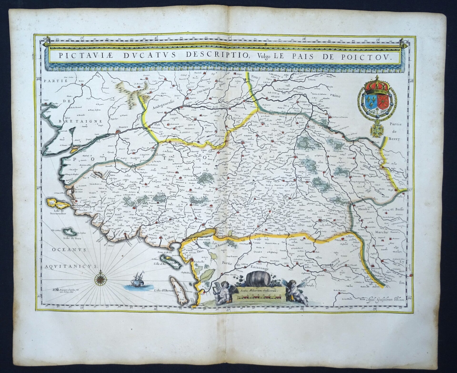
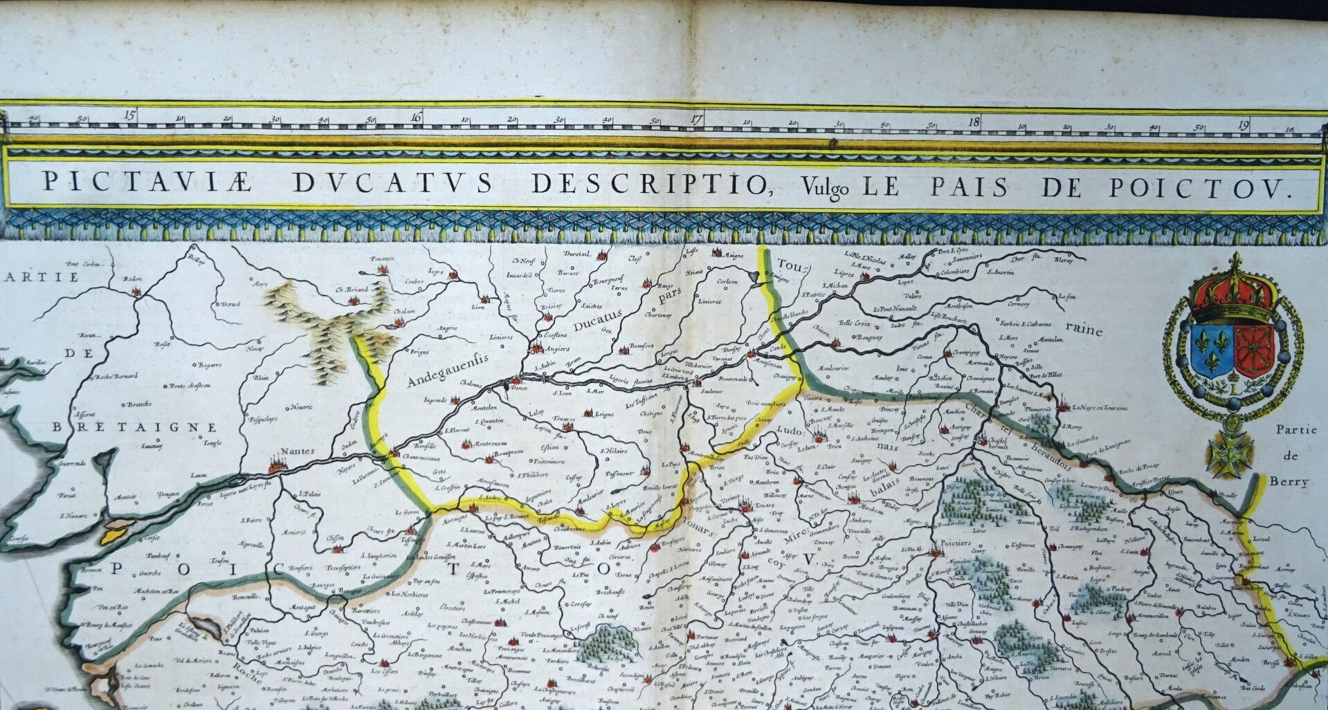
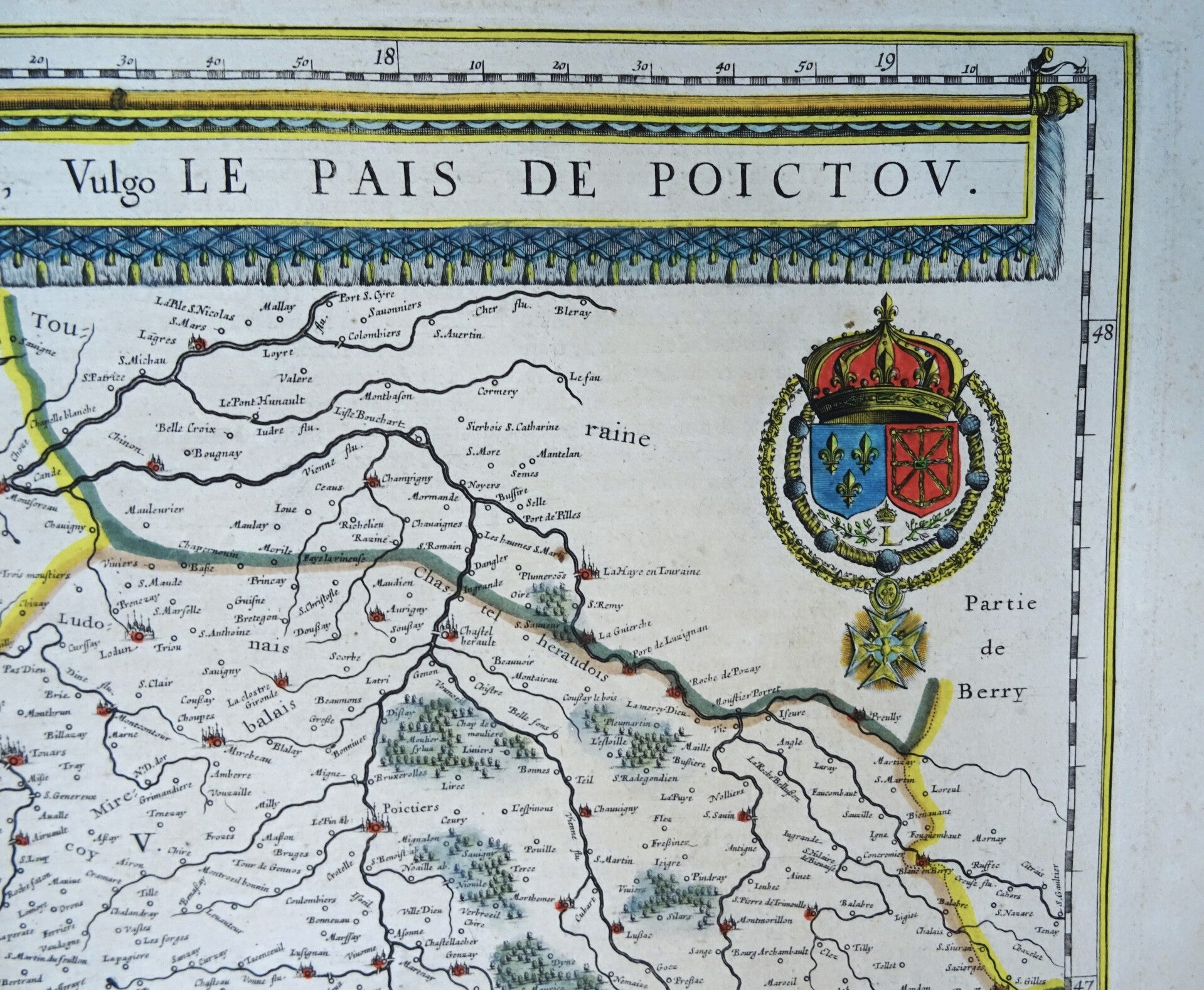
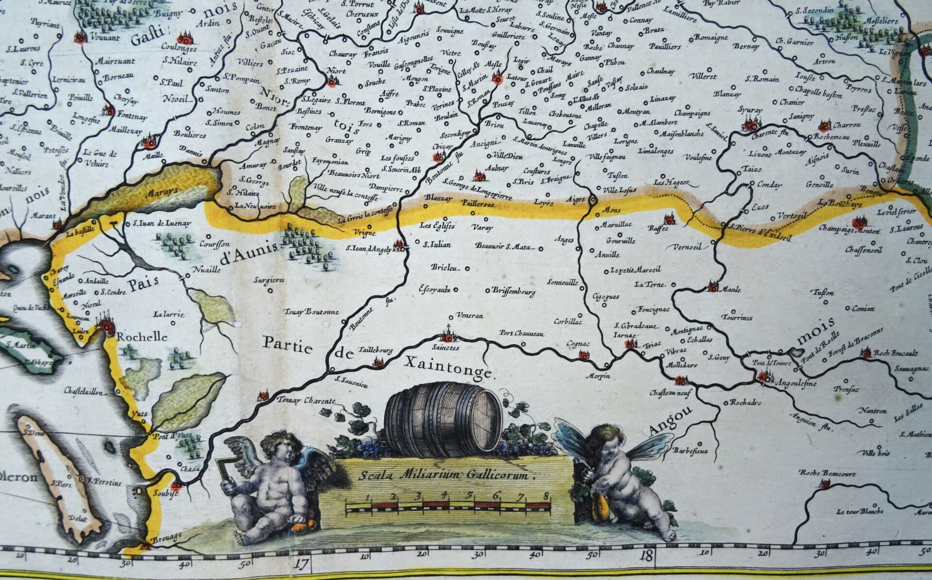
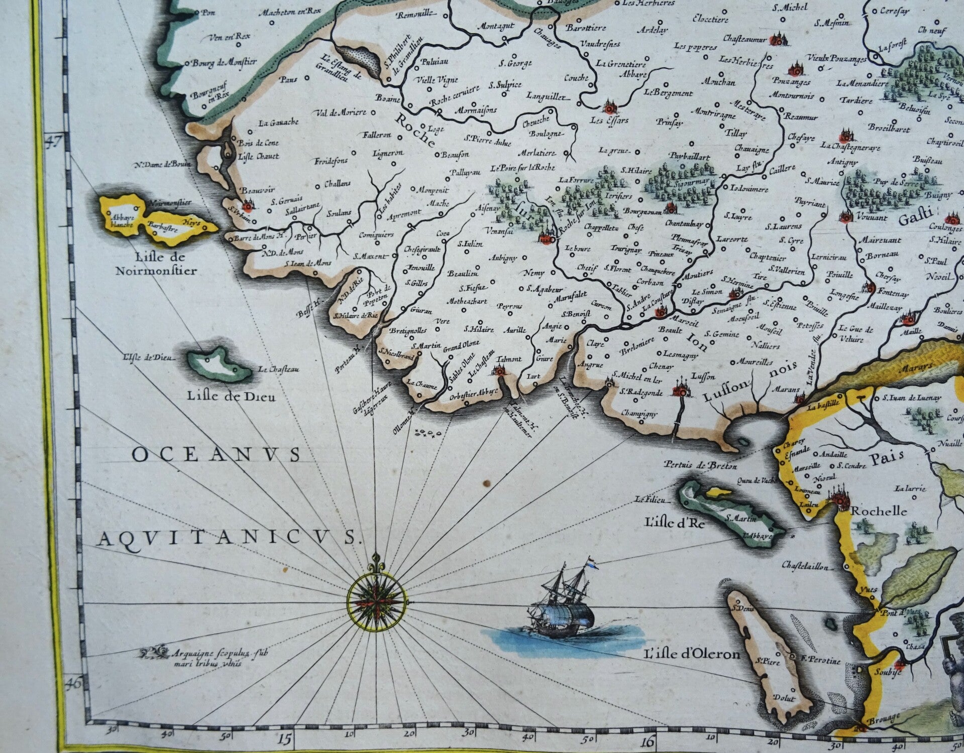
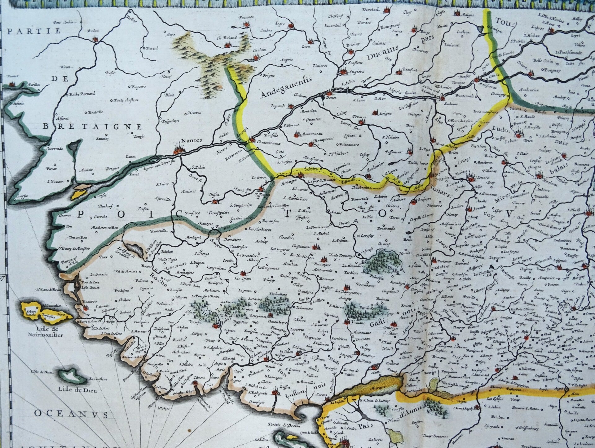
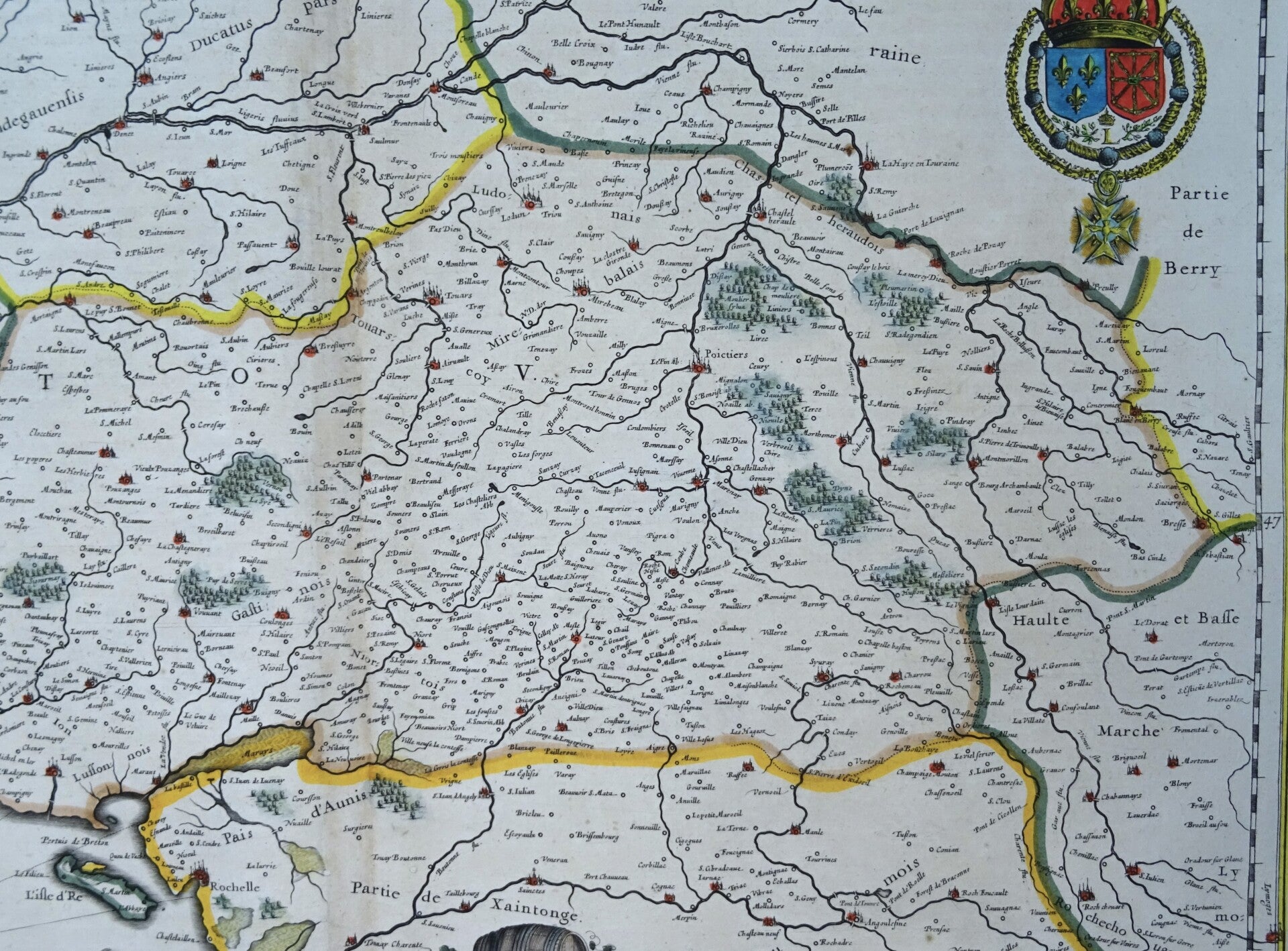
Lovely map of the Poitou region of southwest France with delightful banner title. It also shows Île de Ré, Île de Olerón, Île de Noirmoutier etc. The map identifies important towns, fortifications, rivers, vineyards and villages throughout with beautifully rendered mountains and forests. The white wines of Haut-Poitou are noted for their powerful aroma. Sauvignon blanc and Cabernet franc is produced in the region. A wine barrel and grapes rest on top of the scale cartouche. In the top right the coat of arms of the French king. Signed by Blaeu in the bottom right corner.
Very good condition. Some light age browning. Small repair on the back of the lower part of the central fold and small repaired hole on top, not affecting the image. Otherwise excellent. Clear print. Very wide margins. Nice hand coloring. Reverse side text in French.
Image 38,5x53cm, sheet 49x60cm