Japan, large rare early map De Charlevoix, 1736, Carte de l´Empire du Japon...


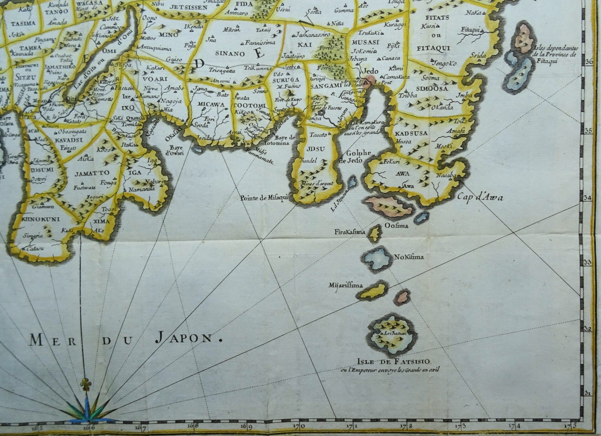


This rare early map of Japann is centered on the Bay of Osaka, covering ranges from the northern islands of Japan (Ezo) to the Ryukyu Islands, which were vassals of Satsuma (Saxuma) Domain. Various towns, harbors, bays, provinces, mountains, and daimyo are noted, although many are speculative.
The map includes several inaccuracies. Shikoku Island (here identified as I. Xixoco) appears to be almost square with a deep inlet on its northern side, while Kyushu (Insel Ximo) is slanted to the east. On the island of Honshu (Insel Nippon), Aomori Prefecture is foreshortened while the Oki Islands appear exaggerated. Shimane prefecture and the Noto Peninsula are also distorted. The island of Hokkaido is referred to as the 'I. de Matsumay,' after the ruling Matsumae clan, which ruled a domain (han) in southern Hokkaido. The Isle de Fatsisio at bottom-right is Hachijō-jima, where political opponents of the shogun (not the emperor) and other criminals were exiled.
Bellin attributed this map to Jesuit and Portuguese sources, but upon deeper analysis it is derived more closely from the work of the German traveler and naturalist Engelbert Kaempfer (16511716). Having spent 2 years in Japan, Kaempfer was considered one of Europe's leading Japanologists. Charlevoix likely did not credit Kaempfer due to his distaste for Protestants and his deep connections to the Jesuit order.
Published in ´Histoire et description générale du Japon...´, P.F.X. De Charlevoix, Paris 1736, Gandouin et al.
Very good condition. Folds, as published. Clear print. Reverse side blank. Lateral and bottom margins short (as published) and extended with antique paper. Otherwise perfect.
Image 41,5x54cm, page 44x56cm