South America, El Dorado, Amazonia, Guyana, Suriname, Brazil... Sanson, 1679, Partie de Terra Firme ou sont Guiane et Caribane


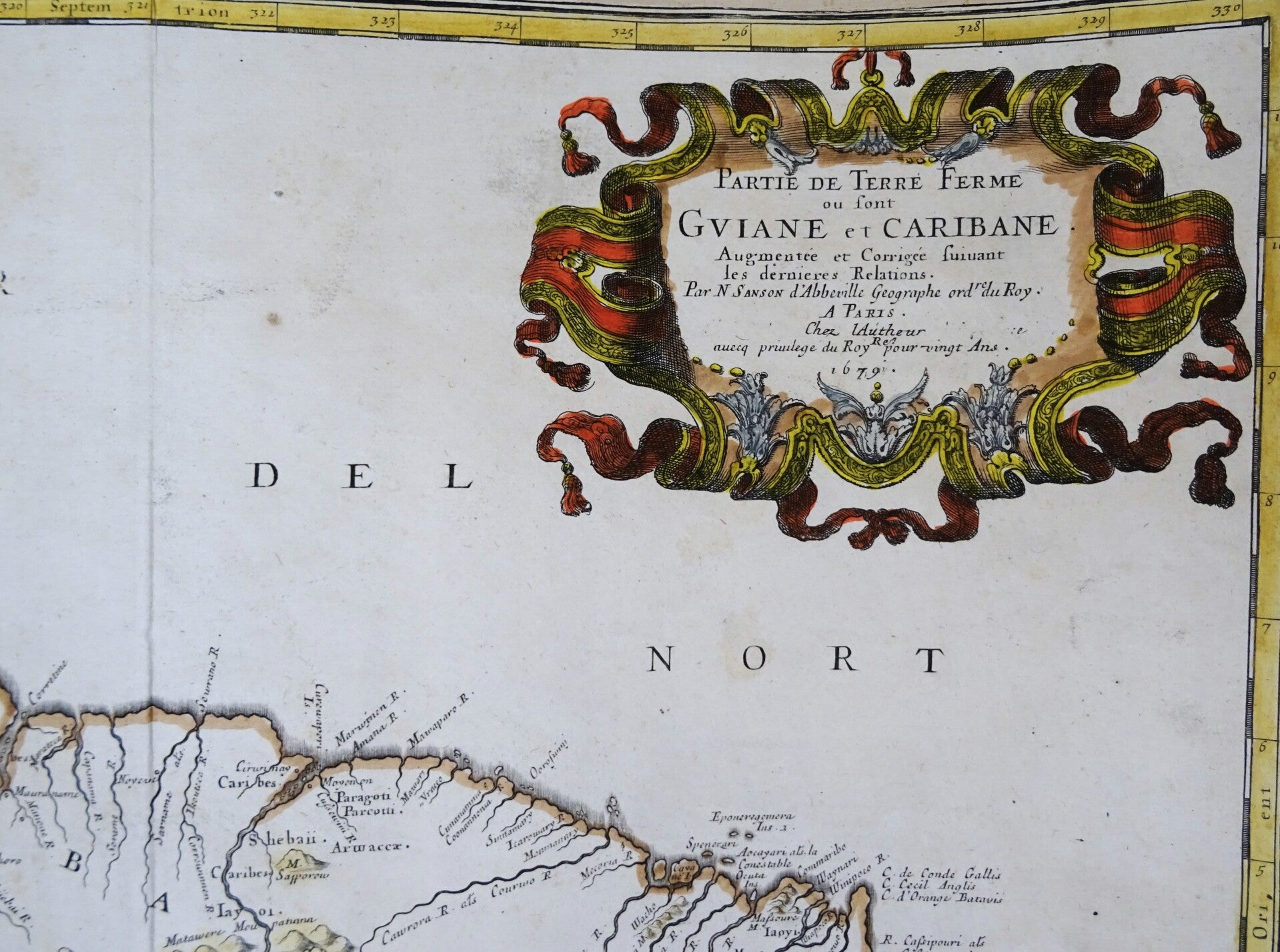


Image 40x53,5cm, page 46x56cm
This is a remarkable 1679 Nicolas Sanson map of the northwestern parts of South America, including Lake Parima (Parime), and the route to El Dorado.
Cartographically, this map is loosely based upon cartographic conventions established by Johannes De Laet. However, Sanson introduced some exciting new ideas, including some of the first fixed political borders in Guiana. The map depicts from Isla Margarita and the Orinoco Delta eastward as far as Tampico and southwards as far as the mouth of the Amazon River.
This part of South America generated considerable European interest in the early 17th century following the publication of Sir Walter Raleigh's fascinating Discovery of the Large, Rich, and Beautiful EMPIRE OF GUIANA. Raleigh's expedition traveled down the Orinoco River in search of the Kingdom of El Dorado.
Today we know that El Dorado did not exist but was instead an amalgam of very real tribal traditions and the European lust for gold. Nonetheless, in the 16th century, tales of El Dorado were everyday conversations in the port cities of the Spanish Main. Having explored a considerable distance down the Orinoco, Raleigh's expedition found itself mired in a remote tribal village at the onset of the rainy season. While waiting for an opportunity to return up the Orinoco, a trading delegation arrived. At this time, the dominant trading empire in the Amazon was the Manoa, who, though based near modern-day Manaus, maintained trade routes from the foothills of the Andes to the Amazon and Orinoco Deltas. While the rainy season prevented Raleigh from moving forward, for the Manoa, it had the opposite effect because it inundated the vast Parima flood plain, creating a great inland sea. Consequently, a vital trade route opened, creating a connection between the Amazon and Orinoco Rivers. When the Manoa arrived, Raleigh and his men noticed that they had various golden trinkets for trade. This was enough for Raleigh to deduce that they must indeed be from the hidden kingdom of El Dorado. When Raleigh asked where the traders came from, the locals, with no common language with which to engage Raleigh, could only explain that they traveled across a great water and were from Manoa. Raleigh's presumptuous narrative inspired many early cartographers to map this massive lake, with the city of El Dorado or Manoa on its shores, in the unexplored lands between the Orinoco and Amazon River basins.
Lake Cassipa
In Volume II of his Personal Narrative of Travels to the Equinoctial Regions of America, Alexander von Humboldt discusses the origins of all the apocryphal lakes in northern South America. Humboldt collected and examined many 16th and 17th century maps on which these lakes appear and read accounts written by explorers and missionaries about their time in the area. Humboldt presents a history of Lake Parima not unlike that included in the above paragraph but also examines the history of another apocryphal lake, Cassipa. This lake, which also first appeared in Raleigh's account, and another apocryphal lake, Lake Xarayes, began appearing on maps of South America during the same era as Lake Parima. Maps of northern South America dating from this time period usually include some combination of these three mythical lakes. Humboldt states that he believes Lake Cassipa arose from a misunderstanding around the native name for the Rio Paragua, which in Caribbee language means either 'sea' or 'great lake.' The lake's name came from the Cassipagotos, a native tribe that lives in the area. Raleigh, says Humboldt, stated that the basin was forty miles wide, and, like both Parima and Xarayes, likely hid gold on its bed (again, the El Dorado legend). Lake Cassipa, per the 'ancient' maps consulted by Humboldt, was the source of several regional rivers, including the Carony, Arui, and Caura. The discussion of Lake Cassipa by Raleigh, and its inclusion in early maps, was enough for it to become a regular part of the cartography of northern South America for decades.
Reasonable/good condition. Map cut short on border and than backed by antique sheet. Otherwise very good. Central fold, as published.