Turkey, Cyprus, Middle East, Persian Empire Janssonius, 1650, Tabula Itineris Decies Mille Graecorum sub Cyro...
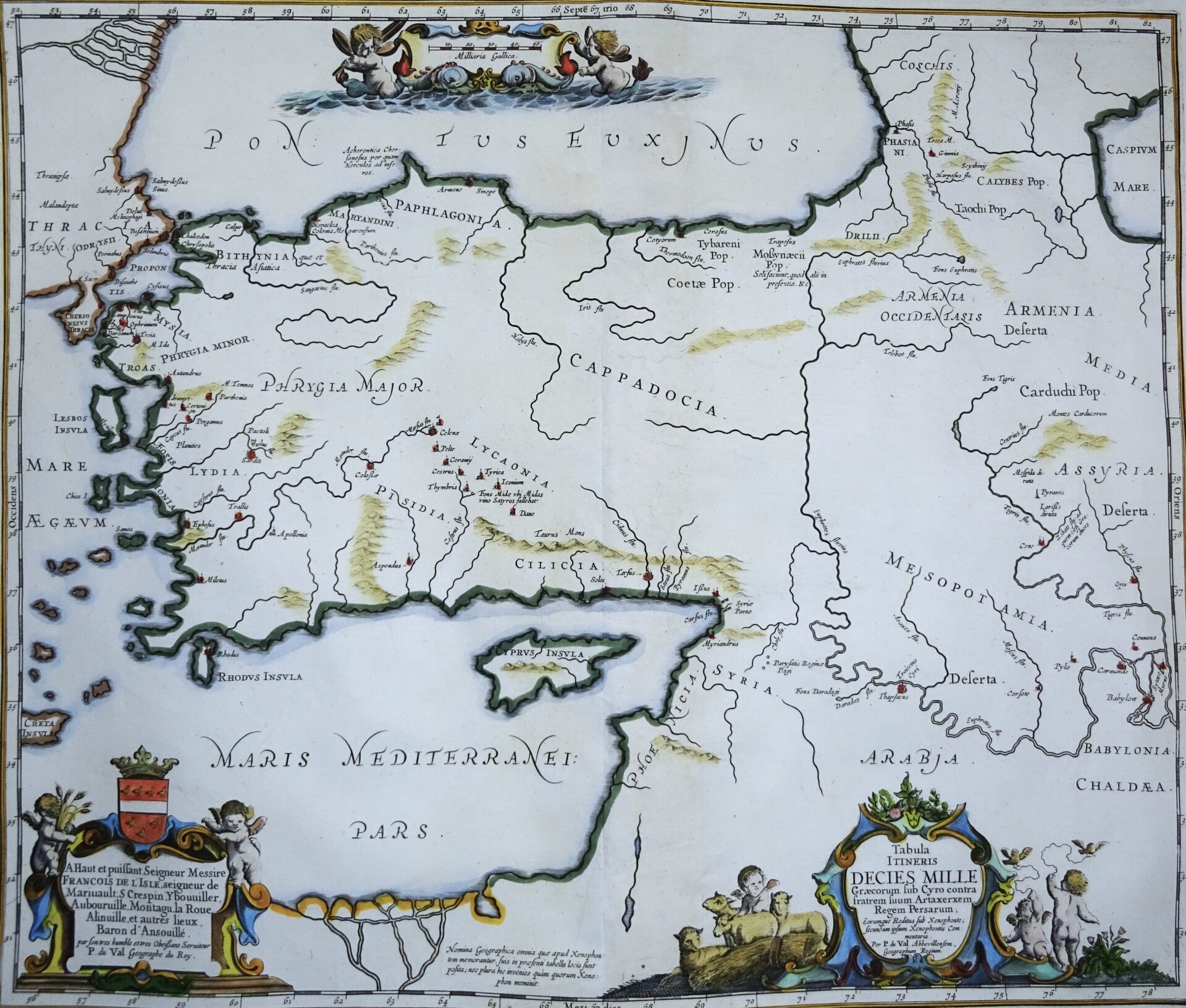
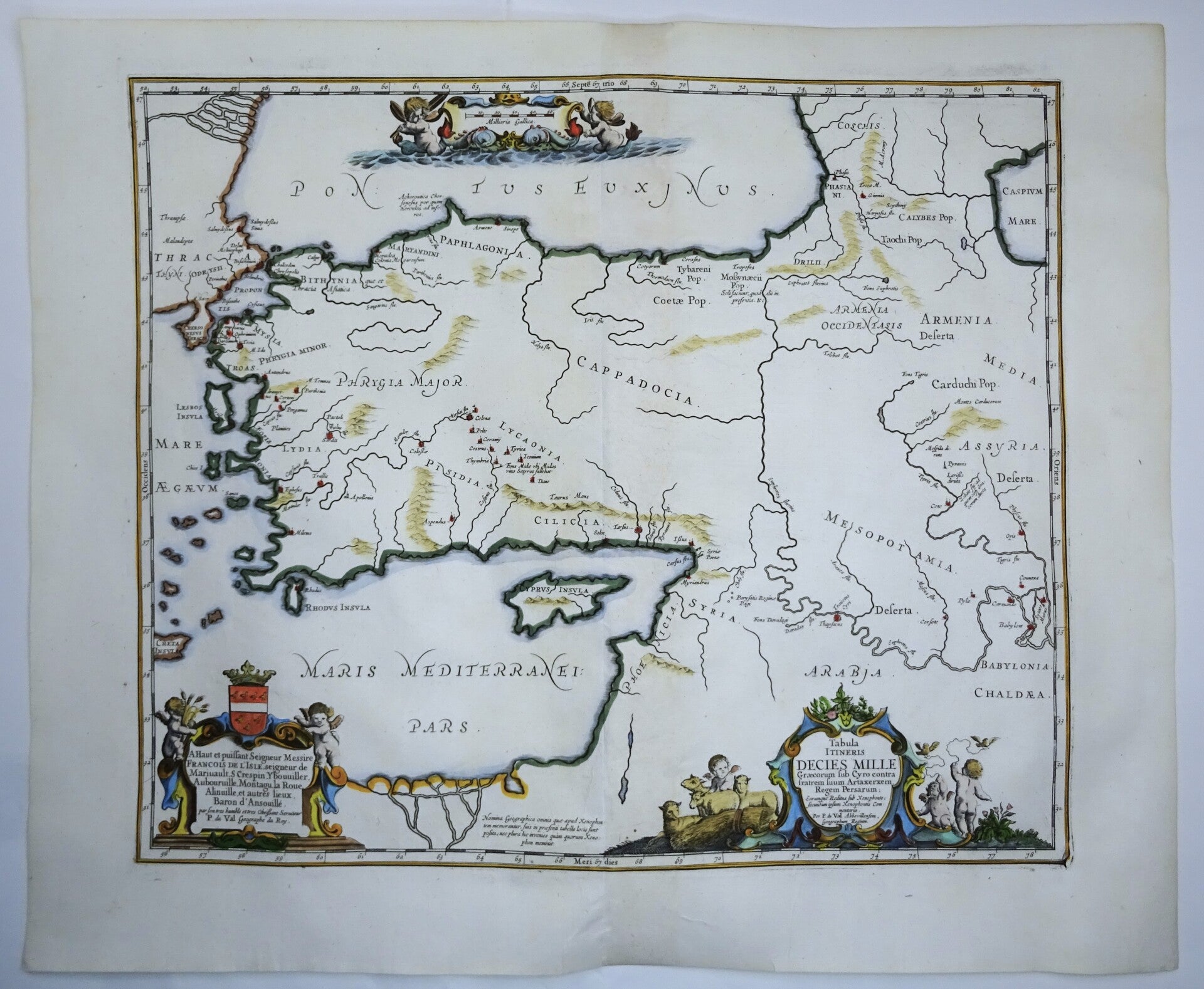

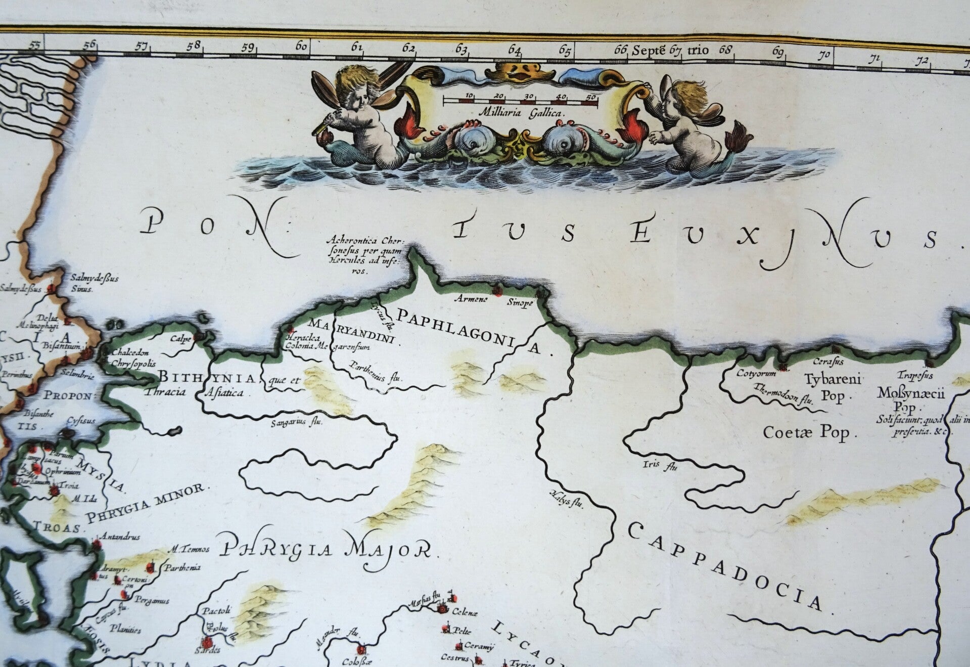
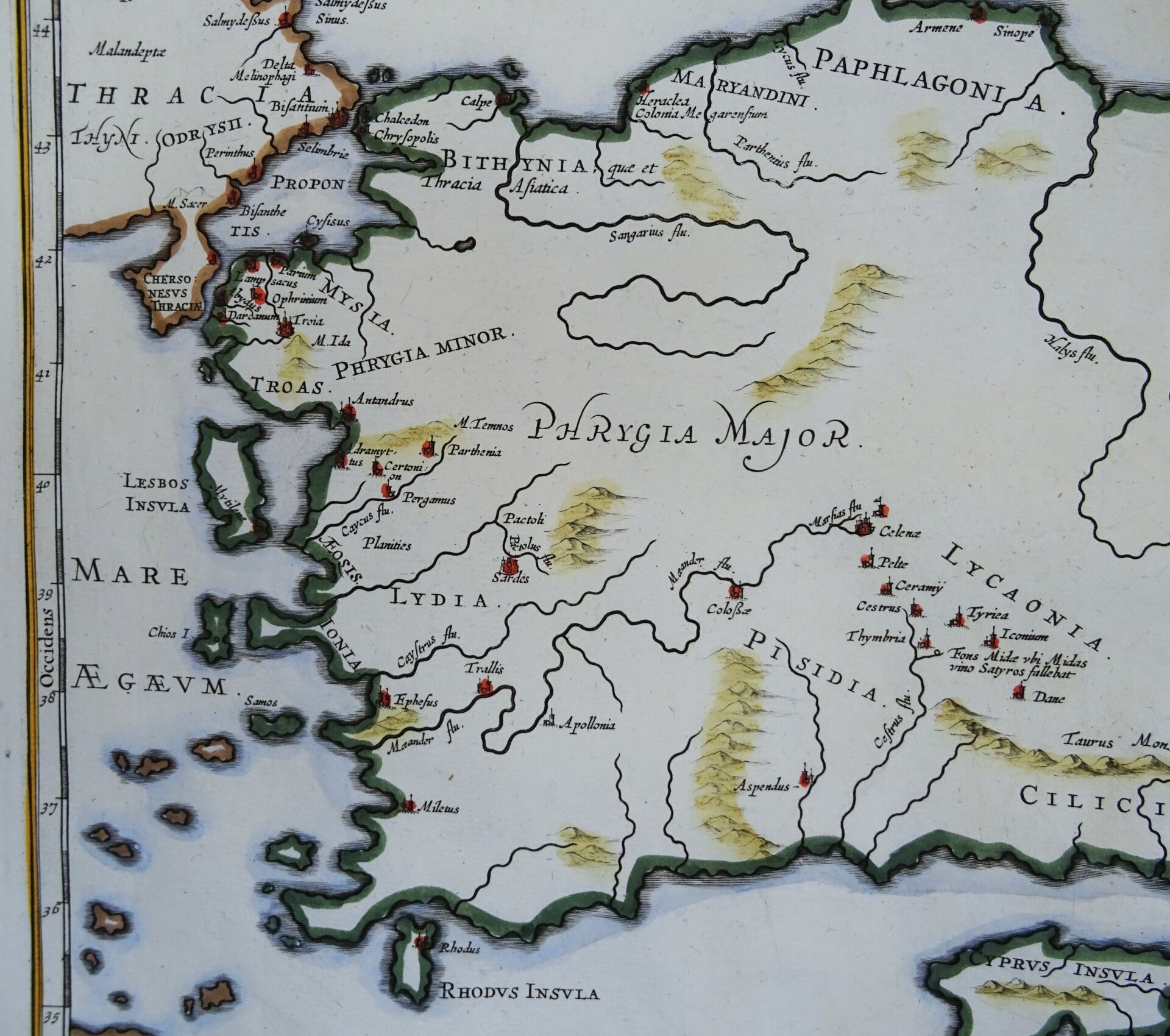
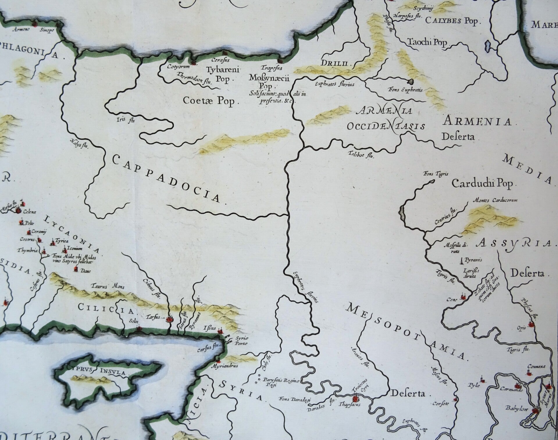
17th century arge folio sized copper engraved map of part of the ancient Persian empire covering modern day Turkey, Cyprus and part of the Middle East. It shows major settlements, regions, and mountain ranges, as well as the march of the Ten Thousand.
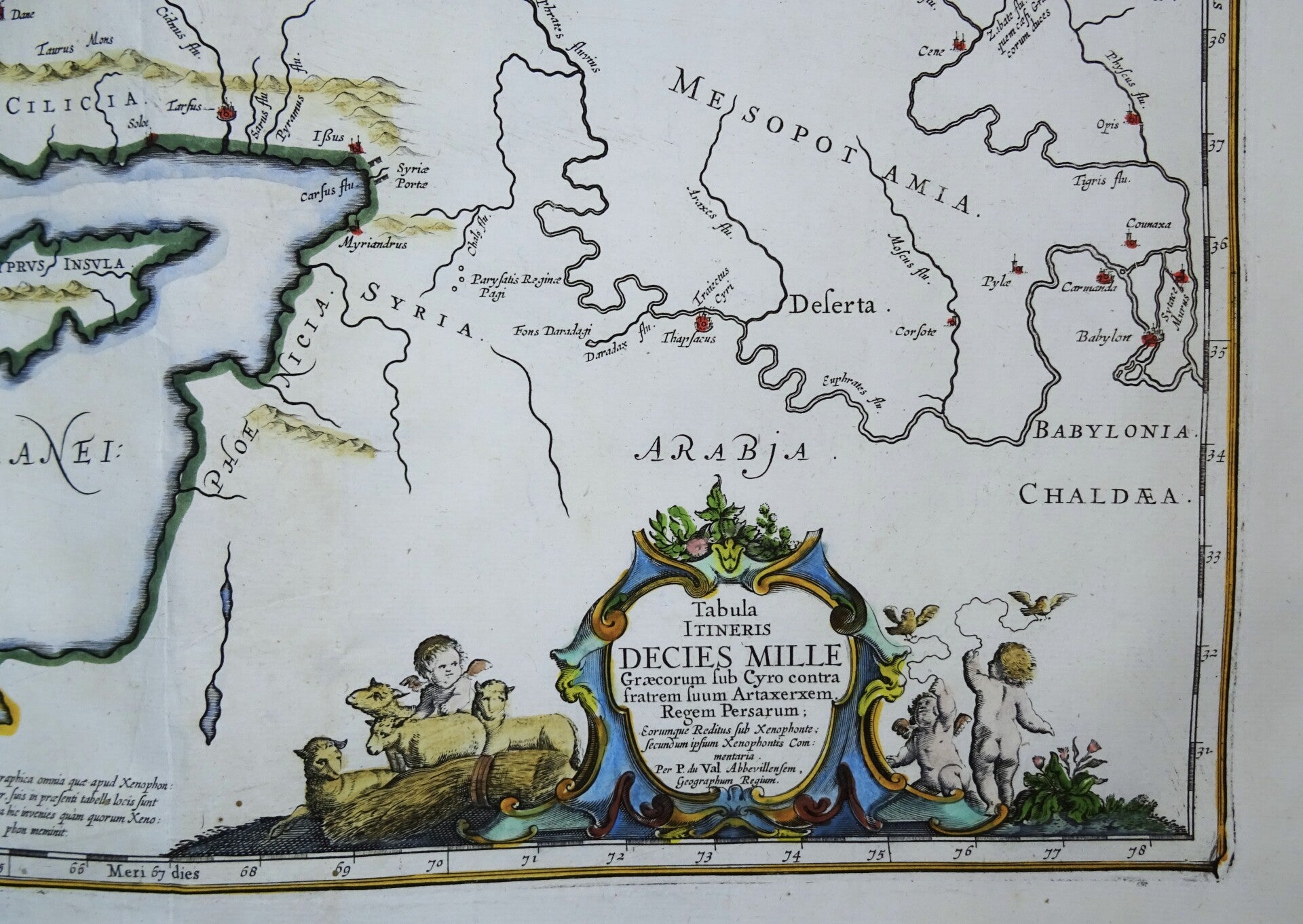
The Ten Thousand were a group of mercenary units, mainly Greek, drawn up by Cyrus the Younger to attempt to wrest the throne of the Persian Empire from his brother, Artaxerxes II.
Their march to the Battle of Cunaxa and back to Greece (401 BC-399 BC) was recorded by Xenophon (one of its leaders) in his work, The Anabasis.
This map was compliled by the French cartographer Pierre du Val, and published in Jansson's Atlas of the Antique World, Accuratissima Orbis antiqui delineatio... which went through several editions 1652-1741.
Engraved by master engraver: J.van den Ende, published around 1650 by Johannes Janssonius in Amsterdam
Very good condition
Image 41,5x49.5cm, sheet 50x60cm