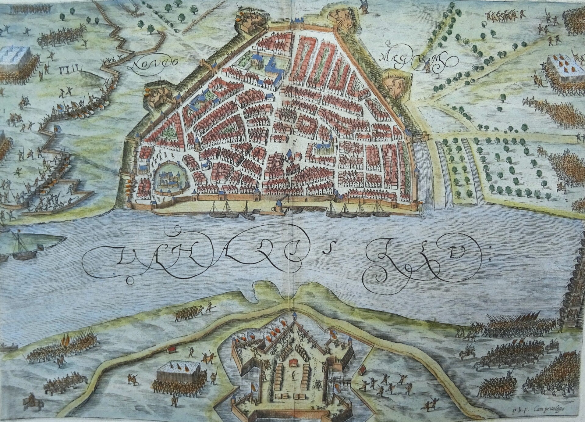
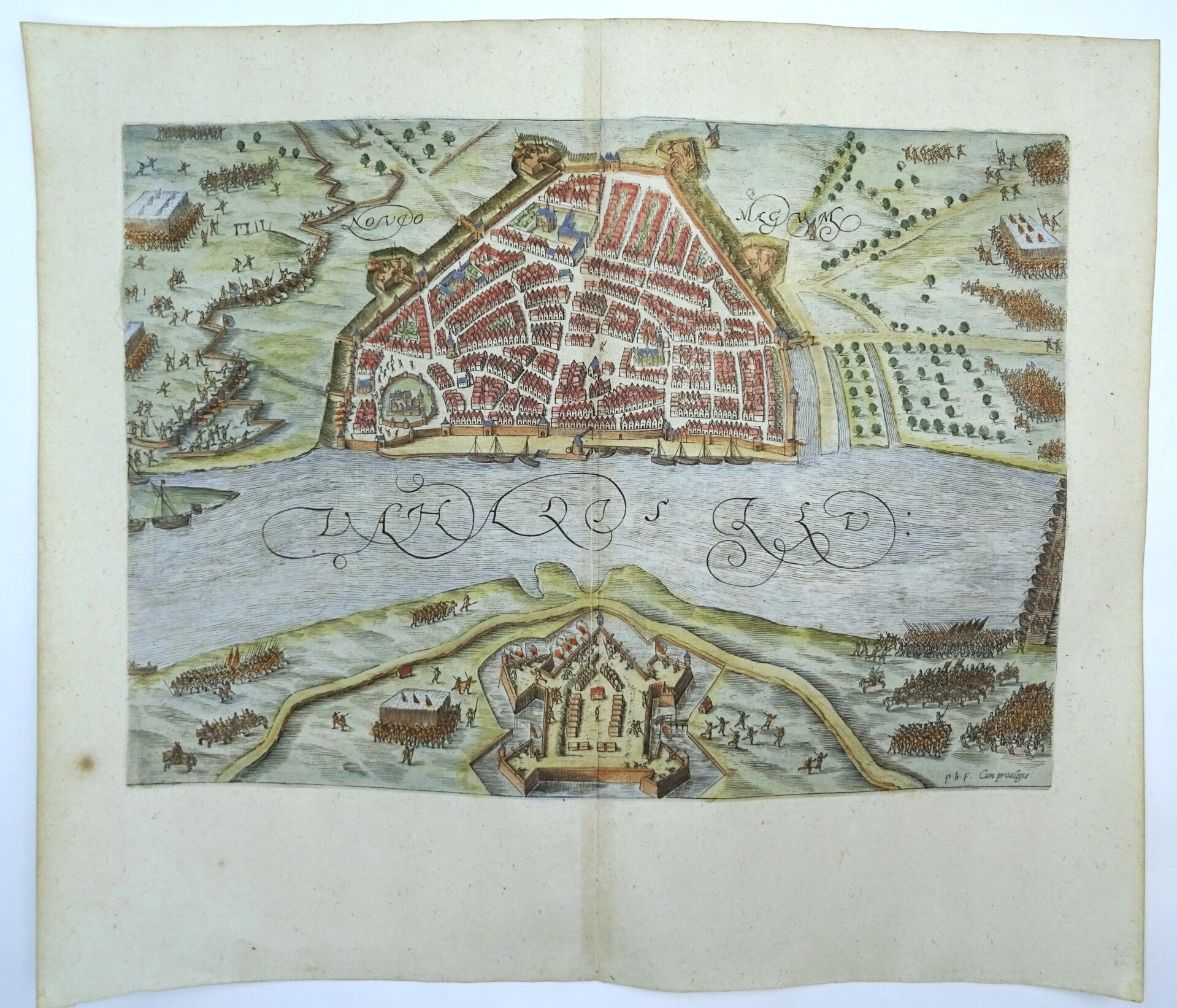
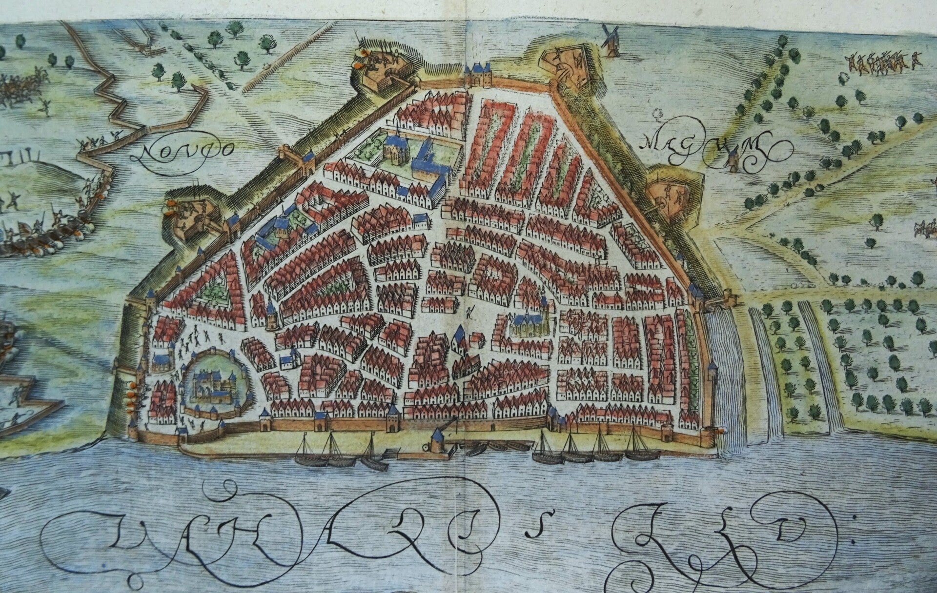
Netherlands, Nijmegen, Knotsenburg Orlers, 1610, Novio Magum

€139.00
Item number:
25 16 D
Map in bird´s eye perspective of the Siege of Nijmegen (under Spanish control) in 1590-1591 by the Dutch troops of Prince Maurice (Maurits). The siege lasted from May 1590 until October 1591. The map shows Nijmegen with the Waal River and Fort Knotsenburg from which Maurice ordered the city to be shelled.
Published in 1610 in Leiden (Netherlands) by J.J. Orlers in ´Den Nassauschen Lauren-Crans: Beschrijvinghe ende af-beeldinge van alle de victorien ... die Godt Almachtich de ... Staten der Vereenichde Nederlanden verleent heeft, deur het wijs ende clouck beleyt des Hooch-ghebooren Fursts Maurits van Nassau´
Excellent condition
Image 23x31,5cm, page 31,5x37cm