Spain, Madrid, Extremadura, Castilla la Mancha Zatta, 1776, L'Estremadura e la Castiglia Nuova...
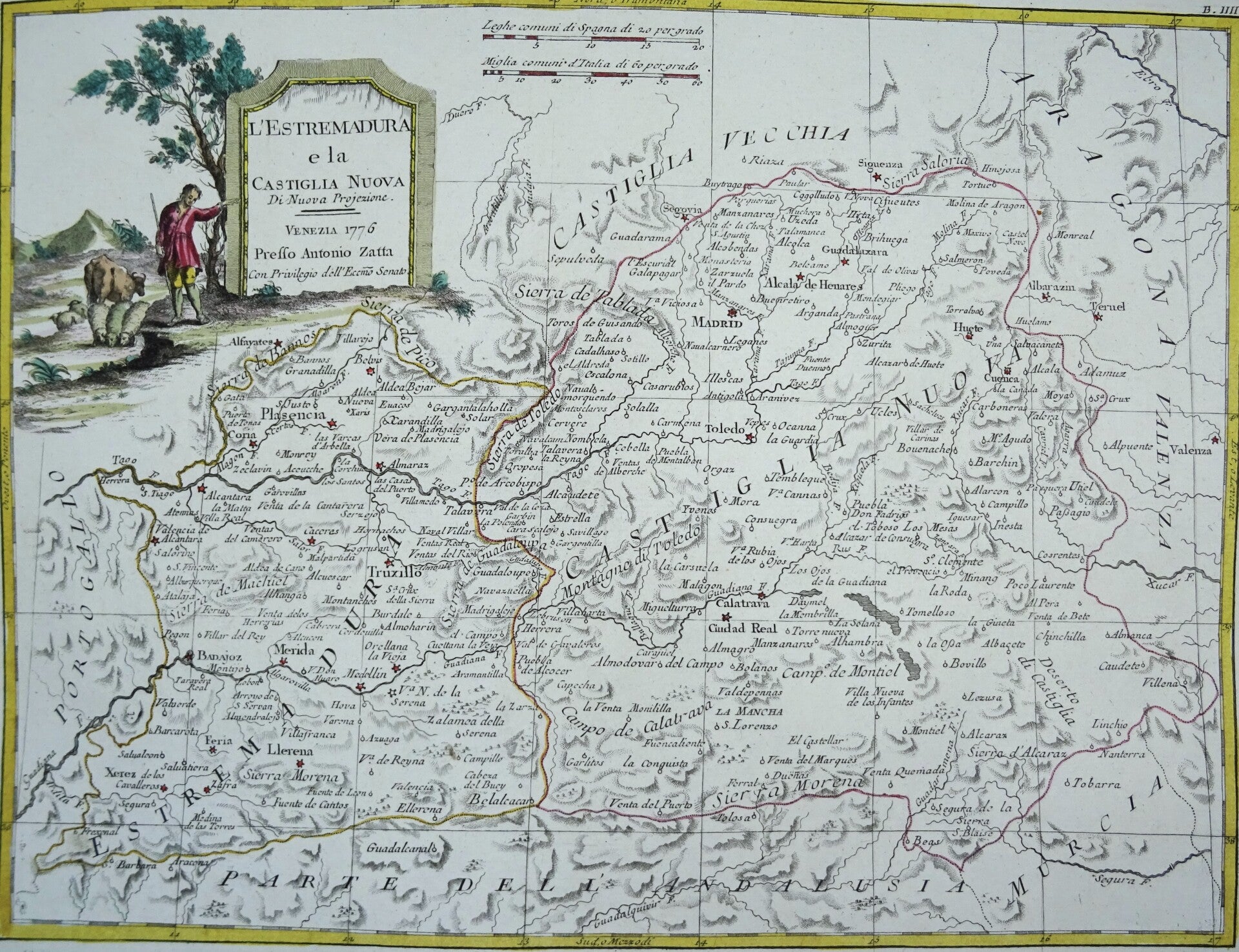

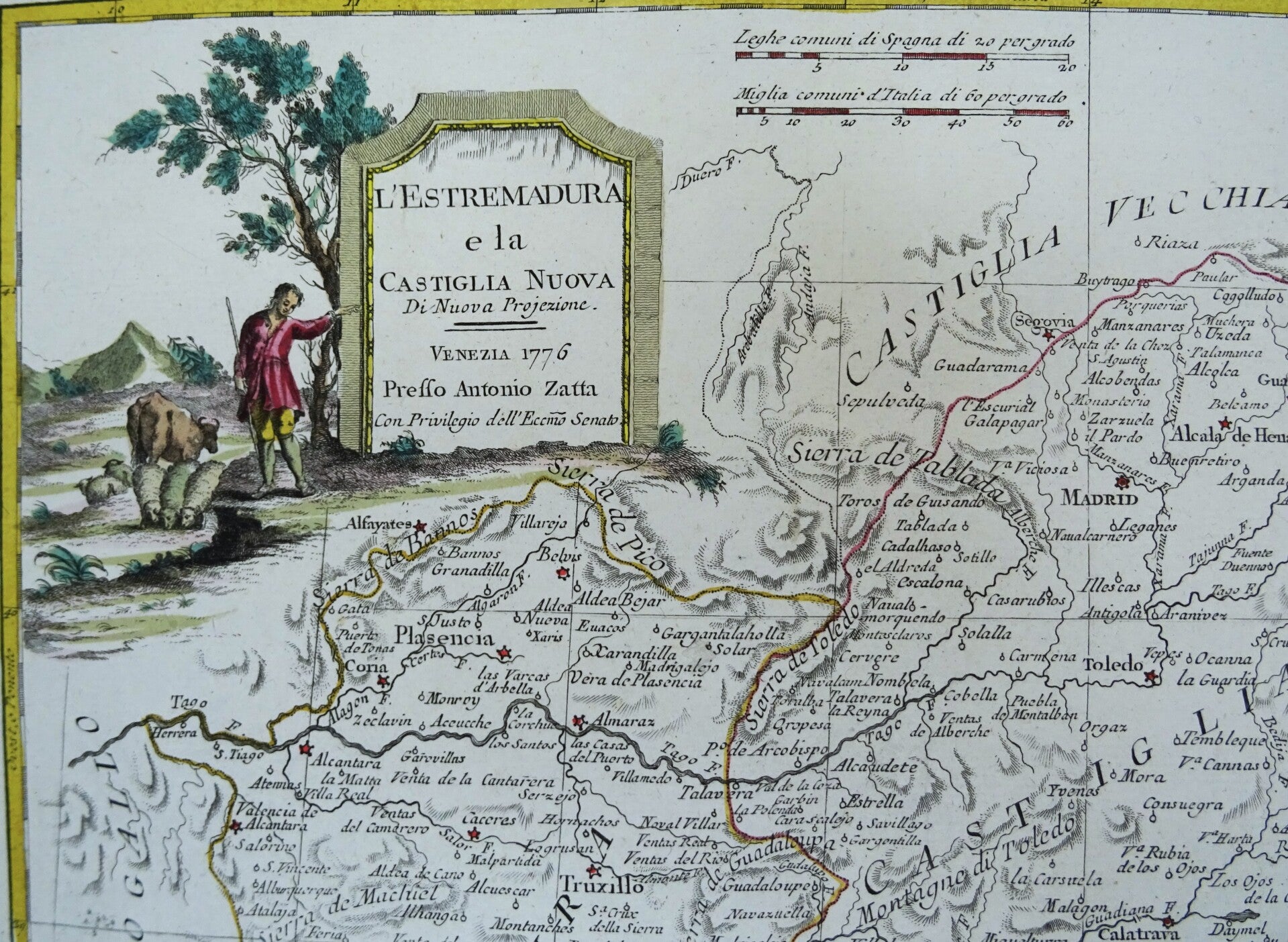


Copperplate map by the Italian cartographer Antonio Zatta. It comes from the work, “Atlante novissimo, ilustrato e accresciuto”, published in four volumes between 1775 and 1785 in Venice with some 240 maps engraved by G. Pitteri, G.V. Pasquali, and G. Zuliani. It shows Extremadura and New Castile (Spain) and their bordering areas: Portugal, Old Castile, Aragon, Valencia, and Andalusia. A highly ornate and decorative map, it has a beautiful vignette in the upper left corner with a rural scene of a shepherd with his flock, pointing to a large stone plaque on which we can read the title of the engraving, the name of the publisher, the date, and the city where it was published. To its right, we can see the scale, also expressed in leagues of Spain and Italy. Frame with meridians and parallels marked to 1°. Cardinal points indicated. Relief represented by shaded contour lines, with the main geographical features and numerous place names. Planimetry with cities represented by small circles or stars and administrative boundaries by colored lines. Hydrography depicts the main river network, with the names of the most important rivers. Text in Italian and Spanish.
Excellent condition. Original colors. Strong paper.
Image 28x37cm, sheet 35.5x43cm