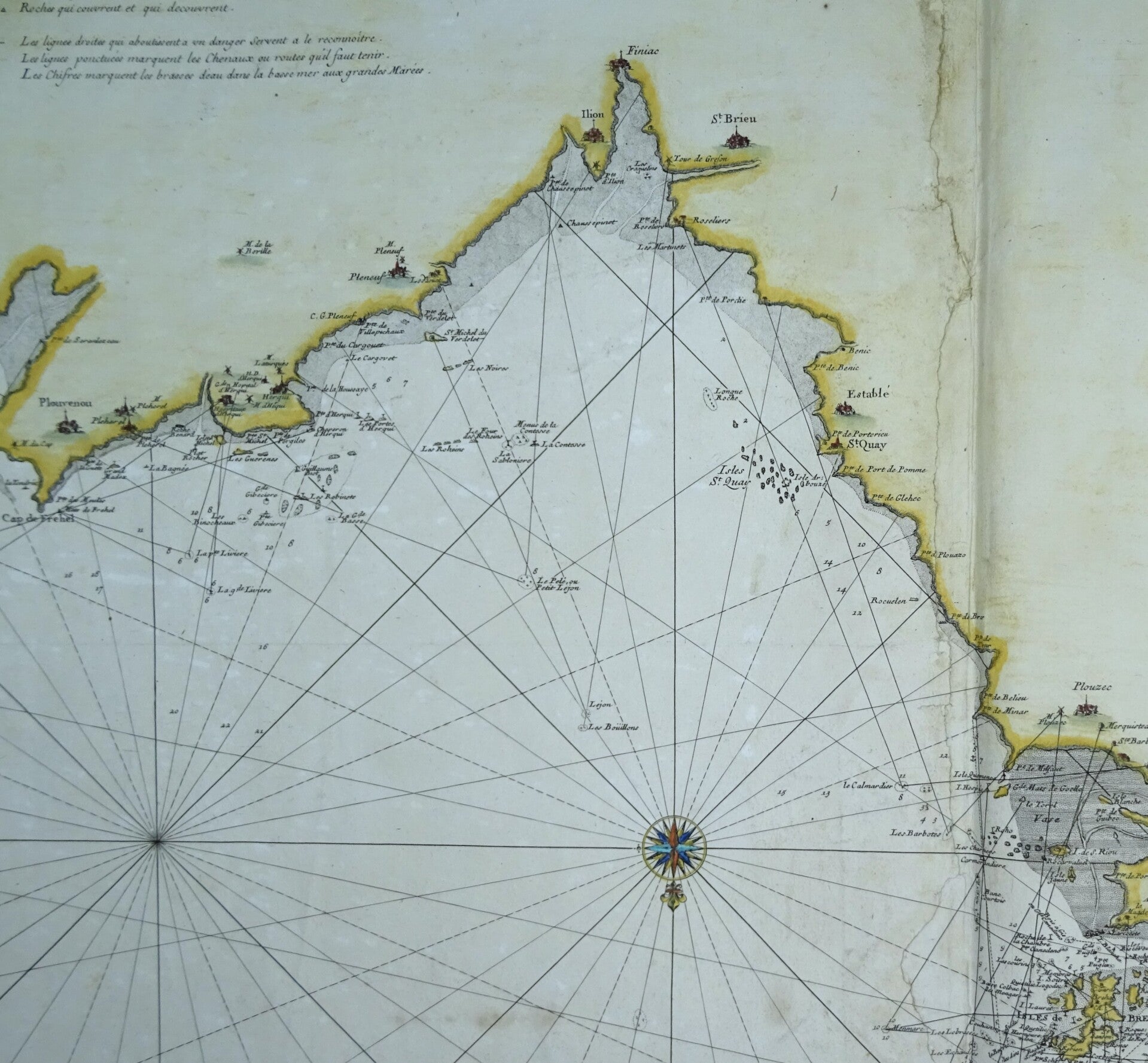
France, Bretagne, Cap Fréhel,l'île de Tome ... Alexis-Hubert Jaillot, 1693, 2me Carte Particuliere des costes de Bretagne depuis le cap de Frehel jusques a Perros et l'isle Tomé 1693


€69.00
Item number:
23 87 EQ
Large nautical chart of the north coast of Brittany. It is oriented with north (the English Channel) at the bottom. It depicts the coast from Cap Fréhel in the west to the town of Perros-Guirec, including the Île de Tome.
This chart is taken from the French nautical atlas "Le Neptune François".
Fair/Poor condition. Several significant repairs also affect the image. See photos. Nevertheless, a very interesting chart, printed on thick paper.
Image 56.5 x 79.5 cm, sheet 64 x 89 cm