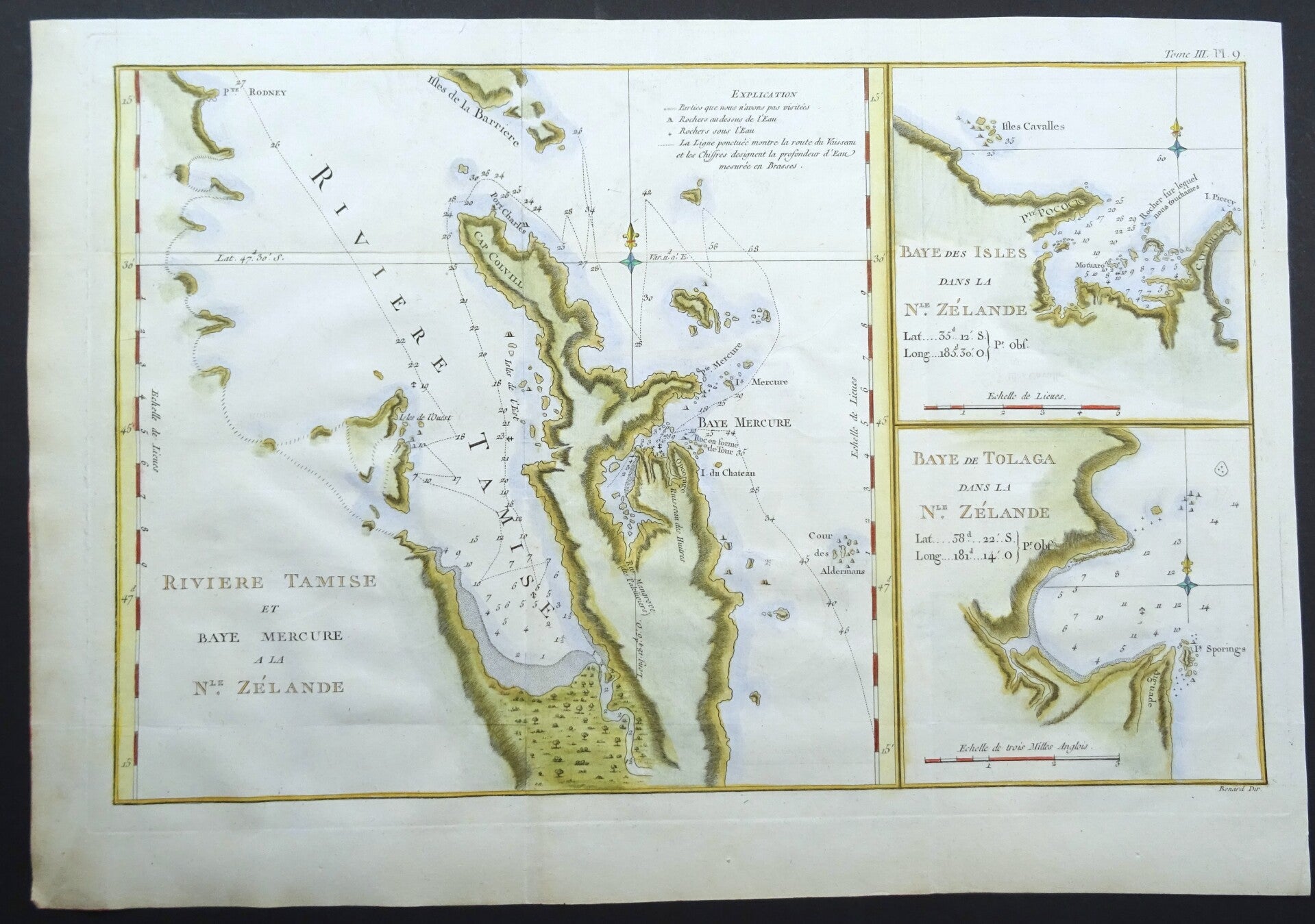
New Zealand, Auckland, Mercury Bay, Hauraki Gulf, Tologa Bay James Cook, 1774, Riviere Tamise et Baye Mercure a la Nle. Zelande / Baye des Isles dans la Nle. Zelande / Baye....


€89.00
Item number:
24 31 AP
This sheet presents three early maps from the explorations of Capt. Cook in New Zealand. The main chart depicts Cook’s discoveries of Mercury Bay and the Hauraki Bay at Auckland, New Zealand with soundings, anchorages, and other navigational data. The two smaller charts show ‘Pte. Pocock’, just north of Whangarei, and ‘Baye de Tolaga’, north of Gisborne.
This map was engraved by Robert Bénard for the 1774 French edition of Hawkesworth's 1773 account of Cook's voyages.
It follows the 1772-1773 English edition engraved by William Whitchurch and published in 1773.
Excellent condition
Image 27x43cm, page 33x48cm