Africa, set of 2 maps L. C. Desnos / M. Brion, 1766, Partie de l´Afrique 2x
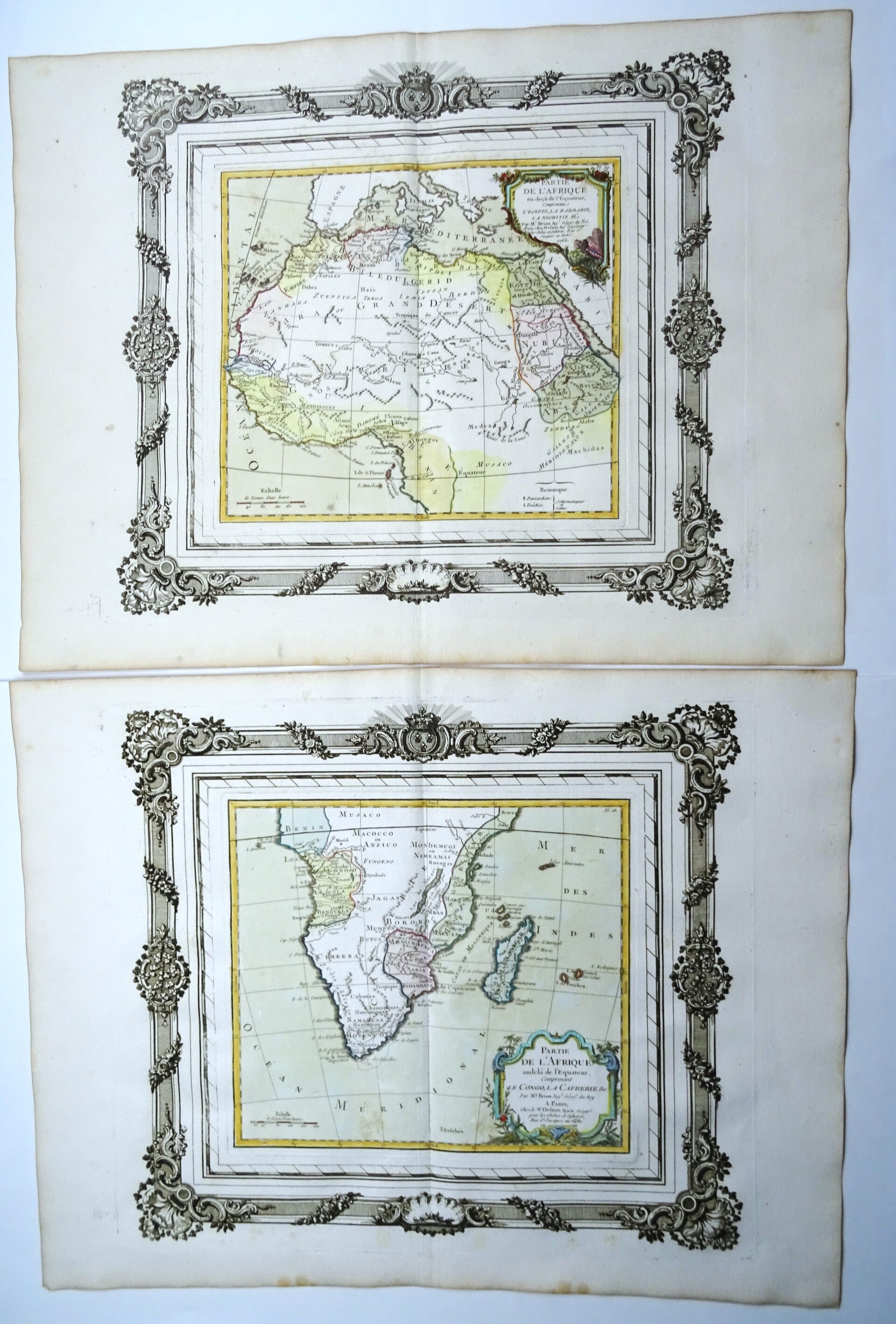


Set of two matching folio sized maps, made by Brion de la Tour, of the North and South of Africa. Decorated with a detailed cartouche. This is the first edition of this famous map.
The map is printed in a decorative frame and in orginal coloring. Dated 1766, published in 1767.
Published in ´Atlas général, civil et ecclésiastique, méthodique et élémentaire pour l'étude de la géographie et de l'histoire / Chez le sieur Desnos à Paris, 1767
Louis Brion De La Tour (fl 1756-1803)
Beyond the fact that Brion was an engineer by profession and held the post of Ingenieur-Geographe du Roi, little is known of his career. He published a wide range of statistical works and a number of atlases, published by the well known French mapmaker Louis Charles Desnos (1725-1805).
Excellent condition. Thick paper. Clear print. Original coloring. Ample margins. Reverse side blank.
Images 35x39cm, sheets 40x52,5cm