The Netherlands, Brabant, Eindhoven, Den Bosch, Helmond, J. le Roy / W. Blaeu, 1705, Quarta Pars Brabantiae cujus caput Sylvaducis


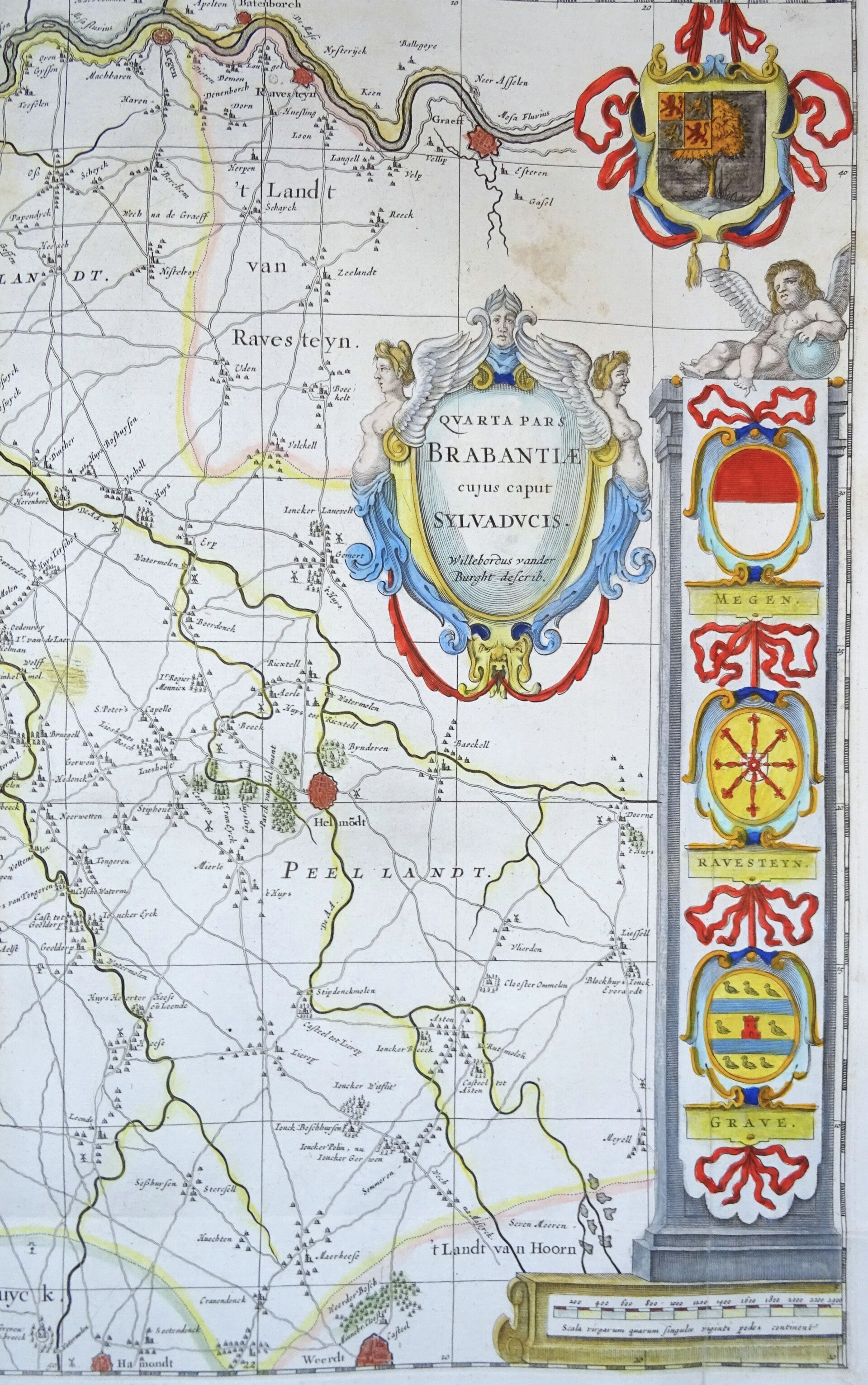


Early 18th-century folio-sized map of eastern North Brabant in the Netherlands. Beautifully decorated with a title cartouche and coats of arms on the sides. The map shows eastern North Brabant with Eindhoven in the center. The coat of arms of Brabant is in the upper left; the coat of arms of 's-Hertogenbosch is in the upper right. On either side of the map is a column crowned with a putto and standing on a base containing the scale bars. The coats of arms of the most important towns are displayed within the columns.
The first edition of this map was published in Amsterdam by W. Blaeu in 1636. This late edition was published in "Brabantia illustrata, continens accuratissimam omnium castellorum et prætoriorium nobilium Brabantiæ, nec non celebrium coenobiorum ... descriptionem" - Illustrated Brabant, with an exact description of all the castles and manors of Brabant - Glorified Brabant / The establishment of all lands, lordships, and titled families of Brabant Leiden - Amsterdam - The Hague D. van den Daelen - A. van Damme - E. Boucquet 1705, Jacques Le Roy
Image 41x52cm, page 42.5x55cm
Good condition, light water stains in the upper half of the map. Some repairs and reinforcements on the back. Folds as published. All in all, a very decorative copy of this remarkable map.