Ukraine, Kiev, J. Blaeu, 1662/1680, Ukrainae pars quae Kiovia Palatinatus

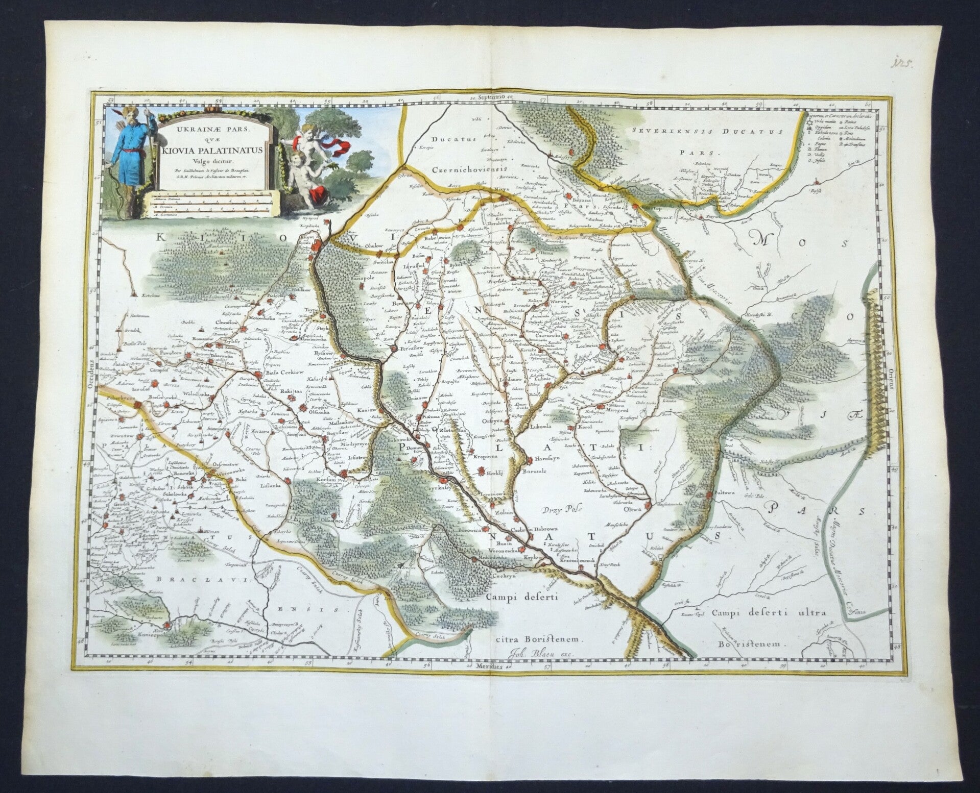
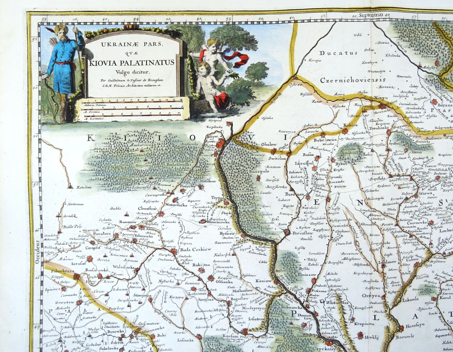
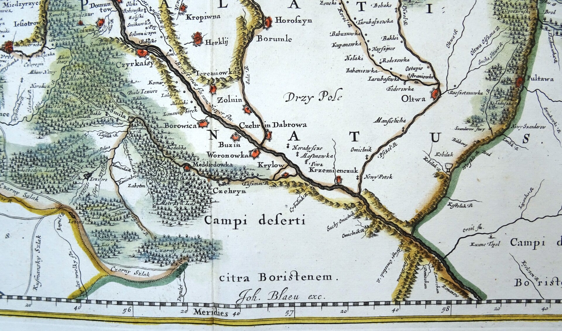
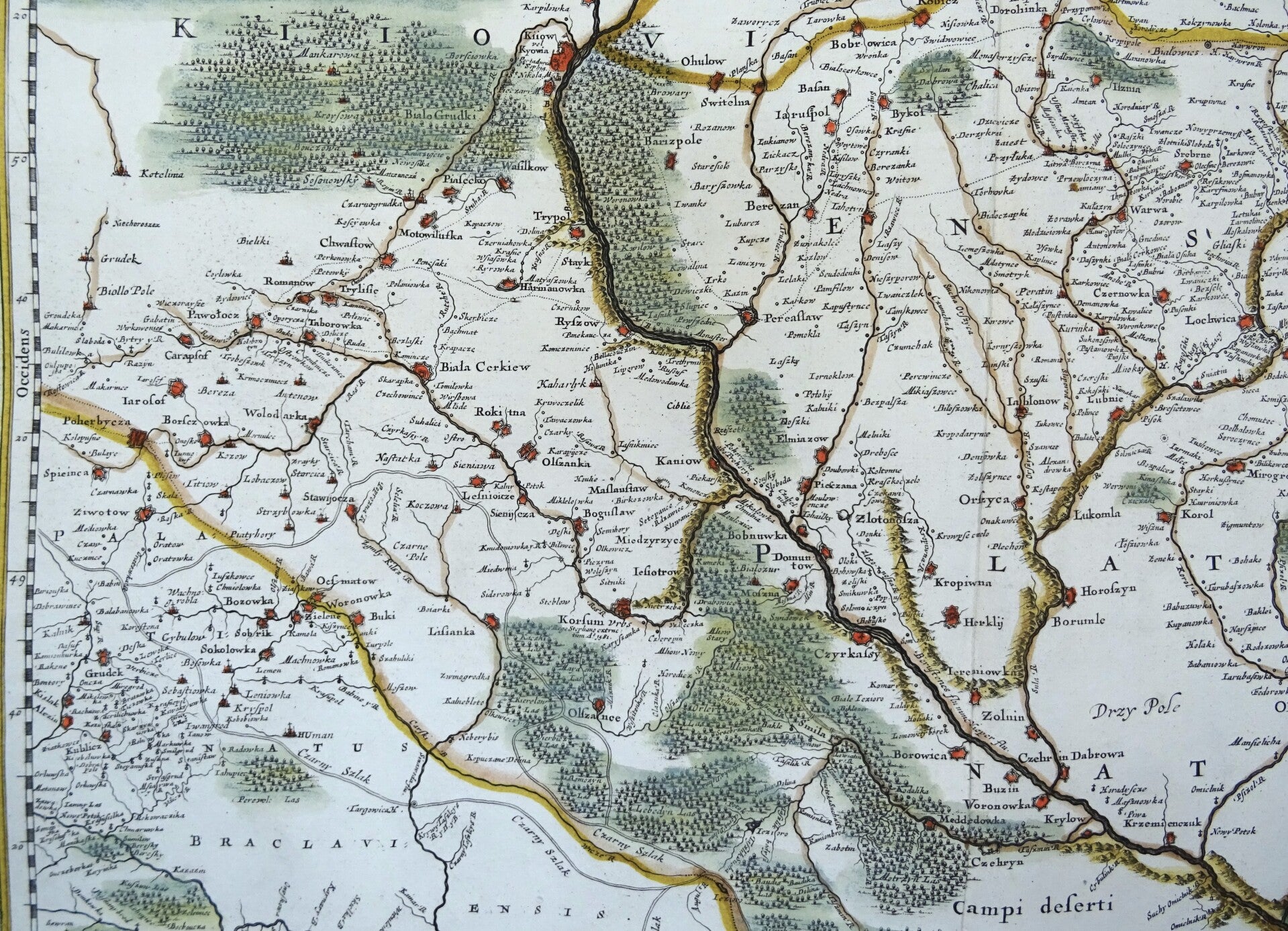
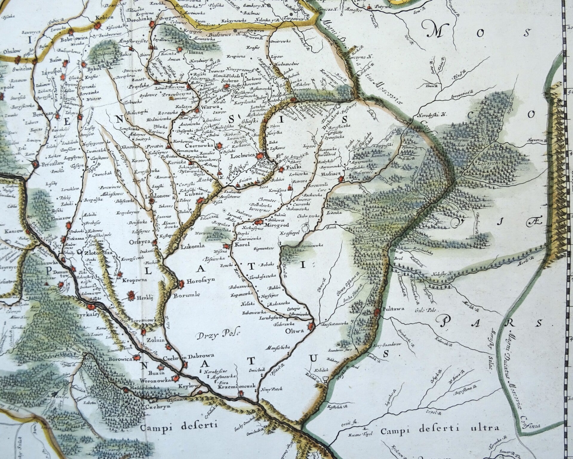
Image 40,5x46,5cm, sheet 52,5x63cm
This is a very scarce Joan Blaeu map of the Kiev region of Ukraine and vicinity. Signature of Joan Blaeu in the lower part of the map. This map was originally based on Guillaume le Vasseur de Beauplan’s map. Beauplan, commissioned by the King of Poland (Wladyslaw IV Vasa), produced detailed maps of the Ukraine, based on his surveys. Later, Joan Blaeu created four maps of Ukraine based on Beauplan’s work detailing the regions of Pokuttya, Podillya, Bratslavschyna and Kyiv. This is the first map in that series.
The map covers from the Carpathian Mountains east along the Dniester River east to Moldova. Includes parts of Poland including Krakow. The entire map is depicted in extraordinary detail, offering both topographical and political information, with forests and mountains beautifully rendered in profile.
The French military engineer Guillaume Le Vasseur de Beauplan (1595-1685), completed in the first half of the 17th century the extensive survey of the Ukraine commissioned by the king of Poland Władysław IV Vasa. Apart from the extensive map of the Ukraine which was finished in 1639, De Beauplan worked for a long time on a detailed map in six sheets that was only finished in 1651. Joan Blaeu (1598-1673) reduced the size of this map to a series of four separate maps. This is the first sheet of the series.
This map first appeared in the 1662 edition of Blaeu's Atlas Maior and is therefore quite scarce on the market. This is an edition of around 1680, without text on the back.
Joan, or Johannes, Blaeu (1596-1673) was the son of Willem Janszoon Blaeu. He inherited his father's meticulous and striking mapmaking style and continued the Blaeu workshop until it burned in 1672. After his father's death in 1638, Joan and his brother, Cornelis, took over their father's shop and Joan took on his work as hydrographer to the Dutch East India Company.
Joan also modified and greatly expanded his father's Atlas novus, first published in 1635. All the while, Joan was honing his own atlas. He published the Atlas maior between 1662 and 1672. It is one of the most sought-after atlases by collectors and institutions today due to the attention to the detail, quality, and beauty of the maps.
Excellent condition