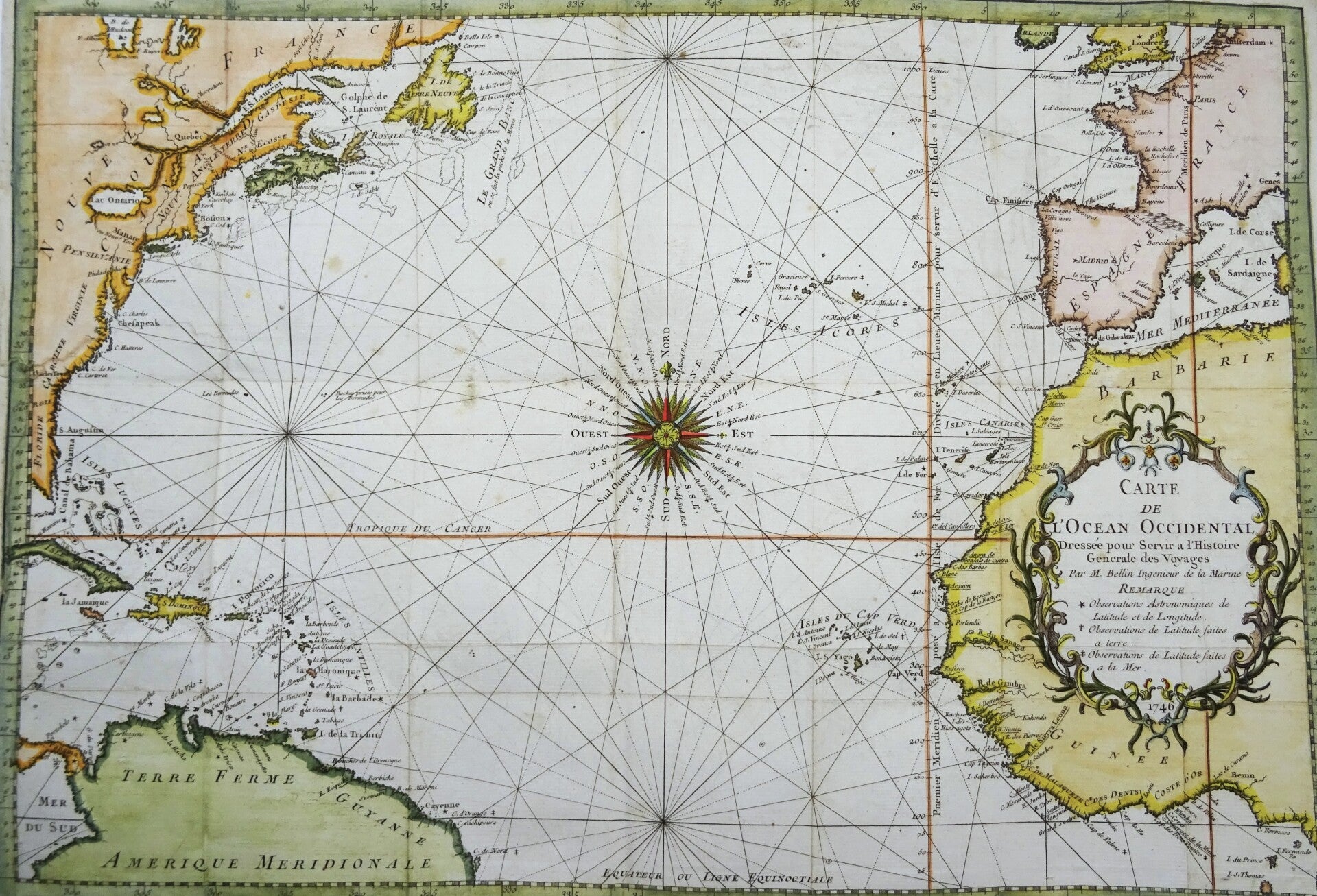
Atlantic Ocean, Africa, America, Europe, USA, Canada… Bellin, 1746, Carte de l´Ocean Occidental…


€119.00
Item number:
26 15 C
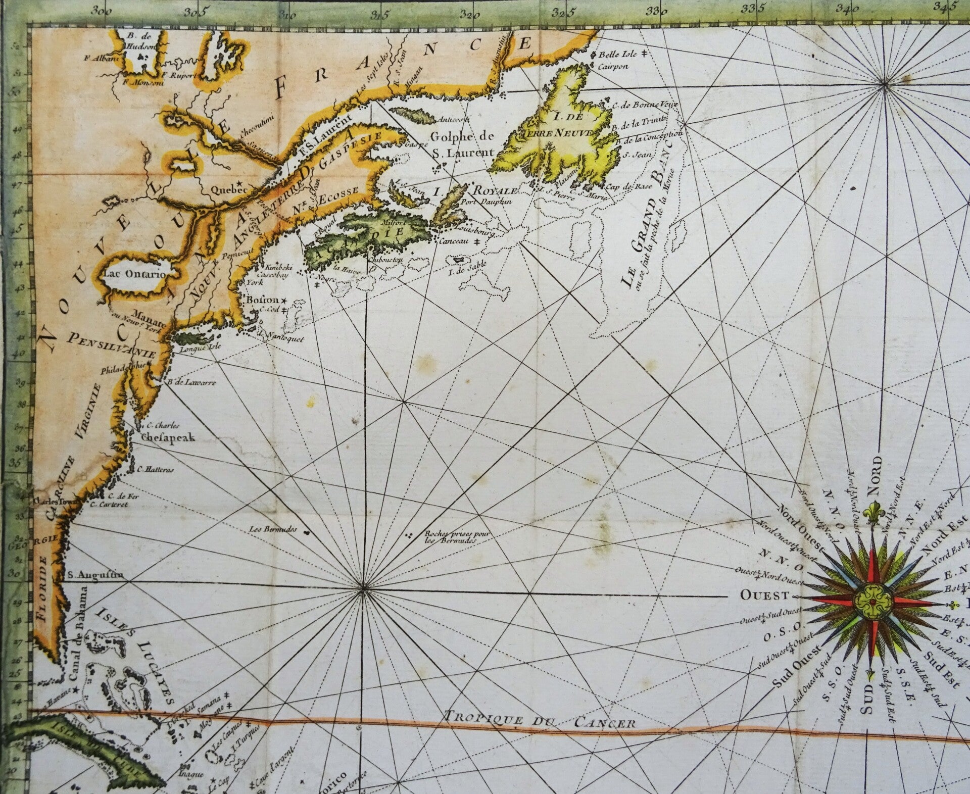
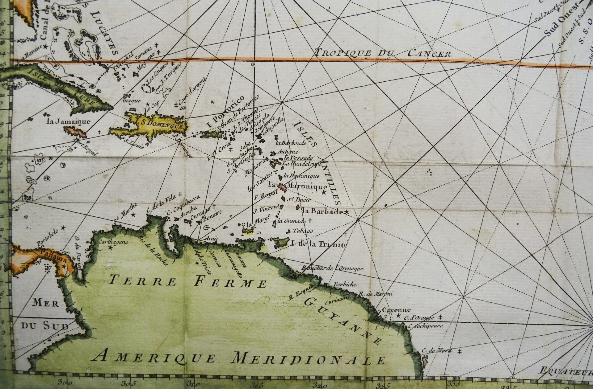
A chart by J.N. Bellin of the northern part of the Atlantic Ocean Europe and West Africa on the right hand side, and the north of South America, the Caribbean Sea and the East Coast of the US and Canada on the left.
Published in 1746 in Paris in ´Histoire generale des Voyages ou nouvelle collection de toutes les relations de voyages par mer et par terre´.
Good condition. Small repair in the upper left margin with minimal impact on the image. Left margin extended with antique paper. Otherwise excellent. Folds as published.
Image 34,5 x 45,5cm, on page of 35 x 48cm