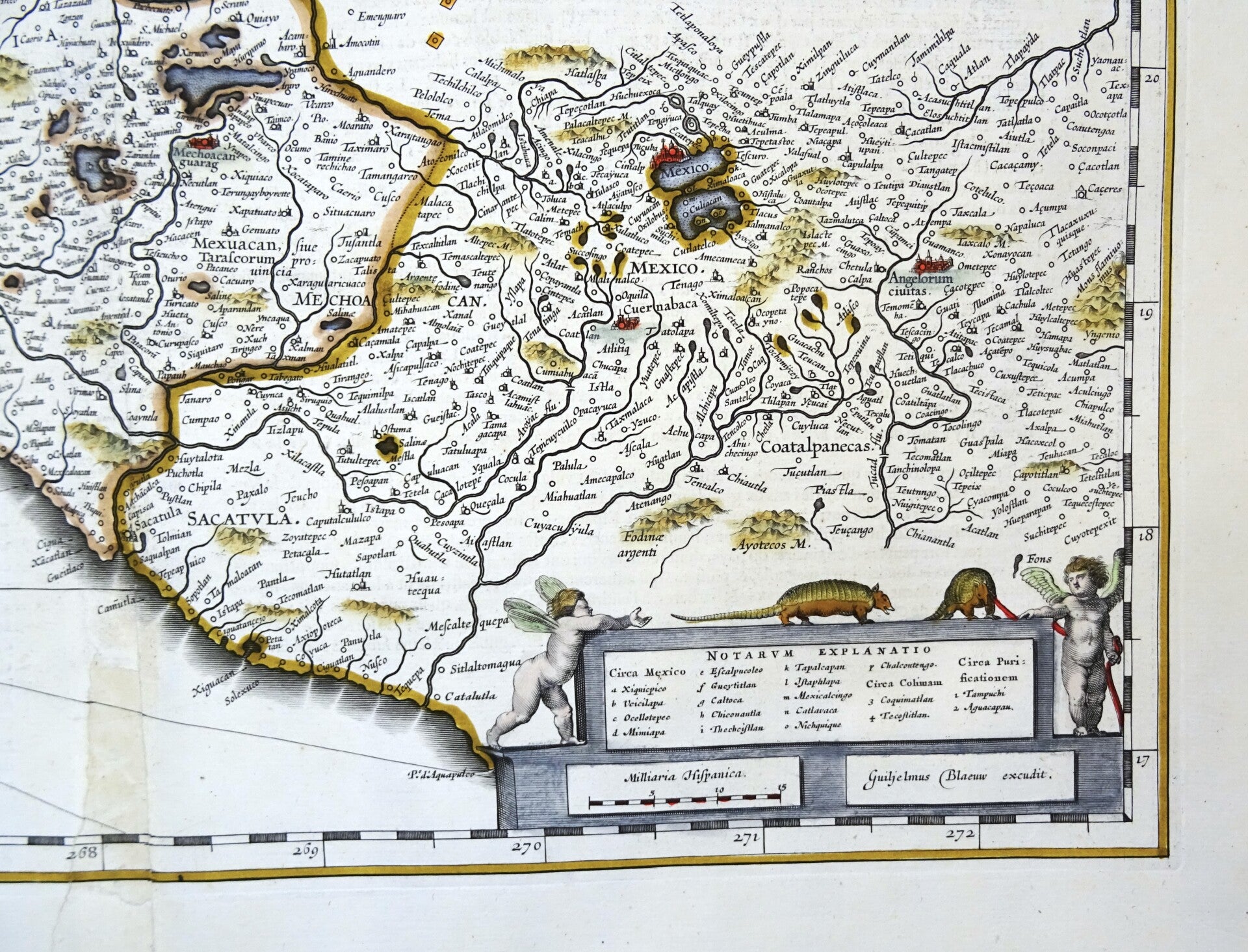
Mexico, W. Blaeu, 1635, Nova Hispania et Nova Galicia
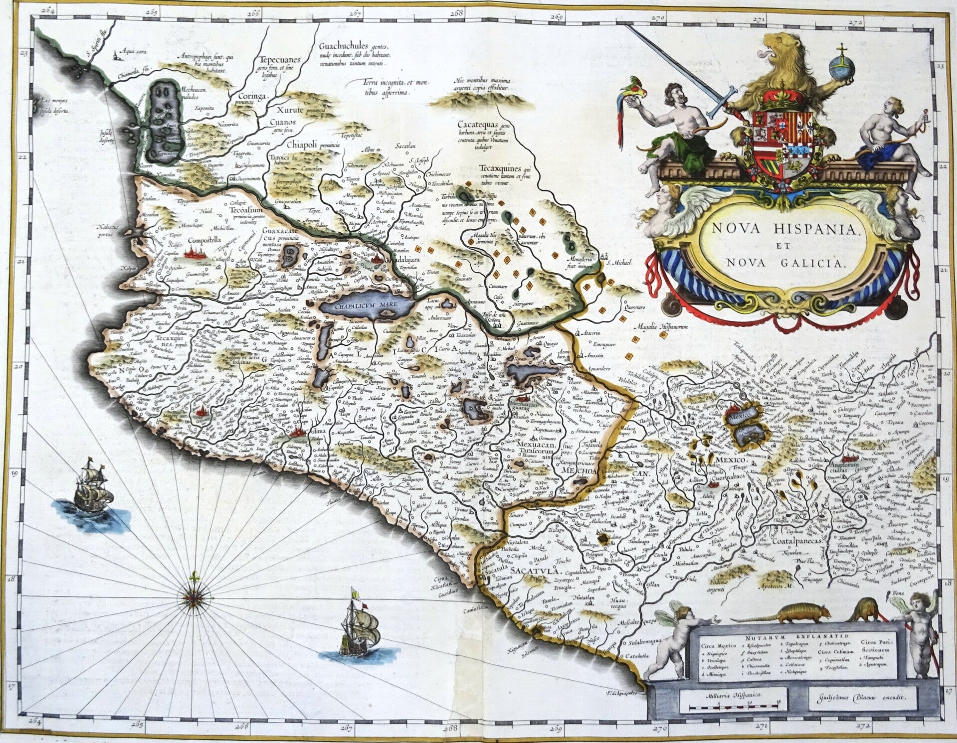


Beautiful 17th century map of the Western part of Mexico showing the coast of the Pacific Ocean. Published by W. and J. Blaeu in 1635 in Amsterdam in the French edition of their first large atlas (Atlas Novus).
This beautiful map of Mexico is decorated with a very large title-cartouche with the coat-of-arms of the king of Spain, another cartouche and two ships and a compass-rose in the sea part.
It is based on Hondius' map of 1606, which itself derives from Ortelius' 1579 map. Mexico City is situated on a large lake.
Several gold and silver mines are located in the central region with a diamond shaped icon. A central mountain range has a Latin note that there are large amounts of silver to be found there.
Good condition. A small repair in the lower part of the central fold, with some minor age browning. Otherwise excellent. Wide margins, reverse side text in French.
Image 38,5x49,5cm, sheet 49x57cm