Middle East, Paradise, Holy land... Romeyn de Hooghe, 1705, Orbis per Creationem Institutus….

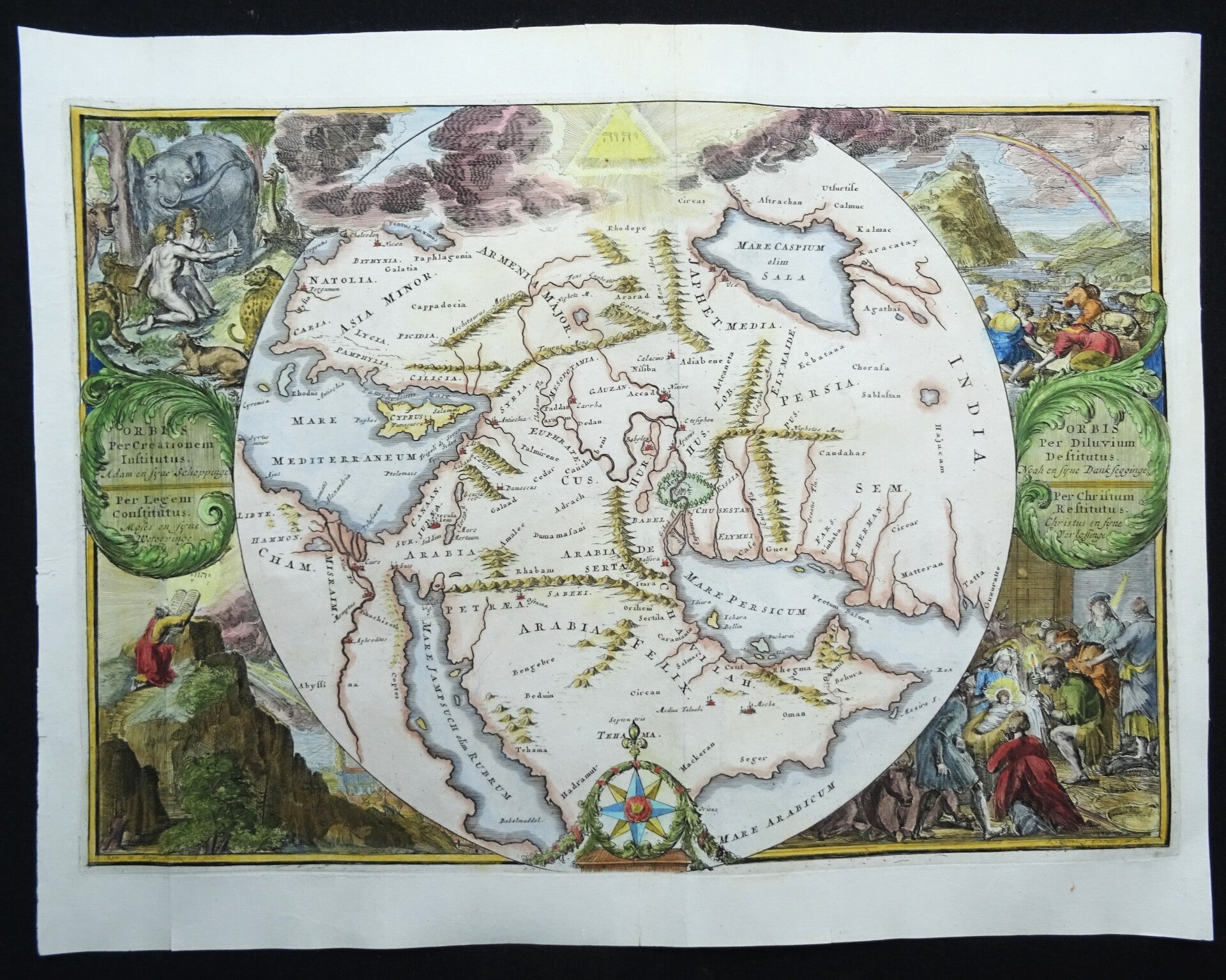


A remarkable 1705 copper engraved map of the Biblical lands by Romeyn de Hooghe. Centered on Babylon, then thought to be the center of creation, the map extends from the Bosporus to the Arabian Sea and from the Nile valley to the Caspian Sea. It names important Biblical locations including, but not l imited to, Jerusalem, Cairo, Memphis, Antioch, Aden, Damascus, Nineveh, Medina, and more.
By far this map' s most sticking feature is i ts extraordinary decorative surround. The map is surmounted by Tetragrammaton set in glowing pyramid. The Biblical scenes, from upper left, includes the Garden of Eden, Noah' s Ark following the Deluge, Moses receiving the ten commandments, and the birth of Jesus Christ in a Bethlehem manger.
This map was issued for Jacobus and Aleywn Basnage, T' groot waerelds tefereel , a r ichly i l lustrated Dutch prentbijbel published by Jacob Lindenberg, between 1705 and 1715 . It was drawn and prepared by Romeyn de Hooghe.
Romeyn de Hooghe ( Septemer 10 , 1645 – June 10 , 1708 ) was a Dutch engraver, portrait artist, caricaturist, painter, and sculptor active in Amsterdam during the second half of the 17 th century and opening years of the 18 th century.
Ref: Laor, E., Maps of the Holy Land: Cartobibliography of Printed Maps, 1475 - 1900 , 341 . Poortman, Wilco C., Kaarten in Bijbels , # 154 .
Excellent condition
Image 32,5x37cm, page 38x51cm