Information
Welcome to the Mapminded blog! Here, we share interesting stories about cartography, historical maps and engravings, and the fascinating people who created them. Join us on a journey through history and artistry.
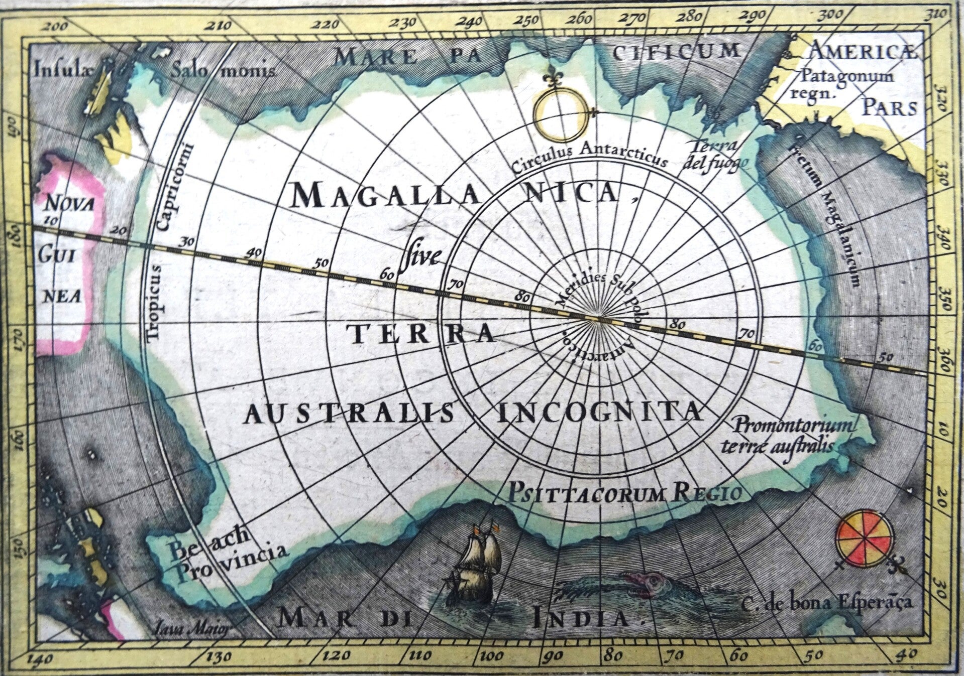
Maps of Unknown Areas
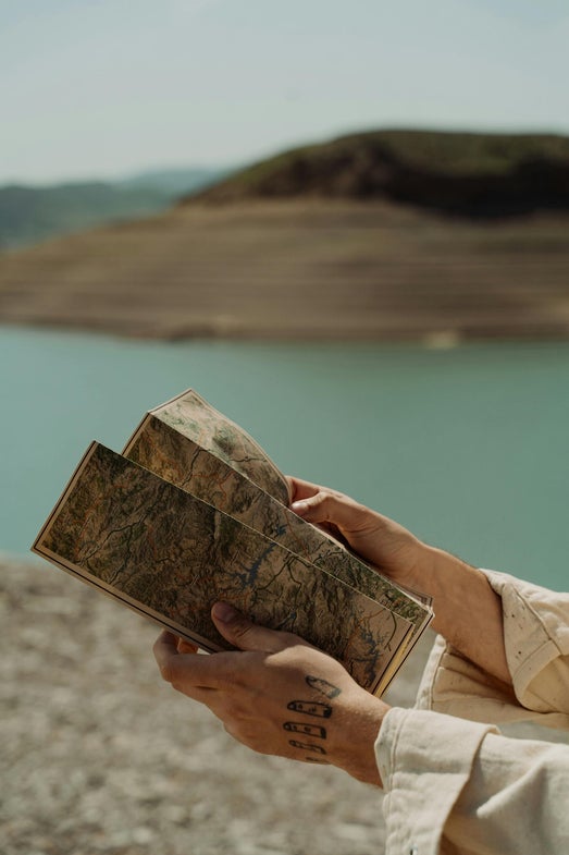
Dive into the intriguing world of early cartography, where uncharted territories fueled the imagination of mapmakers. Discover the stories behind the speculative coastlines, mythical islands, and fantastical creatures that adorned these historical documents. Perfect for collectors and those looking to add a conversation piece to their home.
The Hondius Family: Masters of 17th-Century Cartography
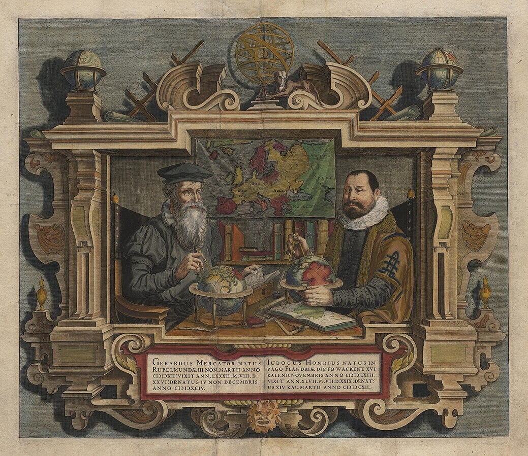
The 17th century was a golden age for cartography, and among the most influential figures of this period were members of the Hondius family. Originally from Ghent, the family moved to Amsterdam, which was rapidly becoming the center of mapmaking in Europe. Their work combined artistry, technical precision, and commercial vision, shaping how the world was seen and understood in an age of exploration.
The patriarch, Jodocus Hondius (1563–1612), is often credited with reviving the great atlas tradition. When Gerardus Mercator’s monumental Atlas struggled to find commercial success, Hondius acquired the plates and published a new, expanded edition in 1606. By adding his own maps and updating content with fresh geographic knowledge, he transformed Mercator’s atlas into a bestseller. This ensured Mercator’s projection and vision lived on, while also cementing Hondius’s reputation as one of the foremost cartographers of his time.
Hondius was not just a skilled geographer but also an engraver of remarkable talent. His maps stood out for their elegant ornamentation—ships sailing on vast seas, elaborate compass roses, and vivid depictions of animals and peoples in distant lands. These features made his maps not only practical tools but also works of art, coveted by scholars, merchants, and collectors alike.
After his death, the business passed to his sons Henricus (1597–1651) and Jodocus II (1594–1629), who continued expanding the family’s publishing empire. They issued further editions of the Atlas, often collaborating with other major figures such as Jan Janssonius. These collaborations blurred the lines between rival publishing houses, but also drove innovation and competition that enriched 17th-century cartography.
The Hondius family’s impact went beyond publishing atlases. They played a key role in the dissemination of geographic knowledge during an era when European nations were fiercely competing for global dominance. By making maps more accessible and visually compelling, they influenced not only navigation and trade but also the European imagination of the wider world.
Today, maps by the Hondius family are prized in collections and museums, valued as much for their historical significance as for their artistry. They remind us that maps are more than geographic records—they are cultural artifacts that reflect the ambitions, anxieties, and worldviews of their time.
The Hondius family’s legacy lies in their ability to merge science and art, commerce and knowledge. Their work helped define the cartographic standards of the 17th century and ensured that the age of exploration would be visually preserved for generations to come.

An Early Map of Sumatra
Uncover the historical significance and artistic beauty of an early map of Sumatra. Trace the evolution of geographical knowledge as you examine the details and depictions of this fascinating island. Perfect for collectors and those looking for a unique piece of history to display in their home.
Find Your Map
Discover the perfect genuine antique map or engraving to enrich your collection or add a touch of historical elegance to your home. At Mapminded, based in Madrid, Spain, we offer a curated selection of unique pieces that tell stories of the past. Explore our collection and find a map that speaks to you!