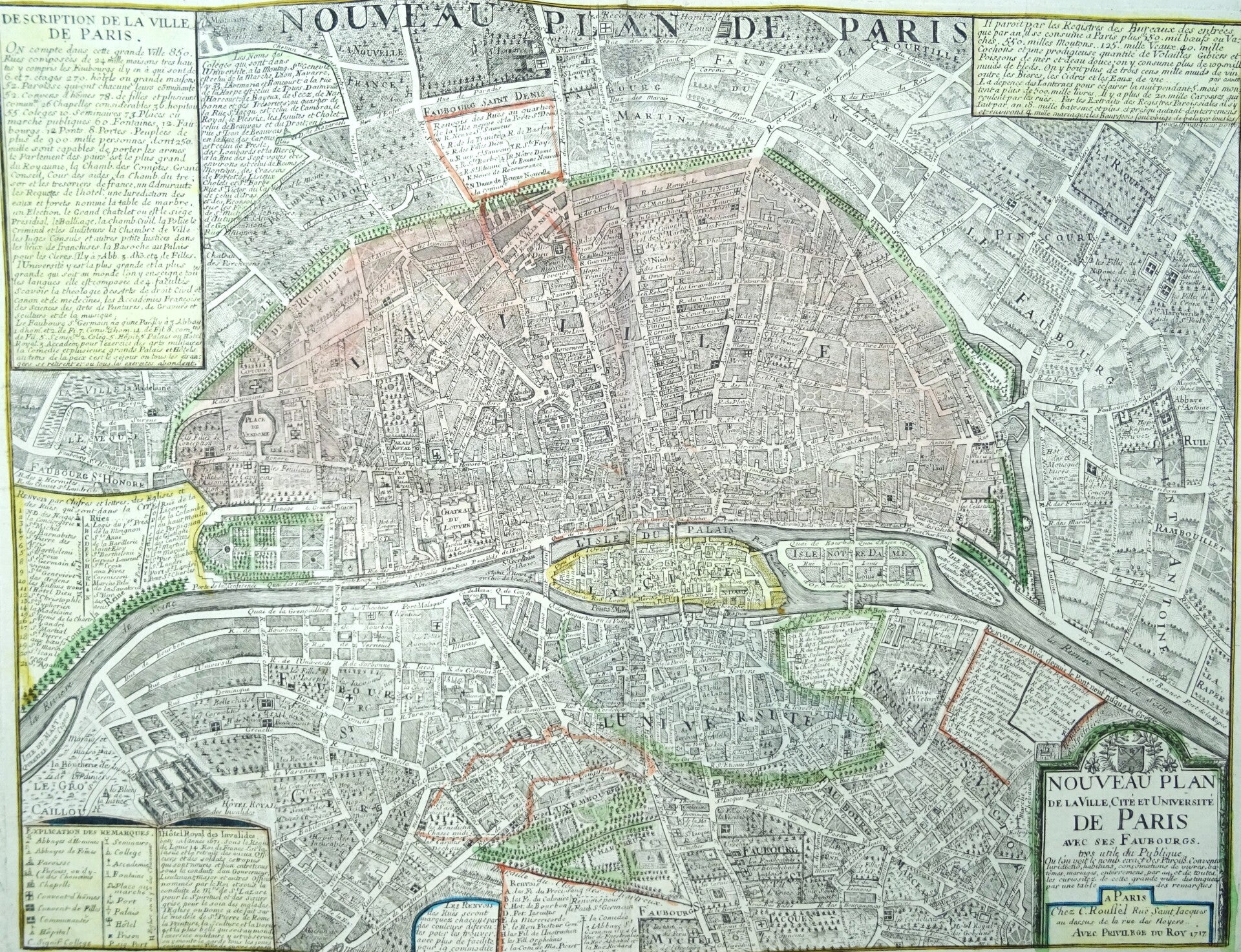
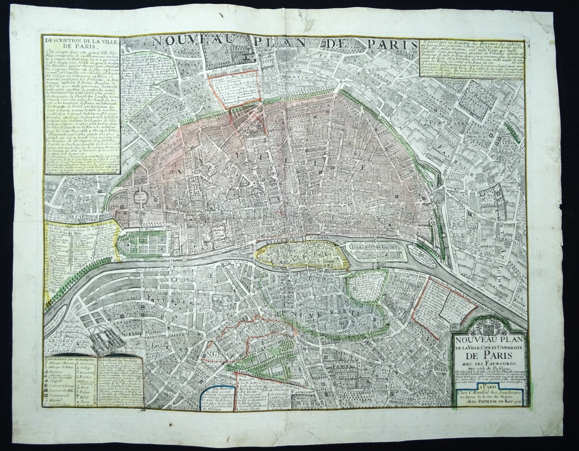
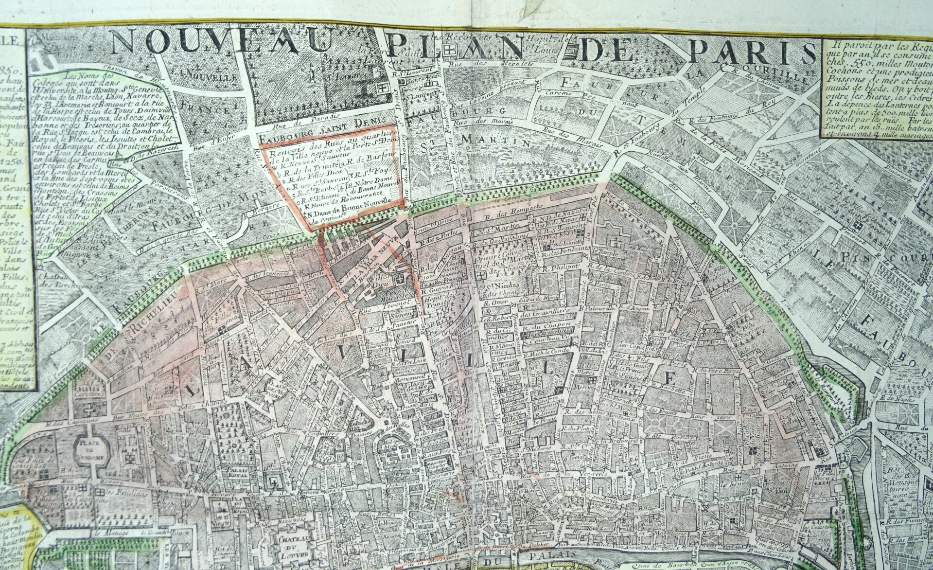
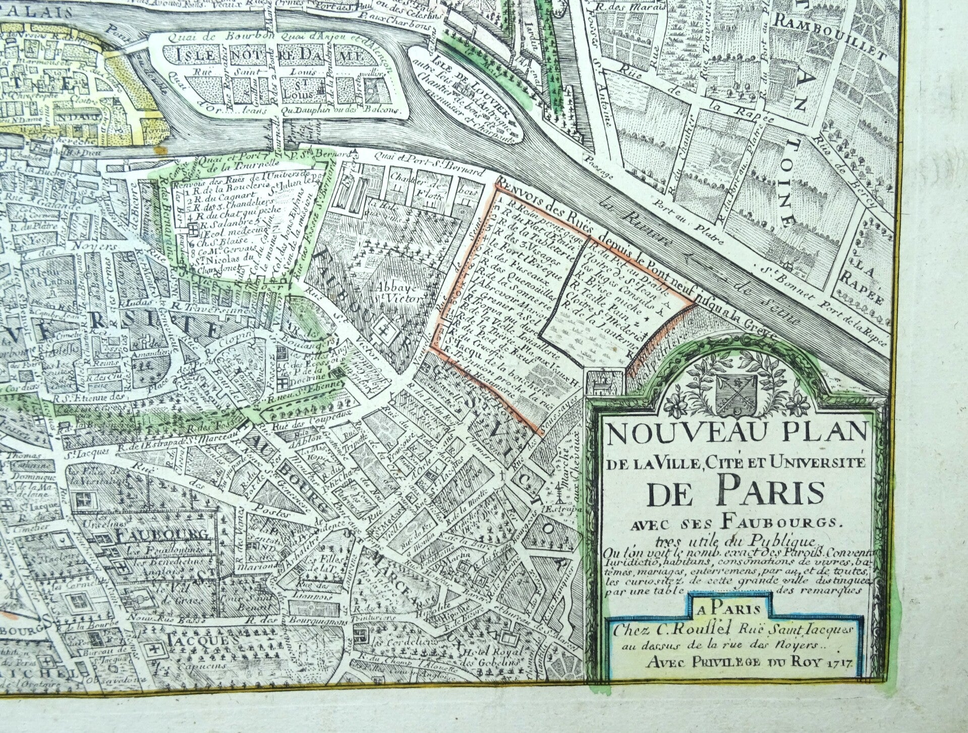
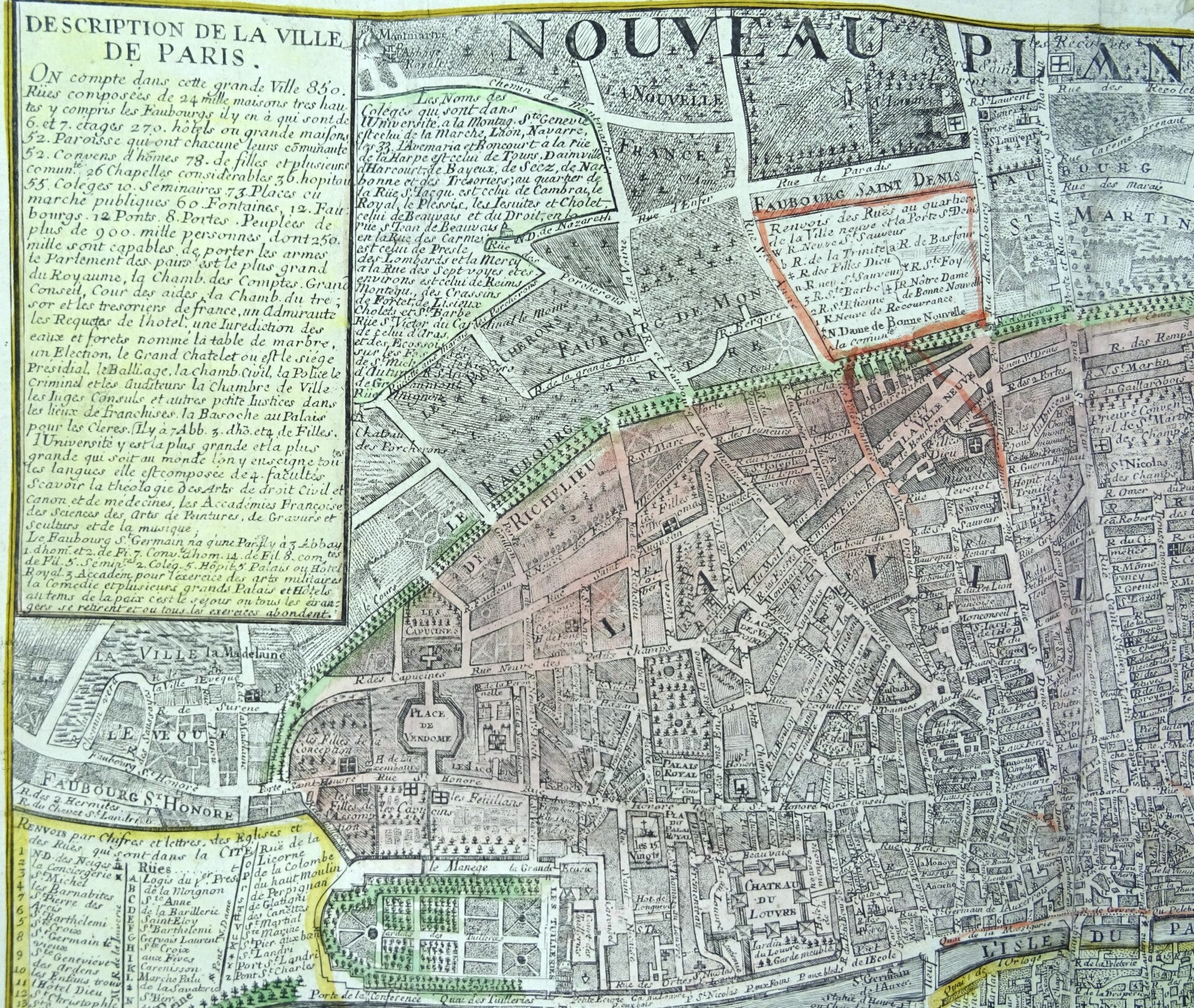
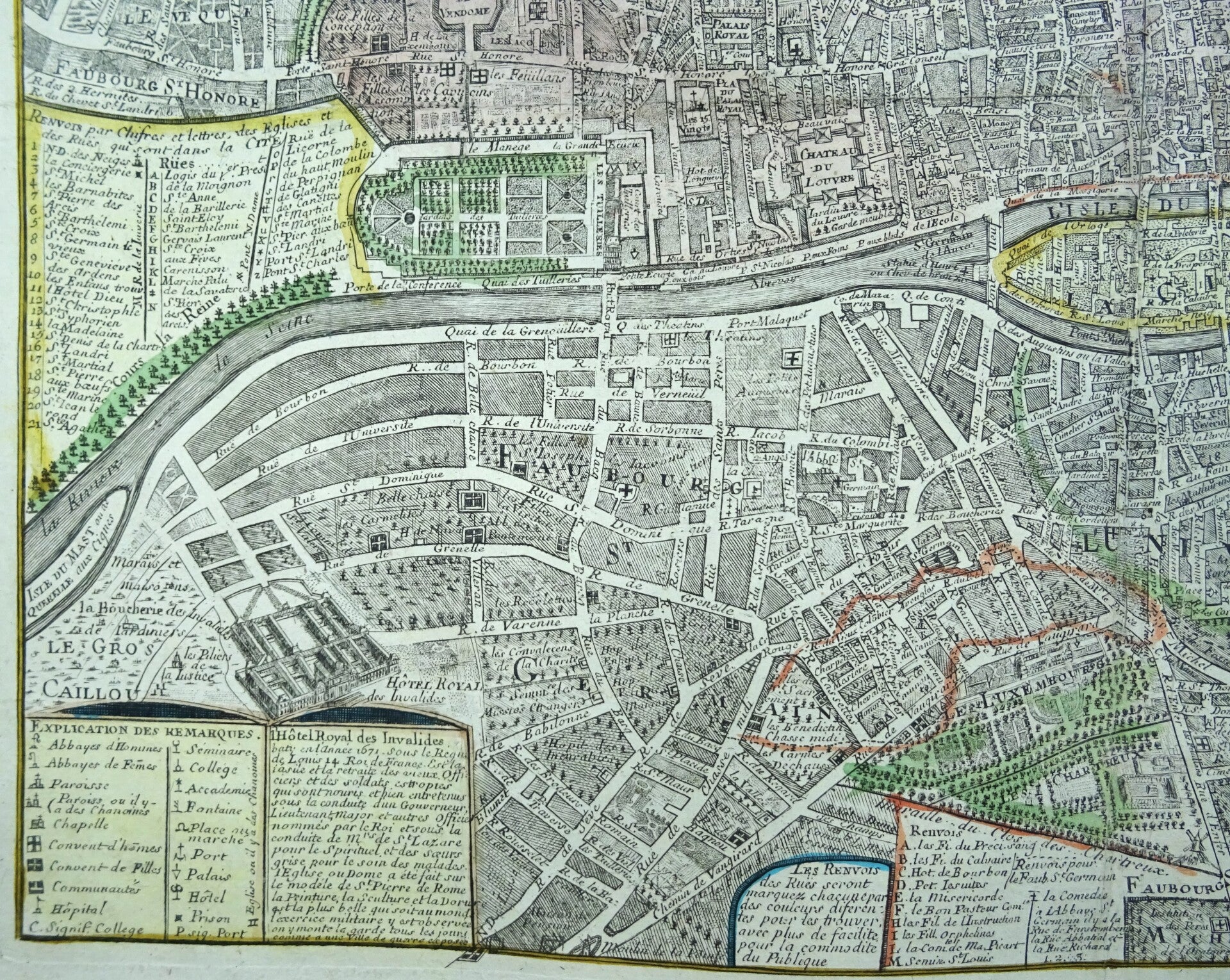
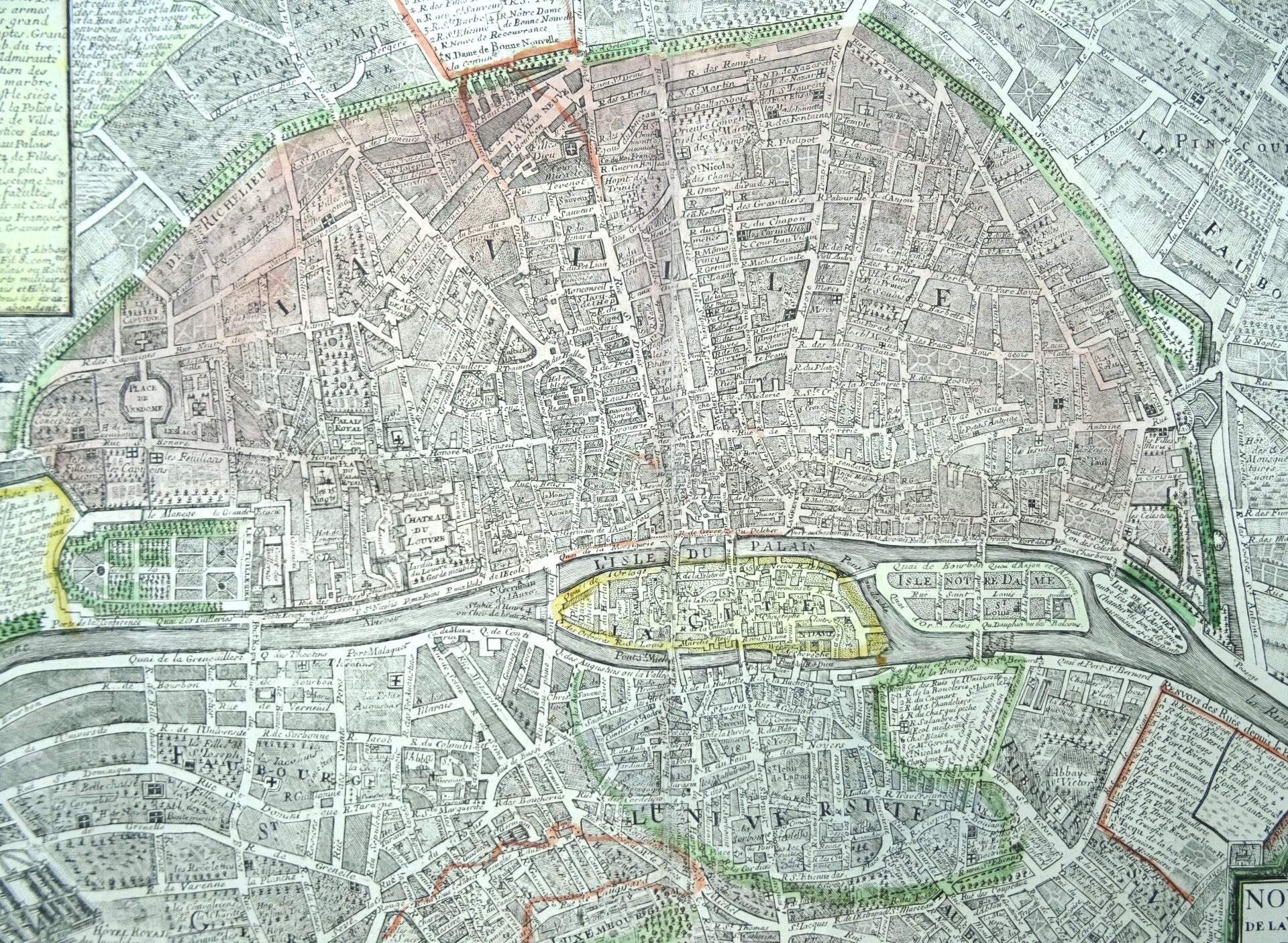
France, Paris, Roussel, 1717, Nouveau plan de la ville, cité et université de Paris avec ses fauxbourgs...
€369.00
Item number:
26 3 A
Fascinating 1717 detailed large map of Paris in original coloring, published by C. Roussel. It shows the division in different neighbourhoods and provides additional information on the city in different text blocks.
Good condition. Folds horizontal and vertical, ample margins, thick paper, some repairs in the area of the folds and the margins, with minimal impact on the image. Original coloring.
Image 41x54cm, sheet 48x61cm